Namtok Bua Tong - Nam Phu Chet Si National Park (under gazetting)
Contact Location : Namtok Bua Tong - Nam Phu Chet Si National Park, Moo 8, Mae Ho Phra Sub-district, Mae Taeng District, Chiang Mai Province
Telephone Number : (+66) 9 3193 3556
Email : namtokbuatong@gmail.com
Facebook : Namtok Bua Tong - Nam Phu Chet Si National Park
Information
The survey of San Sai National Reserved Forest, Mae Taeng National Reserved Forest, Khun Mae Kuang National Reserved Forest, and Namtok Bua Tong - Nam Phu Chet Si Forest Park as the target areas, covering 111,829 rai. It is the forest that was announced to be in watershed class 1 in San Sai, Doi Saket, and Mae Taeng District in Chiang Mai Province.
Background
Non
Note : After paying the entrance fee to the National Park, please carry the receipt for inspection.
53,464.09 rai
|
|
|
|
|
|
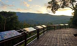
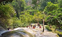
Nature trails ⇔ Forest Viewpoint ⇔ Visit Waterfall ⇔ Swimming ⇔ Geological condition ⇔ Observe flowers/plant ⇔ Bird , butterfly , wildlife watching activities ⇔ Camping ⇔ Relax in a nature
Welfare shop : open daily from 08.00 - 16:00 hrs.
Mobile phone signal:
National Park Headquarters area: AIS, TRUE
|
|
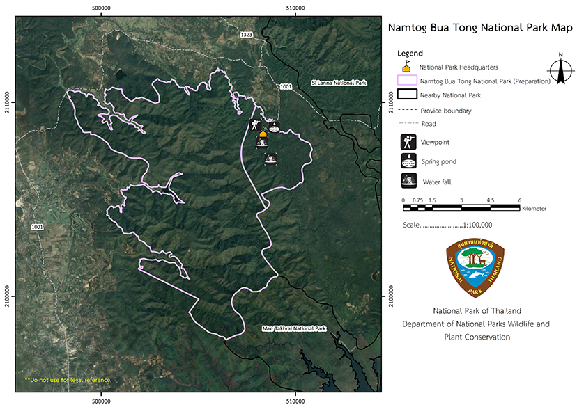
The survey area is bordered on the east by a mountain range and on the southwest by valleys. The map depicts land use zones and forests, with the National Reserved Forest designated as a zone C conservation area. On the east side of the ridge are, the Mae Taeng and Khun Mae Kuang forests, and on the westis a dune forest. There is a plain with a very small river which is incompatible with agriculture due to the gravelly nature of the soil and the shallow topsoil, which is easily is broken. The area is generally between 380 and 947 meters above sea level, with the highest summit being Doi Phi Tak Pha at 947 meters. The area with the lowest elevation is the Huai Mae Pon Reservoir and the surrounding areaat approximately 380 meters abovesea level. The trenches of various mountains, which form streams and rivers, are significant tributaries for the Ping River.
|
|
A survey was undertaken of the Namtok Bua Tong - Nam Phu Chet Si National Park area in Chiang Mai Province, Northern Thailand. The climate was indentified as a tropical monsoon, influenced by the southwest monsoon (wind and rain) during the summer and the northeast monsoon during the winter. The are three distinct seasons.
|
|
|
|
Two Types of Forest 2. Deciduous forests are found in a variety of forms, including mixed deciduous and deciduous dipterocarp forests. 2.1 Moist upper mixed deciduous forest (Mixed deciduous forest) occurs between 350 and 600 meters elevation, and are sparsely forested, They have a large amount of fertile soil and are home to 16 plant species, 15 genera, and 12 families including Anacardiaceae, Dipterocarpaceae, Anacardiaceae, Fabaceae, Combretaceae, Teak, Xylia xylocarpa, Burma Padauk, Bombox anceps, Dalbergia assamica, Dalbergia dongnaiensis, Schleichera oleosa, Cassia fistula, Terminalia alata Heyne, Spondias bipinne, Heyne, and Dongna. Certain sections of the forest are changing to become more like a deciduous dipterocarp forest. 2.2 Deciduous Dipterocarp Forest: It is found on the plains as well as at nearly all elevations. It can thrive between 600 and 900 meters on shallow gravel land with a low fertility levels. A preliminary survey of the deciduous dipterocarp forest revealed the presence of 17 plant species, 11 genera, and 11 families, with the most common family is Dipterocarpaceae, followed by Anacardiaceae, Fabaceae, Combretaceae, Burma Sal, Burmese Sal, Hairy Keruing, Dipterocarpus tuberculatus, Melanorrhoea ustata, Gardenia sootepensis, and various stinging plants were discovered, as well as other lower ground plants such as Cycas siamensis. Merkus Pine (Pinus merkusii Jungh & De Vriese) was discovered at around 700 meters abovesea level. |
How to get there by car :
1. Chiang Mai-Mae Cho-Phrao (Highway No. 1001) from Chiang Mai city arrives at milestone No. 49th in the forest village area and bears right onto a paved road. After approximately 3 kilometers you will find the headquarters and the journey is approximately 53 kilometers in total.
2. Chiang Mai-Fang Road (National Highway No. 107) leads from the city of Chiang Mai city to the Mae Ngat Sombun Chon Dam.Bear right for approximately 10 kilometers to the Mae Taeng Office then turn right onto Ban Phudin-Pa Lao Road, cross the National Highway No. 1001 and bear left upward for approximately 1.5 kilometers. After a final right, the waterfall is approximately 3 kilometers and the total distance is about 65 kilometers.
-Non local Agency
-Non Reserve

