Namtok Khlong Kaeo National Park
Contact Location : Namtok Khlong Kaeo National Park, Bo Phloi Sub-district, Bo Rai District, Trat Province, 23140
Telephone Number : (+66) 6 3958 5404, (+66) 3 952 2039
Email : Klongkao_34@hotmail.com
Facebook : Namtok Khlong Kaeo National Park
Background
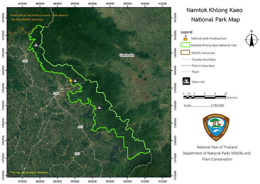
The Royal Forest Department received a letter from Trat Provincial Forest Office informing that at the meeting of the Subcommittee on Prevention and Suppression of Smuggling of Forest Resources, Khao Saming district No. 1/2538, on September 15, 1995, a resolution was passed deeming it appropriate to define forest areas in the area of Khao Cha-om Forest, Khao Khlong Puk, and Khao Mapring in the Khao Saming National Reserved Forest (Khlong Yai - Khao Fai Mai Forest), which is a conserved area in the area of Khao Saming and Bo Rai District, Trat Province, to be a Forest Park or a National Park.
Therefore, the Royal Forest Department issued an order No. 1746/2540 dated October 21, 1997, for Mr. Prayun Pongphan, Forestry Officer Level 5, to supervise the areas that would be declared as Namtok Khlong Kaeo National Park, Trat Province. Later, a working group that considered the matter before submitting it to the National Park Board decided that these following areas should be explored further: the forest areas of Khao Po Mai, Khao Bueng Phawa Dam, Khao Et, Khao Khlong Wang Pho, and Khao Khlong Pun. Later, Mr. Prayun Phongphan, the Superintendent the Namtok Khlong Kaeo National Park, presented preliminary data from the survey. The areas to be established as Namtok Khlong Kaeo National Park are in Khao Saming National Reserved Forest (Khlong Yai - Khao Fai Mai Forest), approximately 123,700 rai (197.92 square kilometers), located in Nong Bon,Chang Thun, Bo Phloi, Nonsi, and Dan Chumphon Sub-district, Bo Rai District, Trat Province. Mr. Prayun proposed the result at the Subcommittee meeting on Prevention and Suppression of the Destruction of Forest Resources of Trat Province No.4/2000 on July 28, 2000. The meeting approved the establishment of the Namtok Khlong Kaeo National Park and brought the matter into the consideration of the National Park Board on October 30, 2000, in which the meeting resolved to approve the establishment of National Park.
Note : After paying the entrance fee to the National Park, please carry the receipt for inspection.

123,700 rai (197.92 square kilometers).
|
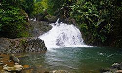
Khlong Kaeo Waterfall |
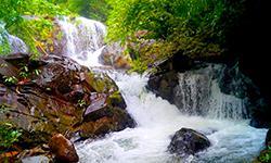
Thap Kadai Waterfall |
||
|
|
|||
Nature trails ⇔ Visit Waterfall ⇔ Observe flowers/plants ⇔ Bird/Butterfly ⇔ Camping
Welfare shop : (Restaurant) opens daily from 8.30 - 17.00 hrs.
Mobile phone signal :
National Park Headquarters area : True
|
|
Most of Namtok Khlong Kaeo National Park area is a relatively uncomplicated mountain range of the Banthat Mountain Range, consisting of Khao Kaeo, Khao Ta Bat, Khao Ta Chot, and Khao Kamphaeng. The peaks of the mountains form the Thai-Cambodian border, at approximately 100 to 836 meters above sea level. The highest peak is Khao Bat Summit, which is at 836 meters above sea level. The geography causes the formation of many streams, such as Khlong Luek, Khlong Ang Puk, Khlong Kaeo, Khlong Ta Bat, Khlong Hin Phloeng, Khlong Lue, Khlong Ka Chai, and Khlong Mala Ko, flowing into Khlong Sato and out into the sea.
|
|
This area is influenced by tropical southwest and northeast monsoons. Additionally, due to the fertile forest environment, it rains profusely throughout the year. It can be divided into seasons as follows :
|
|
|
|
|
Flora and wildlife The area is generally covered by an evergreen forest plant community with high humidity which is a watershed for many streams and creeks. This dense forest is made up of a variety of plant species, ranging from small undergrowth plants to large canopy trees ranging in height from 25 to 60 meters. The predominant plants are Rubber, Shorea hypochra Hance, Anisoptera costata Korth., Iron Wood, Malva Nut, Heritiera javanica Kosterm, Aphanamixis polystachya (Wall.) R.Parker, and Black Rosewood. The shrubs and undergrowth plants commonly seen are those of the ginger family, Rattan, Salacca, various Betel Nuts, Bamboo, Caryota urens, and Fishtail Palm. Additionally, the rare and stunning orchid, "Leung Chan", can be seen throughout the National Park. The area is a natural vibrant forest, which means that wild animals abound, which can be seen at various water sources. In this area, a large number of leeches are found, which indicates the excellent condition of the forest. As found in the surveys and inquiring people in the area, the critical wildlife found are Deer, Tiger, Barking Deer, Wild Boar, Bear, Mouse-Deer, Gibbon, Monkey, Langur, Squirrel, Civet, Palm Civet, various types of Pheasant, White-rumped Shamas, Common Hill Mynas, Falcon, Bulbul, Laughingthrushs, Hornbill, Lineated Barbet, multiple types of Snake, Giant Lizard or Langur, Cyrtodactylus intermediuses, Flying Gecko, Flying Lizard, Monitor Lizard, Turtle, Blyth's Frog, Green Frog, Toad, Common Tree Frog, and Spiny Rock Carb. In addition, around streams and waterways, there are also abundant fish, such as Soro Brook Carp, Siamese Rock Catfish, Jullien's Mud Carp, Gouramies, Red-tailed Snakehead, and Botia. |
How to get there by car :
From Trat province, take National Highway No. 3 to Khlung District for about 17 kilometers to Khao Saming District. Turn right along Provincial Highway No. 3159 for about 27 kilometers, then turn left onto Provincial Highway No. 3157 to the Border Patrol Police Company No.116 and turn right along the route for about 9 kilometers to reach Namtok Khlong Kaeo National Park.
- National Park Ranger Station Kho Ko No. 1 (Than Hin Dat)
- National Park Ranger Station Kho Ko No. 2 (Namtok Thap Kadai)
- National Park Ranger Station Kho Ko No. 3 (Khao Phlu)
- Accommodation: Khlong Kaeo 101 (on the hillside)


