Khao Sip Ha Chan National Park
Contact Location : Khao Sip Ha Chan National Park, Ban Pong Ket, Khun Song Sub-district, Kaeng Hang Maeo District, Chanthaburi Province, 22160
Telephone Number : (+66) 9 8927 1499
Email : khaosiphachan_np@hotmail.com
Facebook : Khao Sip Ha Chan National Park
Background
In 1998, Chanthaburi Province issued a letter to the Royal Forest Department stating that areas in Khun Song National Reserved Forest, Khun Song Sub-district, Kaeng Hang Maeo District, Chanthaburi Province, were suitable for designation as a national park as it is an evergreen forest in a flat area that is still in good condition, located between Khao Ang Rue Nai Wildlife Sanctuary and Khao Soi Dao Wildlife Sanctuary, a high-risk area for invasion and destruction. It is also a plain area of the rain forest nearest to Bangkok, making it suitable for educational and tourism purposes for the general public. Therefore, it should be designated as a national park area in order to maintain natural resources and respond to the royal initiative on forest and wildlife conservation under the Forest Resources and Wildlife Conservation Project in the area connecting five provinces (Eastern region).
Later, the Royal Forest Department issued an order No. 1151/2543, dated June 9, 2000, requiring officers to survey Khun Song National Reserved Forest, Khun Song Sub-district, Kaeng Hang Maeo District, Chanthaburi Province, to determine whether it is appropriate to establish a national park consisting of Mr. Chainarong Chandrasan, Forestry Technical Officer Level 7, Mr. Udomsak Suphanpong, Forestry Administration Officer Level 6, and Mr. Supachok Temsa-ard, Forestry Officer Level 5, and Forestry Officer of Chanthaburi Province. The report revealed that Pa Khun Song National Reserved Forest, which is located in Khun Song Sub-district, Kaeng
Hang Maeo District, Chanthaburi Province, with an area of 75,000 rai, or 120 square kilometers, is characterized by a tropical rain forest in a lowland plain. It has waterfalls, beautiful scenery and biodiversity suitable for tourism, recreation, or academic research, and has an area of decent size and thus has enough potential to be designated as a national park. Therefore, the Royal Forest Department assigned Mr. Winai Somanwat, a Forestry Technical Officer Level 7, to conduct additional surveys in Khun Song National Reserved Forest in order to establish "Khao Sip Ha Chan National Park."
Note : After paying the entrance fee to the National Park, please carry the receipt for inspection.

73,729 rai (117.9664 square kilometers)
|
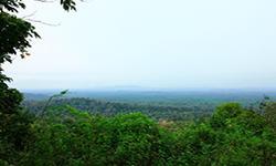
Viewpoint of Khao Sip Ha Chan |
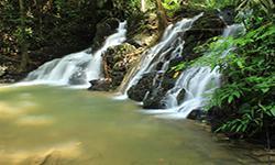
Khao Sip Ha Chan Waterfall |
||
Nature trails ⇔ Visit Waterfall
Welfare shop : (food and drinks) is open daily from 09.00 - 16.30 hrs. only on Saturdays, Sundays, and public holidays.
Mobile phone signal : AIS (Unstable)
|
|
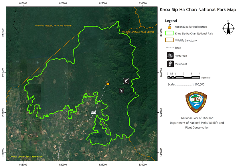
The geography of this Khun Song Forest is primarily a plain area with undulating slopes, which is classified as an expansive low plain. There is a high mountain range that runs north to south. On the eastern side, there is a parallel mountain extending to Khao Soi Dao Wildlife Sanctuary. The highest peak is Khao Sip Ha Chan, at 802 meters above sea level. There are low mountains, Khao Satorn, in the middle of the area, and Khao Saba in the south. The northern side connects to the same forest as Khao Ang Rue Nai Wildlife Sanctuary. Throughout this forest, there are many canals. The canal that is like a large artery is Khlong Tanot, which vast and deep. It has a certain width of almost the entire area, from the north to the west, with a large amount of water. On the northern side, there is Sai Canal. Additionally, there are other streams which originated from Khlong Tanot, including Dinso, Sai Canal, Khot Canal, Ikek Canal, Nam Pen Canal, Saba Canal, and Yang Canal.
|
|
The northeast and southwest monsoons effect the overall climate, thus giving distinct characteristics of all three seasons. Winter starts from mid - October to February, which is the season of the northeast monsoon. It is cold and dry, and the coldest month is January. Summer is from February to mid - May, with April being the hottest month of the year. The last is rainy season, which starts from mid-May to mid-October. It is the period when the southwest monsoon blows into Thailand. The weather is humid and rainy throughout the season, with an average annual rainfall of about 3,059 millimeters. The heaviest rain is in September. The average temperature is around 28 degrees Celsius, with a minimum of 21 degrees Celsius.
|
|
|
|
|
Flora and Wildlife plants are Dipterocarpus intricatus Dyer., Patana oak, Great Elephant Apple, Burmese Sal, Shorea, Shorea siamensis Miq, and Nux-vomica Tree Lower ground plants are cogongrass, Curcuma sessilis, Scleria levis Retz, and Desho Grass. The critical wildlife in this area is mainly mammals, such as Asian elephant, Sambar deer, Barking Deer, Banteng, Gaur, Tiger, and Bear, and bird species such as Hornbills, Common Hill Myna, Asian Woollynecks, Siamese Pheasants, and Silver Pheasants.
|
How to get there by car :
To go to Khao Sip Han Chan National Park from Bangkok, visitors can take National Highway No. 3 (Bang Na - Trat) and turn onto National Highway No. 344 (Chonburi - Ban Bueng) to Kaeng Hang Maeo district, about 240 kilometers away. Then go from Kaeng Hang Maeo District to Khun Song Sub-district, a distance of about 10 kilometers. The total distance is about 250 kilometers. Or the other route is to take National Highway No. 3, turn onto National Highway No. 344, and turn onto Wang Chan - Nong Chek Soi. Heading to Kaeng Hang Maeo District. The distance is about 200 kilometers. Then go from Kaeng Hang Maeo District to Khun Song Sub-district for about 10 kilometers. The total distance is about 210 kilometers.
- National Park Ranger Station Kho Cho No. 1 (Khao Hin Khak)
- National Park Ranger Station Kho Cho No. 2 (Aang Sisiat)
-


