Khao Yai National Park
Contact Location : Khao Yai National Park, P.O. Box 9, Mu Si Sub-district, Pak Chong District, Nakhon Ratchasima Province 30130
Telephone Number : Office (+66) 8 6092 6527 House (+66) 8 6092 6529 Shrine Checkpoint: (+66) 8 6092 6531, (+66 ) 4 424 9305 Noen Hom Checkpoint (+66) 9 0782 1929
Email : ky_kynp@hotmail.com
Facebook : Khao Yai National Park
Information
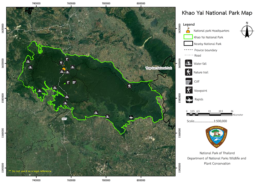
Khao Yai National Park is Thailand's first national park and received the nickname "Heritage Park of ASEAN Countries"; it is generally accepted that it is an important national park in the world. With the cooperation and assistance of Dr. George C. Ruhle, the International Union's National Park Specialist on Conservation of Nature and Natural Resources establishing a national park. The royal decree specified the lands in the area of Khao Yai forest in the area of Pa Kha and Ban Phrao Sub-district, Ban Na District, Nong Saeng and Na Hin Lat Sub-district, Pak Phli District, Sarika, Hin Tang and Phrom Mani Sub-district, Mueang District, Nakhon Nayok Province, Prachantakham Sub-district, Prachantakham District, Satta Mapanta and Thung Pho Sub-district, Kabin Buri District Prachinburi Province, Mu Si Sub-district, Pak Chong District, Nakhon Ratchasima Province and Muak Lek and Sam Phak Phaeo Sub-district, Kaeng Khoi District, Saraburi Province to be a National Park in 1959, which was announced in the The Government Gazette, Volume 79, Part 86, dated September 18, 1962 with a total area of 1,355,468.75 rai or 2,168.75 square kilometers.
Background
The Air Force received a letter No. Ko So 0379/15739 dated November 15, 1976, from the Ministry of Agriculture and Cooperatives., requesting to exclude theRadar station construction site and telecommunication station from the National Park area, the National Park Board had resolved at the meeting No. 1/2520, dated February 3, 1977, to approve the exclusion of the mentioned area.
The royal decree revoked some part of the Khao Yai National Park in the area of Hin Tang Sub-district, Mueang District, Nakhon Nayok Province, BE 2521, which was published in the Government Gazette on Volume 95, Part 99, dated September 21, 1978, with an area of approximately 71 rai, 3 ngan, 16 square kilometers or 0.1149 square kilometers, and the Royal Irrigation Department, Ministry of Agriculture and Cooperatives, Department requested to use some areas in Khao Yai National Park, Pak Phli and Mueang District, Nakhon Nayok Province, area of 1,925 rai, 1 ngan, 73 square wa, or 3.0807 square kilometers for the Royal Initiative Khlong Tha Dan Dam Construction Project for the purpose of water storage for consumption and utilization as well as cultivation and helping to alleviate floods that occur in the area of Nakhon Nayok Province annually.
The Cabinet has approved the construction of The Royal Initiative Khlong Tha Dan Dam Construction Project, which had a royal decree revoking some part of the Khao Yai National Park of the area in Hin Lat Sub-district, Pak Phli District, and Hin Tang Sub-district, Mueang Nakhon Nayok District, Nakhon Nayok Province, and was published in the Government Gazette, Volume 116, Part 119 Ko, dated November 26, 1999. As a result, the current Khao Yai National Park has an area of approximately 1,353,471.53 rai, or 2,165.55 square kilometers.
Note : After paying the entrance fee to the National Park, please carry the receipt for inspection.
1,353,471.53 rai (2,165.554448 square kilometers)
|
|
|
||
|
Viewpoint milestone No. 30 |
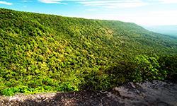
Pha Trom Chai Viewpoint (Khao Khiao) |
||
|
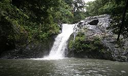
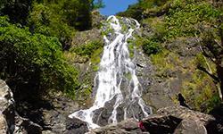
Kong Kaeo Waterfall |
Krok I Dok Waterfall |
||
|
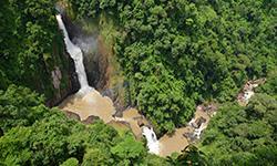
Chet Khot Waterfall |
Takhro Waterfall |
||
|
Than Thip Waterfall |
Than Rattana Waterfall |
||
|
Nang Rong Waterfall |
Pha Kluai Mai Waterfall |
||
|
Sarika Waterfall |
Heo Narok Waterfall |
||
|
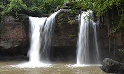
Heo Suwat Waterfall |
Pha Deo Dai |
||
|
Khao Yai National Park Nature Trail |
Nong Phak Chi |
||
-
Welfare shop : (Restaurant) is open Monday - Friday 7.00 - 17.00 hrs.
Saturday - Sunday 07.00 - 19.00 hrs.
Mobile phone signal :
1. National Park Headquarters: AIS, TRUE, DTAC
2. Lam Ta Khong camping ground area: AIS, TRUE
3. Shrine checkpoint area: AIS, TRUE, DTAC
|
|
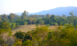
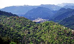
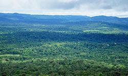
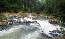
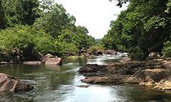
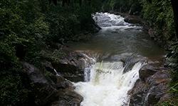
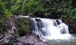
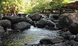
Khao Yai National Park consists of a complex of mountain ranges such as Khao Rom, which is a 1,351 meters above mean sea level, followed by Khao Laem, 1,326 meters above mean sea level, Khao Khiao, 1,292 meters above mean sea level, Khao Sam Yot, 1,142 meters above mean sea level, and Khao Phapha, 1,078 meters above mean sea level. The north and eastareas are sloping downward - Lam Ta Khong and Lam Phra Phloeng are in the north, flowing to nourish the agricultural areas of the Khorat Plateau before converging as the Bang Pakong River. Geology In the western and northeastern parts of Khao Yai National Park, volcanic sedimentary rocks and Permotriassic volcanic rocks formed during the Permian and Triassic periods were found, covering almost half of the park. These rocks consist of volcanic breccia, tufts rock, the rhyolite, andesite, and basalt; and in some areas, igneous rock are found. The eastern and central part of Khao Yai National Park is the area ofsedimentary rocks belonging to Khorat group brought by streams, with sandstones and mudstones of the Phu Kradueng Formation overlaid on sedimentary and Permotriassic volcanic rocks. In the central area of the park, on the way from Mo Singto to the sharp bend before reaching the viewpoint of Pha Deao Die, it is the boundary between the sandstone of the Phu Kradung formation and the sandstone of the Phra Wihan formation that overlaid on top. The southernmost area of Khao Yai National Park contains sediments of gravel, sand, and quaternary clay, which are results of the erosion of the sandstone in the Phra Wihan formation into gravel-sized sand. Then the currents carried the sands and gravels to accumulate along the area where the waterway flows through. Water Resources The main watershed of Khao Yai National Park covers the headwaters of the four main watersheds, namely the Prachin Buri River Basin which comprises the Lower Prachin Buri River Basin, and the Hanuman River Basin as its tributaries, accounting for 12.17 percent of the watershed area. The Bang Pakong River Basin is part of the Nakhon Nayok River Basin, accounting for 5.63 percent. The Nam Mun River Basin which comprises Lam Takong Basin and Lam Phra Ploeng Basin which are tributaries, representing 0.5 percent of the watershed class. The Pa Sak River Basin includes the Huai Muak Lek River Basin as its tributary, accounting for 0.4 percent of the watershed class. |
|
Khao Yai National Park has a dense forest that is influenced by the monsoon, causing seasonal rainfall and the weather is not too hot or too cold, suitable for tourism and various types of recreational activities. The average temperature throughout the year is about 23 degrees Celsius. The highest temperature is between April and May, at about 28 degrees Celsius. From December to January, the temperature is about 17 degrees Celsius. The average relative humidity of Khao Yai National Park is 66%. - Summer: Although the weather is hotter than other seasons, in the high mountains of Khao Yai, the weather is still cool and suitable for relaxing. The average annual rainfall of Khao Yai National Park is 2,270 millimeters in the Khao Yai National Park Headquarters area |
|
|
|
|
|
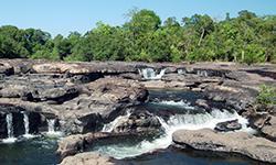
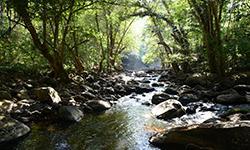
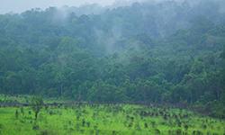
Forests in Khao Yai National Park It covers an area of approximately 1,229,789.63 rai. There are a variety of plant species as follows. Plants found are softwood such as Podocarpus neriifolius, Assam plum yew, and Dacrydium elatum Wall. Additionally, there are plants in the family Fagaceae, including Lithocarpus lindleyanus (Wall. ex A.DC.) A.Camus and Lithocarpus thomsonii (Miq.) Rehder.Along the ridges, Wild Himalayan Cherry are found. The secondary canopy trees contain Dillenia obovata (Bl.) Hoogl., Vaccinium sprengelii., Rhus succedanea L., Metadina trichotoma (Zoll. ex Merr.) Bakh.f, and Jambolan Plum. The undergrowth plants are shrub species such as Ardisia colorata, as well as Paco fern and many types of soil orchids. The trunks and branches of the hill evergreen forest are covered with orchids and various moss. - Tropical Rain Forest is found at an altitude of 400-1000 meters above mean sea level. The forest of this kind covers most of the park which is 892,162.48 rai (1,427.459968 square kilometers), or about 66.36% of the total forest area. Along the stream, there are groups of rattans and ferns. On the upper areas there are para rubber trees and upper canopy trees such as Shorea henryana Pierre, Glycosmis pentaphylla (Retz.) DC., and Boramue, and the secondary plants include plants in the family Fagaceae. - Dry Evergreen Forest is found at an altitude of 200-600 meters above mean sea level. It covers an area of approximately 1,192.88 rai (1.908608 square kilometers), or 0.9% of the total forest area. The upper canopy layer includes Dipterocarpus alatus, Vatica odorata (Griff.) Symington, Shorea henryana Pierre, Iron Wood, Hopea ferrea Laness, White Myrtle Tetrameles, Ipomoea pileata Roxb., Taluto, and etc. Secondary canopy perennial plants include Hydnocarpus ilicifolius King, Walsura trichostemon Miq., and palms such as Pinanga sylvestris (Lour.) Hodel and Fan Palm. The undergrowth plants consist of Coconut, Chinese taro., Ginger, Galangal, Pandanus Palm, and etc. - Mixed deciduous forest is found at an altitude of about 400-600 meters above mean sea level. It covers an area of approximately 185,275.91 rai (296.441456 square kilometers), or 13.78 percent of the total forest area. The forest of this kind appear mainly in the northwest. It consists of deciduous perennials such as Black Rosewood, Burma Padauk, Lagerstroemia , Anogeissus acuminata (Roxb. ex DC.) Guill. & Perr. Var. lanceolata C.B. Clarke, Xylia xylocarpa (Roxb.) Taub. var. kerrii (Craib ex Hutch.) Nielsen., and etc. The undergrowth plants are bamboo and grass on the forest floor, with limestone scatterly springing up. In the dry season, this type of forest is always on fire. It can be seen from the abundance of wild bamboo along the slopes and the densely packed wild bananas along the ravines. - Deciduous Deciduous Forest usually grows up on Khao Samo Pun which is a plain on a ridge mixed with stone terraces. Important plants are Burma Sal, Shorea siamensis, Hairy Keruing, Dipterocarpus tuberculatus, and Dipterocarpus intricatus Dyer. - Savanna Forest and Second-generation Forest cover approximately 70.15 rai (0.11224 square kilometers) and 129,219.65 rai (206.75144 square kilometers) respectively. This forest condition is a consequence of shifting cultivation in the past before the area was declared a national park. Therefore, this forest condition has arisen. Plants in the savanna forest are mostly Thach grasses mixed with The Khagra reed, Bamboo grass, and Saccharum procerum Roxb. In addition, there are some types of Paco Fern that usually grow in burnt areas. What is remarkable is that after it was declared a national park for more than 10 years, some grasslands that had been prevented from the spread of fires have revived into a grove that in the future will surely be revived as a forest as before. Along both sides of the road, because there is no construction to expand; therefore, various types of fast-growing plants are covering, such as Baliospermum solanifolium (Burm.) Suresh. and Hibiscus macrophyllus Roxb. ex Hornem, etc. In terms of animal society, due to diverse forest conditions, they have become shelters and food sources for animals and abundant with various kinds of wildlife, as follows: - Mammals: There are about 71 species. The mammals that are often seen and that are attractive to visitors are wild elephants, barking deer, deer, etc. Large mammals that are important species in Khao Yai National Park include Wild Elephants, Bengal Tigers, Clouded Leopard, Bulls, White-handed Gibbons, and Pileated Gibbons, etc. Wild elephants are one of the most important mammals in Khao Yai and are of great interest to visitors. They are usually found in herds of 5-7 elephants, sometimes up to 30 of them, with a matriarch as a head. While male elephants like to live alone and feed on their own except during the breeding season. A herd of elephants usually moves to find food over long distances. and has a very wide territory. Elephants' favorite foods are bamboo, ginger, wild bananas, grass, etc. The elephants' paths are beneficial because they help create natural pathways that link one another like a network which is useful for patrols by rangers and is a walkway for visitors. It is believed that there are around 140-200 of wild elephants in Khao Yai National Park. The hoofed animals that are commonly found in the park include Sambar Deer, Barking Deer, Gaur, Wild Boar, and Chamois. Among these hoofed animals, Sambar deer are a huge attraction for visitors. In the evening until dusk, Deer and Barking Deer often come out to graze in roadside pastures, which can be seen with the naked eye and you can use spotlights to light on them from the car at night. Wild boars and bulls usually live in deep forests. They seek food in the old grasslands. Bulls live scatterly in the Khao Yai National Park but in a relatively low density, and no one knows the exact number of them. Other lemurs and mammals found in the park include the White-handed Gibbon and the Pileated Gibbon. Normally, these two types of gibbons live separately and independently from each other. But in the forest area of Khao Yai National Park, they may be found living together. The survey found White-handed Gibbons living in the forest area near the national park headquarters and Training Center 2 (Khao Yai), as many as 4 herds per square kilometer. On average, one herd has four members, consisting of a father, a mother, and offspring. Generally, they can be seen along the edge of the forest and around the footpaths in the forest when they are singing together and clambering around on the trees. Macaques can be found in a group of up to 90 in the wild, and they are often found in forests adjacent to the roads. Slow lorises are commonly found but often need lights and an alert eye to see them. Other mammal species include squirrels (including the Black Giant Squirrel) and musks. Various musks are easily discovered by the side of the road at night. Bearcats can be found while they are sleeping the top of the trees in the daytime. Jungle tabby cats and marbled cats, of which there are not many, can be infrequently seen running across the road at night. There are also Asiatic Black Bears, and Dhole, but they only occasionally appear. - Reptiles : There are about 48 species that are commonly seen, including Oriental garden lizards, various skinks and Green-tailed Snakes, whereas Cobras, and King Cobras are seen in some areas, especially around the undergrowth bushes. - Amphibians mostly are frogs such as field frogs, swamp frogs, etc. In addition, frogs in the family Microhylidaeare also found such as Painted Chorus Frog, Micryletta inornata, etc. - There are more than 340 species of Birds, the interesting ones include the Wreathed Hornbill, Great Hornbill, Tickell's Brown Hornbill, Oriental pied Hornbill, as well as Coral-billed Ground-Cuckoo, Scarlet Minivet, Blue Pitta and Red-billed Blue Magpie, etc. |
How to get there by car :
For travel to Khao Yai National Park, visitors can travel on 2 routes:
- Route No.1 from Bangkok, take Phaholyothin Road, passing Rangsit, Pratunam Phra In, and Saraburi, then turn right onto Highway No. 2 or Mittraphap Road before reaching Pak Chong District at the milestone No. 56th, keep left in order to get on the bridge and continue on Thanarat Road which is Highway No. 2090 until reaching the milestone No. 23th where visitors will find the shrine of Chao Pho Khao Yai. Continue for another 15 kilometers to reach the national park headquarters. The total distance is about 205 kilometers.
- Route No. 2 From Bangkok, take Phahonyothin Road, turn right around Rangsit onto Highway No. 305 to Nakhon Nayok town, then take Highway No. 33 (Suwannason Road) until reaching the San Naresuan intersection. Then turn left along the Prachin Buri-Khao Yai route, passing the fee checkpoint at the foot of the hill. Then continue the journey until you reach the National Park Headquarters. The total distance is about 190 kilometers.
- Khao Yai National Park Headquarters
- National Park Ranger Station Kho Yo No. 1 (San Chao Po Khao Yai checkpoint)
- National Park Ranger Station Kho Yo No. 2 (Pha Kho)
- National Park Ranger Station Kho Yo No. 13 (Nang Rong)
- National Park Ranger Station Kho Yo No. 3 (Takhian Ngam)
- National Park Ranger Station Kho Yo No. 14 (Wang Ri)
- National Park Ranger Station Kho Yo No. 4 (Khlong Pla Kang)
- National Park Ranger Station Kho Yo No. 15 (Cha-om)
- National Park Ranger Station Kho Yo No. 5 (Km. 80)
- National Park Ranger Station Kho Yo No. 16 (Muk Lek Nai)
- National Pak Ranger Station Kho Yo No. 6 (Bu Phram Nai)
- National Park Ranger Station Kho Yo No. 17 (Klang Dong).
- National Park Ranger Station Kho Yo No. 7 (Lam Phraya Than)
- National Park Ranger Station Kho Yo No. 18 (Chet Khot)
- National Park Ranger Station Kho Yo No. 8 (Wan Lueang)
- National Park Ranger Station Kho Yo No. 19 (Pha Kluai Mai)
- National Park Ranger Station Kho Yo No. 9 (Sai Yai)
- National Park Ranger Station Kho Yo No. 20 (Namtok Heo Narok)
- National Park Ranger Station Kho Yo No. 10 (Prachantakham)
- National Park Ranger Station Kho Yo No. 21 (Khuean Khlong Tha Dan)
- National Park Ranger Station Kho Yo No. 11 (Khlong Pheka)
- National Park Ranger Station Kho Yo No. 22 (Nonsi)
- National Park Ranger Station Kho Yo No. 12 (Noen Hom)
- National Park Ranger Station Kho Yo No. 23 (Wang Mi)
- Accommodation - Khao Yai 407/1-9 (Followers)
- Accommodation - Khao Yai 932/1-2 (Youth Camp)
- Accommodation - Khao Yai 101,102,105,106 (Kong Kaeo 1,2,5,6)
- Accommodation - Khao Yai 109 (Panasan).
- Accommodation - Khao Yai 107 (Chaiyapruek)
- Accommodation - Khao Yai 201-203 (Oraphim 1-3)
- Accommodation - Khao Yai 204-206 (Thiewthas 1-3)
- Accommodation - Khao Yai 401-404 (Office of the Prime Minister 1-4)
- Accommodation - Khao Yai 405 / 1-2 (minister 1).
- Accommodation - Khao Yai 933/1-2 (Youth Camp)

