Khao Phra Wihan National Park
Contact Location : Khao Phra Wihan National Park, Ban Phoomsral, Sao Thong Chai Sub-district, Kantharalak District Sisaket Province 33110
Telephone Number : (+66) 4 582 6045
Email : Wihan_np54@hotmail.com , Wihanmoedang@gmail.com
Facebook : Khao Phra Wihan National Park
Information
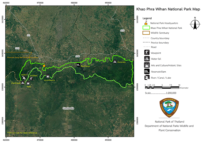
Khao Phra Wihan National Park is located in Nam Yuen District, Nam Khun Minor District, Ubon Ratchathani Province and Kantharalak District, Sisaket Province. It borders with Cambodia. There are a path and a stairway leading up to the Prasat Khao Phra Wihan in the Pha Mo I Daeng area which is located in Sao Thong Chai Sub-district, Kantharalak District, Sisaket Province, in the area of Khao Phra Wihan National Park, which are considered the most convenient.
Khao Phra Wihan National Reserved Forest including Lam Dome Yai Forest is located in Kantharalak District, Sisaket Province and Nam Yuen District, Ubon Ratchathani Province. The area belongs to the 2nd Army Area, Suranaree Camp, Nakhon Ratchasima, which has agreed with the Royal Forest Department to designate the border forest areas as a conservation area that is strictly forbidden to enter and live in it. Because the area is still fertile with forests and watersheds. There are many kinds of wild animals living in it, many kinds of wild animals, beautiful scenery as well as ancient historical sites. The Royal Forest Department was requested to designate and declare
the area as a national park.
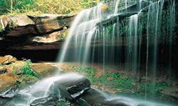
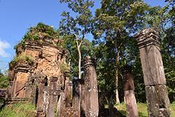
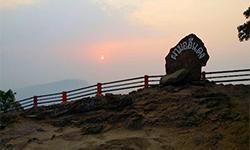
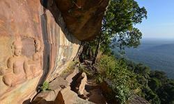
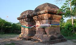
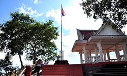
The survey results shows the area is a mixed deciduous forest and under the Rosewood (Kraya Loei) Concession projectin Khao Phra Wihan Forest (So Ko. 7) which has been logged. The other part is located in the Other Hard Woods Concession Project in the Forest on the left side of Lam Dome Yai river (O Bo 2). There are many beautiful views and landscapes such as the Pha Mo I Daeng viewpoint, Chong Phoi cliff viewpoint, forest area and rock garden near Sa Trao, Rue Si Cave, Stone Quarry Site, Twin Stupas, a low relief under Pha Mo I Daeng, Namtok Pha Chong Phoi, Viewpoint, Phu Swiang Mo, Prasat Don Tuan, and another important point is the Khao Phra Wihan temple, an important historical site that used to be a dispute between Thailand and Cambodia in 1962.
The International Court of Justice has decided that Khao Phra Wihan is absolutely the property of Cambodia. However, the road and stairs leading to Khao Phra Wihan Temple are on the Thai side. It is very necessary to pass through Pha Mo I Daeng in Sisaket Province whic is considered the most convenient way. Therefore, there is no problem for all Thai people and foreigners who want to travel to the Khao Phra Wihan temple for both educational and tourist purposes
. Now Thailand via Si Sa Ket Provincial Government has made an agreement with Preah Wihan Province of Cambodia regarding on a request for joint use of this upper Preah Wihan temple as a tourist attraction.
Khao Phra Wihan National Park issued a royal decree specifying forest land on the left bank of the Lam Dom Yai River in Song Sub-district, Nam Yuen District, Khok Sa-at Sub-district, Nam Khun Minor District, Nam Yuen District, Ubon Ratchathani Province and Khao Phra Wihan forest in Sao Thong Chai and Phu Pha Mok Sub-district, Kantharak District to be a national park according to the "National Parks Act 1961", which was declared on March 20, 1998 in the Official Gazette 115, vol 14 ko. It is the 83rd national park of the country.
Background
-
Note : After paying the entrance fee to the National Park, please carry the receipt for inspection.
81,250.00 rai (130 square kilometers).
|
|
|
||
|
Tat Hai Waterfall |
Tham Khun Si Waterfall |
||
|
Don Tuan Castle |
Pha Mo I Daeng |
||
|
Bas-relief |
Twin stupas |
||
|
Sa Trao |
Historic flagpole |
||
-
Welfare shop : Shops and restaurants are open time is 05.00 - 19.00 hrs.
Mobile phone signal :
Headquarters nation park: AIS, TRUE, DTAC
Pha Mo I Daeng Tourist Area: AIS, TRUE
|
|
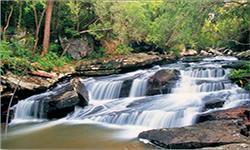
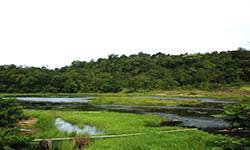
The general geography is mostly mountains, part of the Phanom Dong Rak Mountain range, bordering between Thailand-Cambodia. The area is covered with dry evergreen forest, mixed deciduous forest, and deciduous dipterocarp forest. It contains many important tree species including an giant blue-and-white vines, found in the nature trail, spreading and wrapping the trees in a wide area of 100-400 meters Undergrowth plants and epiphytes are widely distributed, including various types of herbs. The important ones include Stephania venosa, which has the properties as a medicinal herb and can treat many diseases. There are also particularly interesting plants such as orchids, living in trees and rocks. They are very abundant, especially on the Khao Phra Wihan Orchid Nature Trail. Khao Phra Wihan National Park is mainly composed of rocky Cretaceous Lower-Middle (Lower-Middle-Cretaceous) rocks, Jurassic Middle-Upper (Middle-Upper Jurassic) rocks, and a little Jurassic Lower-Upper (Lower-Upper Jurassic) in the mountainous Kingdom of Cambodia. The Cretaceous Lower-Middle belongs to the Khorat Soil Group, the Phu Phan formation. The rocks are composed of sandstone and gravel sandstone and are brown-gray, pink-and-orange, gray, orange have a thick layer, a crossbedding sedimentation, siltstone and reddish-brown shale. Stones from this era are most commonly found in Khao Phra Wihan National Park from the eastern part to Important water sources and creeks in the Khao Phra Wihan National Park area are: - Khuean Huai Khanun Reservoir is located in the area of the National Park Ranger Station Kho Ho No. 1, (Khuean Huai Khanun) and is an irrigation reservoir that receives water from 2 streams, namely Dan Creek, flowing down from the Phu Phong Summit in the south and Ta Aek Creek, a large creek, flowing down from the Phu Phong Summit in the east. In the dry season, the creeks have no water. - Nong Wa Reservoir is located in Phu Pha Mok Sub-district, Kantharalak District, Sisaket Province, receving water flowing from Fon Met Creek, Don Tuan Castle. During the rainy season, there will be some water flowing. - Sa Trao is in the western part of the National Park. It is a water source that receives water from two streams, Tani Creek and Tamaria Creek. Tani Creek receives water from two watercourses. The first one runs from the east through the broken stairway in the area of Preah Wihan and the second one receives water that flows from the west. They converge at the creek located behind the shops and the community near the entrance of the Prasat Khao Phra Wihan (Preah Wihan Temple), then flow through Khun Si Waterfall and into the pond below which is in the territory of Thailand. Tamaria Creek receives water flowing from Phu Makhuea, which is in the western part of the park. This Tamaria creek is also used as a boundary line between Khao Phra Wihan National Park and Phanom Dong Rak Wildlife Sanctuary. - Khun Si Waterfall is a waterfall originating from Tani Creek on the western part of Sa Trao, near the sidewalk leading to Khao Phra Wihan Castle. There is s a lot of water flowing down during the rainy season, but there is no water during the dry season. This makes Khun Si Waterfall a tourist attraction only in certain seasons. - Tat Hai Waterfall is located in the eastern part of Khao Phra Wihan National Park. It receives water from Chong Phuang Creek that flows down from the south side of Phu Lam Duan, from Plantawong and Plantoey which are large stone terraces. There is water only in the rainy season, but in the dry season there is no water. Tat Hai Waterfall is therefore a tourist attraction only in certain seasons, like Khun Si Waterfall. - Bon Creek is a creek in the eastern part of the National Park. There is water almost all year round, especially in the rainy season, there will be a lot of water, but there will be no water next season. Bon Creek is a small creek that is the boundary line between Khao Phra Wihan National Park and Yot Dom Wildlife Sanctuary. |
|
The seasons of Nam Phong National Park can be divided into three seasons: - Summer: from Marth to May, the average temperature is very high in April. - Rainy season: From June to October, rainfall Rainfall is abundant from August to October, - Winter: From November to February, the minimum average temperature is in January which is influenced by a high-pressure from the southern part of China.
|
|
|
|
|
Flora Due to the fact that Khao Phra Wihan and the forest on the left side of Lam Dom Yai River in Phanom Dong Rak Mountain range are still fertile, there are many wild animals such as Wild Boars, Crab-eating Macaques, Mongooses, Hares, Roof Rats, Finlayson's Squirrels, Northern Treeshrews, Painted Bats, Striped Swallows, Bar-winged Flycatcher-shrikes, Black-headed Bulbuls, and Greater Racket-tailed Drongos, Pin-striped Tit Babblers, Eurasian jay, Siamese leaf-toed gecko, Sandstone Gecko, Orange-winged flying lizards, Common Forest Skink, Bengal monitor, blind snakes, Reticulated python, Boigas, Linne's Water Snake, rice field frog, Puddle Frog, Stripe-backed frog, Chinese edible frog, Common tree frog, Dark-sided chorus frog (Microhyla heymonsi), Dark-sided Chorus Frog, etc. In the area of water resources, there are many species of fish living such as Eye-spot Barb, Red tailed Tinfoil, Mrigal Carp, Channa striata, Mozambique Tilapia, and Batrachian walking catfish. |
How to get there by car :
From Bangkok, take Highway No. 1 (Phahonyothin Road), after reaching Saraburi City turn right onto Highway No. 2 (Mittraphap Road). Before reaching the Sikhio district, turn right onto Highway No. 24 and pass through Chokchai, Prakhon Chai and Sangkha District. At the intersection with Highway No. 221, turn right into Kantharalak District and head to the National Park Headquarters. The total distance is about 550 kilometers.
From Sisaket province, take the Highway No. 221 passing through Phayu, Si Rattana and Kantharalak District, with a distance of about 62 kilometers.The distance from Kantharalak District to the National Park Headquarters is about 25 kilometers.Total distance from Sisaket Province to the National Park Headquarters is 87 kilometers away.
From Ubon Ratchathani province, take Highway No.24 passing through Warin Chamrap District. Then take Highway No.2178, passing through Samrong, Non-Khun and Benchalak District. Then take Highway No. 2085 to enter Kantharak District. Then take onto Highway No. 221 heading to the National Park. The total distance from Ubon Ratchathani province to the National Park Headquarters is about 120 kilometers.
- National Park Ranger Station Kho Ho No. 1 (Khuean Huai Khanun)
- National Park Ranger Station Kho Ho No. 2 (Namtok Tat Hai)
-

