Phu Hin Chom That - Phu Phra Bat National Park (Under Gazetting)
Contact Location : Moo. 11, Kut Chap Sub-district, Kut Chap District, Udon Thani Province 41260
Telephone Number : (+66) 6 1460 6624
Email : Phupaya.nationalpark@gmail.com
Facebook : Phu Hin Chom That - Phu Phra Bat National Park (Under Gazetting)
Background
1.1 The Protected Area Regional Office No. 10 (Udon Thani) received a report from the head of the Kao Kloi and Na Klang Forest Development Project
(2) Together with the Department of Forestry in the area, Nong Bua Lamphu Provincial Government suggested that the authorities confiscated teak wood in the Kao Kloi National Reserved Forest and Na Klang Forest, Nong Bua Lamphu Province, and deemed it appropriate to have measures to protect the area by designating the area as a non-hunting area, forest park or national park as appropriate.
1.2 Subsequently, the Protected Area Regional Office No. 10 (Udon Thani) issued an order No. 214/2011 dated May 31, 2011, regarding the government officials to explore the area to be designated as a national park and entrusted Mr. Chaiwatt Hassakarn, the Forestry Technical Officer, Professional Level, a Superintendent of Phu Hin Chom That Forest Park, Udon Thani Province, (then) to conduct a survey on the Kao Kloi - Na Klang National Reserved Forest and surrounding areas in order to propose the National Park, Wildlife and Plant Conservation Department in designating the area as a National Park.
Mr. Chaiwatt Hassakarn, a Superintendent of Phu Hin Chom That Forest Park therefore prepared a survey report of the Kao Kloi and Na Klang National Reserved Forest and the surrounding areas consisting of Khuea Nam National Reserved Forest, Udon Thani Province, Kut Chap National Reserved Forest, Udon Thani Province, and Khok Pha Dam National Reserved Forest, Khok Nong Kha Forest, and Phu Bo Bit Forest, Loei Province. Because these areas are close to each other and are the source of water, have forest resources, wildlife, and biodiversity as well as having many outstanding natural attractions; therefore, these areas are very suitable for establishing as a National Park.
1.2 The Protected Area Regional Office No. 10 (Udon Thani) has reported such preliminary information to the National Parks, Wildlife and Plant Conservation Department according to the document of the Office of Conservation Area Administration No. 10 (Udon Thani) at To So 0920.6./5685 dated 28 September 2011.
1.3 The National Parks, Wildlife and Plant Conservation Department has notified the Royal Forest Department to consider and approve the designation of this area as a national park and use its authority under Section 19 of the National Reserved Forest Act, B.E. 2507 to issue the letter, No. To So 0910.502/8361 dated May 17, 2012, to authorize the officials of the Department of National Parks, Wildlife, and Plant Conservation to control, maintain and maintain the national reserved during the establishment of the said area as a national park by law.
1.4 The Royal Forestry Department has approved the exercise of powers under Article 19 of the National Reserved Forest Act, B.E. 2507, and authorized the National Parks, Wildlife and Plant Conservation Department to designate the areas of Khue Nam National Reserved Forests inn Ban Phue District, Udon Thani Province, with an area of 21,600 rai (34.56 square kilometers), Kut Chap National Reserved Forest in Kut Chap District, Udon Thani Province, with an area of 17,300 rai (27.68 square kilometers ), Pa Kao Kloi-Na Klang National Reserved Forest in Na Klang, Na Wang and Suwan Khuha District, Nong Bua Lamphu Province, with an area of 91,000 rai (145.6 square kilometers), and the Khok Pha Dam National Reserved Forest, Khok Nong Kha Forest and Phu Bo Bit Forest in Na Duang District, Loei Province, with an area of 46,800 rai (74.88 square kilometers) and a total area of 176,700 rai (282.72 square kilometers), to be a National Park area. Also, the Royal Forest Department required the National Parks, Wildlife and Plant Conservation Department to separate the areas previously permitted by the Royal Forest Department for the use of public and private sectors before the establishment of a national parks and to coordinate with the Department of Mineral Resources which has issued a mineral exploration license for mineral exploration and with the Department of Fossil Fuels on petroleum concessions in order to avoid causing problems or obstacles to the management of the national park in the future acccording to the Royal Forest Department letter No. To So 1610.2/5224 dated March 28, 2013.
1.5 The National Parks, Wildlife and Plant Conservation Department has ordered the government officials under the Office of Protected Area Regional Office No. 10 (Udon Thani) to conduct a survey the areas to be established as Phu Pha Ya National Park, Loei Province, Nong Bua Lamphu and Udon Thani Province and to control the area to prevent encroachment, clearance, and destructionaccording to the National Parks, Wildlife and Plant Conservation Department Order No. 333/2559. February 19, 2016
Mr. Thongchai Narat a Forestry Technical Officer (Practitioner Level) under the National Park Division, Protected Area Regional Office No. 10 (Udon Thani) together with the Phu Hin Chom That Forest Park Officers therefore conducted a survey for establishing Phu Phaya National Park, Loei and Udon Thani Province, to control the areas to prevent encroachment, clearance, and destruction, and to coordinate with the Royal Forest Department officials and other relevant institutions to participate in surveying the areas that are considered suitable to be designated as a National Park area or to be combined with part of the National Park. Furthermore, a map of 1: 50,000 and preliminary survey data were produced in book and floppy-disk formats submitted to the National Parks, Wildlife and Plant Conservation Department for further consideration.
Background of the Surveyed Areas
2.1 Khue Nam National Reserved Forest Area in Udon Thani Province is designated as a national forest under Ministerial Regulation No. 745 (BE 2518) in order to protect the state of forests, and other natural resources from Land Use and Forest Land Use Zoning according to the cabinet decision (zoning). It has a total area of 321,975 rai (515.16 square kilometers), divided into the forest area for economy (zone E) with an area of 289,875 rai (463.8 square kilometers), and the forest area for conservation (zone C) with an area of 31,200 rai (49.92 square kilometers); the whole area for Zone E has been transferred to the Office of Agricultural Land Reform, so the remaining area in Zone C is therefore 31,200 rai (49.92 square kilometers).
2.2 Kut Chap National Reserved Forest Area, Udon Thani Province is designated as a national reserved forest by the Ministry No. 199 (B.E. 2510) in order to preserve the forest conditions and other natural resources from Land Use and Forest Land Use Zoning according to cabinet resolution (Zoning). It has a total area of 121,500 rai (194.4 square kilometers), divided into the forest area for agriculture (zone A), with an area of 83,850 rai (134.16 square kilometers), the forest area for economy (zone E), with an area of 18,400 rai (29.44 square kilometers), and the forest area for conservation (zone C), with a area of 19,250 rai (30.8 square kilometers); zone A and zone E have been transferred to the Office of Agricultural Land Reform, so the remaining area in zone C is 19,250 rai (30.8 square kilometers).
2.3 Kao Kloi-Na Klang National Reserved Forest, Nong Bua Lamphu Province, is designated as a National Reserved Forest by Ministerial Regulation No. 942 (B.E.2524) to protect the forest conditions and other natural resources from the land use and forest resource use zoning according to the cabinet decision (zoning). It has the total area of 846075 rai (1,353.72 square kilometers), divided into the forest area for agriculture (zone A), with an area of 146,300 rai (234.08 square kilometers ), the forest area for economy (zone E), with an area of 561,725 rai (898.76 square kilometers), and the forest area for conservation (Zone C), with an area of 138,050 rai (898.76 square kilometers). Later, the government had adopted the policy of transferring the whole forest areas of Zone E and Zone A to the Office of Agricultural Land Reform. Therefore, only the area of Zone C is left, with a total area of 138,050 rai (220.88 square kilometers).
2.4 The areas of Khok Pha Dam National Reserved Forest, Khok Nong Kha Forest and Phu Bobit Forest, Loei Province, according to the Ministerial Regulation No. 353 (B.E.2511), are designated as national reserved forest in order to maintain forests and other natural resource from the land use and forest resource use zoning, according to the cabinet (Zoning). It has a total area of 414,700 rai (663.52 square kilometers), divided into the forest area for economy (zone E) with an area of 267,175 rai (427.48 square kilometers) and the forest area for conservation (Zone C) with an area of 147,525 rai (236.04 square kilometers) while the whole forest area of
Page | 327
Zone E has been transferred the Office of Agricultural Land Reform, so the remaining area of Zone C is 147,525 rai
(236.04 square kilometers).
Note : After paying the entrance fee to the National Park, please carry the receipt for inspection.
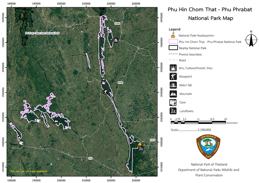
147193.82 rai (235.510112 square kilometers)
|
|
|
||
|
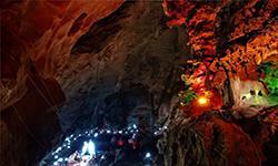
Pha Wiang Cave |
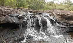
Tat Noi Waterfall |
||
|
Phu Plaek |
Footprints |
||
|
|
|||
Nature trails ⇔ Trekking ⇔ Mountain biking ⇔ Camping
Welfare shop : Not available
Mobile phone signal :
National Park Headquarters: AIS, TRUE, DTAC
|
|
The Survey Area:
|
|
The climate in general is subtropical, with a minimum temperature of between 15-25 degrees Celsius, and the highest temperature of between 25-32 degrees Celsius. The average temperature is about 25 degrees Celsius, with an average rainfall of 1650 annual mm, 3 seasons. There are three seasons as follows:
|
|
|
|
|
Wildlife species 2. Amphibians: According to a survey by inquiring from people in the area, 10 species were found such as Chinese Edible Frogs, Rich Field Frogs, Capped Frogs, Truncate-Snouted Spadefoot Frogs, Bullfrog Bottles, Striped Spadefoot Frogs, Calluella guttulata, Asian Common Toad, Puddle Frog, Granulated Puddle Frog, Occidozyga Lima, and Common Tree Frog, etc. 4.Aquatic animals: According to the information gained by inquiring from the people in the area, 20 species are found such as Shrimp, Ricefield Crabs, Spiny Rock Crab, Asian Redtail Catfish, Giant Snakeheads, Channa Striata, Dwarf Snakehead Or Red-Tailed Snakehead, Siamese Mud Carp, Thai River Sprat, Marble Goby Or Oxyeleotris marmorata, Zig-Zag Eel, Peacock Eel, Three Spot Gourami, Millionfish, River Snails, and etc. Forest Types, Forest Conditions, and Plant Species The undergrowth plants and annual plants found include: Christmas bush (Chromolaena odoratum (L.) R.M. King & H.Rob.), Stemona tuberosa Lour., Harrisonia perforata (Blanco) Merr., Jackal Jujube (Capparis tenera Dalzell), Big Lygodium (Lygodium circinatum (Burm. f.)), Bustard cardamom (Amomum uliginosum K.D. Koenig), Oxalis corniculata L., and Amorphophallus brevispathus Gagnep, etc. Mixed deciduous forests can be found in the piedmonts and along the hillsides. The soil in this forest is quite deep, with scattered bamboo soil. The area is densely forested with bamboo. 10.2 Deciduous Dipterocarp Forest Important plants are found in every area. A prominent canopy covers no less than 60-80% of the area while plants belonging to the other families found scattered in Burma padauk (Pterocarpus macrocarpus Kurz), White Myrtle (Lagerstroemia calyculata Kurz), Parinari anamensis Hance, Cratoxylum formosum (Jack), Kenari (Canarium subulatum Guillaumin), Strychnos nux-vomica L., Morinda coreia ham., Irvingia malayana Oliv. ex A.W.Benn), Quercus kerrii Craib, and Burmese lacquer (Gluta usitata (wall) Dinghou), etc, waiting for ground and annual plants. In the deciduous dipterocarp forest, there are Vienamosasa pusilla (A. Chev. & A. Camus) T. Q. Nguyen, Curcuma sp., White angel (Curcuma parviflora Wall.), Butea Superba Roxb., Glutinous yam (Dioscorea hispida Dennst.), Jackal Jujube (Capparis tenera Dalzell), False Black Pepper (Illigera trifoliata (Griff.) Dunn cucullata (Merr.) Kub), Utricularia delphinioides Thorel ex Pellegr.), Christmas bush (Chromolaena odoratum (L.) R.M. King & H.Rob.), Aganonerion polymorphum Pierre ex spire and Dendrolobium lanceolatum (Dunn) Schindl ., etc. In the dry season undergrowth plants and various herbaceous plants will be dry and shed the leaves which later become fuel and cause forest fire every year. 10.3 Dry Evergreen Forest can be found along both sides of the streams in the valleys with high humidity. The soil conditions are pretty deep, mostly dry evergreen forests adjacent to mixed deciduous forest areas. Usually, plants in dry evergreen forests are not resistant to fire. Therefore, if forest fires are not prevented in the dry evergreen forest, the area of this forest will be decreased because plants in mixed deciduous forests will spread into the dry evergreen forests because they are are more fire resistant. When the large trees fall down, deciduous trees, grasses and bamboos will propagate in their place. Dry evergreen trees are characterized by straight trunks, and relatively smooth barks, and are not fire resistant. In the evergreen plant community, the most common species of plants in the family LEGUMMINOSAE are Afzelia xylocarpa (Kurz) Craib, Xylia xylocarpa (Roxb.) Taub., Indian Coral tree (Erythrina subumbrans (Hassk.) Merr.) and Velvet tamarind (Dialium cochinchinense Pierre), followed by the MELIACEAE family, including Aglaia gigantea (Pierre) Pellegr, Chukrasia tabularis A. Juss., and Walsura trichostemon Miq, etc. Other parts of wood are found widely distributed in the area such as Youngton (Polyalthia asteriella Ridl.), Gonio thalamus laoticus (Finet & Gegnep.) Ban), Hopea ferrea Laness, Anisoptera costata Korth., Diospyros venosa Wall. ex A.DC.), Ebony (Diospyros mollis Griff.), Irvingia malayana Oliv. ex A.W.Benn.), Tummy-wood ( Careya arborea Roxb.) and Ceylon oak (Schleichera oleosa (Lour.) Oken), etc. In addition, small plants are found in dry evergreen forests at height of less than 15 meters such as Streblus ilicifolius (Vidal) Corner, Gigantochloa albociliata (Roxb.) R.Br.), cinnamon (Cinnamomum bejolghota (Buch. - Ham.) Sweet), tabernacle (Microcosm paniculata L.) and Schoepfia fragrans Wall., and etc. found in the dry evergreen forest floor and herbs in tune with investigation in the area such as Streblus ilicifolius (Vidal) Corner, Alpinia malaccensis (Burm.) Roscoe, aromatic ginger (Kaempferia galanga L.), Amorphophallus brevispathus Gagnep, and Globba Sp. 10.4 Lower Montane Scrub On the moist ground, mosses are found covering the rocks and barks. Undergrowth plants and herbaceous plants found in the area include Utricularia delphinioides Thorel EX Pellegr.), tropical sundew (Drosera burmanni Vahl), Broomrape (Aeginetia indigo L.), Aromatic Ginger (Kaempferia galanga L.), Maidenhair Fern (Adiantum stenochlamys Baker), Stemona tuberosa Lour ., Itch flower ( Cyrtococcum patens (L.) A. Camus) and Burmannia district L.), and etc. 10.5 Pine-Deciduous Dipterocarp Forest |
How to get there by car :
From Bangkok, take National Highway No. 2 (Mittraphap Road) passing through Saraburi Province, Nakhon Ratchasima and Khon Kaen Province heading to Udon Thani Province, which is about 600 kilometers in total. 1 Routh to Phu Pha Wiang (Phu Sang Yai) Kao Koi and Na Klang National Reserved Forest, Nong Bua Lamphu Province from Udon Thani. Travel along National Highway No. 210 through Nong Bua Lamphu Province. After reaching Ban Thai Niyom, Na Lao Sub-district, Na Wang District, Nong Bua Lamphu Province, turn right towards Ban Na Kae, Na Kae Sub-district, Na Wang District, and turn right towards Ban Pha Wiang, Na Kae Sub-district, Na Wang District, Nong Bua Lamphu Province heading to the Phu Pha Wiang area (Phu Sang Yai), with a distance of about 120 km.
-
-

