Namtok Samlan National Park
Contact Location : 53 Moo 1, Nong Pla Lai Sub-district, Mueang District, Saraburi Province 18000 or P.O. Box 10, Mueang Saraburi, Saraburi 18000
Telephone Number : (+66) 3 671 3829
Email : samlan2008@hotmail.com
Facebook : Namtok Samlan National Park
Information
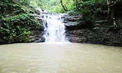
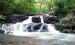
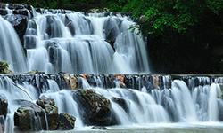
Namtok Samlan National Park is located in Saraburi districts of Kaeng Khoi, Nong Khae, Wiharn Daeng, and Mueang. It includes the Khao Sam Lan Forest, which is located near Bangkok and has fertile forest conditions. Additionally, the forest contains beautiful nature and stunning waterfalls, most notably the Khao Sam Lan Waterfall , which is well-known to visitors.
The transportation routes to Namtok Samlan National Park are convenient. Visitors can travel for a one-day trip from Bangkok.
Namtok Samlan National Park covers a total area of 27,856.25 rai (44.57 square kilometers). It was originally known as the Namtok Samlan Forest Park. The entire area is located within the Phra Chai National Reserved Forest and has an area of 24 square kilometers under the responsibility of Saraburi Regional Forest Office.
Background
when the Royal Forest Department established the National Park Division in 1974, Namtok Samlan Forest Park was transferred to the division. In the past the forest was very rich. During World War II, Japanese soldiers used this area as a strategic point and to make bunkers. They cut down trees to make logs, firewood, charcoal forcooking, and making roads, causing some natural forests to be destroyed. In 1960, reforestation was undertaken to revive the forest, and it has recovered even more since it was declared as a National Reserved Forest.
Later, in 1976, the National Park Division, assigned by the Royal Forest Department, considered designating Phra Chai Forest a National Park. As a result, the National Park Division assigned Namtok Samlan Forest Park Office to conduct a survey. The survey found that Phra Chai Forest area has a complex mountainous landscape. Additionally, it is a source of water catchment. The forest is in perfect condition, with beautiful waterfalls and is home to numerous wild animals. It was therefore deemed suitable to be established as a national park.
On November 30, 1976, the National Park Division of the Royal Forest Department presented Sam Lan Forest Park area to the National Park Committee, which adopted a resolution stating that it was deemed appropriate to designate the area as a national park. The royal decree defined the areas of Phra Chai Forest and Namtok Sam Lan in Nong Nak, Huai Sai, Khok Yae of Nong Khae district, Nong Pla Lai of Mueang Saraburi district, Ban Lam and Khlong Ruea of Wihan Daeng, and Huai Haeng of Kaeng Khoi district in Saraburi province to be a national park. It was declared in the Government Gazette, Volume 98, Section 85, dated June 2nd, 1981, as the country's 27th National Park.
Later, in 2000, the Director-General of the Royal Forest Department had a formal visit and suggested that it should be renamed to Phra Phutthachai National Park. The Royal Forest Department realized that it should be consistent with archaeological data, history, and the area's condition, Khao Sam Lan National Park therefore was renamed to Phutthachai National Park.
On May 31, 2006, the National Parks, Wildlife and Plant Conservation Department considered that the name should be suitable and consistent with the area's strengths and potential. As a result, Phra Phutthachai National Park has been renamed to Namtok Sam Lan National Park.
Note : After paying the entrance fee to the National Park, please carry the receipt for inspection.
27,856.25 rai (44.57 square kilometers)
|
|
|
||
|
Sam Lan Waterfall |
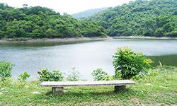
Sap Pla Kang Reservoir |
||
Nature trails ⇔ Trekking ⇔ Visit Waterfall ⇔ Observe flowers/plants ⇔ Bird/Butterfly ⇔ Mountain biking ⇔ History/Culture ⇔ Camping
Welfare shop : Open daily from 8:00 - 17:30 hrs. (selling coffee, drinking water, and snacks).
Mobile phone signal :
National Park Headquarters area: AIS, TRUE, DTAC
|
|
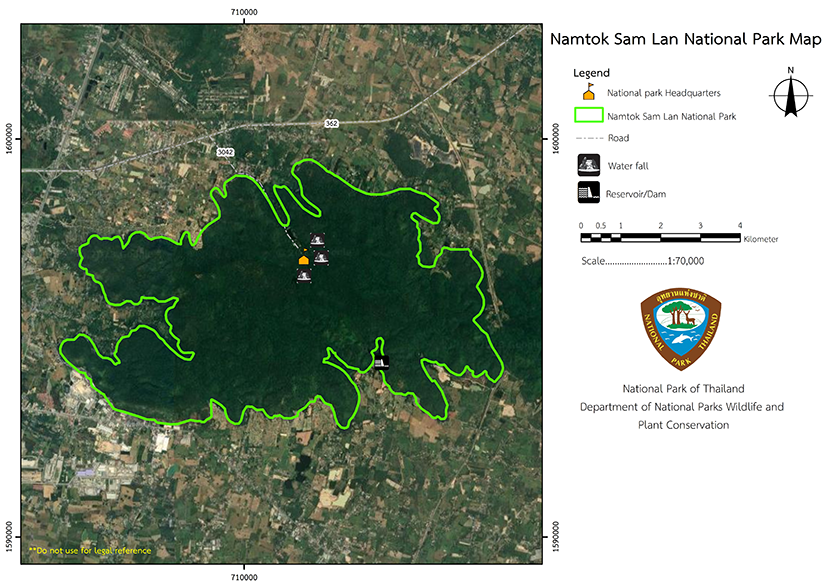
Namtok Sam Lan National Park is located between the U.T.M. coordinates at 705000E to 717000E, and 1592000N to 1599000N The terrain consists of high mountainous areas and narrow plains between the valleys. 1. High mountainous areas consist of complex mountains landscape, with mountain ranges stretching from northwest to southeast encircling the national park area. 2. Narrow plains between the valleys are in the northern part of the park. The terrain contains both large and small mountains and plains between the valleys. The Khao Khrok summit is the highest point in the valley, rising 329 meters above sea level. Visitors can view Saraburi city and nearby districts from this place. The forests within this national park are the source of numerous waterfalls and water streams that flow through the area, nourishing the rice fields belonging to the residents nearby. The national park area is on the west side of Khao Yai National Park, and contains the same type of volcanic rock, which is presumed to be the Permian-Triassic rocks estimated to be 230 to 260 million years old. |
|
Climate Features
|
|
|
|
|
Flora and Fauna
|
How to get there by car :
Visitors can easily travel from Bangkok to the National Park and return in a day by driving along Phahol Yothin Road (National Highway No. 1) heading to Saraburi Province. Be prepared at the milestone No.101st make a U-turn before reaching the milestone No.102nd, and then turn left onto the road number 3042 (Phra Phutthachai Intersection), and continue for about 5 kilometers. Then turn right to the road number 3046 for about 3 kilometers to Namtok Sam Lan National Park.
Additionally, visitors can take another route by traveling along Phahol Yothin Road (Highway No. 1) then enter Saraburi bypass to Nakhon Ratchasima. Turn right at Phra Phutthachai intersection, and continue straight. Then turn right onto the road 3046 for approximately 3 kilometers to Namtok Samlan National Park.
- National Park Ranger Station No So Lo No. 1 (Sub Pla Kang)
Accommodation - Namtok Sam Lan 201 (Dong Wai 1)
- Namtok Sam Lan 202 (Dong Wai 2)
- Namtok Sam Lan 203 (Dong Wai 3)
- Namtok Sam Lan 204 (Dong Wai 4)
- Namtok Sam Lan 931 (Boys) Youth Camp
- Namtok Sam Lan 932 (Girls) Youth Camp

