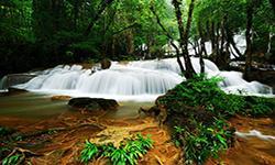
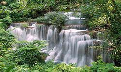
Khuean Sinakharin National Park
Contact Location : Khuean Sinakharin National Park, PO 1, Si Sawat Districtin Kanchanaburi Province 71250.
Telephone Number : (+66) 3 454 0316 (office), (+66) 3 454 317 (housing service center).
Email : khuansrinakarin_np@hotmail.co.th
Facebook : KhueanSrinagarindra National Park
Information
Khuean Sinakharin National Park is located in Sai Yok, Si Sawat, and Thong Pha Phum in Kanchanaburi Province, consisting of beautiful natural landscapes such as waterfalls, hot springs, caves, and islets in the reservior above Sinakharin Dam next to the Sai Yok National Park. Thung Yai Naresuan Wildlife Sanctuary, Erawan National Park, and Salakphra Wildlife Sanctuary cover an area of 957,500 rai or 1,532 square kilometers.
Background
This area is a watershed forest for Khwae Yai River above the Sinakharin Dam and is in perfect condition with complex mountain landscape area teeming with abundant wildlife and endowed with numerous critical natural features, such as Huai Mae Khamin Waterfall, hot springs, caves, and lakes. In response to Cabinet resolution on January 9th, 1979, to preserve the forest, a national park was declared in 1980. The National Park Division under the Royal Forest Department issued an order No. 71/2523, dated January 11th, 1980 for Mr. Nisai Fungkajon, Forestry Technical Officer Level 5, to act as the head of the Erawan National Park survey. In addition, during the meeting of the Kanchanaburi Tourism Promotion Committee No. 3/2522 on December 27th, 1979, Mr. Phong Leng I, Director of the National Park Division, proposed that the Royal Forest Department establish a National Park near Huai Mae Khamin Waterfall in Si Sawat District in Kanchanaburi Province. Therefore, the Provincial Investigation Team was commissioned to investigate, and it found that the forest area is beautiful with many natural features, suitable for the establishment of a National Park. The National Park Division under the Royal Forest Department presented the information to the National Park Board in meeting No. 2/2523 on August 8th, 2523. It deemed it appropriate to designate the area as a National Park by Royal Decree, and defined the land area of Khao Phra Ruesi Forest and Khao Bo Rae Forest in Chalae, Tha Khanun, Hin Dat, Lin Thin, Thong Pha Phum, Khao Chot, Na Suan, Dan Mae Chalap, Nong Phet, Tha Kradan, Si Sawat District and Sai Yok District in Kanchanaburi Province to be included in the National Park, which was announced in the Government Gazette, Volume 98, Section 210, dated December 23rd, 1981 and it became Thailand’s 38th National Park.
Note : After paying the entrance fee to the National Park, please carry the receipt for inspection.

957,500 rai (1,532 square kilometers).
|
|
|
|
Nature trails ⇔ Visit Waterfall ⇔ Observe flowers/plants ⇔ Bird/Butterfly ⇔ Mineral water bathing ⇔ Camping
Welfare shop : open daily from 7:00 to 17:00 hrs. and sells coffee, drinking water, and snacks.
Mobile phone signal :
- National Park Headquarters area: AIS, TRUE, DTAC
- Huai Mae Khamin Waterfall: AIS, TRUE
- Noen Sawan viewpoint area: AIS, TRUE
- Pha Tad Waterfall: AIS
|
|
Part of Khuean Sinakharin National Park was created by the construction of the Sinakharin Dam, which blocked Mae Klong River (Khwae Yai). Many vital waterways flow into this reservoir, such as Mae Khamin Creek, Kha Khaeng Creek, Mae Wong Creek, Kriangkrai Creek, and Mae Phlu Creek. Many streams also flow into Khwae Noi River in Sai Yok District, such as Lin Thin Creek. The terrain is home to karst topography and sedimentary rocks. The highest altitude is about 1,100 meters above sea level, and the average height is about 400 meters. The waters of the reservoir at the Sinakharin Dam have a maximum height of 180 meters above sea level.
|
|
The climate at the Khuean SinakharinNational Park is affected by a rain shadow that has less rainfall than other parts of Thailand. As such, it can get very hot in summer, with maximums in April of 44-45 degrees Celsius. It can also be very cold in winter, with lows of about 8-9 degrees Celsius in December. The average temperature is about 27 degrees Celsius. There are 3 seasons, including rainy season that starts in mid-April through to mid-October, winter is in November to February, and summer is in March and April. The average rainfall is about 1,600 millimeters.
|
|
|
|
The forest of Khuean Sinakharin National Park can be divided into three types: mixed deciduous forest, deciduous dipterocarp forest, and dry evergreen forest. The deciduous dipterocarp forest is composed of important plants such as Burmese Sal, Iron Wood, and Ceylon Oak. The ground plants include Dwarf Date Palm, Cycas siamensis, and Vietnamosasa pusilla. Around the reservoir and waterways, there are many wild animals and aquatic animals including Indochinese Dwarf Toad, Dark-Sided Frog, Malayan Giant Frog, Large-Eared Rock Frog, Northern Cascade Frog, Berdmore's Chorus Frog, Clown featherback , Hampala Barb, Yellow Mystus, Giant Snakehead Fish, Greater Brook Carp, Garras, and Armed Spiny Eel. The encroached agriculture land is now abandoned, including the deforestation land around the reservoir. Animals inhabited there include Barking Deer, Burmese Hare, Bamboo Rat, Great Egret, and Red-Wattled Lapwing (Vanellus indicus), Greater Coucal, Plaintive Cuckoo, Indian Roller, Streak-Eared Bulbul, Calotes emma, Calotes versicolor, Ground Lizard, Asiatic Burrowing Frog, and Dark-Sided Chorus Frog. |
How to get there by car :
1. From Sinakharin Dam runs by the Electricity Generating Authority of Thailand: the road passes through the intersection towards Erawan Waterfall and Phra That Cave. There are 32 kilometers of gravel roads and 10 kilometers of paved roads which makes travel in rainy season quite difficult. The 42 kilometers road runs along the edge of Sinakharin Dam to Huai Mae Khamin Waterfall suitable for pick-up trucks. It is the location of the National Park Headquarters.
2. Erawan-Si Sawat to Tha Phae Car Ferry Huai Mae Lamun: take the car ferry from Mae Lamun side to Si Sawat District area which takes 15 minutes. Then drive for about 20 kilometers to the second car ferry terminal, transiting from Si Sawat to Huai Mae Khamin Waterfall. The trip takes 45 minutes. From the ferry terminal, travel for another 7 kilometers, visitors will reach the waterfall where the National Park Headquarters is located. This route is suitable for cars and vans.
How to get there by boat :
Private ferry charters depart from various ports, such as Mong Krathae Pier, Tha Kradan Pier, and Khuean Nakarin Pier of the Electricity Generating Authority of Thailand. It takes approximately 1 -1.30 hour.
- National Park Ranger Station So Ro No. 1 (Mae Kwa)
- National Park Ranger Station So Ro No. 2 (Dong Yai)
- National Park Ranger Station So Ro No. 3 (Ban Klang)
- National Park Ranger Station So Ro No. 4 (Pha Tat)
- National Park Ranger Station So Ro No. 5 (Sam Prasop)
- National Park Ranger Station So Ro No. 6 (Khao Khiao-Khao Wong)
- National Park Ranger Station So Ro No. 7 (Tha Thung Na)
- N-ational Park Ranger Station So Ro No. 8 (Nam Mut)
- National Park Ranger Station So Ro No. 9 (Krai Kriang)
- National Park Ranger Station So Ro No. 10 (Ongsit)
- National Park Ranger Station So Ro No. 11 (Noen Sawan)
- Accommodation - Khuean Sinakharin 101/4 (Wang Napha 1)
- Accommodation - Khuean Sinakharin 101/2 (Wang Napha 1)
- Accommodation - Khuean Sinakharin 101/3 (Wang Napha 1)
- Accommodation - Khuean Sinakharin 101/4 (Wang Napha 1)
- Accommodation - Khuean Sinakharin102/1 (Wang Napha 2)
- Accommodation - Khuean Sinakharin 102/2 (Wang Napha 2)
- Accommodation - Khuean Sinakharin 102/4 (Wang Napha 2)
- Accommodation - Khuean Sinakharin 203 (Usa Sawat)
- Accommodation - Khuean Sinakharin 102/3 (Wang Napha 2)
- Accommodation - Khuean Sinakharin 302 (Man Khamin 2)
- Accommodation - Khuean Sinakharin 303 (Man Khamin 3X)
- Accommodation - Khuean Sinakharin 304 (Man Khamin 4)
- Accommodation - Khuean Sinakharin 305 (Man Khamin 5)
- Accommodation - Khuean Sinakharin 501 (Kui Mang 1)
- Accommodation - Khuean Sinakharin 502 (Kui Mang 2)


