Chaloem Rattanakosin National Park
Contact Location : Moo 4, Khao Chot Sub-district, Si Sawat District in Kanchanaburi Province 71220
Telephone Number : (+66) 3 451 0979
Email : chaloemrat_np@hotmail.com
Facebook : Chaloemrattanakosin National Park
Information
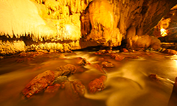
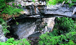
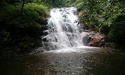
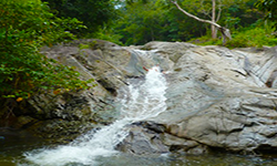
The Chaloem Rattanakosin National Park is small in size but home to rich forests and nature, that is breathtaking, including waterfalls, cliffs, and Than Lot Cave. The cave is considered to be a wonder formed by the collapse of limestone roof and water erosion, which turned the limestone into a vast natural bridge. Additionally, there is evidence that it was a route used by Myanmar army and Japanese army. It has an area of approximately 59 square kilometers or 36,875 rai.
Background
In 1973, the Royal Forest Department issued a letter Ko So 0708/8531 to Kanchanaburi Province on June 4th, 1973, approving a survey of the forest and wood project for Other hard woods-Nong Ri - Huai Mae Phlu Fang-Sai Forest (Ko Cho 6). This was to help establish national parks in selected areas, and in 1974, the Royal Forest Department established the Tham Than Lot Forest Park. Subsequently, the National Park Division received a letter dated February 19th, 1976 from Ko So 0808/656 addressed to Mr. Cho Phongrungsap, the Superintendent of the Tham Than Lot Forest Park, who then conducted a forest survey.
Than Lot Cave was designated as a National Park as the area is endowed with numerous noteworthy features and beautiful natural scenery. In particular, the Than Lot Cave has a creek flowing through it that comes from the mountains. The cave is enormous with asizable dome-shaped ceiling, which is a unique natural phenomenon. The forest conditions are complete and home to a variety of wild animals. According to the survey report No. Ko So 0808 (Tho Lo)/14 dated April 7th, 1976, historical evidence shows it was a route used by the armies of Myanmar and Japan. The Royal Forest Department proposed the establishment to the National Park Board at meeting No. 2/2519 on August 17th, 1976.
The Royal Decree specifying the land area of Nong Ri forest in Khao Chot Sub-district, Si Sawat District, Kanchanaburi Province to be a National Park, was announced in the Government Gazette, Volume 97, Section 20, dated February 12th, 1980.
Later, during the Rattanakosin celebrations, it was confirmed that an area within the National Park was used as a route and battleground for fights between the Thai and Myanmar forces, based on evidence such as weapon remnants. Antiques, skeletons, and a variety of amulets were found from the time of His Majesty, King Buddha Yodfa Chulalok the Great, who reigned during a period of numerous armed conflicts with Myanmar in Kanchanaburi Province area. It was determined at the meeting on December 22, 1981 that it was appropriate to named the National Park after His Majesty King Buddha Yodfa Chulalok the Great. By renaming the park "Phra Phuttha Yot Fa Chulalok Maharat National Park," he is honored and the park benefits from a link to an auspicious leader. The Royal Secretariat informed the King via letter No. 0002/6924 dated July 1, 2525, and His Majesty, King Bhumibol Adulyadej renamed the park "Chalerm Rattanakosin National Park."
Note : After paying the entrance fee to the National Park, please carry the receipt for inspection.
36,875 rai (59 square kilometers)
|
|
|
||
|
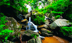
Trai Trueng Waterfall |
Than Ngoen Waterfall |
||
|
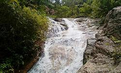
Than Thong Waterfall |
Slider Waterfall |
||
Nature trails ⇔ Visit Waterfall ⇔ Cave exploration/Geological condition ⇔ Observe flowers/plants ⇔ Bird/Butterfly ⇔ Camping
Welfare shop : Restaurant opens on Saturday-Sunday and holidays from 09.30 - 16.00 hrs.
Mobile phone signal :
National Park Headquarters: AIS, TRUE
|
|
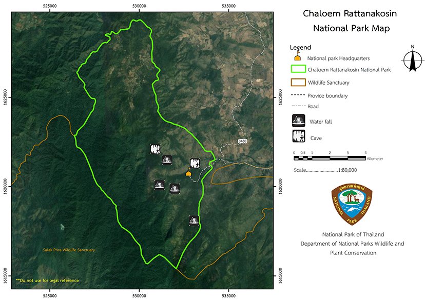
Chaloem Rattanakosin National Park is located in the western mountains, which are complex mountains landscape with karst topography. The altitude is between 240 to 1,260 meters above sea level and consists of Khao Kamphaeng, Khao Mai Hom, and Khao Phu Chang Mop. The highest point is the Khao Kamphaeng summit, which is about 1,260 meters above sea level. These mountains are the catchment area for Mae Phlu Creek, Takuat Creek, Mae Kra Phroi Creek and Kra Phroi Creek. Northern Border Contact: Adjacent to the National Reserved Forest, the 6th plot of Thai Paper Factory, Khao Chot Sub-district. Southern Border Contact: Nong Ri National Reserved Forest, Khao Chot Sub-district, Si Sawat District in Kanchanaburi Province. Eastern Border Contact: Nong Ri National Reserved Forest, Khao Chot Sub-district, Si Sawat District in Kanchanaburi Province. Western Border Contact: Salak Phra Wildlife Sanctuary, Khao Chot Sub-district, Si Sawat District in Kanchanaburi Province. |
|
The climate of this area is influenced by the southwest and northeast monsoons. May to November is the southwest monsoon season which causes high humidity, heavy rains, and cloud cover, with an average rainfall of 1,700 milimeters per year. November to February is the northeast monsoon season when the weather is colder and sunny, with an average minimum temperature of 16 degrees Celsius in December and January. Summer is in March and April and has an average high temperature of 37 degrees Celsius. Chaloem Rattanakosin National Park is part of the Western Forest Complex and is home to four types of forest: hill evergreen forest , dry evergreen forest, mixed deciduous forest, and deciduous dipterocarp forest. |
|
|
|
In the valley areas, there is deep topsoil, which is moist due to the high humidity, especially in places such as the Rim Huai Mae Phlu Valley, Mae Kra Phroi Creek, Kra Phroi Creek, and the surrounding forests of Khao Kamphaeng summit, next to the hill evergreen forest, between elevations of 200 to 1,000 meters above sea level. This area covers with dry evergreen forest with major plants such as Yang, Dipterocarpus turbinatus C.F., Paldao, Pterocymbium tinctorium (Blanco) Merr., Aphanamixis polystachya, Siamese Rough Bush, Syzygium megacarpum, Sugar Palm, Iron Wood, and Chukrasia tabularis A.Juss. . The epiphytic plants are the Dendrobium Orchid, Rhynchostylis Orchid, Oak-Leaf Fern, Hoya Mirabilia Kidyoo, American Elder, Bird's Nest Fern, Holttum's Staghorn-fern, and Dischidia Major (Vahl) Merr. Vine plants include Bauhinia scandens L. var. horsfieldii., Entada glandulosa Pierre ex Gagnep., Calamus viminalis Willd, Bushwillows, Sappan tree, and Getonia floribunda Roxb. The lower ground plants found include Ixora chinensis Lamk, Lime Berry, Bandicoot Berry, Diospyros undulata Wall. ex G. Don , Sand Ginger, Bustard Cardamom, Lasia spinosa (L.) Thwaites, Musa acuminata , Vietnamosasa cililta (A.Camus) T.Q. Nguyen, Common reed , and Ludwigia hyssopifolia ( G. Don.) Exell. As the canopy of the trees are closely connected, the area is moist and is home to a variety of wildlife species, including White-Handed Gibbon, Pig-tailed Macaque, Black Giant Squirrel, Great Hornbill, Spotted Dove, and Blue-winged Leafbird., Wild Boars and Sambar Deer use the mud reservoirs for wallowing. Ground plants include the Dendrocalamus strictus (Roxb.) Nees, Bambusa bambos (L.) Voss, Thyrsostachys siamensis Gamble, Gigantochloa albociliata (Munro) Kurz, Gigantochloa densa , Ixora chinensis Lamk., Bandicoot Berry, Canthium parvifolium Roxb.., Aglaonema nitidum (Jack) Kunth, Kaempferia roscoeana Wall, and Tillansia usenoides L. Wild animals that live in the mixed deciduous forests include Asian Elephants, common Wild pig, Barking Deer, Banteng, Asiatic Brush-pailed porcupine, Malayan Porcupine, Burmese Hare, Red Junglefowl, Kalij pheasant, and Woodpecker. Than Lot Noi Cave and Than Lot Yai Cave are home to a variety of wildlifes such as Blue Whistling Thrush, Hipposideros armiger , Giant Jungle Toad, Elaphe Radiata, Apis dorsata frabicius, and a many fish in the stream flowing through the cave, such as Minnows, Goldfin Tinfoil Barb, and Rasbora paviei , including shrimp. In the open areas next to the forest, visitors can see Vanellus indicus, Greater Coucal, and Asian Grass Frog. In the areas adjacent to villages and farms, visitors can observe Wild Deer, Barking Deer, Wild Boar, and birds such as Sooty-Headed Bulbul, Brown Shrike, Indian Roller, Calotes versicolor, Tokay Gecko, and Asian Common Toad. |
How to get there by car :
The highway from the downtown via Kanchanaburi-Sinakharin Dam (Provincial Highway No. 3199) is 16 kilometers after turning right at the Lat Ya District market. Continue to the Bo Ploy district on Provincial Highway No. 3086 (Kanchanaburi Road-Bo Ploy-Dan Chang) for about 68 kilometers to Nong Prue, and then turn left towards the Than Lot Cave for 22 kilometers, which is a total distance of 234 kilometers from Bangkok.
- National Park Ranger Station Cho So No. 1 (Khao Lek)
- National Park Ranger Station Cho So No. 2 (Khao Kamphaeng)
Accommodation- Small Tent
- Rattanakosin 101 (Lamthonglang)
- Rattanakosin 102 (Huai Kra Phroi)
- Rattanakosin 103 (Trai Trueng)
- Big CabinTent
- Big Dome Tent
- Big Tent
- Small Dome Tent
- Parking lot-Parking lot
- Restrooms -male and Female
- Trash bin-separate trash bins

