Namtok Huai Yang National Park
Contact Location : Huai Yang Sub-district, Thap Sakae District, Prachuap Khiri Khan Province , 77130
Telephone Number : (+66) 8 4701 2795, (+66) 9 8312 6808
Email : np_3Huaiyang@hotmail.com
Facebook :
Information
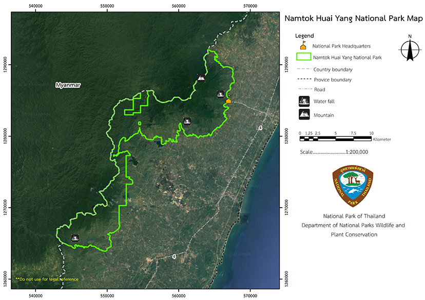
Namtok Huai Yang National Park is located in the districts of Bang Saphan, Thap Sakae, and the city district of Prachuap Khiri Khan Province, which is the narrowest part of Thailand. The park combines the area surrounding Namtok Huai Yang Forest Park, which is home to numerous beautiful waterfalls and a wide variety of wild animals. The total area is approximately 100,625 rai, or 161 square kilometers.
In 1987, the Phetchaburi Forest Department notified the Department of Forestry via letter Ko So 0714 (Pho Bo)/825 dated May 14th, 1987, that it had received a letter from Prachuap Khiri Khan Province, No. Po Cho 0009/940 dated January 16th, 1987. A report was submitted on the State Reserved Forest Supervision by the Thap Sakae Forestry Department stating that this area has two beautiful waterfalls and should be established as a Forest Park. The Phetchaburi Forest Department sent personnel from the Forest Park Ranger Station Po Cho No. 3 (Thap Sakae) to conduct a detailed investigation.
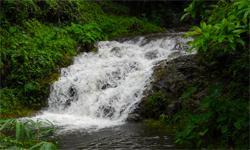
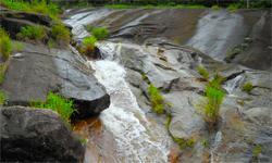
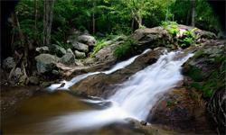
It discovered Kha-on Waterfall (Tap Mon) and Huai Hin Dat Waterfall, and is suitable to become a forest park in order to preserve this beautiful forest and watershed. Mr. Thammarong Prakobboon, Director of the National Park Division proposed to the Royal Forest Department that it should establish a National Park.
The National Park Division has a letter dated June 9th, 1987, Ko So No. 0713/1673, addressed to Mr.Sin Maliwan, Forestry Officer Level 4, at Namtok Huai Yang Forest Park asking him to conduct a preliminary survey around the area containing the two waterfalls. The survey results, according to Ko So No. 0713 (Ho Yo)/161 of Namtok Huai Yang Forest Park, dated September 14th, 1987, suggested that the forests and waterfalls be merged into the Namtok Huai Yang Forest Park to protect natural resources.
Later, the National Park Division issued a letter numbered Ko So 0713/2613 on July 8th, 1988, requesting Namtok Huai Yang Forest Park to include Wanakon Beach area into the National Park. According to the suggestion of Mr. Kasem Rattaanachai, Assistant of Petchburi Forestry Office, and according to the survey, the results of the survey, according to the forest park book Ko So 0713 (Ho Yo)/148 dated November 29th, 1988, Wang Duan Forest and Huai Yang Forest (Wanakon Beach), should be included in the entire area, and established as a part of the National Park.
An inspection of the Phetchaburi Forestry Office by Mr. Yukti Sarikaputi, Deputy Permanent Secretary for Agriculture and Cooperatives, acting for the Director-General of the Royal Forest Department between December 31st, 1988 and January 2nd, 1989, ordered the area around Wanakon Beach to become a National Park. At the meeting of the directors of the Royal forestry department on January 5th, 1989, Huai Yang Forest Area and Huai Yang Forest Plantationwere considered to be included, which is the area adjacent to Wanakon Beach.
The National Park Division began the process of merging Kha On Waterfall Forest area, Huai Hin Dat Waterfall, and Namtok Huai Yang Forest Park to Thap Sakae Forest in Thongchai Sub-district in Bang Saphan District, Ang Thong Sub-district in Thap Sakae District in Prachuap Khiri Khan Province, and Wang Duan Forest, Huai Yang Forest in Huai Sai and Huai Yang Sub-district, Mueang and Thap Sakae District in Prachuap Khiri Khan Province, It has a total area of approximately 124,300 rai s or 199 square kilometers (including 15.36 square kilometers of water area), and became a National Park under the National Park Act 1961. The National Park Division are in Namtok Huai Yang National Park area, which includes Kha on Waterfall, Huai Hin Dat Waterfall, and Namtok Huai Yang Forest Park, which are connected, while Wang Duan Forest and Huai Yang Forest ( Wanakon Beach) are not linked. So for the convenience of rangers in maintenance and control, it is divided into two national parks; Namtok Huai Yang National Park and Hat Wanakon National Park.
Note : After paying the entrance fee to the National Park, please carry the receipt for inspection.
100,625 rai (161 square kilometers)
|
|
|
|
|
|
|
|
Nature trails ⇔ Trekking ⇔ Visit Waterfall ⇔ Camping
Welfare shop : opens daily 8:00 to 16:30 hrs. and sells coffee, drinking water, and snacks.
Mobile phone signal:
- National Park Headquarters: AIS, TRUE
- Khao Lan Waterfall: AIS, TRUE
- Kha on Waterfall: AIS
|
|
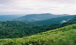
Namtok Huai Yang National Park a high continuous mountain range that are part of Tanaosi Mountain range, which dominates most of the area. It has elevations of 100 to 1,200 meters above sea level, with Khao Luang being the highest summit. It is the catchment areas such as Khlong Ang Thong, Khlong Kaeng, Khlong Thap Sakae, Khlong Chakra, Khlong Khai Nao, Khlong Ta Klet, Khlong Huai Yang, Khlong Huai Ma, and Khlong Hin Chuang, which separate Thailand and the Myanmar. The soil characteristics are sandy loam, with rocks made up of granite and gravel. The eastern side is adjacent to the plains and the Gulf of Thailand with the north adjacent to the Muaeng District of Prachuap Khiri Khan Province. The south is adjacent to Ban Nong Hoi and Ban Khao Man, Bang Saphan District in Prachuap Khiri Khan Province , and the west is adjacent to the Myanmar.
|
|
Namtok Huai Yang National Park is located in southern Thailand near the Gulf of Thailand, so the seasonal weather does not vary that much. The climate is divided into three seasons: Summer starts from February to May when thetemperature rises and the weather became increasingly hot. The average maximum temperature from March to May and April is around 29 degrees Celsius. The annual average temperature is 27 degrees Celsius. |
|
|
|
The forest types in Namtok Huai Yang National Park area include mixed deciduous forest, hill evergreen forest, and dry evergreen forest. There are plants such as Iron Wood, Lagerstroemia loudonii, Bungor, Resin Tree, Dipterocarpus grandiflorus, Toona ciliata, Ailanthus triphysa (Dennst.) Pterospermum diversifolium, Vitex glabrata R.Br., and Golden Fig. The ground plants in the area include various types of bamboo.
|
How to get there by car :
From Bangkok, take National Highway No. 4 (Phetkasem Road) to the milestone No. 350 - 351 around Huai Yang Market, which is about 20 kilometers before reaching Thap Sakae District. Then take Phetkasem Road - Huai Yang Waterfall Road and turn right after about 7 kilometers to reach Huai Yang Waterfall. The travel time is approximately 6 hours from Bangkok.
Update soon
- National Park Ranger Station Ho Yo No. 1 (Khao Lan)
- National Park Ranger Station Ho Yo No. 2 (Kha On)
Accommodation - Huai Yang 101 (Kradang-nga)
- Huai Yang 102 (Noen Sai)

