Hat Wanakon National Park
Contact Location : Hat Wanakon National Park, Moo 7, Huai Yang Sub-district, Thap Sakae District, Prachuap Khiri Khan Province, 77130
Telephone Number : (+66) 6 3142 1121, Fax: (+66) 3 251 0272
Email : wanakorn77130@hotmail.co.th
Facebook : -
Information
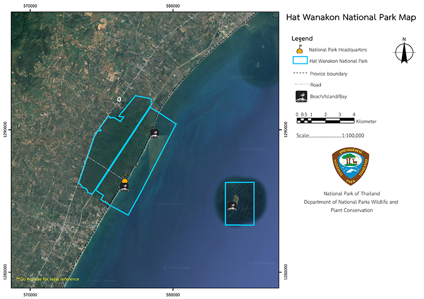
Hat Wanakon National Park is located on the seafront, about 22 kilometers from Prachuap Khiri Khan Province, between KM345-346 on Phetkasem Road, though it is separated from the main road, travel along the paved road for about 3 kilometers. There is also a railway line to the south that travels through the middle of the area, carrying both people and cargo.
The area to the north is adjacent to land owned by the Border Patrol Police, and the south is adjacent to Kok Ma Creek and Faculty of Forestry Student Training Station at Kasetsart University. To the east is the Gulf of Thailand and the western border is marked by Phetkasem Road.
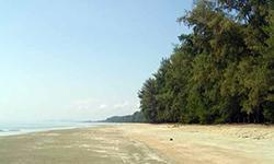
The famous Wanakon beach is in the National Park and resembles a long line extending into the sea. The area is very scenic, with a clean white sandy beach edged by sea pine trees. It covers an area of about 23,750 rai or 38 square kilometers in Huai Sai Sub-district, Khlong Wan Sub-district, Mueang District and Huai Yang Sub-district, Thap Sakae District, Prachuap Khiri Khan Province. Most of the plant species are newly introduced, such as Australian pine, Iron Wood, Horsetail, and Siamese Neem.
Background
Hat Wanakon National Park was originally named Wang Duan and Huai Yang National Reserved Forests, and included Huai Sai Forest Plantation, Mueang Prachuap Khiri Khan District, Huai Yang Forest Plantation, Huai Yang Arboretum, and Wanakam Huai Yang Forestry Station, Thap Sakae District, Prachuap Khiri Khan Province. Later, Wanakkam Huai Yang Forestry Station was removed from the park. The Royal Forest Department policy of establishing National Park to preserve the environment meant this area was transferred to the National Park Division from the fiscal year 1989 onwards. A Royal Decree specifying the land in Wang Duan Forest, Huai Yang Forest, the nearby islands in Huai Sai and Huai Yang Sub-district, Mueang Prachuap Khiri Khan and Thap Sakae District, Prachuap Khiri Khan Province covers a total area of 38 square kilometers. It was designated as Thailand’s 76th National Park in the Government Gazette, Volume 109, Section 126, dated December 30th, 1992.
Note : After paying the entrance fee to the National Park, please carry the receipt for inspection.

2,3750 rai (38 square kilometers)
|
|
|
||
|
|
|||
Nature trails ⇔ Observe flowers/plants ⇔ Bird/Butterfly ⇔ Wildlife watching activities ⇔ Mountain biking ⇔ Snorkeling ⇔ Camping
Welfare shop : stores and restuarant are opens daily 8:00 to 17.00 hrs.
Mobile phone signal :
National Park Headquarters: AIS, TRUE, DTAC
|
|
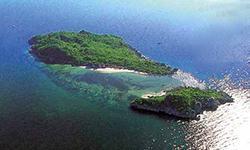
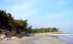
Hat Wanakon National Park comprises an area with a plain landscape, a coastline, and an escarpment. The average elevation above sea level is between 0 - 5 meters, and it resides in the central part of Prachuap Khiri Khan Province. The National Park area is coastal lowland area with slight undulations on flat terrain. It is ideal for farming and is surrounded by coconut plantations. Most areas of the park are adjacent to the coastline, and the beach is influenced by the sea. There are two small islands called Ko Chan and Ko Tai Si, which are connected. The terrain of the island is igneous and sandstone, with short sandy beaches of relatively fine sand formed by coral. The islands are characterized by west to east facing slope, with a steeper gradient on the west side. The north is borderd by land owned by Ban Wang Duan and Border Patrol Police Camp 14, and the south is adjacent to Kok Ma Creek and Faculty of Forestry Student Training, Station Kasetsart University. The east reaches the Gulf of Thailand and the west is bordered by Phetkasem Road. |
|
The climate is influenced by monsoons and the sea. There is a distinction between dry and rainy seasons, but the temperature is more stable than other parts of Thailand. Rainy season lasts from May to November, approximately 6 to 7 months a year. Winter covers December to January, while the three months of February to April are hot and dry. Annual precipitation totals 1,013.52 millimeters with most rainfall in October, with 288.32 millimeters, while December has the least, with 12.72 millimeters.
|
|
|
|
|
Hat Wanakon National Park has is home to plants at 0-5 meters above sea level and a total of 116 plant species were discovered. The study of plant species with a diameter at the chest height of more than 4.5 centimeters in the forests of Hat Wanakon National Park, Mueang District and Thap Sakae District in Prachuap Khiri Khan Province, found that the plants with the highest relative density were Bushwillows <i> (Combretum quadranguare) </i>, Siamese Neem <i> (Axadirachta indica), Suregada multiflora </i> (A. Juss.) Baill, Wattle <i> (Acacia auiculiformisr) </i>, and <i>Croton oblongifolius </i> Roxb respectively. Siamese Neem <i> (Axadirachta indica) </i> are scattered throughout the area and of high ecological significance because it grows in clusters and rows, so provides stability to the area. Other plants that benefit are Wattle and Australian Pine. Index of the plant species was considered and found that the Siamese neem tree had the highest ecological significance index. followed by Bushwillows, Wattle, <i>Suregada multiflora </i> (A. Juss.) Baill, and <i>Croton oblongifolius </i> Roxb respectively. There are 71 species of larger plants such as Siamese neem (Axadirachta indica), Bushwillows (Combretum quadranguare), Wattle (Acacia auiculiformisr), Suregada multiflora (A. Juss.) Baill, Croton oblongifolius Roxb, etc. Plants with a diameter at the height only up to the chest is 4.5 centimeters or more (big wood) such as Casearia grewiifolia Vent., Ramontchi (Flacourtia indica.), White – Meranti (Shorea roxburghii), Lagerstroemia speciosa, etc. The forest area in Hat Wanakon National Park was originally an area with planted forests. Bushwillows , Wattle, False Mahogany, were discovered to grow naturally in the area. It is now the leading tree in the area, with the highest density. Fauna Aquatic animals can be divided into the following categories: 2.2 Fish that are found in the sea or along coral reefs are mostly large fish or beautiful fish such as Blue-Spotted Fantail Ray <i> (Taeniura lymma) </i>, Redcoat Squirrelfish <i> (Holoceentrus rubrum) </i>, Copperband Butterfly <i>(Chelmon rostratus) </i>, Indo-Pacific Sergeant <i> (Abudefduf bengalensis) </i>, Pink Anemone <i> (Amphiprion penideraion) </i>, and Quoy Parrotfish <i> (Scarus quoyi) </i>. Other sea creatures seen along the beach include Oysters, Green Mussels <i> (Mytilus viridis) </i>, Wedge Shells <i> (Donax faba) </i>, <i>Poker chip Venus, Matuta banksii,</i> Ghost Crab, Cuttlefish <i> (Sepia pharaonis) </i>, Bicolor Pen Shell <i> (Pinna nobilis) </i>, and <i> Cymbiola nobillis</i>, mammals such as <i>Neophocaena phocaenoides</i> may also come to feed near the beach. Ecological and Genetical Significances |
How to get there by car :
. How to get there by Private car: From Bangkok, drive along Phetkasem Road (Highway No. 4) until the milestone No. 331 . After approximately 200 meters, visitors will notice a sign for Hat Wanakon National Park and the entrance. Turn right, and after approximately 150 meters there is a checkpoint where visitors should pay the entrance fee. After paying, continue straight for another 3 kilometers, until you reach the Hat Wanakon National Park beach.
How to get there by public buses :
There is a first-class air-conditioned bus service numbered route 66 from Bangkok - Bang Saphan that departs from the Bangkok Bus Terminal and costs 250 baht (fare information in February 2007). The destination you should inform the driver of is Hat Wanakon National Park. Alternatively, there is a second classbus to Chumphon which will also make a stop at the national park's entrance if requested. Visitors must pay the entrance fee at the checkpoint and then walk for 3 kilometers to reach a beautiful beach.
3. How to get there by Train: From Thon Buri Railway Station, take the Thon Buri - Lang Suan line to Huai Yang station. Then take a taxi to the national park entrance, paying the entrance fee (for the driver too if you want him to stay), and continue 3 kilometers to admire the beauty of Hat Wanakon National Park.
- Hat Wanakon National Park Headquarters
Accommodation - Zone 1 Wanakon 103-104 Bungalows, National Park Headquarters, is located in the south of Wanakon Beach.
- Zone 2 Wanakon 201/1-4 Rooms, National Park Headquarters, is located in the north of Wanakon Beach.
- Zone 2 Wanakon 202/1-4 Rooms, National Park Headquarters, is located in the north of Wanakon Beach.
- Zone 3 Wanakon 301-302 Bungalows, National Park Headquarters, is located in the campground area.


