Ao Siam National Park (Under Gazetting)
Contact Location : Ao Siam National Park (Under Gazetting) Address: Moo 6, Mae Ramphueng Sub-district, Bang Saphan District, Prachuap Khiri Khan Province 77140.
Telephone Number : (+66) 3 269 1226
Email : aosiam.np@outlook.co.th
Facebook : Ao Siam National Park
Information
The west coast of the Gulf of Thailand include Pa Klang Ao Forest Park, Mae Ramphueng Forest Park, Ko Talu, Ko Sing, and Ko Sang in Bang Saphan Noi District, Prachuap Khiri Khan Province. The area is located 8 kilometers, 6 kilometers, and 5 kilometers from the coast, as indicated on the map, scale 1:50,000 , series number L7018, section name AMPHOE BANG SAPHAN, tonnage number L7018, displacement 4831II. It was classified as a watershed quality class by Cabinet resolution on November 7, 1989. The classification of forest resources and land use zones are shown on the map. According to a Cabinet resolution dated 10-17 March 1992 and located in the Ministry of Natural Resources and Environment's drafting area, notification regarding the establishment of boundaries and environmental protection measures in certain areas of Sam Roi Yot, Kui Buri, Mueang Prachuap Khiri Khan, Thap Sakae, Bang Saphan, and Bang Saphan Noi Districts in Prachuap Khiri Khan Province.
Note : After paying the entrance fee to the National Park, please carry the receipt for inspection.
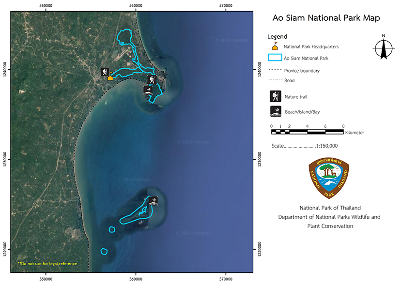
19,960 rai (31.9 square kilometers).
|
|
|
|
|
|
|
|
Nature trails ⇔ Trekking ⇔ Observe flowers/plants ⇔ Bird/Butterfly ⇔ Wildlife watching activities ⇔ Mountain biking
Welfare shop : opens daily (Except Thursday) 9:00 to 22:00 hrs.
Mobile phone signal:
National Park Headquarters: AIS, TRUE, DTAC
|
|
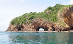
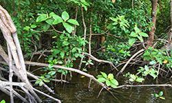
1. Mae Ramphueng Forest Park consists of forests set in mountainous tower karst including Khao Mae Ramphueng, whose summit is 248 meters high and faces the sea on 3 sides. The majority of gradients in the park are over 35 degrees on all sides. To enter to Khlong Mae Ramphueng you must pass through a mangrove swamp forest area of muddy soil or beaches. This area contains 2.4 square kilometers of terrestrial forest and 4.88 square kilometers of mangrove swamp forest, giving it a total land area of approximately 7.28 square kilometers. 3 Ko Thalu, Ko Sing, and Ko Sang Ko Thalu is a natural resource with high abundance of wildlife and great biodiversity. There is a diversity of land and marine animals and coral reef ecosystems. These ecosystems are classified as important areas for living things in terms of habitats, refuge, and food sources. At present, Ko Thalu is used in many ways, both directly and indirectly, as a tourist attraction, diving and snorkeling on the beautiful coral reef dive site. |
|
The land and islands on the Gulf of Thailand are influenced by the monsoon climate. There are a lot of rains in rainy season which starts from June to November. Moreover, the area also gets the southwestern monsoon from the Andaman Sea but blocked by Tanaosi Mountain range. Winter starts from mid November to February, and summer starts from March to May Water Supply |
|
|
|
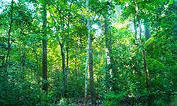
The ecosystem in Chaloem Phrakiat Thai Prachan National Park is characterized by mixed deciduous forest, which covers the majority of the national park's western portion. The significant plant species include Burma Padauk, Ironwood, Thai Bungor, Simpoh Air, Afzelia Wood, Ceylon Oak, Garuga pinnata Roxb., Beleric Myrobalan, Bastard Cedar, Barking Deer's Mango, and Hog Plum. The western and northern regions are covered in dry evergreen forest which include significant plant species such as Resin Tree, <i>Dipterocarpus turbinatus </i> C.F., Iron Wood, <i>Toona ciliata </i> M.Roem., Orange Champak, Crown Flower, <i>Magnolia baillonii </i>Pierre, Mesawa, <i>Mangifera caloneura </i> Kurz, Bungor, Monkey Jack, Burmese Grape, and Siamese Neem Tree. The ground plants are <i> Bambusa nutans</i>Wall. Ex Munro, <i>Cephalostachyum virgatum </i> (Munro) Kurz, Sugar Palm, rattan, Palm, and Fern. |
How to get there by car :
Travel to Ratchaburi from Bangkok by car along Phetkasem Road or via Thonburi Road - Pak Tho, or by train from Hua Lamphong Station to Ratchaburi Railway Station, a distance of approximately 100 kilometers. From Ratchaburi Province, visitors travel approximately 20 kilometers along Phetkasem Road before turning right onto Provincial Highway No. 3206. The distance between the two points is approximately 45 kilometers. Following that, visitors must turn left into Ban Thai Prachan for a 5-kilometer drive to the Chaloem Phrakiat Thai Prachan National Park Headquarters. The route is entirely paved.
- National Park Ranger Station Tho Cho No. 1 (Huai Ton Hang)
- National Park Ranger Station Tho Cho No. 2 (Bang Kama)
- National Park Ranger Station Tho Cho No. 3 (Tak Daet)
- Thai Prachan National Park Ranger Station
- Accommodation - Campground

