Chaloem Phrakiat Thai Prachan National Park
Contact Location : Chaloem Phrakiat Thai Prachan National Park, Moo 4, Ban Bueng Sub-district, Ban Kha District, Ratchaburi Province 70180
Telephone Number : (+66) 8 7165 3278
Email : thaiprachan_np@hotmail.co.th
Facebook : -https://www.facebook.com/chaloemprakiatthaiprachannationalpark
Information
The Chaloem Phrakiat Thai Prachan National Park is located in the administrative areas of Yang Hak, Thung Luang, and Ang Hin, Ban Kha Sub-districts in Pak Tho, Ban Buen, Nong Panchan and Ban Kha District in Ratchaburi Province, and was established by the National Reserved Forest. It is located on the western bank of the Phachi River, and is anational park located within the Chaloem Phrakiat Thai Prachan National Park Project which honors Her Majesty Queen Sirikit, The Queen Mother. In 1992, the Queen underwent five cycles of life in order to fulfill Her Majesty's commitment to forest conservation by allowing the public to assist in preserving forests that benefit people's livelihoods. Her Majesty Queen Sirikit, the Queen Mother, envisioned more than a decade ago that Thailand would retain numerous fertile forests of different types of forests to serve as models of forest rehabilitation and animal conservation.
Historically, this area was a critical strategic point for the Thai Communist Sectiony, and there were, violent clashes that resulted in enormous loss of life and property. Peace was brought to the area when government officials gained control and it was decided to expedite the development of forest resources and wildlife rehabilitation in areas destroyed in accordance with Her Majesty Queen Sirikit The Queen Mother's wishes. This would also promote and enhance new careers for local residents in order to improve their quality of life.
Background
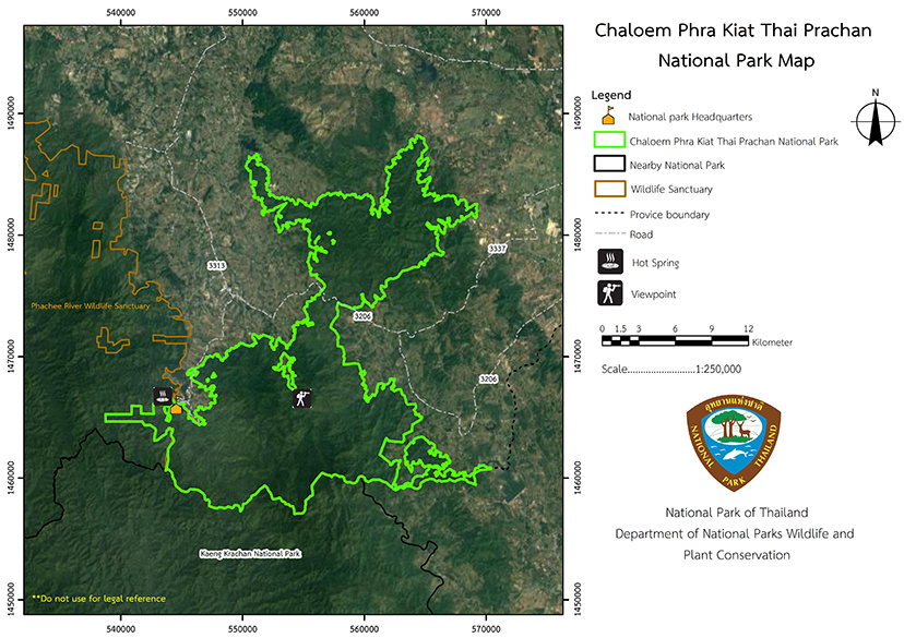
The Department of National Parks, Wildlife, and Plant Conservation determined that the establishment of the Chaloem Phrakiat Thai Prachan Park Project was appropriate in 2003. It was designated as a national park under the name "Chaloem Phrakiat Thai Prachan National Park" pursuant to Department of National Parks, Wildlife, and Plant Conservation Order No. 2393/2546 dated December 12, 2003, and the national park management plan and budget was established in 2005. The Chaloem Phrakiat Thai Prachan National Park encompasses the towns of Pak Tho and Ban Kha in Ratchaburi, the forest on the west bank of the Phachi River in Puyang Forest, Phu Sam Son, and Forest Khao Kong Kwian in Ratchaburi Province. The National Park Headquarters are located at Number 110 Moo 5, Ban Thai Prachan, Yang Hak Sub-district, Pak Tho District, Ratchaburi Province, Thailand, at coordinates 0560310 E 1466527 N, between latitudes 13 degrees 16 minutes north and 99 degrees 33 minutes east. It covers an area of about 205,777 rai (329.24 square kilometers). Later, a Royal Decree designated the forest area on the west bank of the Pachi River, Kong Kwian Forest, Phu Yang Forest, Phu Sam Son Forest in Ang Hin, Thung Luang and Yang Hak and Nong Pan Chan Sub-district , Pak Tho, and Ban Kha Districts of Ratchaburi province to be a National Park, and the information was published in the Government Gazette, Volume 129, Section 9 Ko, on January 24th, 2012. The area is 328.74 square kilometers or 205,463.9 rai.
Note : After paying the entrance fee to the National Park, please carry the receipt for inspection.

205,463.90 rai (328.74 square kilometers)
|
|
|
|
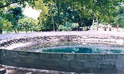
Nature trails ⇔ Visit Waterfall ⇔ Bird/Butterfly ⇔ Stargazing ⇔ Mountain biking ⇔ Take a boat ride or a paddle ⇔ Mineral water bathing ⇔ Camping
Welfare shop : There are no shops and restaurants. Visitors should prepare necessities, food and beverages.
Mobile phone signal :
National Park Headquarters: AIS, TRUE
|
|
It is a high, folded complex mountain region where the mountains run on a north-south through Ratchaburi Province, covering an area of 349.59 square kilometers until it reaches Myanmar. Khao Yeat, or Khao Phra Rop, is the highest summit in the area at of Pak Tho District, Suan Phueng District, and Ban Kha Minor District, Ratchaburi Province, with approximately 834 meters above sea level. The area's geology is sedimentary, with pebbles, strata, limestone, shale, and sandstone. The soil is extremely fertile and rich in organic matter due to the sandy loam nature of the soil, and it has an excellent capacity for water absorption. Khao Mae Prachan is the watershed of many waterways including Phu Sai Creek, Tha Khoi Creek, Phu Nam Ron Creek, and the Mae Prachan River, which flow into the Phetchaburi River. Additionally, the Phachi River flows into Mae Klong River. |
|
The climate is relatively cold throughout the year, influenced by the southwest monsoon in the rainy season and the northeast monsoon in the winter.
|
|
|
|
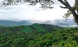
The ecosystem in Chaloem Phrakiat Thai Prachan National Park is characterized by mixed deciduous forest, which covers the majority of the national park's western portion. The significant plant species include Burma Padauk, Ironwood, Thai Bungor, Simpoh Air, Afzelia Wood, Ceylon Oak, Garuga pinnata Roxb., Beleric Myrobalan, Bastard Cedar, Barking Deer's Mango, and Hog Plum. The western and northern regions are covered in dry evergreen forest which include significant plant species such as Resin Tree, <i>Dipterocarpus turbinatus </i> C.F., Iron Wood, <i>Toona ciliata </i> M.Roem., Orange Champak, Crown Flower, <i>Magnolia baillonii </i>Pierre, Mesawa, <i>Mangifera caloneura </i> Kurz, Bungor, Monkey Jack, Burmese Grape, and Siamese Neem Tree. The ground plants are <i> Bambusa nutans</i>Wall. Ex Munro, <i>Cephalostachyum virgatum </i> (Munro) Kurz, Sugar Palm, rattan, Palm, and Fern. This national park area is still very fertile, and wildlife migration is frequent due to the shared forest with Kaeng Krachan National Park, Phachi River Wildlife Sanctuary, and the Myanmar. |
How to get there by car :
Travel to Ratchaburi from Bangkok by car along Phetkasem Road or via Thonburi Road - Pak Tho, or by train from Hua Lamphong Station to Ratchaburi Railway Station, a distance of approximately 100 kilometers. From Ratchaburi Province, visitors travel approximately 20 kilometers along Phetkasem Road before turning right onto Provincial Highway No. 3206. The distance between the two points is approximately 45 kilometers. Following that, visitors must turn left into Ban Thai Prachan for a 5-kilometer drive to the Chaloem Phrakiat Thai Prachan National Park Headquarters. The route is entirely paved.
- National Park Ranger Station Tho Cho No. 1 (Huai Ton Hang)
- National Park Ranger Station Tho Cho No. 2 (Bang Kama)
- National Park Ranger Station Tho Cho No. 3 (Tak Daet)
- Thai Prachan National Park Ranger Station
- Accommodation - Campground
- Seminar Room - Meeting Room 1-2
- Parking lot - Parking lot
- Restroom-Restroom


