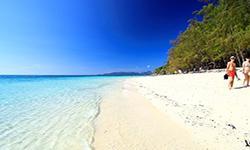
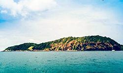
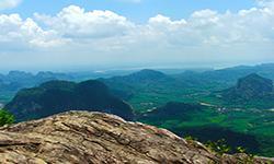
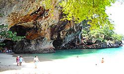
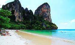
Hat Noppharat Thara – Mu Ko Phi Phi National Park
Contact Location : No. 79 Moo 5, Ao Nang Sub-district, Mueang District, Krabi Province
Telephone Number : (+66) 7 566 1145 (National Park Headquarters), (+66) 7 565 6150 (House) Fax: +66 7 566 1145
Email : phiphi_np@hotmail.com
Facebook : Hat Noppharat Thara – Mu Ko Phi Phi National Park
Background
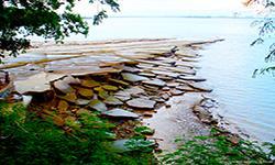
According to the resolution of the Cabinet meeting on January 26, 1977, the government wanted to develop Phuket as a tourist destination as it had many beautiful features that should be preserved as permanent attractions. Therefore, the National Park Division proposed that the Royal Forest Department conduct a survey, in the order 1261/2523 dated July 7, 1980. Mr. Santi Sikulap, forest official 4, was chosen to survey the area in order to establish a marine national park in Phuket nearby provinces. According to the survey report dated February 11, 1981, it appears that the area around Mu Ko Phi Phi and the nearby islands between Phuket and Krabi are the most appropriate to be classified as national parks. The Royal Forest Department of Nakhon Si Thammarat has a letter No. Ko So 0709 (No So)/269 dated January 19, 1982, informing that the forests of Noppharat Thara Beach and nearby islands, including Mu Ko Phi Phi in Mueang District, Krabi province would be considered appropriate as another national park. Consequently, the Royal Forest Department order524/2525, dated April 14, 1982, tolf Mr. Somchit Phawaratpinyo, a forest official 4 , to conduct a further survey and establish the Mu Ko Phi Phi and the forest area of Noppharat Thara Beach, Mueang District, Krabi Province as a National Park. Furthermore, the National Park Division deemed it appropriate to survey the 75-million-year-old shell cemetery in Mueang District, Krabi Province, and hoped it would be part of the same national park. According to the report dated May 27, 1982, the survey results concluded that the area consists of various sources that are particularly beautiful, and has many distinctive features with astonishing sea scenery. It was predicted it would be popular as a tourist attraction for both Thais and foreigners. The National Park Division presented the information to the National Park Board and it was approved on June 15, 1982, at meeting 1/2525, with a royal decree specifying that the 75-million-year-old Shell Cemetery, Noppharat Thara Beach, Mu Ko Phi Phi, nearby islands, Nong Thale, Ao Nang, Sai Thai and Pak Nam Sub-district in Mueang Krabi District, Krabi Province were suitable. The total area is approximately 243,725 rai, or 389.96 square kilometersand it became Thailand’s 47th National Park on October 6, 1983. Subsequently, the annexation of the area around the Shell Cemetery and nearby islands increased the size of the park by 12.17 rai, or 0.02 square kilometers, according to Royal Decree, Volume 113, Part 65 Ko, dated November 22, 1996. Later, the National Park Headquarters revoked some areas in the Hang Nak Mountain area, Nong Thale, Mueang District, Krabi Province, with an area of 1,300 rai, or 2.08 square kilometers removed for use by the Navy. According to Royal Decree, Volume 115, Part 72 A, dated October 13, 1998, he leftover area is now 387.90 square kilometers.
Note : After paying the entrance fee to the National Park, please carry the receipt for inspection.
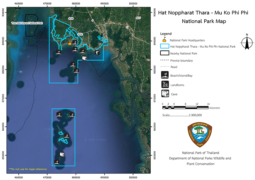
242,437 rai (388 square kilometers)
|
|
|
|
|
|
|
|
|
|
|
|
|
|
|
|
|
|
|
|
|
|
|
|
|
|
||
Nature trails ⇔ Cave exploration/Geological condition ⇔ Observe flowers/plant ⇔ Bird/Butterfly ⇔ Snorkeling ⇔ Scuba diving
Welfare shop : (Coffee, Drinking water, Snacks) : Open daily from 8.30 – 16.30 hrs.
Mobile phone signal :
Area of the National Park Ranger Station Pho Pho No. 1 (Hat Noppharat Thara): AIS, TRUE, DTAC
Area of the National Park Ranger Station Pho Pho No. 2 (Shelly Limestone): AIS, TRUE, DTAC
Lan Hoi Laem Pho area: TRUE unstable
Area of the National Park Ranger Station Pho Pho No. 3 (Ko Mai Phai): AIS, DTAC
Area of the National Park Ranger Station Pho Pho No. 4 (Thap Khaek): TRUE
Area of the National Park Ranger Station Pho Pho No. 5 (Ao Maya): AIS, TRUE
Area of the National Park Ranger Station Pho Pho No. 6 (Poda): AIS, TRUE, DTAC
Area of the National Park Ranger Station Pho Pho No. 7 (Ko Phi Phi Don): AIS, TRUE, DTAC
Information Service Center Area, Thale Waek: AIS, TRUE, DTAC
Railay Information Service Center: AIS, TRUE, DTA
|
|
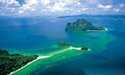
The park consists of coastal areas, with landforms including Ao Nam Mao, Ao Nang-Hang Nak Forest, and various small islands. The landscape is that of a steep mountain range that runs northwest-southeast. The coastal area has a greater gradient to the westside, . The geomorphology of the coastal regions and islands in the Andaman Sea is influenced by the movement of the earth’s crust known as the Indonesia Teotonic Movement. In the Khao Hang Nak mangrove swamp forest along the seashore, Khao Klom receives freshwater drained from a large swamp known as “Nong Thale,” which helps create the the mangrove swamp forest. The low plains of Samet forest at the National Park office are known as “Khlong Haeng’’ (Nopparat Thara Beach). Geological and Agronomical Features Hat Noppharat Thara-Mu Ko Phi Phi National Park covers the high mountains on the northern side of Noppharat Thara Beach, including Khao Khuan Sai, which is 529 meters above sea level, and the glacial morphology of cuesta mountain, which resembles a cleaver knife. The eastern side is steep, while the western side is slopy, and the slopy side has similar angle of the rock layers. Khao Khuan Sung, or Khao Khuan Haeng, is a long mountain range from Noppharat Beach to the northwest with karst landforms on the coast and the water-reaching plains of the Son Canal and Chi Lat Canal, covered by mangrove swamp forests. The beach lies between the headlands of the mountains and the erosion of coastal tidal waves on the rock strata of the Krabi Formation, which is the fossilized layer of the Laem Pho Shell Cemetery. The same body of water covers the two island groups Both islands have a general tower karst topography with sandstone layers interspersed, causing many islands to accumulate sandy beaches along coves. There are bays between the steep headlands, and many coves are created by the collapse of dolines in the limestone layer and erosion of one wall until it penetrates, such as at Ao Maya and Ao Pi on Ko Phi Phi Le. The two island groups formed a shoal connecting the island’s tombolo. An area with interesting geomorphology is Thale Waek around Ko Poda and the sandbar connecting Ko Nai and Ko Nok in the Ko Phi Phi Don area. Hat Noppharat Thara National Park soil is coastal loam that lies on the tidal plains behind the dunes and river mouths. The beach area is composed of sandy soil formed by plant organic matter that formed on top of the dunes and mountains. Both onshore and offshore areas are classified as complex slopes in the soil series classification system. Rock Hierarchy and Structural Geology Hat Noppharat Thara National Park has different rock hierarchies in four rock formations: Khao Laem Hang Nak consists of Arcos sandstone, which light brown, powdery sandstone, a violet mudstone, and pebbles in the Laab category, from the Trang rock group, Hua Laem and Khao Khlong Haeng. It is a rock group similar to that found at Kaeng Krachan. Khao Ao Nang is made up of rock from the Ratchburi Group, while the coast at Hoi Laem Pho Cemetery is from the Krabi Group, consisting of mudstone, sandstone, semi-hard sandstone, marl, argillaceous limestone, and lignite coal. Fossilized snails and Viviparus were found, with gypsum crystals interlaced. By studying the pollen and spores of plants that accumulate in the clay layer at the cemetery of Hoi Laem Pho, the shells appear to be 20 million years old. Most islands’ limestone was created in the Permian period as part of the Ratchaburi Formation. It is a gray to dark gray dolomite and limestone with very thick rock layers and a bulbous, layered shirt insert. Typical fossils found included fossilized brachiopods, crinoids, and bryozoa. Ko Mai Phai and Ko Phi Phi Don are from the Kaeng Krachan Formation, which is composed of shale inserted with sandstone and siltstone. There is shale interspersed with sandstone, mudstone, feldspar sandstone, Taft sandstone, quartz, conglomerate shale, and dark gray conglomerate mudstone with a greenish-gray brown color. The hierarchical rocks and age are from the Carboniferous period. Soil Characteristics and Areas where Landslides Occur Coastal loam is classified as part of the Takua Thung series. It is a saline soil with latent acidity and a texture that is from clay or silty loam with black and grey topsoil. . The lower soil is a dark gray or greenish-gray clay that can be found in the floodplain area and the estuary. It is a league soil with poor drainage, high levels of nutrients, and high salinity. The soil is neutral to moderately acidi, with a pH of 7.0 – 8.0 When the soil is wet, it is neutral or alkaline when wet, but when the soil is drained or dried, the sulfur in the soil releases sulfuric acid, thus making the ground acidic. Sandy soil is found in the Ban Thon series soil. The topsoil is dark gray, and below it is a layer of white sand. The lower soil is the accumulated layer of organic matter, which is brown or red in color and is compacted into a layer. It is relatively flat and pretty deep soil with good drainage but low nutrient levels. The soil is sacidic with a pH of about 5.0-6.0. The soils on the islands are found in complex sloping areas where soil erosion occurs due to the loamy soil that is mixed with rubble, classified as the Khlong Teng Series, which is composed of sandstone, quartzite, or shale. The color of the soil is brown, yellow, or red, with a loam topsoil and sandy loam underneath that occurs mainly from the decomposition of sandstone, mudstones, and limestone in some areas. The soil depth is very shallow, but it has good drainage and relatively low in nutrients. The soil is acidic with a pH of about 5.0-5.5.lately 53 square kilometers in the park is classified as a landslide-prone area, or accounting for 13.73% of the total national park area. The areas exploited for tourism and recreation with a high and moderate risk of landslides are Ko Phi Phi Don, Ko Phi Phi Le, Khao Ngon Nak Nature Trail, Ao Rai Le, and Noppharat Thara Beach. Water Resources Hat Noppharat Thara – Mu Ko Phi Phi National Park consists mainly of watershed class 18 areas that cover 21.57% of the area, followed by watershed class 3 which accounts for 17.65%. Hat Noppharat Thara – Mu Ko Phi Phi National Park has a short creek consisting of Tub Kaek Creek, flowing from the Na Nong Khla House in Ton Nam Forest into the sea. Another essential surface water source near the Hat Noppharat Thara-Mu Ko Phi Phi National Park is a large freshwater marsh called “Nong Thale.” Water Quality The results of water quality measurements from sampling points at significant water sources in the Hat Nopparat Thara-Mu Ko Phi Phi National Park, which were obtained by the Office of the Environment No. 15 (Phuket), are as follows: - The water source at Noppharat Thara Beach (Pak Khlong Haeng) is an area where boats run in and out periodically, and the estuary of the canal is heavily moored with boats so oil or petrol is found on the water surface. The water source at Noppharat Thara Beach has few visitor activities so there is no oil or greasefound on the surface of the water which is clear or light brown, and odorless. Bile Beach (Ko Hong) has many visitor activities, with floating algae but no oil or grease found on the water surface. As a result, the watercolor is blue-green and odorless. There is a water source at Ao Nang where boats are moored, and there are visitor activities. Along the banks are dense tourist establishments but there wasno oil or grease found but it smelled like sewage. - Water source at Ao Rai Le. Visitors wade in the water in relatively dense boats. Along the coast, there are resorts and accommodations. There is no oil or grease found on the surface of the water. The water is clear, green, and odorless. The water source at Thale Waek. It is an area where boats and visitors are crowded without any oil or grease found on the water surface. The watercolor is a clear blue and odorless. - Water source at Ko Poda. Boats run in and out from time to time, and they are pretty crowded with visitors. The water is green and odorless. - The water at Ko Kai is a place where boats travelbut no oil or grease was found on the water surface, which was clear blue and odorless. - At Ko Yung, no visitor activities were found, so no oil or grease was found on the water surface and the wateris clear blue and odorless. - At Laem Tong, Ko Phi Phi the boats are packed denselyand there are restaurants all the way along the banks. Oil or grease was found on the water’s surface but the water is clear blue and odorless. - At Ao So Ba Kao, Ko Phi Phi haslittle visitor activity, with about 20 ships docked which serve the resorts and hotels. There was no oil was found on the water surface, which was clear blue and odorless. - At Ao Lo Da Lam, Ko Phi Phi (western central), there are tourist activities which bring boats, and with them is brown sediment. Sludge, from the nearby wastewater treatment system was found, but no oil or grease was found on the water surface. The water is clear and odorless. - At Lo Da Lum Beach, Ko Phi Phi there are no visitor activities and boats are moored on the shore. No oil or grease was found on the water surface which was clear blue and odorless. - At Ton Sai Beach (Ton Sai Village), Ko Phi Phi (South) lots of boats are moored and a onjugate outley pipe enters the bay. There was oil or grease on the water’s surface but it is clear blue and odorless. - At Ton Sai Beach (in front of Ton Sai Village) boats run in and out periodically along the shore to the port. No oil or grease was found on the water surface and the water is green and odorless. - At Yao Beach, Ko Phi Phi (east side of the south) boats are moored and visitors wade in the water. There are resorts and hotels scattered along the coast but no oil or grease was found on the water surface which is is clear blue and odorless. - Ao Maya is closed for visitor activities and boats can only dock outside the buoy. As a result there was no oil or grease on the water surface, which is turquoise and odorless. - At Ao Lo Sa Ma there are cruise ships moored for diving, but they leave no oil or grease on the water surface. The water is clear blue and odorless. |
|
Hat Noppharat Thara – Mu KoPhi Phi National Park is influenced by the tropical monsoon So the climate is divided into two seasons: the rainy season starts from May to December, and the summer begins from January to April. The temperature ranges between 17 – 37 degrees Celsius, with an average annual rainfall of about 2,231 millimeters. The most precipitation occurs in the month of July and the least in February.
|
|
|
|
The evergreen forest appears on steep hills, including the areas of Khao Hang Nak, Ao Nang, west of Ko Phi Phi Don, and most of Ko Phi Phi Le. It covers 33 square kilometers but trees may be stunted on because the site is a limestone hill with a thin soil layer and is exposed to strong winds. Plants found includeHopea ferrea Laness, Hopea odorata, Dipterocarpus, White-Meranti (Shorea talura) and ground plants such as Dracaena cochinchinensis (Lour.) S.C. Chen, Rattan, Golden Fig (Ficus benjamina L.), and various climbers. Mangrove swamp forests exist in Haeng Canal, near the National Park Headquarters, on the southeast side of Hang Nak Mountain and in Yan Saba Canal, and on the northeast side of the Shell cemetery. They cover an area of approximately 9 square kilometers with plants thatI include Asiatisk Mangrove, Avicennia spp., Xylocarpus granatum Koenig, Briguiera pamviflora, and Phaseolus vulgaris L. Swamp Forest has one dominant plant, Paper Bark Tree, and is only found at Noppharat Thara Beach, with a narrow area of approximately 0.32 square kilometers. The soil is a sandy beach mixed with loam, influenced by seawater, or a place where the sea has been flooded before. Other plant species found include White -meranti (Shorea talura), Syzygium claviflorum (Roxb.) A.M. Cowan & Cowan, Non, Diospyros wallichii, and Imperata cylindrica. At Ao Nang, four types of seagrass species were found, including Cymodocea rotundata, Halodule pinifolia, Halophila ovalis, and Thalassia hemprichii. The climate and plant societies yield suitable habitats for specific animal species, classified as follows: Mammals include wild boars, Mouse Deer, monkeys, Langur, Bottlenose Dolphins, Malayan Bottlenose Dolphins, Finless Porpoises, Pantropical Spotted Dolphins, and Chinese White dolphins. The birds found include of Frigate Birds, Brahminy Kites (Haliastur indus), White-Bellied Sea-eagles, Swifts, and Laridae. The reptiles consist of Green Turtles, Hawksbill Sea Turtles, Olive Ridley Sea Turtles, Cantor’s Giant Soft-Shelled Turtles, Tokay Gecko, House Gecko, Skinks, Lizards, and Snakes. Amphibians include toads, Kaloula, Frogs, Common Green Frogs, and bush frogs. In addition, the marine life includes Stingrays, Spearfish, Grouper, Brown Spotted gGouper, Lates calcarifer, Jacks, Seabass, , Marine Angelfish, Freshwater Butterfly Fish, Labridae, Scorpio Spider Conch, oysters, shrimps, sea-cucumbers, sea stars, sea urchins, jellyfish, and sea anemones. Corals found includeMerulinidae, Finger Coral (Porites spp.), Flower Coral, Staghorn Coral, Acroporidae (Acropora carduus), Encrusting Coral, Tabulate Coral, Mushroom Corals, Lettuce Corals, and soft corals. |
How to get there by car :
From Bangkok, take National Highway No. 4 Phang-Ngafor a total distance of 946 kilometers.
How to get there by planes
from Bangkok Airport travel to Krabi Airport, and taxis or buses are available for the trip to the resort or National Park. The taxi will go direct but on bus you must depart at the National Park accommodation located at Hat Nopparat Thara – Mu Ko Phi Phi. (via Ao Nang)
How to get there by boats
boats from Krabi Province depart from Chao Fa Pier or Ao Phra Nang Pier from where it is f 40 kilometers, so about 2 hours. Travel by boat from Phuket Province from Chalong Pier also takes 2 hours.
How to get there by Train from Bangkok Railway Station
Visitors alight at Trang, Phunphin in Surat Thani Province, or Thung Song in Nakhon Si Thammarat Province. Then take a bus to Krabi Province, followed by the Krabi – Ao Nang bus to the Hat Noppharat Thara – Mu Ko Phi Phi National Park Headquarters and the accommodation (via Ao Nang).
How to get there by bus
From theBangkok Southern Bus Terminal at Sai Tai Main there are bus companies operating service, namely Transport Company Limited and Lignite Tour Company. After arriving in Krabi city, take the Krabi Skyway or the Ao Nang bus to Hat Noppharat Thara – Mu Ko Phi Phi National Park Headquarters and the accommodation (via Ao Nang)
- National Park Ranger Station Pho Pho No. 1 (Hat Noppharat Thara)
- National Park Ranger Station Pho Pho No. 2 (Susan Hoi)
- National Park Ranger Station Pho Pho No. 3 (Ko Mai Pai)
- National Park Ranger Station Pho Pho No. 4 (Thap Khaek)
- National Park Ranger Station Pho Pho No. 5 (Ao Maya)
- National Park Ranger Station Pho Pho No. 6 (Ko Poda)
- National Park Ranger Station Pho Pho No. 7 (Ko Phi Phi Don)
Accommodation : Phi Phi 101/1 (Susan Hoi 1)
Phi Phi 101/2 (Susan Hoi 2)
Phi Phi 101/3 (Susan Hoi 3)
Phi Phi 101/4 (Susan Hoi 4)
Phi Phi 102/1 (Lodana)
Phi Phi 102/2 (Lodana)
Phi Phi 102/3 (Lodana)
Phi Phi 102/4 (Lodana)
Phi Phi 103/1 (Lodalam)
Phi Phi 103/2 (Lodalam)
Phi Phi 103/3 (Lodalam)
Phi Phi 103/4 (Lodalam)
Phi Phi 107/1 (Ban Poda 1)
Phi Phi 107/2 (Ban Poda 2)
Phi Phi 107/3 (Ban Poda 3)
Phi Phi 107/4 (Ban Poda 4)
Phi Phi 110/1 (Ban Thale Waek 1)
Phi Phi 110/2 (Ban Thale Waek 2)
Phi Phi 110/3 (Ban Thale Waek 3)
Phi Phi 110/4 (Ban Thale Waek 4)
Hat Noppharat Thara – Mu Ko Phi Phi National Park has facilities such as lodges, camping grounds, tents, equipment rental services, restaurants, and supplies from the national park welfare shop and a private shop.

