Mu Ko Chumphon National Park
Contact Location : P.O. Box 8, Pak Nam Chumphon Post Office, Muang District, Chumphon Province, 86120
Telephone Number : (+66) 7 755 8144 ,(+66) 6 1989 3554
Email : mukochumphon@hotmail.com
Facebook : Mu Ko Chumphon National Park
Information
-
Background
With the abundance of natural resources and many aspects, the Bureau of Town Planning, Ministry of Interior, received invitation letter from the Royal Forest Department about a discussion on planning for Chumphon City in 1986, and conducting a survey of the natural resources in Chumphon Province.
The survey results showed that Chumphon province had various natural resources, such as mangrove swamp forests, forests, wildlife, marine animals, and coral reefs. Whether on beaches or islands, the natural conditions are beautiful and deserve to be considered for national park status to benefit from conservation and the protection of natural resources. It is a tourist attraction for people’s recreation and is a source of knowledge for academic research and dissemination.
Later in 1989, the Royal Forest Department ordered the National Park Division (formerly) to conduct additional surveys to prepare for the declaration of a national park. As a result, the National Park Division set up a temporary office at the Khao Chao Mueang Viewpoint and during this period, the area was called “Hat Sai Ri National Park”. In 1997 the office was temporarily moved to the entrance of Pak Khlong Tha Charakhe from where it continues to operate.
There area was declared a National Park on February 24th 1999 by Royal Decree, which specified the lands of Ao Thung Kha, Ao Sawi Forest and various islands in the area of Sa Phli Sub-district, Pathio District, Pak Nam, Tha Yang, Hat Sai Ri, Thung Kha and Wisai Nue Sub-district, Mueang Chumphon District, Wisai Tai, Dan Sawi and Tha Hin Sub-district, Sawi District, Pak Tako Sub-district, Thung Tako District Bang Nam Chuet Sub-district, Lang Suan District, in Chumphon Province. It was named the “Mu Ko Chumphon National Park.”
Note : After paying the entrance fee to the National Park, please carry the receipt for inspection.

198,125 rai (317 square kilometers)
|
|
|
||
|
|
|||
Nature trails ⇔ Observe flowers/plant ⇔ Bird/Butterfly ⇔ Wildlife watching activities ⇔ Take a boat ride or a paddle ⇔ Snorkeling ⇔ Scuba diving ⇔ Camping
Welfare shop : (Food) : Open daily from 8.30 to 16.30 hrs.
National Park Headquarters: AIS, TRUE, DTAC
|
|
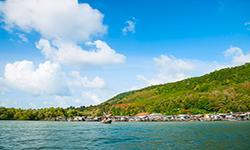
Geography Mu Ko Chumphon National Park consists of a variety of geographical features divided into four forms: 1.The coast is influenced by seawater and direct sea currents. The general characteristics are of sandy or muddy beaches and then behind the beach, there are beach forests or coconut farms. This coastline is located in the National Park and includes Ao Thung Makham Noi, Ao Thung Makham Yai, Ao Thong Tom Yai, Sai Ri Sawi Beach, Ao Mamuang, Ao Thong Tom Noi, Arunothai Beach, Ko Katha Coast, and Ao Thong Khrok. 2. Bays and river mouths are part of the coast and influence by adding freshwater to the sea. The bays here have large amounts of freshwater mixed with the seawater flowing down. These characteristics can be found in mangrove swamp forests where the ground is usually with a fine or sandy mud. In some areas, there are seagrass and seaweed found together on the seabed. Most areas have shallow water there are large muddy deltas or mudflats that emerge from the water at low tide. These important coastlines, such as Ao Thung Kha-Sawi, has more than ten canals that flow into the sea, and isregistered as an “International Wetland.” The other estuaries, such as Tom Canal, Bang Hak Canal, and Pak Nam Tako Canal, create different river deltas or sand bars. 3. Islands: The National Park has a total of 40 islands, which are mostly small with small caves. The coastline of the large island is influenced by sea vapor (salt spray), which affects the beach forest plants, but it doesn’t affect the higher ground. It may appear in the tropical rain forest. The smaller islands often contain stunted plant species. Underwater, the coral reefs often appear on the western side of the island, whereas the eastern part is influenced by the tides and easterly windsso primarily the coral reef may appear on the rocks. 4. Mountains that appear in the southern national parks are usually not very as they are by the sea. They are covered by tropical rain forest except for the cliff area. The mountains in this national park are as Khao Phong Phang at 145 meters high, Khao Bo Kha at 180 meters high, Khao Pra Chamhiang at 240 meters high, and Khao Katha at 300 meters high. Water Resources and Watersheds: - Important watersheds in Mu Ko Chumphon National Park and nearby areas consist of the Mae Nam Chumphon River Basin, the Ao Sawi River Basin, the Chaifang Thong Tom Yai River Basin, and the Pak Khlong Tham Tako River Basin. - The Pak Mae Nam Chumphon River Basin is the watershed class of the Chumphon River, continuing the influence of estuary sediments to the nearby island of Mu Ko Samet. - Ao Sawi River Basin is the watershed that flows into the Sawi Canal, before continuing to Ao Kho, which flows down to the coast through the mangrove swamp forest and brings the sediments into the Cole Plains that emerge from the low water tide. The six significant waterways that carry sediment downstream are the Tha Charakhe Canal, I Let Canal, Bang Tin Canal, Chumphon Canal, Sawi Thao Canal, and Sawi Canal. The I Let Canal connects to the Chumphon River near the estuary. - Chaifang Thong Tom Yai River Basin covers the coastal area around the Sawi District on the rocky cliffs of Khao Pra Hiang (Chong Hiang). The shoreline is straightbefore forming a dune which connects to Ko Maphrao. - Pak Tako River Basin is the watershed class that flows into the Khlong Lamut swamp and then drains the water into the sea through the Pak Tako. |
|
Chumphon Province is located on Laem Malayu between the Andaman Sea and the Gulf of Thailand; hence it is influenced by both monsoons. The northeast monsoon winds start in October and last until January of every year. Following on, the southwest monsoon blows from mid-May until the end of September. Thus, the seasons are divided into three seasons: The winter starts from November to February, summer runs from February to May, and then the rainy season is from May until November. Chumphon province has a long rainy season which lasts almost the whole year, with an average rainfall of 2,029.3 mm and 173 days. Therefore, the weather is humid but not too hot so there are abundant natural resources and the land is suitable for all kinds of agriculture.
|
|
|
|
|
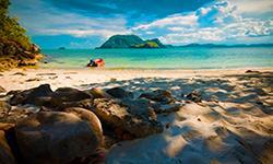
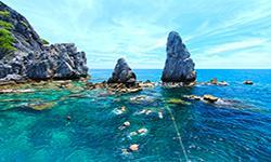
Mu Ko Chumphon National Park contains various intact resources essential in terms of genetic sources and knowledge for education and research. 1. Mangrove swamp Forest is an evergreen plant society that appears in coastal areas, estuaries, and in the shoreline. However, it often occurs in areas where freshwater flows, which results in lower salinity than seawater. Fine muddy soil is suitable for the mangrove swamp forest because it is rich in organic matter and pioneer species are often found, such as (Avicennia sp.), (Sonneratia sp.), and Mangrove (Rhizopha sp.). On the hard peaty soil, where there is less changes in tide and there are plant species such as Bruguiera sp, Ceriop sp., Xyiocarpus sp., Lumnitzera sp., and Acanthus sp. The mangrove swamp forest in Mu Ko Chumphon National Park currently has about 17,357 rai (27square kilometers), primarily found in Ao Thung Kha – Sawi, appearing along the bay’s shores and the canals, including the Chumphon Canal, Sawi Canal, and Sawi Thao Canal. 2. Tropical Rain Forest. The land area in the National Park is relatively narrow, so the tropical rain forest is only found on the mountains and large islands such as Ko Samet, Ko Mattra, and Ko Kula. Rainfall is relatively consistent throughout the year, with diverse flora in the evergreen foreststhat varies from area to area. The index plants are often found in the tropical rain forest consist of the rubber tree family (Dipterocarpaceae) such as Cotylelobium lanceolatum Craib, Hopea odorata, Anisoptera costata Korth., and Parashorea stellata Kurz. Other family trees include Terminalia pierrei Gagnep., Peltophorum (Vogel) Benth., Needle Wood, Mesua ferrea Linn., Aphanamixis polystachya, Calameae, and Palmae. 3. The beach forest is a plant community on the sandy coast both onshore and on the island, receiving salt spray from the sea. At present, occupying the area behind the beach for agriculture such as coconut plantations or tourism accommodation, including resorts and restaurants, which has destroyed much of the beach forest area. As a result, the remaining beach forest smalland are low bushes with bent trunks and short branches. The leaves are thick and often thorny due to the influence of sea breezes and the area’s drought. Mu Ko Chumphon National Park has only a few small beach forests left which are non-invasive patches. 4. The cliff plant community is a group of plants that have unique characteristics and are found on the cliffs. Most plants are classified as drought-tolerant plants (Xerophytes), with slow-growing, small shrubs converging on the strong wind direction along the cliffs. They are found on almost every island on the sloping and windy cliffs often on the eastern side. 5. Seagrass communities are found in marine plant communities in calm coastal areas and they are generally connected and often mixed with many different species. Sometimes there is only one dominant species but seagrass and seaweed may thrive together. Seagrass is usually found in sandy mud soil and a habitat and food source for many marine animals. It is a breeding and spawning ground for shrimp, shellfish, crabs, and fish. It is also the principal food source for rare marine mammals, such as the Dugong (Dugong dugon). Seagrass in the Mu Ko Chumphon National Park appears around Ao Thung Kha – Sawi, at the estuary of Pak Khlong Sawi Thao , Pak Khlong Sawi, and Pak Khlong Chumphon. Only one species of seagrass is currently surveyed, Harophila Beccarii, and a few species are still under further exploration. 6. Coral reefs are an important marine ecosystem that is home for many marine life species. They are inhabited for food, shelters, and spawning. The ecological structure of coral reefs is often complex in terms of components, organisms, and ecosystem functions. The coral reef is an excellent area that brings many divers to see various marine animals and corals. In addition to the benefits of being an important ecosystem and recreation area, coral reefs are also considered to be an resource of genetic materials, chemicals, and products that can be used in pharmaceuticals.Coral reefs in Mu Ko Chumphon National Park are found on various islands where the coral reefs adhere to the west and south because they shield the wind from the northeast monsoon. It has the general appearance of a fringing reef and can form at depths of 1 to 8 meters and the width can be about 35–500 meters wide. Scleractinian corals are often found near hard corals such as staghorn corals (Acropora sp.) and submassive corals (Porites lutea). Outside of the reef slope to the seafloor, large lumps of Porites lichen are often found.The northeast monsoon waves influence the eastern part of the island and corals that form on the rocks are often found as soft corals, encrusting corals, Antipathes sp. (black coral), sea whips, and Sea Fan (Gorgonians). Distinctive features of coral reefs on various islands in Mu Ko Chumphon National Park are the composition of living things. Coral reefs, which are different from other areas as follows: - Antipathes sp. (Black coral) is a soft coral that is often found in Thailand. - Animals are often found in a group of soft corals. - It has the largest soft coral, Corallimorph, Zoanthids, and Sea Anemone in the Gulf of Thailand. - The largest number and variety of fish species in the Gulf of Thailand. - There are various quantities and types of sea snail, Babylonia spirata, which is the most exciting exploration point in the Gulf of Thailand. Another outstanding geological feature is found on Ko Ngam Noi and Ko Ngam Yai, which have many underwate sea caves. Some are more than 15 meters long and 10 meters wide. Inside the caves are often sponges, corals, and marine animals, with the Whale Shark a possible sighting, which is the largest fish in the world. The shallow reef is suitable for snorkeling activities, and can be found on Ko Mattra, Ko Thonglang, Ko Lang Ka Chio, Ko La Wa, Ko Klaep, and Ko I Raet. The deepwater coral reefs are ideal for scuba diving and are found on Ko Ngam Yai, Ko Ngam Noi, and Ko Lak Ngam. Wildlife There are many different natural characteristics in the Mu Ko Chumphon National Park, such as mangrove swamp forests, mountains, islands, caves, beaches, and seas. Therefore, a wide variety of animals are found in each area with crucial species including many sea birds, consisting of herons, Marsh Sandpiper, Laridae, Alcedinidae, Cormorants, Threskiornithidae, and Hirundinidae. Reptiles: Clouded Monitor (Bengal Monitor), Common Water Monitor, Reticulated Python, Hawksbill Sea Turtle, Green Sea Turtle, and Sea Serpent. Mammals: Crab-Eating Macaques, Island Flying Foxes, Dolphins, Whales. Underwater, they are important species of fish, shellfish, Antipathes sp., sea anemones, corallimorphs, and zoanthids, with the highest number and diversity in Thailand |
How to get there by car :
From Bangkok, it takes about 6–7 hours to drive along Highway No. 4 (Phetkasem) to the Pathomphon Intersection. Thenturn left for about 8 kilometers to reach the city of Chumphon.
How to get there by bus :
Depart from the Southern Bus Terminal.
- National Park Ranger Station Mo Pho No. 1 (Hat Lok Phae)
- National Park Ranger Station Mo Pho No. 2 (Thung Kha)
- National Park Ranger Station Mo Pho No. 3 (Ko Matra) temporary unit
Accommodation : Mu Ko Chumphon 102/1-8 (Krachok’s Nest) (Close)
Mu Ko Chumphon 103/1-6 (Krachab’s Nest) (Close)
Other – Tents
Mu Ko Chumphon National Park Accommodation is available in both lodges and camping grounds. Rental services and restaurants are available.


