Hat Chao Mai National Park
Contact Location : Hat Chao Mai National Park, No. 142/18, Moo 5, Maifat Sub-district, Sikao District, Trang Province 92150
Telephone Number : (+66) 7 582 9967 (Office), (+66) 8 0572 2583 (Visitor Center)
Email : hatchaomai@hotmail.com
Facebook : Hat Chao Mai National Park
Information
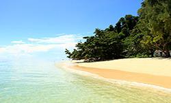
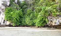
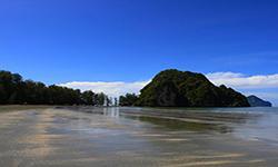
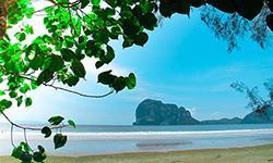
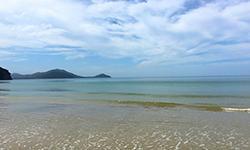
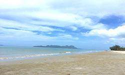
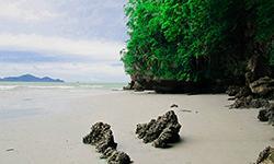
Hat Chao Mai National Park is in Sikao and Kantang District in Trang Province, in the Andaman Sea. It includes mangrove swamp forests, seagrasss, the island of Ko Kaeng, white sand beaches, and beautiful natural sea pines. Hat Chao Mai National Park covers an area of approximately 144,292 rai, or 231 square kilometers.
Background
In 1979, Mr. Pramoon Raksakaeo, head of the Kantang Forest Ecology Research Center, at the National Park Division, Royal Forest Department conducted a survey on November 7th, 1979into the ecology of Kantang sub-district, Trang Province, and found that Laem Yong Beach was a beautiful, 5km long, white sand beach on which there are natural sea pines suitable to be classified as a forest park as it was already a recreation place for the public. The National Park Division, Royal Forest Department issued an order 2502/2522, dated December 22, 1979, for Mr. Somboon Wongpakdee, Forest Scholar 5, to conduct a further survey, which showed that the condition of the area was suitable for establishing a forest park. The Royal Forest Department then issued an order 378/2523, dated February 25, 1980, for Mr. Pramoon Raksakaeo to act as the head of Laem Yong Lam Park.
In 1980, Laem Yong Lam Forest Park was also surveyed, to establish Laem Yong Lam Forest Park, and the National Park Division presented the National Park Board at meeting 3/2523 on October 21, 1980, with the planto consider determining the land in Laem Yong Lam as a National Park. The National Park Board deemed it appropriate to incude as large an natural area as possible. The National Park Headquarters surveyed the area and presented the information it to the National Park Committee at meeting 4/2523 on December 23, 1980 which resolved to designate the areas of Laem Yong Lam, Yao Beach, San Beach, Chao Mai Beach, and Pak Meng Beach as National Parks. There was a royal decree specifying the land of Khlong Hai Lo Forest, Khlong Po Forest, and Khlong Kantang Forest, in Mai Fat Sub-district, Sikao District, Bo Nam Ron, Bang Sak and Ko Li Bong Sub-district, Kantang District, Trang Province, an area of 144,300 rai, or 230.88 square kilometers, as a national park. It was announced in the Government Gazette, Volume 98, Section 170, dated October 14, 1981, and became Thailand’s 36th National Park.
Subsequently, a royal decree revoked some areas in the Pa Khlong Hai Lo National Park, Khlong Po Forest and Khlong Kantang Forest, in Ko Libong Sub-district, Khlong Kantang Forest, Trang Province, in 1989, with an area of 0.012 square kilometers removed for the construction of the Ban Hat Yao School of the Kantang District Primary Education Office, Trang Province. The present area of Hat Chao Mai National Park is 231 square kilometers.
Note : After paying the entrance fee to the National Park, please carry the receipt for inspection.
144,292.35 rai (230.86776 square kilometers)
|
|
|
|
|
|
|
|
|
|
|
|
|
|
|
|
|
|
Nature trails ⇔ Cave exploration/Geological condition ⇔ Observe flowers/plant ⇔ History/Culture ⇔ Bird/Butterfly ⇔ Mountain biking ⇔ Take a boat ride or a paddle ⇔ Snorkeling ⇔ Scuba diving ⇔ Camping
Welfare shop : (food and drinks) : Open daily from 8.30 - 16.30 hrs.
National Park office area : AIS, TRUE, DTAC, My by CAT
Visitor center area : AIS, TRUE, DTAC, My by CAT
|
|
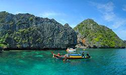
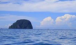
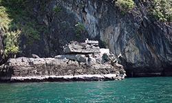
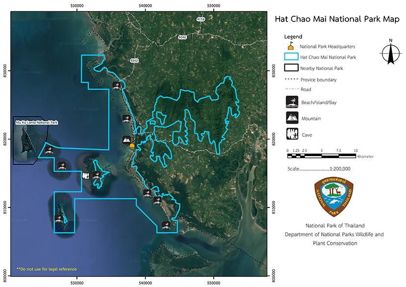
Hat Chao Mai National Park is located in Sikao and Kantang District, Trang Province, between 7 degrees, 17 minutes to 7 degrees, 32 minutes north and a longitude of 99 degrees, 13 to 99 degrees, 29 minutes. The north border is at Chong Chan Mountain, Kantang District, Khlong Meng, and Khlong Lam Yao, Mai Fat Sub-district, Sikao District, Trang Province. - The south border is the Andaman Sea, Ko Libong, and the Kantang Estuary. - The east boarder is at Khuan Din Daeng, Khuan Medjun, Khuan Luo and Khuan Daeng. - The west border is with the Andaman Sea, Ko Ngai, Ko Ma, and Mu Ko Lanta National Park. Hat Chao Mai National Park can be divided into two parts: The coastal land area consists of steep limestone hills, and includes Ko Muk, Ko Kradan, Ko Waen, Ko Chueak, Ko Meng, Ko Pling, and Ko Chao Mai. In the north and northeast, the Chong Chan Mountain range, Khuan Met Chun Mountain range, and Khuan Daeng mountain range are the sources of many streams that form the Bang Sak Canal, which flows into the Trang River. The water in the park covers a surface area of approximately 137 square kilometers and has an average depth of 20 meters. Geological Features The geological features of Hat Chao Mai National Park's coastal areas and islands are influenced by the Andaman Sea and tectonic plate movement, which created various rock elements with different characteristics. Most of the coastal headlands and islands in Hat Chao Mai National Park are limestone rocks from the Permian Ratchaburi Formation. Some areas of Khao Meng and Ko Kradan consist of mudstone, pebby rock, and conglomeratic sandstone, and the high mountains on the land are Arkosic Sandstone from the Jurassic period, known as the Trang Formation, which is comparable to the Lam Thap Formation. Hat Chao Mai National Park is an essential ecosystem and conservation of its sand shoal, which blocks the Khlong Khuan Tung Ku until it becomes the Laem Yong Lam with a triangular sandbar. It accumulates on the east side of Ko Muk, where the mangrove swamp forest juts out and there is seagrass, which is food for dugongs. A doline known as the Emerald Cave is a famous geological attraction and adventurous visitors are allowed to wade through the caves on excursions. Water Source Hat Chao Mai National Park consists of forest areas, mountains, and grasslands. There are hills in the northeast, including Khao Nam Rap, Khao Khuan Khaeng, Khao Phlu, Khao Chong Chan, Khuan Khaeng, and Khuan Met Chun. These form the catctment area for several streams that converge to form the Bang Sak Canal and flow into the Trang River (Figure 6). The coastal area includes Laem Meng, Ao Pak Meng, Pak Khlong La, Pak Khlong Chang Lang, Chang Lang Beach, Khao Maen, Pak Khlong Hai Lo, Laem Yong Ling, Pak Khlong Lat Chao, San Khao Yong Ling Beach, Yao Beach, Chao Mai Beach, and Khao Chao Mai, and is approximately 24 kilometers long from north to south. There are various islands, such as Mu Ko Chueak, Ko Waen, Ko Kradan, Ko Muk, Ko Meng, and Ko Chao Mai. The water surface covers an area of approximately 137 square kilometers with an average depth of 20 meters. Hat Chao mai National Park has very few freshwater sources so the coastal plains have a groundwater level of about 2 meters in the dry season and 1 meter in the rainy season. The water is slightly brackish and not suitable for consumption. The area above the canal along the beach is a mangrove swamp forest and there is a charcoal kiln nearby that causes sediment from the burning of charcoal. The freshwater sources in the national park are a spring near to the National Park Headquarters, which has water all year round. There is also broad swamp in Hat Chang Lang National Park, which is about 30 meters wide and 100 meters long, but it can dry up in March and April. At the same time, the Laem Yong Ling area has narrow and shallow basins. The sea at Changlang Beach in the National Park is transparent and clean, with about 20 meters of visibility, great clarity, and calm waters. Microscopic organisms such as plankton and various beneficial marine life species are found. |
|
The climate of Hat Chao Mai National Park has a tropical climate that is monsoons, but it rains throughout the year. The summer and rainy seasons are the dominant seasons with the summer is from January to April, and the rainy season from May to December. The weather is hot and humid with an annual average temperature of 27 degrees Celsius, and the annual rainfall over 2,100 millimeters per year.
|
|
|
|
Forests and Wildlife Ecosystems found in the Hat Chao Mai National Park can be classified as:The Khao Nam Rap Rainforest, which covers the coastal areas in Khao Nam Rab, including the hot pool, and east of the sandy beach, including Ko Muk. The plants there consist of Dipterocarpus chartaceus Symington, Hopea ferrea Laness, Hopea odorata, Tristaniopsis burmanica (Griff.) Peter G. Wilson & J. T., Intsia bijuga (Colebr.) Kuntze, and Xerospermum intermedium. The lower ground plants include rattan and vines. Khao Hinpun Forest is found on the west side of Ko Muk, Ko Chueak, Ko Waen, Ko Pling, Bae Na Mountain, Khao Yong Ling, Khao Meng, and Khao Chao Mai and the local flora consists of Dracaena cochinchinensis (Lour.) S.C. Chen, Phoenix acaulis Ham., Malayan Spurge Tree, Morinda coreia, Pandanus onjugate Martelli, False Sago, various orchids, and elephant ears. The beach forest is located in a narrow area along the coast and on rocks that the seawater cannot reach. Important plant species there consist of Indian Almond, Casuarina equisetifolia, Krating, and Syzygium grande (Wight) Walp. The flat area next to the beach is home to a sparse forest of stunted trees including Cotylelobium lanceolatum Craib, Peltophorum (Vogel) Benth, Syzygium antisepticum, Morinda coreia, Catunaregam tomentosa (Blume ex DC.) Tirveng, and Gmelina asiatica L. Lower ground plants there include different grasses. Mangrove swamp forests are found to the beach, located behind the National Park Headquarters, from Pak Meng Beach to Chao Mai Beach, and distributed throughout Ko Muk. The important plants are Rhizophora Apiculata Blume, Rhizophora onjugate Lam., Brownlowia onjuga Benth., Xylocarpus granatum Koenig, Xylocarpus rumphii (Kostel.) Mabberley., Myrica esculenta Buch. -Ham. Ex D. Don, Excoecaria agallocha L., Phoenix paludosa, Holly-Leaved Mangrove / Sea Holly, Nipa Palm, and Flagellaria indica L. The water Based plants consists of seagrass and seaweed. Hat Chao Mai National Park has an enormous seagrass resource covering 3,975 rai (6.36 Square kilomaters) between Laem Yong Ling and Ko Muk. The survey found eight seagrass types: Thalassia hemprichii, Cymodocea rotundata, , Cymodocea rotundata, Halodule uninervis,Cymodocea serrulate, Syringodium isoetifolium, Halodule pinifolia, and Halophila ovalis. Animals in Hat Chao Mai National Park can be classified as follows: Mammals: 51 species - Dugong, Serows, Raffles’ Banded Langur, Banded Surili, Dusky Leaf Monkey, Indian Muntjac, Lesser Mouse-Deer, Leopard, Asian Small-Clawed Otter, Large-Spotted Civet, Himalayan Striped Squirrel, Yellow Rajah Rat, and bats. Birds: 137 species Black-Necked Stork, Lesser Adjutant, Chinese Egret, Nordmann’s Greenshank, Chinese Crested Tern, Great Hornbill, Pitta, and the Greater Racket-Tailed Drongo. Reptiles: 29 species - Yellow-Headed Temple Turtle, Garnot’s House Gecko, Tokay Gecko, Calotes mystaceus, Common Water Monitor, Reticulated Python, Bocourt’s Water Snake, Mangrove Viper. Amphibians: 9 species - Giant Jungle Toad, Common Asian Toad, Black-Spined Toad, Dark-Sided Frog, Common Tree Frog, and Asiatic Burrowing Frog Aquatic animals Hat Chao Mai National Park is an essential ecosystem of mangrove swamp forests, seagrass, and coral reefs so there is a habitat, food source, shelter, and nursery for larvae of various marine life, such as Meder’s Mangrove Crab, Spider Crab, oysters, Leather donex, Laevistrombus canarium, Grouper, Freshwater Butterfly Fish, and dolphins. |
How to get there by car :
From Trang Province, take Trang Provincial Highway 4046 (Trang – Sikao) to the 30-kilometer milestone, and then turn left onto Provincial Highway 4162 to Pak Meng Beach. This is a journey of about 40 kilometers. From Pak Meng Beach, turn left to reach the Hat Chao Mai National Park Headquarters (Changlang Beach area) by traveling along the beach road for about 7 kilometers.
How to get there by Boat :
Boats can be chartered at Pak Meng Pier. Hat Long Pier and Khuan Tung Ku Pier. Pak Meng Pier is the main port for Ko Kradan, Ko Muk, Ko Waen, and Ko Chueak, and for Ko Kradan, Ko Muk, and Ko Ngai and is a distance of 40km from Pak Meng Beach to Trang Province is 40 kilometers. The journey takes about 30 minutes and boats are available for daily rental. Hat Long Pier is located on Trang – Kantang Roadalong the way to Chao Mai Beach. The distance is about 50 kilometers.
- National Park Ranger Station Cho Mo No. 1 (Bo Nam Ron)
- National Park Ranger Station Cho Mo No. 2 (Yong Ling)
- National Park Ranger Station Cho Mo No. 3 (Ko Kradan)
- National Park Ranger Station Cho Mo No. 4 (Pak Meng)
- National Park Ranger Station Cho Mo No. 5 (Tham Phueng)
Accommodation : Chao Mai 101 (Pha Yun)
Chao Mai 102 (Pa Ka Rang)
Chao Mai 103 (Ya Thale)
Chao Mai 104 (Jik Thale)
Chao Mai 105 (Yhi Thale)
Chao Mai 108/1 (Tham Morrakot)
Chao Mai 108/2 (Tham Morrakot)
Chao Mai 108/3 (Tham Morrakot)
Chao Mai 108/4 (Tham Morrakot)
Chao Mai 109/1 (Ko Kradan)
Chao Mai 109/2 (Ko Kradan)
Chao Mai 109/3 (Ko Kradan)
Chao Mai 109/4 (Ko Kradan)
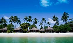
Hat Chao Mai National Park has lodges, camping grounds, tents, equipment rental services, and restaurants.

