Namtok Yong National Park
Contact Location : Namtok Yong National Park, Moo 7, Tham Yai Sub-district, Thung Song District, Nakhon Si Thammarat Province, 80110
Telephone Number : (+66) 7 580 9277
Email : namtokyong_np5@hotmail.com
Facebook : Nam Tok Yong National Park
Information
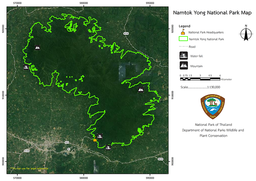
Namtok Yong National Park Headquarters is located at Yong Waterfall, which is near Moo 7, Tham Yai Sub-district, Thung Song District, Nakhon Si Thammarat Province, UTM coordinates 47 P 0582365 E 0903210 N, latitude 8 degrees 10 minutes, 12.3 arcminutes North and longitude 099 degrees 44 minutes, 42.0 arcminutes East.
It is 7.5 kilometers from Thung Song District and 58 kilometers from Nakhon Si Thammarat Province. It is about 120 kilometers from Surat Thani Province, about 80 kilometers from Trang Province, 78 kilometers from Phatthalung Province, and about 140 kilometers from Krabi Province.
Namtok Yong National Park covers forest areas in Chang Klang Sub-district, Chawang District (now Chang Klang District), Khao Kaeo and Lan Saka Sub-district, Lan Saka District, Na Bon Sub-district, Na Bon District, Na Luang Sen and Tham Yai Sub-district, Thung Song District, and Hin Tok and Ron Phibun Sub-district, Ron Phibun District, in Nakhon Si Thammarat Province.
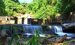
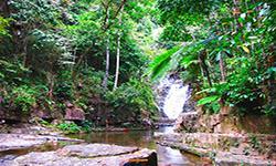
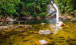
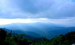
There is a complete forest with beautiful scenery and waterfalls, such as Khao Men Peak, Khao Ram Rom Peak, Yong Waterfall, Plio Waterfall, Khlong Chang Waterfall, Nan Toei Waterfall, Nan Plio Waterfall, Nan Tak Pha Waterfall, Nan Chon Waterfall, and Khuha Sawan Waterfall. It is suitable for tourism, recreation, and nature study. Namtok Yong National Park covers an area of approximately 128,125 rai, or 205 square kilometers.
The Royal Forest Department received a letter from Mr. Boonsong Chamnankit, a House of Representatives member from Nakhon Si Thammarat province, dated March 18, 1985. He had received a complaint requesting improvements to the Plio Waterfall area, located in Na Luang Sen Sub-district, Thung Song District, and wanted to create a tourist attraction As the area is covered with pristine forest and there are beautiful waterfalls, as well as the local population has given support and wanted to preserve the area as a national park. Mr. Chamnong Phothisaro, Director General of the Royal Forest Department, has a record dated March 31, 1985, for the National Park Division to consider the establishment of a national park. The National Park Division, therefore, has a letter No. Ko So 0713/1663, dated May 6, 2528, which stated that the Khao Luang National Park should help survey the condition of the area.
Subsequently, Mr. Samphan Thongsamak, Deputy Minister of Education, Members of the House of Representatives in Nakhon Si Thammarat province, wrote a letter, Sortor 0100/8, dated January 15, 1986, to Mr. Narong Wongwan, Minister of Agriculture and Cooperatives, requesting that the Khao Men Forest area should be declared as a National Park urgently. The forests of Khao Men were fertile, and there were many wild animals in the area, as well as beautiful scenery. The forest is a catchment area eight streams and has home to a multi-tiered waterfall, with a tier called "Nan Plio," which was classed as astonishing. The Minister of Agriculture and Cooperatives has recorded an order dated January 20, 1986, to Mr. Thaloeng Thamrongnawasawat, Permanent Secretary, Ministry of Agriculture and Cooperatives, to ask the National Park Division to conduct a survey.
The National Park Division, therefore, has a letter No. Ko So 0713/621, dated February 10, 1986, to the National Park Superintendent of Khao Luang National Park to conduct a preliminary investigation. Subsequently, Mr. Thawin Praison, Mr. Boonsong Chamnankit, and Mrs. Supattra Masdit, Members of the House of Representatives, Nakhon Si Thammarat Province, sent a letter dated October 1, 1986, to General Han Leelanon, Minister of Agriculture and Cooperatives, to expedite the operation. According to records, Mr. Somwang Petchkan, National Park Superintendent of Khao Luang National Park, has reported the inspection. Ko So 0713 (Kho Lo)/11, dated October 27, 2529, found complete forest conditions, beautiful scenery, and waterfalls, and that the area should be preserved as a national park. Therefore, the National Park Board, in meeting No. 1/2532 on May 4, 1989, agreed to establish a national park.
Later, in 1991, a royal decree specified the area of Khao Men Forest, Khao Luang Forest, Plai Khlong Wang Hip Forest, Namtok Yong Forest, and Plai Khlong Pak Phraek Forest, Chang Klang Sub-district, Chawang District, (Changed to Chang Klang District), Khao Kaeo and Lan Saka Sub-district, Lan Saka District, Na Bon Sub-district, Na Bon District, Na Luang Sen and Tham Yai Sub-district, Thung Song District, and Hin Tok and Ron Phibun Sub-district, Ron Phibun District, in Nakhon Si Thammarat Province should become Thailand’s 64th Natiional Park, and it was announced in the Government Gazette, Volume 108, Section 127 dated July 22, 1991.
Note : After paying the entrance fee to the National Park, please carry the receipt for inspection.
128,125 rai (205 square kilometers)
|
|
|
|
|
|
|
|
|
Nature trails ⇔ Trekking ⇔ Visit Waterfall ⇔ Observe flowers/plant
Welfare shop : (drinks, coffee, snacks): open daily from 8.00 - 16.30 hrs.
National Park Headquarters: AIS, DTAC, TRUE
Area of the National Park Ranger Station Kho No No. 4 (Ban Saphan Tao): AIS
Area of the National Park Ranger Station Kho No No. 3 (Namtok Ton Yai): AIS
Area of Operation Base Bang Hin Yai: AIS
Phai Chian run area: AIS
Ton Yai Waterfall Area: AIS
|
|
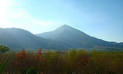
The topography of the mountain is a complex, folded mountain range, which is part of the Nakhon Si Thammarat Mountain range that stretches from north to south. Connecting to the southern side of Luang Mountain range with elevation between 80-1,307 meters above sea level with the highest peak being is Khao Men, a mountain peak that divides the administrative area between Na Bon Sub-district, Na Bon District, and Chang Klang Sub-district, Chang Klang District, Nakhon Si Thammarat Province. Namtok Yong National Park highest elevation is 1,307 meters above sea level, located at Khao Men Peak. 42.7% of the area is between 500 and 750 meters height, and 58.50% of the area has gradients of between 5 and 15%. Water Resources Watershed Class: The main watershed of Namtok Yong National Park is the South West Basin which is located on a tributary of the Trang River. The watershed quality classification of Namtok Yong National Park consists of watershed class 1A, accounting for 54.92%, followed by watershed class 2, covering the park’s area. 24.36%, followed by the watershed quality class at 1AR, covering the park area, accounted for 15.89%. Most of the canals around Namtok Yong National Park consist of the Namtok Yong Canal, Pik Canal, Tha Lon Canal, Tha Lao Canal, Pak Phraek Canal, and Wang Hip Canal, which originate in Namtok Yong National Park and flow into the Trang River. Ban Namtok Canal, Chang Canal, Kui Canal, Men Canal, which are upstream from Namtok Yong National Park, flow into the Tapi River and the San Khun Canal, Wang Hong Canal, Khun Phang Canal, Chedi Canal, Lan Saka Canal, Phian Canal, Khuha Canal, Mut Creek, and Nong Pet Creekflow into the Pak Pha-nang River. |
|
Namtok Yong National Park is located on the peninsula It is influenced by the monsoon wind that blows through the sea on both sides and it has rain almost all year round. The weather is quite cool from May to December, and summer starts from January to April. The average temperature is about 26 degrees Celsius.
|
|
|
|
The topography is a complex of mountains with a rain for most of the year since it receives both the southwest monsoon and the northeast monsoon. The average humidity and rainfall are high, causing the ecosystem to have a tropical rainforest and a hill evergreen forest. The details are as follows: 1. Tropical Rain Forest or “tropical evergreen forest,” is a forested area that is green all year round. There is a canopy of large trees above middle and lower levels. Common plants such as Dipterocarpus (Diterocarpus sp.), Malacca Teak (Intsia palembanica), Hopea odorata, Parashorea stellata Kurz, Hopea pierrei, Shorea gratissima (Shorea gratissima), Shorea Ferinosa (Shorea Ferinosa), Mesawa (Anisolonomera coatumata), Chenoxylonamera coatumata, Cinnanomum porrectum (Cinnanomum porrectum), Eugenia utailei, Hertiera sumatrana (Hertiera sumatrana), Michelia champaca, and Ailanthus triphysa. Toona tebrifuga, Parkia speciosa Hassk, Elateriospermum tapos, Xerospemum intermedium. 2. Hill Evergreen Forest Normally, it is a forest area that rises above the average elevation of 1,000 meters above sea level. But at Namtok Yong National Park, it is found at an altitude of about 700 meters above sea level, The plant species canopy level is relatively consistent with moss and ferns on the trunks. The plants found are Fagaceae, Heather (Ericaceae),Vaccinium viscifolium King & Gamble,Styrax benzos Craib (Styrax betongensis),Lithocarpus sp.,Schima wallichii,Ternstroemia wallichiana), utailei (Ternstroemia wallichiana),Ardisia crenata Sims,Melastoma malabathricum, Chloranthus spicatus, and Thunmalb spicatus. Most ground cover plants are mosses, suchas Bryophyta, or ferns, and orchids, such as Paphiopedilum callosum (Rchb.f.). The original nature of the foothills around the national park boundary line and the nearby villages was destroyed by human activity but hhe forest has been revived. The ecosystem has replaced the former natural forest and consists of pioneer species such as Macaranga gigantea (Macaranga gigantea), Macarautaileilata (Blume), Mull. Arg. utaileilata), Macaranga tanarius (M. tanarius), Trema orientalis (L.) Bl., Mallotus paniculatus Mull. Arg., M. barbatus (M. barbatus) and Musa acuminata Colla (Musa acuminata Colla). There are many rare plants found at Namtok Yong National Park, such as - Magnolia elegans (Blume) H. Keng, which is found in the tropical rain forest in front of the Yong Waterfall and in the tropical rain forest behind the campsite bathroom. - Hedychium khaomaenense Picheans & Mokkamul, found around Khao Men Peak and Khao Ram Rom Peak. - Caulokaempferia khaomaenensis is found around Khao Men Peak. - Paphiopedilum sp., found around Khao Men Peak - Dipteutailegata is found around Khao He Mon Peak and Ram Rom Mountain. Wildlife found includes Tapirs, Chamois, bears, Barking Deer, porcupines, Wild Boars, deer, Spotted Civet, and monkeys.Birds: Oriental Honey-buzzard, Great Argus, Spectacled Bulbul, Black-naped Oriole, Green Bee-eater, Green-billed Malkoha, Babblers, Green pigeons and Lineated Barbet. Rare species that appear at Namtok Yong National Park include: |
How to get there by car :
from Bangkok to Thung Song District is about 774 kilometers. From Thung Song District to Namtok Yong National Park Along National Highway No. 403, turn left beside Rajamangala University of Technology Srivijaya, Nakhon Si Thammarat Campus From there is about 4 kilometers to the Yong Waterfall area. The total distance is about 8.5 kilometers.
How to get there by train :
from Bangkok to Thung Song District which is a distance of about 775 kilometers, followed by a short journey to the Namtok Yong National Park Headquarters of about 7.5 kilometers.
- National Park Ranger Station To Yo No. 1 (Namtok Khlong Chang)
- National Park Ranger Station To Yo No. 2 (Namtok Nan Chon)
- National Park Ranger Station To Yo No. 3 (Khao Ram Rom
Accommodation : Namtok Yong 102 (Maha Sadam)
Namtok Yong 103 (Hong Hoen)
Namtok Yong 104 (Phetthaksin)
Namtok Yong 201 (Ton Ram)
Namtok Yong 202 (Puang Kaimuk)

