Hat Khanom - Mu Ko Thale Tai National Park (Under Gazetting)
Contact Location : Hat Khanom - Mu Ko Thale Tai National Park (Under Gazetting) Moo 1, Khanom
Sub-district, Khanom District, Nakhon Si Thammarat Province 80210
Telephone Number : (+66) 8 6475 8392
Email : hadkhanom@hotmail.co.th
Facebook : Hat Khanom Mu Ko Thale Tai National Park
Information
-
Background
Hat Khanom - Mu Ko Thale Tai National Park is located in Nakhon Si Thammarat and Surat Thani Provinces and hasan area of approximately 197,500 rai, or about 316 square kilometers, which is divided into:
The land area is approximately 73,000 rai (205 square kilometers), or 37% of the total area.
The water surface is approximately 124,500 rai (199.2 square kilometers), or 63% of the total area.
It covers 51 villages, seven sub-districts, four districts, and two provinces, consisting of Thung Sai Sub-district, Sichon District, Khanom, Khuan Thong and Thong Nian Sub-district, Khanom District, in Nakhon Si Thammarat Province, and Pak Phraek and Don Sak Sub-district, Donsak District, Taling Ngam Sub-district, Ko Samui District in Surat Thani Province. The area is contiguous, which is why some parts were divided to prevent conflict between villagers and the National Park.
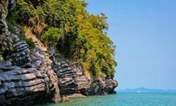
The area designated as a national park area contains intact forests, water sources, and an island with rich marine resources that can be developed into a tourist attraction.
The territories are as follows:
North: Don Sak and Ko Samui District, Surat Thani Province
East: The Gulf of Thailand
South: Sichon District, Nakhon Si Thammarat province
West: Donsak District, Surat Thani Province.
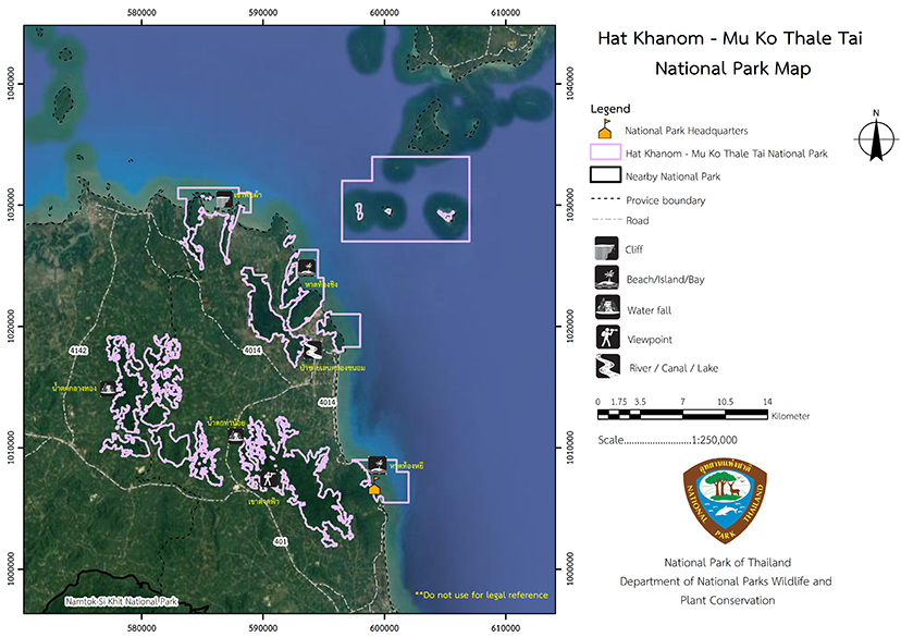
194,445.54 rai (311.112864 square kilometers)
|
|
|
|
|
|
|
|
|
Nature trails ⇔ Visit Waterfall ⇔ Observe flowers/plant ⇔ Bird/Butterfly ⇔ Stargazing
Welfare shop: Not available.
National Park Headquarters: AIS, DTAC, TRUE, MY by CAT
Area of the National Park Ranger Station (Thong Ching): AIS, DTAC, TRUE, MY by CAT
Area of the National Park Ranger Station (Pa Len Khlong Khanom): AIS, DTAC, TRUE, MY by CAT
Temporary National Park Ranger Station area (Tham Khao Wang Thong): AIS, DTAC, TRUE, MY by CAT
Checkpoint area (Namtok Klang Thong): AIS, DTAC, TRUE, MY by CAT
|
|
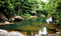
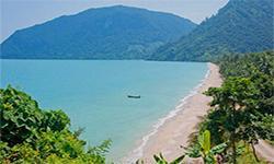
Hat Khanom - Mu Ko Thale Tai National Park is located in Thung Sai Sub-district, Sichon District, Thong Nien, Khuan Thong and Khanom Sub-district, Khanom District, in Nakhon Si Thammarat Province, Pak Phraek and Don Sak Sub-district, Don Sak District, Taling Ngam Sub-district, and Ko Samui District. In Surat Thani Province. They are separate areas that is not contiguous in order to prevent conflicts with the local people who have used areas for many years. In the area that is designated as a national park area, the forest that is still intact, and the sea and islands are abundant in marine resources so could be developed into a tourist destination as well. The territories it has are as follows: North: Don Sak and Samui District, Surat Thani Province, South: Sichon District, in Nakhon Si Thammarat Province East: The Gulf of Thailand West: Don Sak District in Surat Thani Province. Hat Khanom - Mu Ko Thale Tai National Park consists of both land and sea. The land area consists of a complex mountain range that stretches from north to south, with a large area of flat land. The mountain foothills open onto the Gulf of Thailand coast. Khao Luang is the highest point, with a summit at about 814 meters above sea level. The marine area consists of 11 islands, including Ko Taen, Ko Rap, Ko Mat Kong, Ko Mat Taeng, Ko Wang Nok, Ko Wang Nai, Ko Mat Sum, Ko Ra Yai, Ko Tha Rai, Ko Phi, and Ko Noi. Water Resources and Watershed Class: The main catchment area in the Hat Khanom-Mu Ko Thale Tai National Park is the Southern Basin on the East Coast,The tributary basin is the southern branch watershed, east coast section 3, watershed classification in Hat Khanom-Mu Ko Thale Tai National Park is classified according to watershed classification data. It covers an area of 103.9024 square kilometers, which mainly consists of watershed quality class 1A, which as an area of 31,550 rai (50.48 square kilometers) or 48.5%, followed by watershed class quality 18, with an area of 12,400 rai (19.84 square kilometers), covering 19%with the remaining area being watershed quality classes at 2,3,4,5, which are distributed in the National Park area. The waterways around Hat Khanom - Mu Ko Thale Tai National Park vary in length but mainly flowwest to east. Important water sources include such as Khanom Canal, Bang Not Canal, Khun Nom Canal, Tha Noi Canal, Ban Klang Canal, Phrao Canal, Leng Canal, Tin Pet Canal, Tha Lam Phu Canal, Khao In Canal, Tha Ko Canal, and Hin Kling Canal. Khanom Canal is a canal whose watershed is in the Hat Khanom - Mu Ko Thale Tai National Park, where the water sources from Khun Nom Canal, Bang Not Canal, Bang Khu Canal, and Ban Klang Canal flow into the Khanom Canal and then into the Gulf of Thailand, so it the most important canal in the area |
|
The Meteorological Department has collected climate statistics data at the Ko Samui Weather Station, which is closest to the Hat Khanom - Mu Ko Thale Tai National from 1966-1995.Various influences have created two main seasons, which are Summer, which is between February and mid-April , and is the period between the monsoon seasons after the end of the northeast monsoon season. The weather is hottest from April to May. The rainy season is between May and January during the southwest monsoon where the hot humid wind are blown from Indian Ocean, thus rainy. There is also a low-pressure area that covers the south periodically. Moreover, in November to January, there is northeastern monsoon moving across the Gulf of Thailand making it heavy rain in November to December The influence of the southwest monsoon from the Indian Ocean and the northeast monsoon that blows through the Gulf of Thailand brings a lot of steam and moisture to the area so the area is not as hot as other areas of Thailand in summer. The average temperature throughout the year is about 28 degrees Celsius with temperature as low as 19 in December and January, and the highest temperature in May at about 33 degrees Celsius. The average annual relative humidity is about 79% with the average highest relative humidity in October and November at 92%. The lowest average relative humidity occurs in July with about 63%. The average annual rainfall is 1,910 millimeters, with November being the wettest month with 511 millimeters. February has the least amount of rain with just 35 millimeters. |
|
|
|
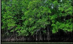
Hat Khanom - Mu Ko Thale Tai National consists of various types of forests, as follows: 1. The Tropical Rain Frest covers about 20.71% of the area and is a humid forest found in high mountain areas. The plant species consist of Dipterocarpus, Hopea Odorata, Malacca Teak, Parashorea stellata Kurz, Mesua ferrea L., and Fagraea fragrans. The ground layer includes various bamboos, Salacca wallichiana (Gaertn.) Voss, Caryota urens, and episcopal trees such as orchids, moss, ferns, and vines. This type of forest is found in Khlong Thong Forest, Khlong Leng Forest, Chaikram Forest, Wat Pradu Forest, and some parts of the Khao Ok Forest, Khao Thong Not Forest, and Khao Chaison Forest. 2. Dry Evergreen Forest covers approximately 3.03% of the area, and it is found along hillside, limestone cliffs, and in rocky creeks with thin layers of soil. It generally consists of smaller trees with some large trees scattered around. The predominant plants are Hopea ferrea Laness, Memecylon ovatum Sm, Hydnocarpus ilicifolius King, Barringtonia pendula (Griff.) Kurz, Cinnamomum bejolghota, Litsea petiolata Hook.f., and brambles such as Streblus ilicifolius (Vidal) Corner. This type of forest is located in Khao Ok Forest, Khao Thong Not Forest, and Khao Chaison Forest. 3. The Mangrove Swamp Forest covers about 4.2% of the forest area, which appears around muddy areas and estuaries flooded with seawater. Predominant plants include Rhizophoramucronata, Rhizophora Apiculata Blume, , Avicennia alba Bl., Xylocarpus granatum Koenig, Sonneratia caseolaris (L.) Engl., Sonneratia alba Sm., Briguiera pamviflora, and Bruguiera cylindrica. We can find this kind of forest in mud forest in 4. The Beach Forest covers approximately 1.04% of the area, and is a sparse forest found in narrow spaces and on islands. The predominant plants are Terminalia catappa, Casuarina equisetifolia, Derris indica (Lamk.) Benn., Fish Poison Tree (Barringtonia asiatica (L.) Kurz), and Scaevola taccada (Gaertn.) Roxb.. A Swamp Forest may be located nearby, such as in the upper part of the Khlong Khanom swamp forest and in Ko Wang Nok. The Limestone Forest covers 5.69% of the forest area, and is most commonly found in the limestone mountains of Khuan Tong Sub-district and Khanom District in Nakhon Si Thammarat Province, Don Sak and Pakphraek District in Surat Thani Province. The plants found are indicative of vegetation, such as Stephania venosa Spreng, Dracaena cochinchinensis (Lour.) S.C. Chen, Dillenia reticulata King, Cape lily, Konjac, Cinnamomum iners Reinw. ex Blume, and Morinda coreia. Hat Khanom - Mu Ko Thale Tai National is a habitat for many kinds of wildlife that can be classified as follows: 1. Mammals: 18 species It consists of deer, wild boar, macaques, langurs, dhole, marmots, gibbons, squirrels, chipmunks, and dolphins. Protected Wildlife: Serows and Tapir 2. Birds: 140 species, both terrestrial and marine birds. They include Crested Serpent-Eagle (Spilornis cheela), White-Bellied Sea-eagle, Hornbill, Green Pigeon, Myna, Western Koel, Cormorant, Nicobar Pigeon, and Laridae. 3. Reptiles: 14 species |
How to get there by car :
How to get there by car: Surat Thani province takes National Highway No.401 (Surat Thani-Nakhon Si Thammarat), a distance of about 50 kilometers, and then turns into Khanom District along Provincial Highway No. 4041, 30 kilometers to the National Park Headquarters.
From Nakhon Si Thammarat province, take National Highway No. 401 (Nakhon Si Thammarat-Surat Thani), a distance of about 80 kilometers, and then turn into Khanom District along Provincial Highway No. 4041 for about 30 kilometers to the National Park Headquarters.
- Hat Khanom - Mu Ko Thale Tai National Park Extraction Point (Namtok Klang Thong)
- Hat Khanom - Mu Ko Thale Tai National Park Ranger Temporary Station (Tham Khao Wang Thong)
- Hat Khanom - Mu Ko Thale Tai National Park Ranger Temporary Station (Pa Len Khlong Khanom)
- Hat Khanom - Mu Ko Thale Tai National Park Ranger (Thong Ching)
Hat Khanom - Mu Ko Thale Tai National Park offers a camping ground area, but tents, equipment, and food are unavailable for purchase or rent. You must bring your own.


