Budo - Su-ngai Padi National Park
Contact Location : Budo - Su - ngai Padi National Park 67 Phiphit Pacho Road, Bacho District, Narathiwat Province 96170
Telephone Number : (+66) 7 353 0406
Email : budo.sungaipadi@gmail.com
Facebook : Budo Su ngai Padi National Park
Information
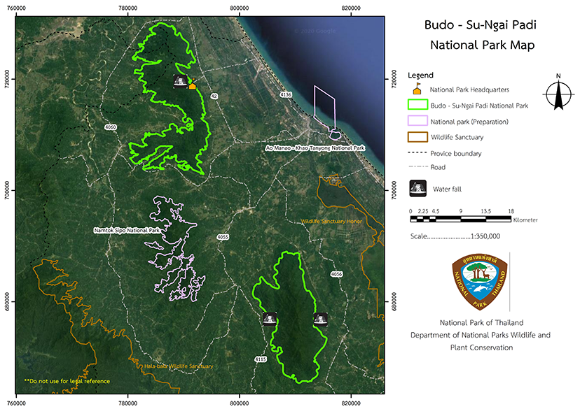
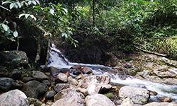
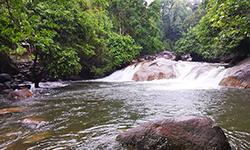
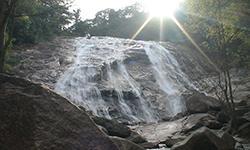
Budo - Su-ngai Padi National Park covers an area that includes Ba Cho, Rue So, Yi Ngo, Cho Ai Rong, Rangae and Sukhirin District in Narathiwat Province, Raman District in Yala Province, and Ka Pho District in Pattani Province. The terrain is complex, with high mountains and watersheds, as well as many valuable plants such as Bangsun Palm and Golden Leaf Bauhinia. It also has many beautiful natural features, such as waterfalls and a site of historical importance at Budo and Pulo. The National Park area is approximately 213,125 rai, or 341 square kilometers in size.
Background
In the past, the forest areas of Thueakkhao Bu Do Forest and Thueakkhao Su ngai Padi Forest were a gathering place for protestors and terrorists that were known as the "Pulo group" and the "Budo group." The insurgency was suppressed, and the the area is now peaceful and safe. The condition of the forests is still beautiful so in 1974, the Royal Forest Department established the Namtok Pa Cho Forest Park, which is inside the forest of Thueakkhao Bu Do, and in 1976, Namtok Chat Warin Forest Park, which is in the Thueak Khao Su Ngai Padi Forest. The forest parks are under the supervision of the Pattani Regional Forest Office.
When His Majesty visited the people in the area of Su-Ngai Padi and Rangae District, he made a speech on September 7, 1981, “The Su-ngai Padi Mountain Range, at 1,800 feet, is the highest mountain range in Narathiwat Province. There is water vapor that causes the water source to be humid and have three streams. . As a result, the water source should be seriously preserved.” where the Watershed Conservation Division inspected and reported that, The forest area of the Su-ngai Padi Mountain Range is in very good condition. It is surrounded by beautiful nature and should be established as a national park.
The Royal Forest Department issued order 740/2525 letter dated June 1, 1982, which stated that Mr. Samphan Midewan should conduct a preliminary survey, which has been reported in the book Ko So. 0713 (Kho Po)/Special
On September 11, 1983, the Su-Ngai Padi Mountain range in Su-Ngai Kolok District, Narathiwat Province was deemed suitable for national park status.
Later, the National Park Division received a letter from the Southern Provincial Border Administrative Center Mo Tho 1501/1955, dated September 2, 1983, and a letter from the Pattani Regional Forest Office Ko So 0714 (Po No)/1689, dated September 8, 1983. The note, dated September 8, 1983, suggests that the Budo Mountain range area in Pattani, Yala, and Narathiwat Province has fertile forest conditions and abundant wildlife so Regional Forest had issued order 222/2526. This stated that Mr. Aphai Yongstar, forest official 4, and Mr. Suthon Chansawang, Forestry Officer No. 2 should conduct a preliminary survey in order to establish a national park.
Subsequently, the National Park Division has book Ko So 0706/1073, dated April 22, 1984, which was proposed to Mr. Chamnong Phothisaro, Director General of the Royal Forest Department, and recorded on May 22, 1984, that the area should be designated as a National Park.
The National Park Division at theRoyal Forest Department ordered officials to proceed with the establishment of both forest areas as national parks in 1984, and presented them to the National Park Board, which, in passed the resolution at the 2/2531 meeting on October 19, 1988. The forest areas of Bu Do Mountain Range Forest and Su-Ngai Padi Mountain Range Forest were then defined as national parks.
The Budo - Su-Ngai Padi National Park was declared a National Park under the National Park Act, 1961, when a royal decree specified the forest lands in the Thueak Khao Rueso Forest, Yi Ngo Forest and Bacho Forest in the area of Paluka Samo, Bare Nuea, Kayo Mati and Lubo Sawo Sub-district, Bacho District , Suwari, Samakkhi, Rueso Ok and Lalo Sub-district, Rueso District, Tapoyo, Lubo Baya and Cho Bo Sub-district, Yi-ngo District, and Marue Botok Sub-district, Ra-ngae District in Narathiwat Province, Karubi Forest in Talo Due Raman and Karubi Sub-district, Ka Pho District in Pattani Province, Cha Kwua Forest in the Kero and Cha-kwa Sub-district, Raman District, Yala Province, and Bu Ke Ta We Forest, Plot 2, Bo Ngo Forest and Bu Ke Ta We Forest, Plot 1, in Chuap and Bukit Sub-district, Cho-airong District , Bo-ngo, Ra-ngae, Todeng, Riko, Sako, Su-ngai Padi and Kia Sub-district, Sukhirin District in Narathiwat Province. The announcement was made in the Government Gazette, Volume 116, Part 48 Ko, dated June 17, 1999 and it became Thailand’s96th National Park.
Budo - Su-Ngai Padi National Park is located between latitudes 6 degrees 01 minutes and 6 degrees 36 minutes north and between latitudes 1 degree 32 minutes and 1 degree 51 minutes, with approximately 213,125 rai (341 square kilometers). The boundaries are as follows:
The north connects with Ka Pho District, Pattani Province, Raman District and Yala Province.
The South connects with the Su-Ngai Padi and Sukhirin District. Narathiwat Province.
East is connected to Ba Cho, Yi-Ngo, Cho-Airong and Su-ngai Padi District in Narathiwat Province.
The West connects to the Rueso, Ra-Ngae and Sukhirin District in Narathiwat Province.
Note : After paying the entrance fee to the National Park, please carry the receipt for inspection.

213,125 rai (341 square kilometers)
|
|
|
||
|
|
|||
Nature trails ⇔ Visit Waterfall ⇔ Observe flowers/plant ⇔ Bird/Butterfly ⇔ Mountain biking ⇔ History/Culture ⇔ Camping
Welfare shop : (coffee, drinks, snacks): open daily from 7.00 - 16.00 hrs.
National Park Headquarters: AIS, TRUE, DTAC
|
|
Landforms The terrain is that of complex mountains, with the highest peak Khao Tawe, at approximately 1,182 meters above sea level. The grounds are mostly sandy-clay based soil based on igneous rocks, partial limestone, and conglomerate. The forest is located on the north to south mountain axis, and is the source of many rivers, such as the Sai Buri River and the Bacho Canal. There is valuable nature, such as the Diamond Joey Palm, hornbills, Bauhinia aureifolia, and the provincial tree,Neobalanocarpus heimii. There are many beautiful natural features, such as waterfalls, caves, viewpoints, and the historical significance of the Budo and the Pulo terrorists. Budo - Su-Ngai Padi National Park has an area ofapproximately 341 square kilometers, or 213,125 rai.
|
|
The Budo - Su-Ngai Padi National Park has two seasons; the rainy season runs from May to December, and summer begins in January and runs to April. The average annual rainfall is over 2,500 millimeters and The temperature of the two seasons low is about 19.2 and the high is 36.2 degrees Celsius.
|
|
|
|
|
|
|
The troical rain forest covers the entire mountain range and includes large plants such as Hopea pierrei Hance, Shorea faguetiana heim, Parashorea stellata Kurz, Shorea faguetiana, Malacca Teak, Mesua nervosa Planch. & Triana, Dyera costulata (Miq.) Hook.f. The lower ground plants include Calameae, Palmae, and Bauhinia aureifolia, as well as rare and valuable plants such as ”Calamus caesius Blume" and "Diamond Joey Palm", which are found in dense, high mountain forests assuming that there is only in this forest. This golden-leafed plant or Yan Da-o has scientific name Bauhnia aureifolia, is a large vine with a distinctive golden velvet leaf that is similar to the Bauhinia acuminata L. or Orchid Tree leaves but larger. The base and the leaf tip curve slightly inward, creating a shape like two oval leaves connected to each other. It generally grows around Budo forest and the National Park Headquarters. The forest condition is generally an evergreen forest that covers mountainsides with large trees, such as various types of Malabar Iron Wood (Hopea odorata). Other trees include Shorea faguetiana heim, Parashorea stellata Kurz, Shorea ovata Dyer ex Brandis ,Malacca Teak, Mesua ferrea L., Dyera costulata (Miq.) Hook.f. and the rare, expensive and endangered species such as Calameae, Calamus caesius Blume, Diamond Joey Palm, and Bauhinia aureifolia, which has another local name, " Yan Da O", and is found in the forests of the three southern provinces. “Yan Da O” is a local vine with delicate golden leaves from Narathiwat Province. Wild animals include Indian Muntjac, Mouse Deer, Serows, Marmot, Monkey, Dusky Leaf Monkey, Eagle, Butorides striata, Coturnix, Green pigeons, Maroon Woodpecker, Trichixos pyrropygus, Copsychus malabaricus, Anorrhinus galeritus, Flowerpeckers, and Red Junglefowl. |
How to get there by car :
It is approximately 1,122 kilometers along Highway No. 42 from Bangkok to Ba Cho District, and then a further 3 kilometers until Budo - Su-ngai Padi National Park.
How to get there by plane :
From Ban Thon Airport, Khok Khian Sub-district, Mueang District, Narathiwat Province, it is 16 kilometers, to the Budo - Su-ngai Padi National Park Headquarters.
How to get there by train :
From Bangkok take the train to Tanyong Mat District, Amphoe Ra Ngae, then travel approximately 30 kilometers to Budo - Su-Ngai Padi National Park Headquarters.
- National Park Ranger Station Bo Do No. 1 (Namtok Pacho)
- National Park Ranger Station Bo Do No. 2 (Namtok Chat Warin)
Accommodation : Budo 101 - 102 (Pacho 1,2)
Budo 104 (Puke)
Budo 105 (Pinae)
The Budo - Su-Ngai Padi National Park has a relatively small number of lodges. However, the camping ground is available and tents and equipment can be rented. There is also a restaurant.


