Namtok Sai khao National Park
Contact Location : Namtok Sai khao National Park, Moo5, Sai Khao Sub-district, Khok Pho District, Pattani Province, 94120
Telephone Number : (+66) 7 342 0295
Email : namtoksaikhao2023@gmail.com
Facebook : Namtok Sai Khao National Park
Information
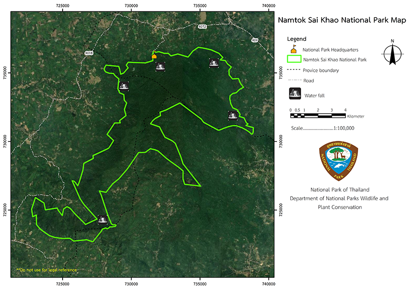
Namtok Sai Khao National Park is located at Moo 5, Sai Khao Sub-district, Khok Pho District, Pattani Province, coordinates 47N UTM E731735 N736303, with territory in the three southern border provinces of Pattani, Yala and Songkhla Province. It has a total area of 43,482 rai, or approximately 69.5712 square kilometers and covers the area of the Khao Yai National Reserved Forest and Thueak Khao San Kala Khiri National Reserved Forest The landscape is that of a tropical rain forest that contains various kinds of plants and wildlife. The territories it has are as follows:
North: Chang Hai Tok, Sai, and Na Pradu Sub-district, Khok Pho District, Pattani Province.
South: Tachi Sub-district, Yaha District, Yala Province.
East: Thung Phla and Pak Lo Sub-district, Khok Pho District, Pattani Province, and Lam Phaya Sub-district, Mueang District, Yala Province.
West: Chang Hai Tok Sub-district, Khok Pho District, Pattani Province; and Ban Not, Pian and Than Khiri Sub-district, Saba Yoi District, Songkhla Province.
Background
Initially named "Krathon Waterfall," Namtok Sai Khao National Park was discovered by the provost, Phrakhru Si Rattanakon (Than Si Kaeo), former abbot of Wat Sai Khao, in 1932. Later, there was sequential development at the Sai Khao Waterfall under the supervision of the Pattani Regional Forest Office (Royal Forest Department). In 1987, the Royal forest department asked officers to survey and establish the Khao Yai Forest and Thueak Khao San Kala Khiri Forest to prepare for the establishment of a national park under the National Park Act, B.E. 2504. The purpose is to protect national resources and beautiful scenery for research and tourist recreation.
The resolution was approved by the National Park Board to establish a national park was on July 10, 1990. Subsequently, the Council of Ministers passed a resolution on February 16, 1993, approving in principle the draft decree specifying the area of the National Park. The surveys were conducted in succession until the cabinet approved the establishment of a national park and the Secretary of the Cabinet published a map that was attached to the end of the Royal Decree before it was presented to His Majesty the King for signature.
However, in January 1998, local people in Lam Phaya Sub-district, Muang District, Yala Province, rallied against the announcement of the establishment of the Namtok Sai Khao National Park. As a result, the Namtok Sai Khao National Park decided to look again at the relevant information such as the status and potential of the area, including the way of life and living of local people, and created a new boundary line to avoid impact on the local people.
The announcement of Namtok Sai Khao National Park must maintain the integrity of natural resources and be acceptedby the local people.
In 2009, there was an exploration in the National Park Forest area that separated the farming areas of local people from the national park. The residents living around the area wereinspected and the boundary determined. Therefore, the Sub-District Administrative Organization (Sub-district Administrative Organization), including ten relevant organizations, together with the Sub-committee for Prevention and Suppression of Smuggling of Resources, the provincial forests involved in three provinces on the southern border, consisting of Pattani, Yala and Songkhla Province, have approved the new territory of the national park. The National Parks, Wildlife and Plant Conservation Department established thenational park by royal decree that specified the area of Khao Yai Forest in Chang Hai Tok, Sai Khao, Na Pradu, Thung Phla and Pak Lo Sub-district, Khok Pho District, Pattani Province, Lam Phaya Sub-district, Mueang Yala District, Ta Chi Sub-district, Yaha District, Yala Province, and Thueak Khao San Kala Khiri Forest in Ban Not, Pian and Than Khiri Sub-district, Saba Yoi District, Songkhla Province, as a national park. The announcement is in the Government Gazette, Volume 125, Part 71 Ko, dated May 28, 2008 made it Thailand’s 110th national park.
Note : After paying the entrance fee to the National Park, please carry the receipt for inspection.
43,482 rai (69.5712 square kilometers)
|
|
|
|
|
|
|
|
|
Nature trails ⇔ Trekking ⇔ Visit Waterfall ⇔ Cave exploration/Geological condition ⇔ Observe flowers/plant ⇔ History/Culture
Welfare shop : (coffee, drinks, snacks): open daily from 8.30 - 16.30 hrs.
National Park Headquarters: AIS, TRUE, DTAC
|
|
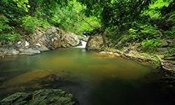
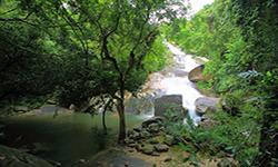
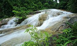
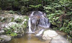
Namtok Sai Khao National Park is located in the San Kala Khiri Mountain range. The terrain aroud it is mountainous, complex, and contiguous, extending to the south, west, and east. The highest peak is San Kala Khiri (Khao Nang Chan Peak) at 1,000 meters above sea level. There are foothills and plains, and the long ridges demarcate the boundaries of Pattani, Yala, and Songkhla province. Geological and Agronomical Features: Namtok Sai Khao National Park is located at Ban Tok Wat, Moo 5, Sai Khao Sub-district, Khok Pho District, in Pattani Province. It is a waterfall that falls from a cliff that is about 40 meters high on Khao Nang Chan. The stream flows along the valley down to the large basin below, and there is a400m long path to the waterfall. There are large stones and trees alongboth sides of the creek, providing shade for the path and astonishing views. The geological characteristics are those of abiotite granite from the Triassic period, which is light gray to gray in color and has a uniform texture. The feldspar in there is of various sizes and can be observed visibly. There are medium-to-large complete crystal sizes that include biotite and quartz. The biotite-chlorite granite has a grey color and consists of semi-complete crystals and medium-to coarse-grained feldspar, showing a precise arrangement of mineral crystals. Tourmaline Biotite, Muscovite Granite, and Leucocratic Granite have a light gray color and a uniform texture that mainly consists of acceptable to medium-grained feldspar. Soil characteristics Namtok Sai Khao National Park has steep slopes on the west side. The soil is generally loam due to the deposition of humus with some areas with a high percentage of sand. The water resources in the area, watershed level, and the source of forest water of Namtok Sai Khao National Park include the origins of the creeks, canals, and several streams that flow together to the Thepha River.Locals rely on the water for cultivation and consumption throughout the year. Important creeks are Sai Khao Creek, where residents of Sai Khao, Na Pradu and neighboring sub-districts has been using the water for farming and in the household. For Ngao Creek, people in Thung Pla and adjacent sub-districts have been using the water for farming and in the household. For Phong Phong Creek, people in the adjacent areas have been using the water for farming and in the household. For Bon Creek (Pra Mai Pai Waterfall) and Kae Dae Creek (Phru Bon Waterfall), which is use by the people in. Sa Kha Yoi District, Songkhla Province for agriculture and consumption. In addition, there are Lam Yang Creek, Khlong Ruea Creek, Ton Takhian Creek, Lam Ching Creek, Lam Phaya Creek, and other creeks that local residents and nearby areas have used for cultivation and use all year round. Water Quantity Namtok Sai Khao National Park has a total of 11 tiers over a distance of 7,000 meters, in which the average amount of rainfall is 32.542.758 million cubic meters throughout the year. The month with the highest water content in streams is November until December, and the month with the least water is in March to April. Water Quality in Namtok Sai Khao National Park, There is no measurement of the quality of the water by sample. The initial observation of the water quality of Sai Khao Waterfall, it is odorless with minimum turbidity. However, the waterfall is very turbid during rainy season where there is a lot of rain between November and December. The water hardness and water taste are undetected. |
|
The National Park in the tropical climate is under the influence of the southeast monsoon and northeast monsoon. In addition, the Namtok Sai Khao National Park is very humid due to its location on a peninsula, so it has abundant rainfall and cooler weather throughout the year. The temperature ranges from 25.5 to 28 degrees Celsius with the highest rainfall occurring in November and December of every year.
|
|
|
|
The tropical rain forest is located on fertile land between the mountain peaks and is home to essential types of plants such as Dipterocarpus, Shorea faguetiana, Anisoptera costata Korth, Malacca Teak, Parashorea stellata Kurz, Nitta Tree (Parkia timoriana Merr.), Dialium cochinchinense, Hopea odoratam, Neobalanocarpus heimii, Cynometra iripa, and Hopea sangal Korth. The lower ground plants are Salacca wallichiana Mart., Calameae, ferns, vines, and various types of orchids. Tropical rain forest are found in areas with less fertile soil and a high percentage of sand. The essential types of wood are rubberwood, various Takhian trees, Fagraea Fragrans (Ternstroemia wallichiana (Griff.) Engl.) and Anisoptera costata. The wild animals inhabiting the Namtok Sai Khao National Park consist of serows, wild boars, Indian Muntjac, porcupines, Mouse Deer, monkeys, langurs, Palm Civet, and squirrels. The birds found are the Common Hill Myna, Oriental Magpie-Robin, Bulbul, Falcon, and Asian Koel. Aquatic animals consist of Spiny Rock Crab, Soft-Shelled Turtles, prawns, and fish. Amphibians include frogs, green frogs, tree frogs, toads, and giant toads. Reptiles include Reticulated python, cobras, and other snakes. |
How to get there by car :
Travel to Namtok Sai Khao National Park from Pattani Cityon Highway 409 (Pattani - Yala) to the Na Pradu Intersection, Khok Pho District, Pattani Province, which is a distance of 28 kilometers. The continue for 7km on the Na Pradu - Sai Khao to Namtok Saikhao National Park.
- National Park Ranger Station Tho Kho No. 1 (Namtok Phong Phong)
- National Park Ranger Station Tho Kho No. 2 (Namtok Phra Mai Phai)
- National Park Ranger Station Tho Kho No. 3 (Namtok Kae Dae)
Accommodation : Sai Khao 102 (Duangdala)

