Khao Lampi - Hat Thai Mueang National Park
Contact Location : Khao Lampi - Hat Thai Mueang National Park 60/10, Moo 5, Thai Mueang Sub-district Thai Mueang District, Phang-Nga Province, 82120
Telephone Number : (+66) 7 667 9134, (+66) 7 667 9135 (Toll Fee), (+66) 7 667 9136 (Tourist Information Center).
Email : lampi_np@hotmail.com
Facebook : Khao Lampi-Hat Thai Mueang NP
Information
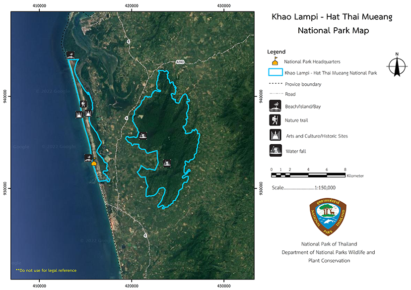
Khao Lampi - Hat Thai Mueang National Park is approximately 45,000 rai or 72 square kilometers in area and is located in the Lam Kaen, Thung Maphrao, Thai Mueang, Bang Thong and Na Toei Sub-district, Thai Mueang District, of Phang-Nga Province. It is between the latitudes of 80 23, -80 33, North and 980 12, and 980 20, East. The area is separated into 2 parts by Phetkasem Road. (Highway No. 4) is the dividing line, and it includes the Thai Mueang Beach area along the Andaman Sea, which is 13.6 kilometers long, and the Lampi Mountain range area, which is a tropical rain forest. The National Park Headquarters are located on Thai Mueang Beach.
The Lampi Mountain range area borders the following territories:
North: Ban Khao Kluai and Ban Inthanin, Thung Maphrao Sub-district, Thai Mueang District
East: Ban Na Ta Kham and Ban Klang, Bang Thong Sub-district, Thai Mueang District.
South: Ban Huai Sai, Na Toei Sub-district, Thai Mueang District
West: Ban Bo Hin, Ban Lampi, Thai Mueang Sub-district, and Ban Khanim, Thung Maphrao Sub-district, Thai Mueang District.
The Thai Mueang Beach area has contact territories as follows:
North: Naval Land Area (Khao Na Yuk area)
East: Hin Lat Canal
Background
-
Note : After paying the entrance fee to the National Park, please carry the receipt for inspection.
44,950 rai (71.92 square kilometers)
|
|
|
|
|
|
|
|
|
Nature trails ⇔ Trekking ⇔ Visit Waterfall ⇔ Observe flowers/plant ⇔ Bird/Butterfly ⇔ Wildlife watching activities ⇔ Stargazing⇔ Mountain biking ⇔ Camping
Welfare shop: Not available.
National Park office area: AIS, TRUE, DTAC
Lampi Waterfall area: AIS, TRUE, DTAC
|
|
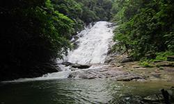
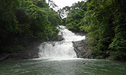
Khao Lampi - Hat Thai Mueang National Park has an area on the east coast of the Andaman Sea of 72 square kilometers, or about 45,000 rai. It is located in Lam Kaen, Thung Maphrao, Thai Mueang, Bang Thong, and Na Toei Sub-district in Thai Mueang District, Phang-Nga Province. The national park areas are separated into two parts by Highway No. 4 with the first part being the Thai Mueang Beach area, which is on the Andaman Sea. The beach is about 13.6 km long, with the broadest part of the park measuring 1,600 meters and the narrowest point of about 350 meters. At the end of the beach is a cape called Laem Ao Kham (Khao Na Yak), and in the eastern area is a large brackish water canal is the Thung Maphrao Canal and the Hin Lat Canal, which have most of the freshwater flows from the Lampi Mountain range. It is a tropical rain forest, with complex mountain landscape along norht-south, which is called Lampi Mountain range consisting of Khao Khanim, Khao Lampi, Khao Ton Yan Sai, and Khao Lam Lang, with elevations of 40–100 meters above mean sea level until the higher mountain area in the middle of the national park. The highest peak is Khao Khanim, which is located on the north side of the area, with a height of 622 meters above mean sea level. The Khao Lampi - Hat Thai Mueang National Park is a source of many rivers and streams, such as the Lampi Canal, Khanim Canal, Lam Lang Canal, Phlu Canal, Khamnueng Canal, Intha Nin Canal, and Bang Po Canal. The area has average slope gradients of about 10 to 25%. The National Park Headquarters are located at Thai Mueang Beach, which is the mountain area of the Khao Lampi National Park area. In addition to beingthe habitat of many wildlife, it is also a catchment area for two important rivers. They are Khlong Thung Maphrao and Khlong Khan. The Khlong Thung Maphrao River basin has a total water intake area of about 42.94 square kilometers and consistss of the Khlong Inthanin Basin, Khlong Khanim Basin, Khlong Lampi Basin, Khlong Pa Te Basin and other sub-basins. The Khlong Khan Basin has a water intake area of approximately 14.06 square kilometers. It consists of sub-branch streams, namely Khamnueng Canal, Nata Kham Canal, Huai Sai Canal, Huai Klang Canal and other sub-stream, including the national park area, which counts as approximately 57 square kilometers or 35,625 rai. Thai Mueang Beach is about 15 square kilometers, or 9,375 rai, so about 20% of all the national park’s area. The mountains in this area are extremely important because they are the catchment area for so many important rivers. |
|
The climate in Khao Lampi - Hat Thai Mueang National Park is influenced by the southwest monsoon, which is strong between May and October and brings moisture from the Indian Ocean to the land in the form of heavy rainfall. The northeast monsoon winds' influence is less in this area since high mountains range act as a barrier, causing the wind to weaken and causing some rain during November. From December to April, there is a dry season with a clear sky, warmer temperatures and less precipitation.
|
|
|
|
|
|
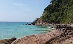
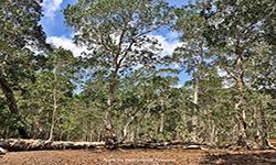
Khao Lampi - Hat Thai Mueang has two areas that are separated by Phetkasem Road. They are the Thai Mueang Beach area, which is on the shores of the Andaman Sea, and the Lampi mountain range, which is a tropical rain forest. The Lampi Mountain range runs on a north-south axis and includes Khao Chu Chi, Khao Khanim, Khao Lampi, Khao Khuan Ta Chai, and Khao Ton Yan Sai, with the highest peak at Khao Khanim Summit. The forest condition is of tropical rainforest, where plant species include Dipterocarpus, Malacca Teak, Hopea odorata, Mesua ferrea Linn., Phyllanthus columnaris Mull.Arg., Bullet Wood, and Spanish cherry. The lower ground plants include ferns, Calameae, and bamboo, and there is a rubber plantation around the boundary line. Thai Mueang Beach covers an area of approximately 15 square kilometers, or 20% of the national park area. The beach occurs was created by wave erosion, which created the a fine sand shoal that extends in the northwest direction from the Thai Mueang District parallel to the mainland. At the end of the beach is a cape called Khao Na Yak, and there is a large brackish water canal on the east side where freshwater flows down from the Lampi Mountain range through the Thung Maphrao Canal and Hin Lat Canal into the sea. The muddy area at the’ estuary is a mangrove swamp forest that includes plant species such as Rhizophora apiculate Lam., Rhizophora apiculate, Xylocarpus moluccensis (Lam.) M. Roem., Xylocarpus granatum Koenig, Sonneratia caseolaris (L.) Engl., Sonneratia alba J. Sm., Bruguiera pamviflora, Vigna unguiculata L., and Avicennia alba Bl There are also the Nipa Forest and the beach area is the beach forest. Casuarina equisetifolia L., Fish Poison Tree (Barringtonia asiatica (L.) Kurz), Terminalia catappa, Derris indica (Lamk.) Benn., Black Plum, Scaevola taccada (Gaertn.) Roxb., and Seashore crewpine. In the middle of the Thai Mueang Beach area there is about 1,000 rai (1.6 square kilometers) of freshwater that is trapped during the rainy season. The plant community is a swamp forest which has been disturbed until it turns into a Samet forest. in which the white melon (Melaleuca leucadendra) is a prominent plant. Khao Lampi – Hat Thai Mueang National Park in the Lampi Mountain range is home to many important wildlife species, such as Bengal Tigers, Asian black bear, Indian Muntjac, Barking Deer, wild boars, porcupines, Mouse Deer, Leopard, Palm Civet, Civets, Langur, gibbons, and various kinds of birds. Thai Mueang Beach is on the Andaman Sea coast, a flat area with a white sand beach. There are mammals and birds at the dunes, such as Indian Muntjac, wild boars, deers, Mouse Deer, porcupines, Common Palm Civet, Red Junglefowl, Brahminy Kite (Haliastur indus), White-Bellied Sea Eagle, Amourornis phoenicurus, doves, Alcedinidae, and Laridae. The most significant part of the park’s wildlife is the sea turtle’s nesting area on Thai Mueang Beach, where turtle lay their eggs. Aquatic animals and marine resources consist of many species, especially in the Khlong Hin Lat mangrove swamp forest. It is a breeding habitat for marine animals that require brackish water ranging from small shrimps, shellfish, crabs, various fish species, and even dolphins. |
How to get there by car :
1) The travel between Phang-Nga Districts and other provinces relies on the road system, which consists of national highways, provincial highways, and local highways with details as follows;
- National Highways: There are three main routes:
- National Highway No. 4, Phetkasem Route, is a national highway of the South starting from Bangkok, passing through Nakhon Pathom, Ratchaburi, Phetchaburi, Prachuap Khiri Khan, Chumphon, Ranong and Phang Nga Province, via Kuraburi District, Takua Pa, Thai Mueang, Takua Thung, Mueang District and Thap Put. This route runs along the western coast of the south, and the total distance from Bangkok to Phang-Nga is approximately 839 kilometers.
- National Highway No. 401 separates from Highway No. 4 in Takuapa District, passing through Surat Thani Province and ending in Nakhon Si Thammarat Province.
- National Highway No. 402, the Khok Kloi – Phuket route
1.2 Provincial highways. Six lines connect different districts of the province.
1.3 Local highways It is a short route with a distance of fewer than 20 kilometers connecting districts, sub-districts, or villages in Phang-Nga Province.
For bus services (The Transport Company Ltd.), there are both intra-provincial and inter-provincial routes for both regular and air-conditioned buses.
Waterway transportation was formerly the main transportation mode in the province. At present, rivers and canals are shallow due to mining, but on the coast and in Ao Phang-Nga water transportation is still widely used.
Boats are primarily used for short trips between islands or for fishing and tourism purposes.
There are four significant piers, which are:
- Provincial Administrative Organization pier
- Thap Lamu Pier
- Kuraburi Pier
- Surakul Pier
By air : Phang-nga is only 66 kilometers away from Phuket airport, then the air transportation to Phang-nga is quiet convenient.
Getting to Khao Lampi – Hat Thai Mueang National Park uses National Highway No. 4 (Phetkasem Road) from Bangkok, passing through Takua Pa, Phang-Nga Province, then taking the Takuapa – Thai Mueang route, a distance of about 66 kilometers, or taking the Phang-Nga – Thai Mueang route, a distance of about 56 kilometers. Travel along the coastal path for about 6 kilometers to reach the National Park Headquarters. For the Khao Lampi National Park area, visitors must continue traveling from Thai Mueang District for a distance of about 9 kilometers to the entrance of Lampi Waterfall, then use the paved road for a distance of about 2 kilometers.
- National Park Ranger Station Lo Po No. 1 (Headquarte
- National Park Ranger Station Lo Po No. 2 (Namtok Lampi)
- National Park Ranger Station Lo Po No. 3 (Pang)
- National Park Ranger Station Lo Po No. 4 (Namtok Ton Phrai)
- National Park Ranger Station Lo Po No. 5 (Thung Maphrao)
Accommodation : Thai Mueang 102/1-4 (Chik Thale)
Thai Mueang 104/1-4 (Son Thale)

