Si Phang-Nga National Park
Contact Location : Si Phang-Nga National Park, 65/16 Moo 2, Bang Wan Sub-district, Kuraburi District, Phang-Nga Province 82150
Telephone Number : (+66) 8 6952 5246, (+66) 8 3647 2983
Email : Siphangnga@gmail.com, Siphangnga_dnp@yahoo.co.th
Facebook : Si Phang Nga National Park
Information
-
Background
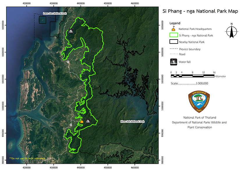
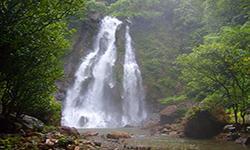
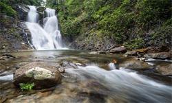
Si Phang-Nga National Park covers the Kuraburi and Takua Pa district areas of Phang-Nga Province and it was one of the five national parks established to honor His Majesty the King Bhumibol Adulyadej on the auspicious occasion of His Majesty the King's 60th birthday on December 5, 1987. The forest condition is complete with natural resources and watersheds, and includes abundant wildlife and beautiful natural features such as waterfalls and cliffs. Si Phang-Nga National Park has an area of approximately 153,800 rai, or 246.08 square kilometers. In early March 1986, the people of Kuraburi District, Phang-Nga Province, proposed to Mr. Borom Tanthien, Deputy Minister of Agriculture and Cooperatives, asking for the government to establish an area near Tam Nang Waterfall, Kuraburi District, Phang-Nga Province, as a National Park.
The purpose of establishment was to improve the area, . The National Park Division, Royal Forest Department, was proposed to the National Park Board at meeting 2/2529 on March 18, 1986 His Majesty the King's 5th age cycle. The meeting resolved in principle to establish a forest area near Tam Nang Waterfall.
In May 1986, the National Park Division, Royal Forest Department, issued order 877/2529, dated May 23, 1986, to Mr. Tawat Chaipat, Forest Officer 4, to conduct surveys and establish the Namtok Tam Nang Forest Area as
a National Park with the name "Si Phang-Nga National Park." According to the survey report, found in book No. Ko So 0713 (So Ngo)/32, dated December 15, 2529 BE, the area is a fertile forest and contains beautiful scenery of natural features, The National Park Division has established it as a National Park.
The National Park Division was established as a national park according to a royal decree that specified the area of Thueak Khao Nom Sao Forest in Kura, Mae Nang Khao and Bang Wan Sub-district, Kuraburi District and Bang Nai Si Sub-district, Takua Pa District, Phang-Nga Province as a national park.
The announcement was published in the Royal Gazette, Volume 105, Part 60, dated April 16, 1988
and it became Thailand’s 56th national park.
Note : After paying the entrance fee to the National Park, please carry the receipt for inspection.

153,800 rai (246.08 square kilometers)
|
|
|
|
Nature trails ⇔ Visit Waterfall ⇔ Observe flowers/plant ⇔ Bird/Butterfly
Welfare shop : (coffee, drinks, snacks): open daily from 8.30 - 16.30 hrs.
National Park Headquarters: DTAC
|
|
The general condition is that of a complex high mountain range that runs parallel to the Andaman Sea coast on a north-south axis. The National Park contains a fertile forest habitat that is home to a lot of wildlife, The main mountains include Khao Phra Mi, Khao Pho Ta Luang Kaeo, Khao Ya, and Khao Nom Sao. It is also the origin of important streams such as Tam Nang Canal, Bang Wan Canal, and Nang Yon Canal, and much astonishing scenery. Water resources, catchment areas, watersheds, and classification of water resources The main watersheds of Si Phang-Nga National Park are on the west side of the southern river basin and the Tapi River Basin. The tributary basins are the Khlong Sok Basin, Khlong Phra Saeng Basin, and the Khlong Takua Pa Basin. The watershed qualification of Si Phang-Nga National Park can be classified into 7 classes as follows: 1. Class 1A has been in the intact forest since the year 1982. Therefore, it is needed to preserve the watershed and the country's forest resources,. Itcovers approximately 133.89 square kilometers or 83,678.35 rai, accounting for 54.41% of the National Park. 2. Class 1 AR used to be watershed class 1A, but now rubber plantations appear in the area. It covers approximately 0.09 square kilometers or 55.18 rai, accounting for 0.04% of the national park. 3. Class 1B is the watershed class 1 where most of forest conditions were destroyed or changed to develop for land use before 2525, with covers approximately 4 square kilometers or 2,498.88 rai (3.998208 square kilometers) accounting for 1.62% of the National Park. 4. Class 2 is the second most suitable, and covers 73.36 square kilometers or 45,849.39 rai, accounting for 29.81% of the National Park. 5. Class 3 is in the hillside area with a high gradient where the soil has moderate erosion. They is generally suitable for economically valuable forests, pastures, logging, mining, and perennial farming activities, but the requires soil and water conservation measures to maintain it. It covers approximately 30.96 square kilometers or 19,351.54 rai, accounting for 12.58% of the national park. 6. Class 4 is in the hilly area with a moderate slopes. The forest conditions have been encroached upon and cleared, which makes them suitable for crop activities, fruit plantations, and pastures that require preventive measures for soil erosion. It has an area of approximately 3.54 square kilometers or 2,213.49 rai, accounting for 1.44% of the National Park. 7. Class 5 areas are generally flat or lowland with a slight slope that are suitable for agriculture. Most of the forests have been encroached upon and cleared for farming and other activities. It is not necessary to take preventive measures against soil erosion. The area covers approximately 0.25 square kilometers or 153.17 rai, accounting for 0.10% of the National Park. The characteristics of the canals around Si Phang-Nga National Park are that they are primarily short and flowfrom east to west. They include Klang Canal, Kam Phuan Canal, Ko Ko Canal, Ta Phrom Canal, Tam Nang Canal, Triam Canal, Sai Ngam Canal, Nang Phon Canal, Bang Khrang Nuea Canal, Bang Dong Canal, Bang Daeng Canal, Bang Tong Canal, Bang Nai Sang Tai Canal, , Bang Lu Canal, Bang Yai Canal, Ban Suan Mai Canal, Phraek Khwa Canal, Phraek Sai Canal, and Suan Plu Canal. The water originates in the Nom Sao Mountain range, flowing through various canals into the Andaman Sea. Another vital surface water source nearby Si Phang-Nga National Park is the Ban Bang Soi Reservoir. The volume of water from the 7 tributary basins in Si Phang-Nga National Park over a period of 30 years contains approximately 3,846.5 millimeter. From the model, the average annual water volume is about 211.61 million cubic meters or accounted for around 1,692.86 millimeters, equivalent to approximately 47.78 million cubic meters per square kilometer of water yield. The month with the highest water content in streams is September, averaging about 58.19 million cubic meters. The month with the least water volume (less than 1 million cubic meters) is February. |
|
There is heavy rainfall almost all year round, and the year is divided into two seasons; the rainy season runs from May to December, and summer is from January to April. The highest average temperature is 34.7 degrees Celsius, and the lowest average temperature is 20 degrees Celsius. The best time to travel is from December until April.
|
|
|
|
The forest in Si Phang-Nga National Park is a tropical rain forest. The important plants are Dipterocarpaceae, Hopea odorata , Magnolia champaca, Diospyros transitorea., and the palm family. Various orchids, such as Lady's Slipper, Uraria acaulis Schindl, Dendrobium anosmum Lindl., Dendrobium palpebrae Lindl, and Rafflesia kerrii.
|
How to get there by car :
From Bangkok, take National Highway No. 4 (Chumphon - Ranong route), passing through Ranong Province to Kuraburi District, Phang-Nga Province. From Kuraburi District, take Highway No. 4 for about 25 kilometers to Ban Tam Nang. At the milestone No. 756, turn left onto the paved Ban Tam Nang – Si Phang-Nga Road for 5 km.
From Phang-Nga Province, take National Highway No. 4 (Phetkasem), along with the Takua Pa - Ranong district line, to the milestone No. 756 at Ban Tam Nang. Turn right at the intersection and go 5 kilometers to the National Park Headquarters via a paved road.
- National Park Ranger Station So Ngo No. 1 (Namtok Suan Mai)
- National Park Ranger Station So Ngo No. 2 (Saphan Phra Aram)
- National Park Ranger Station So Ngo No. 3 (Thung Chali)
- National Park Ranger Station So Ngo No. 4 (Khurot)
Accommodation : Si Phang-Nga 102 (Phra Aram) (Close)
Si Phang-Nga 103 (Thung Chali) (Close)
Si Phang-Nga 104 (Khurot) (Close)


