Sirinat National Park
Contact Location : Sirinat National Park 89/1 Moo 1 Ban Nai Yang, Sakhu Sub-district, Thalang District, Phuket Province 83140
Telephone Number : (+66) 7 632 8226, (+66) 7 632 7152 Fax: (+66) 7 632 7152
Email : sirinath_np@hotmail.com
Facebook : Sirinat National Park
Information
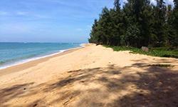
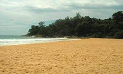
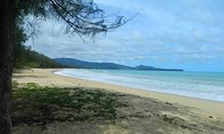
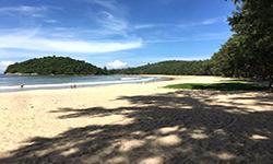
Sirinat National Park covers Thalang District, in Phuket province and is a marine National Park on the northwest coast of Phuket Island, which consists of natural casuarina equisetifolia forests, clean white sand beaches, and beautiful coral reefs. It is also a nesting area for many sea turtles, sand crabs, and various rare shellfish. Sirinat National Park is located only 1 kilometer from Phuket Airport, and covers approximately 56,250 rai, or 90 square kilometers.
Background
Initially, around the National Park was known as the Ban Sakhu Reserved Cattle Area but the Royal Forest Department issued letter Ko So 0801/3326 dated March 1, 1977, to Phuket Province, which was copied to the Secretariat of the Minister, numbered So Ro 0202/1305, and sent on January 31, 1977. It was regarding the development of Phuket as a tourist destination.
On January 26, 1977, the Cabinet meeting voted to approve the policy of developing Phuket as a tourist destination, and Phuket Province urgently asked the Royal Forest Department to organize a survey of the beach area in Thalang district in letter No. Pho Ko. 09/7211, dated July 6, 1977, in order to establish a marine forest park at Sai Kaeo Beach, Mai Khao Beach, along the coast until Nai Yang Beach, a distanced of approximately 13 kilometers long. This was met with fantastic support from Mr. Sanae Wattanathorn, the Governor of Phuket Province.
Phuket Provincial Forestry Unit sent an urgent letter, Pho Ko. 09/484, dated September 23, 1977, regarding the submission of a preliminary survey report into the condition of the forest in Phuket Province.
Casuarina equisetifolia Forest, Mai Khao Beach, Nai Yang Beach, in Thalang District, Phuket Province are considered public property, and a request was made to the Royal Forest Department regarding the establishment of a forest park.
The National Park Division, Royal Forest Department, sent officers to conduct a survey and found that the area was suitable to be classified as a tourist attraction due to its natural identity and highlights such as the natural casuarina equisetifolia forests, clean white sand beaches, coral reefs, and beautiful rocks. Also, along parts of the beach were nesting grounds of sea turtles and mole crabs, so overall it was considered most suitable for the establishment of a national park.
National Park Division, Royal Forest Department, presented to survey to the National Park Board and the decision was made at meeting 1/2523 on January 8, 1980 to define the area as a national park. It would include sea pine forest, Khao Ruak Forest, Khao Mueang Forest and the Nai Yang Beach. The area covered the areas of Mai Khao, Sakhu and Choeng Thale Sub-district, in Thalang District, Phuket Province, which is an area of 90 square kilometers. It became Thailand’s 31st National Park when details were published in the Government Gazette, Volume 98, Section 115, dated July 13, 1981, and it was to be known as Hat Nai Yang National Park. .
Consequently, the Council of Ministers passed a resolution on September 25, 1990, to declare the royal property area in the area of Tha Chatchai, Mai Khao Sub-district, Thalang District, Phuket Province, with an area of 4.48 square kilometers to be a national park. This was in honor of the auspicious occasion for Her Majesty, Queen Sirikit’s 60th birthday on August 12, 1992. The Royal Forest Department combined the area with Hat Nai Yang National Park.
The goal is to develop the area and renovate it as a recreational attraction. and conserve natural resources to last forever.as well as asking for a suitable new name, which has been given the new name, "Sirinat National Park.
Note : After paying the entrance fee to the National Park, please carry the receipt for inspection.

56,250 rai (90 square kilometers)
|
|
|
|
|
|
|
|
|
Nature trails ⇔ Observe flowers/plant ⇔ Bird/Butterfly ⇔ Wildlife watching activities ⇔ Mountain biking ⇔ Snorkeling ⇔ Camping
Welfare shop: Open daily from 10.00 – 22.00 hrs.
National Park Headquarters: AIS, DTAC, TRUE
|
|
Sirinat National Park is made up of approximately 76% water and 24% land. The main mountains are Khao Ruak, Khao Mueang Forest, and Khao Sai Kru, which feature granite mountains and foothills that have been eroded and therefore reshaped. Both Khao Sai Kru, which is 335 meters above sea level, and Khao Muang, which is 295 meters above sea level lead down to The coastal landscape is formed by sedimentation in various forms. The sandy beaches include Tha Chatchai Beach, Sai Kaeo Beach, and Mai Khao Beach., which runs from the north to the south. Due to the germination of sand behind the reef, the area looks like a pointed head protruding into the sea which reduces the intensity and power of the waves. . The total length of the coast is about 13 kilometers, and includes the beach at Ao Thung Nung, which is a sandy plain about 1 square kilometer wide. The sand emerges during low tide. It's the mouth of Phama Long Canal, also known as Khlong Pak Bang mouth. In the past, at the water mouth, it was a submergeable flatland with brackish water of the river mouth and was a mangrove swamp forest in the National Park area. However, this has been damaged by encroachmentso the land has been completely destroyed. In the national park, there is a short sandy beach that was formed by the accumulation of sand from the erosion of rock cliffs caused by the waves and currents along the shore. This created the beaches at Nai Thon Beach, Nai Thon Noi Beach, and Ao Hin Kruai Beach. As for Ko Tha in the south, it is a sandy beach that was found near the sandbar connecting the land to Ko Tha. The seaside areas of Khao Sai Khru and Khao Muang are mostly rock cliffs above rocky beaches and courtyards, which were also created by erosion. Sirinat National Park consists of a mountain range in the south which is home to Khao Muang, and Khao Sai Khu which are located in the west next to the sea. The highest peak is Khao Sai Khu, which is 324 meters above sea level. There are short and narrow sandy beachs located at Laem Pha Chan cape, namely Nai Thon beach and Hin Kruai bay. There are dunes connectting the main land to Ko Tha, the southernmost island. Connecting to Ao Po cape, the northern part of Khao Sai Ku, is a 13 kilometer long beach to Tha Chatchai. The plain along the coast is sand hills blown by wind, and sand dunes. The structural geology of Khao Sai Khu is granite rock that is about 82 (+4) million year. The geological map shows Hornblende-Biotite Granite, which has a coarse to medium grain, and uniform or porphyritic texture. The minerals found are pink feldspar and allanite. Khao Muang is also made up of granite that is 100 (+6) million years old. Muscovite and biotite granite make up the geological map, and they have a small to medium grain, with a uniform or porphyritic texture. Soil characteristic: In Sirinat National Park, it's mostly beach where sand is mixed with soil caused by the accumulation of organic matters on sand dune, and soil. Khao Sai Khu and Khao Muang are based on alluvial complex soils in the Ban Thon series, which have sandy texture and are dark grey or white in color. The lower layer of the soil is humus-based, with a brown or reddish-brown color and tightly packed consistency. The land is relatively flat or has minor undulations, with a rather deep soil layer and moderate water drainage. The minerals in the soil are deficient, and it is a strong to moderate acidwith a pH value of 5.0 – 6.0. Some of the areas around Khao Sai Khu and Khao Muang are loam, sandy loam, or clay loam, where the lower layer is clay. The soil colors are brown, yellow, or reddish-brown, caused by granite decomposition. The mineral level is quiet to moderate, with good water drainage, but strong acidic reactions with a pH of 4.5 – 5.5. Small rock outcrops exist in all areas.
The canals in Sirinat National Park are primarily short and flow from east to west into the sea. These includePak Bang - Pha Ma Long Canal, and Nai Yang Canal, which originate in the Bang Khanun National Reserved Forest and other waterways originating from Khao Ruak - Khao Mueang, for example, Naithon Canal and Bang Thap Chang Canal.
|
|
Sirinat National Park is located on the western coast and has abundant rainfall throughout the year. The temperature is also relatively high due to the influence of the southwest monsoon, which brings hot and humid winds from the Indian Ocean from May to September. Winter runs from November to April when the southwest monsoon is weak and is replaced by the northeast monsoon winds. The temperature drops only slightly with some rainfalls from the Gulf of Thailand. The hottest month is April with an average temperature of 29 degrees Celsius, while the coolest month is December when it is27 degrees Celsiuson average.
|
|
|
|
|
|
The plant species in Sirinat National Park can be divided into: The Beach Forest, which acts as a barrier to the wind and rain during the monsoon season, in a sparse forest along the National Park coast. It is home to the Fish Poison Tree (Barringtonia asiatica (L.) Kurz), Syzygium claviflorum (Roxb.) A.M. Cowan & Cowan, Golden Fig (Ficus Benjamina L.), Green Pome Tree, Mitragyna diversifolia (Wall. ex G. Don) Havil., Bombox anceps, Bos gaurus, Casuarina equisetifolia, Thespesia populnea (L.) Sol. ex Corrê, Terminalia catappa, Atalantia monophylla DC., Chulta, Cajuput Tree, and Melastoma malabathricum. The ground plants include Antidesma puncticulatum Miq., Calameae, Chromolaena odorata (L.) King & Robinson, Pandanus tectorius Parkinson ex Du Roi, shrubbery, various climbers , and epiphytic plants such as ferns and orchids. Mangrove swamp forests are found along waterways where sea water meets and they are home to important plant varieties such as Rhizophora apiculata, Ceriops tagal, Lumnitzera littorea (Jack) Voigt, Xylocarpus moluccensis (Lam.) M. Roem., Avicennia officinalis L., Avicennia alba Blume, Phaseolus vulgaris L., Excoecaria indica, Cerbera odo. Ground plants include palms and holly-leaved mangroves (Sea holly). Tropical rain forest is found in the mountainous area to the south of the national park on Khao Ruak and Khao Mueang. The essential plants are Parashorea stellata Kurz, Malacca Teak, Catechu Tree (Callerya atropurpurea (Wall.), Schot (Millettia atropurpurea (Wall.) Bebtg), Parkia timoriana (DC.) Merr., Microcos tomentosa Smith, Vitex pinnata, and Morinda coreia. In the sea at Laem Sai Khru there are two types of seagrasses, which are Enhalus acoroides and Cymodocea. Tha Chatchai and the Khlong Tha Yit estuary are home to another five types of seagrass species, including Enhalus acoroides, Cymodocea, Cymodocea serrulata, and Paddle Weed (big and small leaves). The wildlife found in Sirinat National Park is primarily smaller animals, including the Common Treeshrew, Plantain Squirrel, Three-Striped Ground Squirrel,and Grey-Bellied Squirrel. It is also home to many types of birds, including Seagulls, Brahminy Kites, Oriental Magpie-Robin, White-Throated Kingfisher, Greater Coucal, Common Myna, Spotted Dove, Asian Fairy-Bluebird, and Forest Wagtail, as well as reptiles such as the Orange-Winged Flying Lizard, Red-Headed Lizard, Butterfly Lizard, Many-Striped Skink, Tokay Gecko, Water Monitor, andColubrid Snake. There are also amphibians such as the Common Toad, Stripe-Backed Frog, Common Tree Frog, and Banded Bullfrog. The canal behind the National Park Headquarters and the freshwater swamp area are habitats of various fish such as the Broadhead Black Lancer, Snakeskin Gourami, Three-Spotted Gourami, Java Barb, Trichopsis, and other marine life such as river snails, leeches, and shrimps. The marine animals found on sandy beaches and coral reefs include Leatherback Sea Turtle, Hawksbill Sea Turtles, Olive Ridley Sea Turtles, Ghost Crabs, Sand Crabs, Button Top Shells, Big-Eyed Snapper, Ray-Finned fish, Spotted Sickle Fish, Longfin cavalla, Serranidae, Mullet, Rays, Puffers, Longtooth Grouper, Moray Eel, Red Lionfish, Chinese Trumpetfish, Chaetodon octofasciatus, Marine Angelfish, Ocellaris Clownfish, and corals such as the staghorn coral, mountain coral, brain coral, mushroom coral, soft coral, sea anemones, encrusting coral, and Zoanthids. A sand crab, or mole crab, is a crustacean that looks like a cross between a prawn and a crab. Its body has an oval shape, and the female is twice the size as the male. They live in the sand on the tidal zoneand only their eyes and antenna emerge from the same to trap plankton. There are two types of sand crabs found at Mai Khao Beach: The Mole Asactyla, a large and rare species and Emerita emeritus which is more common and smaller than the other type. |
How to get there by car :
From Phang-Nga Province cross the Thepkasattri Bridge and then turn right for about 3 kilometers to the Tha Chatchai National Park Ranger Station on the north side of the National Park. Travel along National Highway 402 to the airport entrance, then turn right for about 3 kilometers to reach the Sirinat National Park Headquarters. The distance from Bangkok is 876 kilometers.
How to get there by bus: The fare rate is as follows:
- The standard passenger bus costs 378 baht.
- The air-conditioned passenger bus costs 484 baht.
- The VIP air-conditioned bus costs 775 baht.
How to get there by plane:
Take a flight to Phuket International Airport, which located near the Sirinat National Park Headquarters at Nai Yang Beach. Then take a taxi to the park.
For domestic flights, they are as follows:
Flights from Bangkok - Phuket from 07.00 - 21.35 hrs.
An average of one flight per hour.
Flights from Phuket - Bangkok from 07.05 - 21.30 hrs.
An average of one flight per hour.
Contact number: 076-212400, 327194
Flight from Hat Yai - Phuket at 10.50 hrs. (TG 284)
Flight from Phuket - Hat Yai at 09.10 hrs. (TG 283)
Flight from Chiang Mai - Phuket at 11.15 hrs. (TG 129
- National Park Ranger Station So No No. 1 (Hat Nai Yang)
- National Park Ranger Station So No No. 2 (Tha Chatchai)
Accommodation: Sirinat 101/1-4 (Thio son)
Sirinat 102/1-4 (Dok Wa)
Sirinat 103/1-4 (Andaman)
Sirinat National Park offers accommodation Youth Camp and camping grounds, including a tent and equipment rental service for visitors. There is no restaurant available in the national park so tourists must prepare food and drinks from the outside shop.


