Mu Ko Ranong National Park
Contact Location : Mu Ko Ranong National Park, 192 Moo 4, Ngao Sub-district, Mueang Ranong District, Ranong Province, 85000
Telephone Number : (+66) 7 788 0438
Email : mukoranong@hotmail.com
Facebook : Mu Ko Ranong National Park
Information
-
Background
In 1989, the Royal Forest Department ordered officers to survey all four national reserved forests and nearby islands to establish a national park. The mangrove swamp forests, terrestrial forests, and marine resources around the islands were classed as fertile and no logging concessions were noted in the preliminary survey. There are many valuable plants and biodiversity both on land and in the sea, which are suitable for conservation in order that they remain in their original conditions and can be used for public recreation and education, according to the intent of the National Park Act B.E. 2504.
In 1997, the UNESCO organization declared the Khlong Hua Keao forest, Khlong Ko Samui forest, Khlong Hin Kong Forest, Khlong Muang Kluang forest, and nearby areas as a biomass reserve. This was the 4th reserve listed in Thailand, and it took place on October 30, 2000.
At the meeting of the National Parks Committee 3/2543, the committee approved the area of Khlong Hua Khiao Forest, Khlong Ko Samui Forest, Khlong Hin Kong Forest - Khlong Muang Kluang Forest, Ko Chang Forest, and Ko Phayam in Pak Nam, Ngao, Ratchakrut and Ko Phayam Sub-district, Mueang District, Ranong Province, to be a National Park by the Royal Forest Department procedures.
On September 14, 2004, the Cabinet approved the draft royal decree specifying the land area of Khlong Hua Khiao Forest – Khlong Ko Samui Forest, Khlong Hin Kong Forest - Khlong Muang Kluang Forest, Ko Chang Forest, and Ko Phayam in Pak Nam, Ngao, Ratchakrut and Ko Phayam Sub-district, Mueang District, Ranong Province to be a National Park and submit to the Council of State for consideration. However, on April 9, 2005, local villagers filed an objection to the announcement of Mu Ko Phayam National Park with the Minister of Natural Resources and the Environment (Mr. Yongyuth Tiyapairat). The latter came to inspect the local government in Ranong and Chumphon provinces.
The objection was caused by the overlap between the national park and the villagers' farmland. The ministry was ordered to delay the announcement and set up a committee in Ranong Province to resolve the problems (Urgent letter Tho So 0206.4(3)/359, dated April 29, 2005). The advisory panel and a committee investigated the farmland and villages in the area under national park preparation according to report 934/2548, dated July 18, 2005.
The new boundary was showcased on March 15, 2007 by the Board of Directors, pursuant to Ranong Provincial Order 934/2548, dated July 18, 2005. A meeting was held at Ranong City Hall with the Deputy Governor as Chairman, and the certification of the above survey registration was resolved. The 12 villages, totaling an area of 222,938 rai, or 356.7008 square kilometers agreed, and the National Park Division for Wildlife, and Plant species submitted the results to the Council of State for consideration in order to proceed with the establishment of a national park
Thedecision to annex Ko Phayam into the national park came later, and with it was the change of name to the Mu Ko Ranong National Park.
On September 19, 2007, National Park Superintendent of Mu Ko Phayam National Park (Mr. Sompol Ruangnoi) and the Council of State, agreed to resolve the boundary issues caused by overlapping between farmland and the National Park. After remapping and changing the name, the Office of Agricultural Land Reform verified the preparatory zone.
Subsequently, the Council of State approved the draft royal decree specifying the area in Khlong Hua Khiao Forest, Khlong Ko Samui Forest, Ko Chang Forest, Khlong Hin Kong Forest, and Khlong Muang Kluang Forest, as well as nearby islands in Pak Nam, Ngao, Ko Phayam and Ratkrut Sub-district, Mueang Ranong District, Ranong Province, to be the Mu Ko Phayam National Park. On August 26, 2008, the Cabinet approved the draft royal decree.
The Secretariat of the Cabinet presented the draft to His Majesty for confirmation before publication in the Government Gazette. But the Government changed Prime Minister (Mr. Samak Sundaravej), causing a delay in the submission. On November 11, 2008, the Cabinet presented the draft royal decree to the Prime Minister (Mr. Somchai Wongsawat) at the temporary Government House .
After the change in government, Mr. Abhisit Vejjajiva was the new Prime Minister, and the Cabinet Secretariat re-sent the requisition to the Ministry of Natural Resources and Environment to confirm the submission and request to delay the national park declaration by the National Human Rights Commission.
The Mu Ko Phayam National Park clarified the situation in urgent letter Tho So 0914.511/69, dated March 9, 2009, and on September 29, 2009, the Cabinet resolved to approve the draft royal decree again and presented it to the King.
Finally, the the area of Khlong Hua Khiao forest and Khlong Ko Samui Forest, Ko Chang Forest, Khlong Hin Kong Forest, and Khlong Muang Kluang Forest and nearby islands in Pak Nam, Ngao, Ko Phayam, and Ratchakrut Sub-district, Mueang Ranong District, Ranong Province ) was declared a National Park in an announcement in the Government Gazette, Volume 126, Section 96 Ko, Pages 20-22, dated December 23, 2009. It became Thailand’s 119th national park.
On February 23, 2010, the Department of National Parks, Wildlife, and Plant species announced that it would change the name of Mu Ko Phayam National Park to Mu Ko Ranong National Park.
Note : After paying the entrance fee to the National Park, please carry the receipt for inspection.

115,800 rai (185.2 square kilometers)
|
|
|
|
|
|
|
|
|
|
|
|
|
|
|
|
Nature trails ⇔ Observe flowers/plant ⇔ Bird/Butterfly ⇔ Take a boat ride or a paddle ⇔ Camping
Welfare shop : not available.
National Park Headquarters: AIS, TRUE, DTAC
|
|
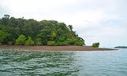
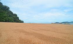
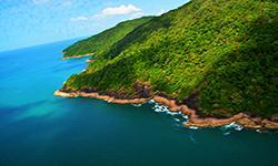
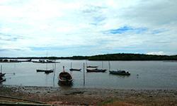
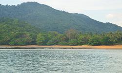
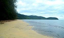
Mu Ko Phayam National Park is located in Ko Phayam, Ngao, Ratchakrut and Pak Nam Sub-district, Mueang District, Ranong Province. The territories are as follows: North : Republic of the Union of Myanmar, Pak Nam Sub-district, Mueang District, Ranong Province.South : Khao Chai and Muang Kluang Canal, Ratchakrut Sub-district, Mueang District, Ranong Province East : The mangrove swamp forest in Ngao Sub-district, Mueang District, Ranong province. West : The Andaman Sea, Ko Phayam Sub-district, Mueang District, Ranong Province. The topography of Mu Ko Phayam National Park can be divided into three categories as follows: The coastal slopes run down from the east of Ranong Province, with a beach extending into the sea that is covered with extensive mangrove swamp forests. Due to the high biodiversity within the mangrove swamp forest, the Thai Government, in cooperation with the UNESCO organization, declared the coastal area to be an International Coastal and Marine Biosphere. This was the fourth such location in Thailand, and it covers approximately 214.35 square kilometers, of which 176 square kilometers are in the Mu Ko Phayam National Park. This area has the purpose of preserving natural diversity. Areas near the coast include Ko Bang Chak, Ko Yew, Ko Sai Dum, and Ko Son, which consist of mangrove swamp forests in the east and sandy beaches in the west. Areas away from the coast include Ko Chang, Ko Phayam, Ko Talu, Ko Ta Krut, Ko Mo, Ko Pring, Ko Rai, and Ko Fai Mai, all of which are parallel to the coast and covered with tropical rainforests and coral reefs scattered around. |
|
Mu Ko Phayam National Park is influenced byer the monsoons. The rainy season runs from mid-May to mid-October, with the most rainfall falling from June to September. - Winter is from mid-October to mid-February, when the weather is not more temperate and there is rain caused by the northeast monsoon winds that blow through the Gulf of Thailand. - Summer runs from mid-February to mid-May, with the hottest month being April. The coastal location helps decrease the temperature compared to the rest of Thailand.
|
|
|
|
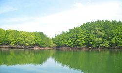
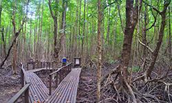
The ecosystems in Mu Ko Phayam National Park can be classified as follows: Mangrove swamp forests have high fertility and biodiversity and include plant species such as Avicennia spp., Avicennia alba Blume, Avicennia marina (Forssk.) Vierh., Avicennia officinalis L., Phaseolus vulgaris L., Briguiera pamviflora, Bruguiera sexangula, Black Mangrove, Ceriops decandra (Griff.) Ding Hou, Ceriops tagal, Excoecaria agallocha L., Intsia bijuga (Colebr.) Kuntze, Lumnitzera littorea, Lumnitzera racemosa Willd, Zrhizophora apiculata, R. mucronata, Sonneratia caseolaris (L.) Engl., Sonneratia alba J. Sm., Xylocarpus moluccensis (Lam.) M. Roem., Xylocarpus granatum Koenig, and Nypa sruticans. The lower ground plants include Volkameria inermis L., Finlaysonia aritima Wall., Holly-Leaved Mangrove / Sea Holly, Cycas rumphii, and Acrostichum speciosum Willd. Tropical rain forest is in good condition, especially in Ko Bang Chak, Ko Yio, Ko Chang, Ko Sai Dam, and Ko Phayam. The predominant plants found are Tristaniopsis burmanica (Griff.) Peter G. Wilson & J. T., Artocarpus rigidus Blume subsp. rigidus, Nageia wallichiana (C. Presl) Kuntze, Parashorea stellata Kurz, Carallia brachiata, Hopea odorata, Hopea pierrei Hance, Alstonia scholaris (L.) R. Br., Cinnamomum parthenoxylon (Jack) Meisn., Chukrasia velutina, Parkia speciosa Hassk., Knema furfuracea (Hook.f. & Thomson) Warb., Mangifera caloneura, Fagraea fragrans, Oncosperma tigillarium. The lower ground plants include rattan, Salacca, mosses, and ferns. Beach forests appear along some of the coasts of Ko Phayam, Ko Chang, and Ko Sai Dam. Plant species found include Casuarina equisetifolia, Sea Poison Tree, Derris indica (Lamk.) Benn., Seashore Screwpine, and Queen Sago. A meadow grows on Ko Yio and Ko Sai Dam, and is home to plant species such asgrasses, which interspersed with sparse forest. Seagrass: A survey was undertaken in Mu Ko Phayam National Park during March - April 2002 using a Monta tow and snorkeling. It found eight different types of seagrass, including Cymodocea serrulata, Halophila ovalis, Halodule pinifolia, Halodule uninervis, Enhalus acoroides, Halophila beccarii, Syringodium isoetifolium, and Thalassia hemprichii. The grasses are found in Ko Chang, Ko Phayam, Ko Bang Chak, Ko Ta Krut, and Ko Sin. Wildlife in Mu Ko Phayam National Park can be classified as follows: Mammals: 11 species including Crab-Eating Macaques, Otters, Sunda Flying Lemurs, squirrels, treeshrews, wild boars, moles, civets, and rodents. Birds: 52 species including Oriental Pied Hornbill, herons, falcons, swallows, White-Breasted Waterhen, Oriental Magpie-Robin, Little Cormorant, and Kingfishers. Reptiles include lizards, monitor lizards, snakes, and turtles. Amphibians include frogs, toads, bullfrogs, common green frogs, and tree frogs. Insects include butterflies, dragonflies, spiders, water striders, and sea slaters. Aquatic animals include Fiddler crab, Sesarma, Giant Mud Crab, Hermit Crab, Banana Shrimp, Krill, Crawfish, Snapping Shrimp, Thalassina, Pacific Oyster, Dostia violacea, Faunus ater, Wedge shell, Mudskippers, Goby, Mullet, Garfish, Crescent Grunter, Pufferfish, Great Barracuda, Red Snapper, White Snapper, Longtooth Grouper, Spanish Mackerel, jellyfish, squid, sea urchin, sea cucumber, and corals. From surveying the coral reefs in Mu Ko Phayam National Park, which are found around Ao Kwang Pip, Ao Mae Yai, Ko Phayam, Ko Thalu, Ao Khangkhao, Ko Chang. Many types of corals are found including hump corals, brain corals, cauliflower corals, staghorn corals, finger leather corals, table corals, and leaf corals, are found. Soft coral is found around the Ko Thalu area on the west coast. Sea Fans, Sea Whips, Hydroids, and magnificent Sea Anemones are found around Ao Siat, Ko Chang, and the west coast of the Ko Thalu area. Beautiful marine fish consist of Clown Fish, Powder Blue Surgeonfish, Blue Ring Angelfish, Orange-Lined triggerfish, White-Spotted Moray, Black-Spotted Moray, Stone Fish, and Miles' Fire Fish, which are found in rock piles and around coral areas. |
How to get there by car :
How to get there by car: From Ranong Province, take National Highway 4 (Ranong - Takuapa) for about 14 kilometers to Ngao Sub-district, where you turn right into Ngao Municipality. Then continue along the Ban Lang - Hua Thanon route for about 4 kilometers to the National Park
How to get there by boat :
There are two routes to the attractions:
Travel from the Fish Marketing Organization Pier, Pak Nam Sub-district, Mueang District, Ranong Province where a passenger boat service will take you 33 kilometers, which takes about 3–3.5 hours. From Mu Ko Phayam National Park Pier, it is a distance of about 19 kilometers, takes about 1.5 hours. Chartered boats are available.
- National Park Ranger Station Ro No No. 1 (Ko Chang)
- National Park Ranger Station Ro No No. 2 (Ko Sai Dam)
Accommodation : Mu Ko Ranong 104 (Kanlapangha 1)
Mu Ko Ranong 105 (Kanlapangha 2)
Mu Ko Ranong 106 (Kanlapangha 3)
Mu Ko Ranong 107 (Kanlapangha 4)
Mu Ko Ranong 108 (Kanlapangha 5)
Mu Ko Ranong National Park offers relatively small lodges, camping grounds, tents, and equipment rental services, but there is no restaurant available. Visitors who are interested in camping, hiking, and snorkeling must contact the national park in advance. There is also private accommodation and shops on Ko Chang.

