Khao Nam Khang National Park
Contact Location : Khao Nam Khang National Park, Moo 1, Khlong Kwang Sub-district, Na Thawi District, Songkhla Province 90160
Telephone Number : (+66) 7 480 5342
Email : Khaonamkang@gmail.com
Facebook : Khao Nam Khang National Park
Information
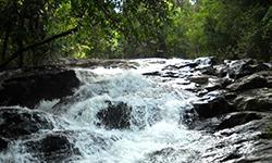
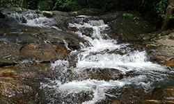
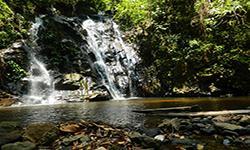
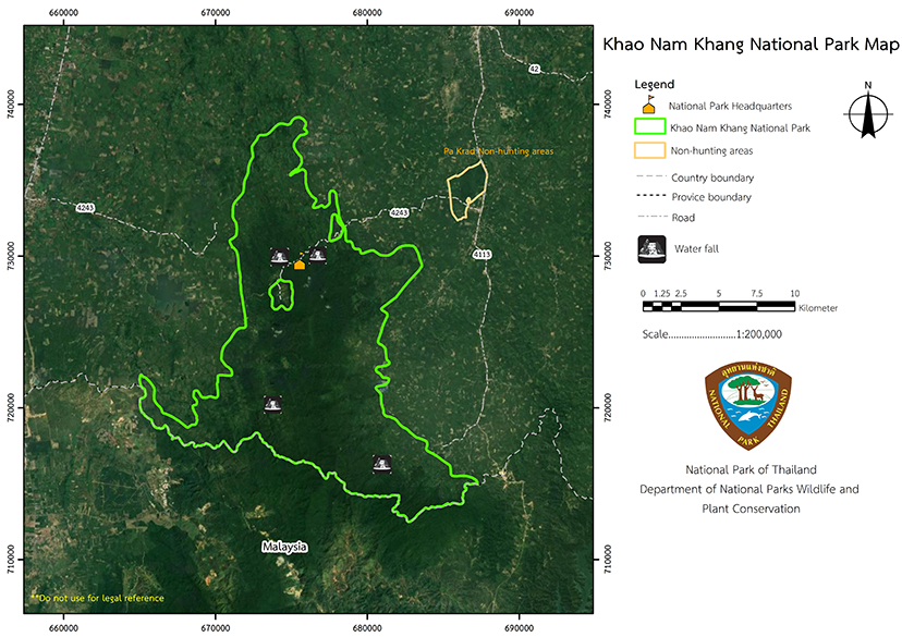
Khao Nam Khang National Park lies within the Na Thawi and Sadao District of Songkhla Province. The National Park area is rich in forests and natural resources, with many interesting and beautiful features, such as numerous waterfalls. It is also a historical site it was a stronghold of the Communist insurgents so it is home to historical sites and objects that reflect the long battle that took place. It covers an area of approximately 132,500 rai, or 212 square kilometers.
Background
Khao Nam Khang is a high peak with cold weather all year round. In ancient times, people who had climbed to the top of the mountain would find scaly dew on the tops of the grass that looked like spider webs. Even at noon, there was a sporadic dew on the tops of the grass. This is a unique condition, so it is known as "Khao Nam Khang."
Khao Nam Khang has been restricted for more than 40 years starting from the World War II, where it was controlled by the Malayan Communist Party (MCP). It is a desolate complex mountain range that was the largest operational base for the Malayan Communist Party in the area. Later, the "Tai Rom Yen" Strategy had been implemented by Army Region 4 and Combined Civilian Army No.43 (Pho To To 43) and the MCP camp was successfully closed on July 25, 1980. The MCP members were finally dispersed.
At the meeting of the National Park Committee No. 1/2526 on March 15, 1983, Mr. Thaloeng Thamrongnawasawat, Chairman of the National Parks Committee, ordered the Royal Forest Department to conduct a survey around Phu Nam Khang, Na Thawi District, Songkhla Province to consider establishing a national park with the people of Ban Tanot, Saba Yoi District, Songkhla Province.
A written record was made on August 3, 1983, asking the Royal Forest Department to consider the area around Phra Mai Phai Waterfall and nearby forest areas of the San Kala Khiri Mountain range. This are would be suitable for the establishment of a national park as it has a beautiful waterfall and natural, rich forest conditions.
The National Park Division submitted letter Ko So 0713/2786, dated September 23, 1983, to the Royal Forest Department, who thenissued order 1412/2526, dated September 26, 1983 top Mr. Somphop Sukwong, Forest Officer 4, to explore the Nam Khang Mountain range, Na Thawi District, Pramaipai Waterfall, in the San Kala Khiri Mountain range, Saba Yoi District, Songkhla Province and nearby areas.
From the survey report. Ko So 0713/Special, dated January 14, 1984, the areas of Khao Nam Khang Forest, Khao Khaen Forest, Khuan Saya Forest, Khuan Khao Mai Forest, and Khuan Si Reng Forest covered an area of approximately 220 square kilometers. They are home to a fertile forest with natural beauty features such as many waterfalls, as well as a historical place, a stronghold of Chinese communist bandits suitable to be established as a national park.
The National Park Division sent a very urgent letter, Ko So 0713/717, dated February 27, 1984, to the Royal Forest Department. which issued order 309/2527, dated February 28, 1984, for Mr. Somphop Sukwong, Forest Officer 4, to establish and improve the Khao Nam Khang forest. Na Thawi and Sadao District, Songkhla Province, are National Parks, to establish and improve Khao Nam Khang forest in Na Thawi and Sadao District, Songkhla Province, as a National Park. As the area was a former communist stronghold, though the government had suppressed them, some came back with power and set mine traps around the area. The National Park has worked with military from the begining till today, hence the problems and dangers are eliminated.
Note : After paying the entrance fee to the National Park, please carry the receipt for inspection.
132,500 rai (212 square kilometers)
|
|
|
|
|
|
|
|
Nature trails ⇔ Observe flowers/plant ⇔ Visit Waterfall ⇔ Cave exploration/Geological condition ⇔ History/Culture ⇔ Bird/Butterfly ⇔ Camping
Welfare shop : no Welfare shop or restaurants in the National Park
National Park Headquarters : AIS (Unstable signal) 3BB wifi available.
|
|
It is a complex mountain range that stretches all the way to the border of Malaysia and is home to three important peaks, namely Khuan Saya, Khuan Khao Mai, and the Khao Nam Khang, which is the highest summit at 648 meters above sea level. The area is the source of many waterways such as Na Thawi Canal, Prik Canal, Thap Chang Canal and Sai Khao Canal and the soil I s loam, clay or sandy clay. The rock base is mainly limestone and granite. Water Resources The main catchment area in the Khao Nam Khang National Park is the Southern Basin on the East Coast, which has an area of 1,549.14 square kilometers (68.209.38 rai). Khlong Na Thawi Basin receives water from various waterways such as Nam Khem Canal, Wang Khan Dai Canal, Lik Canal, Tha Khlong Creek, Na Thawi Canal, Sam Rak Canal, Ang Taek Canal, Yai Canal, and Prang Canal, which from the south, near the Thai - Malaysian border, to the north, and it enters the Gulf of Thailand at Ban Pak Bang Na Thap, Chana District, Songkhla Province. Most of the waterways in Khao Nam Khang National Park are short and flow into the Khlong Na Thawi. Other important surface water sources in the vicinity of Khao Nam Khang National Park include the Sadao Reservoir, which is located in the area of Ban Ko Mi, Moo 10, Samnak Tae Sub-district, Sadao District, Songkhla Province. |
|
The weather isinfluenced by the monsoons, so it rains a lot. Khao Nam Khang National Park Forest Area. It is a large, contiguous forest, and importantly, it is located in the tropical zone. The general weather condition is therefore a tropical monsoon type and receives monsoons all year. influenced by the northeast monsoon and southwest monsoon. As a result, it rains heavily and has similar weather conditions throughout the year.It has a long rainy season between May and January, and then a dryer (but still quite rainy) summer from February to April.
|
|
|
|
Most of the forests are are tropical rain forests which are dense and fertile. They include economically valuable trees such as Lum Pho (Intsia palembanica Miq.), Takhian (Hopea odorata), Shorea, Krabak Dam (Anisoptera costata Korth.), Yang (Dipterocarpus alatus Roxb.), Champak, Red Seraya, Khai Khiao (Parashorea stellata), Piangkha Nang (Homalium tomentosum (Vent.) Benth.), Taeo (Cratoxylum formosum), Mangkha (Cynometra iripa Kostel.), Pikul Pa (Mimusops elengi L.), and Wild Mango as well as ground plants such as Betel Nut, rattan, bamboos, Salacca, orchids, ferns, and mosses. The wildlife that can be found in the park includes wild boars, bears, Barking Deer, Chamois, Short-Tailed Macaque, gibbons, tapirs, Panther, deers, hawks, turtles, monitor lizards, and a variety of birds, such as hornbills, Great Argus pheasants, partridges, peacocks, Hill Myna, and magpies.
|
How to get there by car :
From Mueang District, Songkhla Province, by following the Songkhla - Na Thawi Road to Pa Ching Intersection, Chana District, which is a distance of 35 kilometers. Then turn right towards Na Thawi Districtand then pass through Ban Reflect, Ban Na Prang, and on to the Khao Nam Khang National Park Headquarters. It is a total distance of 86 kilometers.
From Hat Yai District travel towards the Khlong Wa Intersection along Hat Yai - Sadao Road to Sadao District passing through Ban Muang, Ban Ko Mi, and Samnak Taeo Sub-districts. It is a total distance of 84 kilometers.
- Khao Nam Khang National Park Ranger Station No Kho No. 1 (Khlong Yon)
- Khao Nam Khang National Park Ranger Station No Kho No. 2 (Ko Mi)
- Khao Nam Khang National Park Ranger Station No Kho No. 3 (Namtok Ton Sung)
In Khao Nam Khang National Park, there is accommodation for visitors, a camping ground, and you can hire tents and equipment. There is no restaurant service available, but visitors can buy them from nearby community stores, which are about 6 km from the national park.

