Mu Ko Ang thong National Park
Contact Location : : 145/1 Talat Lang Rd, Talat Sub-district, Mueang District, Surat Thani Province, 84000
Telephone Number : (+66) 6 4642 5186, (+66) 7 728 6025 Fax: (+66) 7 728 6588
Email : np_angthong@hotmail.com
Facebook : Mu Ko Ang Thong National Park
Information
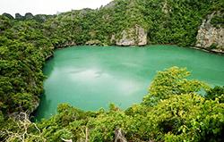
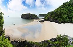
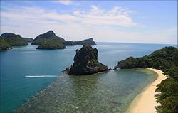
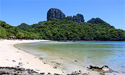
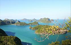
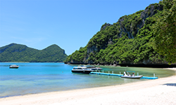
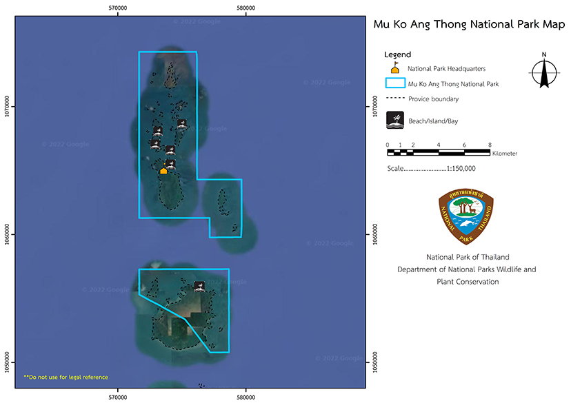
The only sea lagoon in the Gulf of Thailand Mu Ko Ang Thong National Park is an archipelago in the Gulf of Thailand, located in the Ang Thong Sub-district, Ko Samui District of Surat Thani Province. It is about 20 kilometers west of Ko Samui and Ko Pha-Ngan and consists of about 40 islands. There are beaches on almost all of the islands, with some being pure white sand beaches. Some islands have coral reefs along their coasts which have beautiful colors that reflect the tranquility. Mu Ko Ang Thong National Park covers an area of approximately 63,750 rai, or 102 square kilometers.
Background
The Mu Ko Ang Thong Archipelago was a restricted area that was designated as a naval base for Thai Royal Navy in the Gulf of Thailand for national security. However, in June 1975, Mr. Somboon Wongpakdee, a Forestry Scientist at National Park Division, wrote an article entitled "Mu Ko Ang Thong National Park," which was published in the Thai Rath newspaper on June 29, 1975. The report said that the area has beautiful natural features such as lakes, cliffs, caves, islands, beautiful scenery and various wildlife. It is also a spawning area for marine animals, and as such Ko Ang Thong should be a marine national park. Together with the project of the National Park Division, the National Parks Committee resolved in meeting No. 2/2518 on October 22, 1975, to have the Royal Forest Department consider the Mu Ko Ang Thong as a marine national park.
In 1975, the National Park Division issued letter Ko So 0708/915, dated November 19, 1975, proposing to the Royal Forest Department for Mr. Somboon Wongpakdee, a forestry scholar, to conduct a survey. The Royal Forest Department presented to the National Park Board, which made resolution 1/2519 on April 21, 1976, for the Royal Forest Department to investigate Mu Ko Ang Thong for details with the Ministry of Defense. Subsequently, the National Park Division issued letter Ko So 0708/1613, dated May 26, 1976, to the Royal Forest Department for Mr. Sinchai Buranarak, forest official 4 , to proceed. The Ministry of Defense letter Ko Ho 0352/26927, dated December 17, 1976, agreedwith the Royal Forest Department to designate Mu Ko Ang Thong as a national park
The Royal Forest Department presented the information to the National Park Board, which was made a resolution at meeting 1/2520 on February 3, 1977. Surat Thani Province issued letter So Do 25/21994, dated April 18, 1977, to support the establishment of Ang Thong National Marine Park, and a royal decree specified the area in Ang Thong Sub-district, Samui District, Surat Thani Province with total area of 102 square kilometers to be a national park. It was announced as Thailand’s 21st National Park in the Government Gazette, Volume 97, Part 174, dated November 12, 1980.
Note : After paying the entrance fee to the National Park, please carry the receipt for inspection.
63,750 rai (102 square kilometers)
|
|
|
||
|
|
|
||
|
|
|
||
Nature trails ⇔ Cave exploration/Geological condition ⇔ Observe flowers/plant ⇔ Take a boat ride or a paddle ⇔ Swimming ⇔ Snorkeling ⇔ Take a photo/Video ⇔ Camping ⇔ Relax in a nature
Open daily in 2 periods from 07.30 – 15.00 hrs. and at night open from 18.00 – 21.00 hrs.
Ao Kha office area : AIS, TRUE
Thale Nai area, Nathap Beach, Tham Rang Beach (Ko Mae Ko) : TRUE
Area of Ranger Station No. 1 Ko Samsao : TRUE
Area of Ranger Station No. 3 Ao Son : AIS, DTAC
|
|
Mu Ko Ang Thong National Park consists of 42 islands, including Ko Phaluai, Ko Wua Chio, Ko Wua Ta Lap, Ko Mae Ko, Ko Sam Sao, Ko Phai Luak, Ko Kha, Ko Hin Dap, Ko Phi, Ko Wua Kantang, Ko Pae Yat, Ko Wua Te, Ko Nai Phut, Ko Chang Som, Ko Hanuman, Ko Thai Phlao, Ko Hua Klong, and Ko Khon Ban. The island's terrain is mostly that of limestone mountains, with elevations of 10 to 400 meters above sea level. The physical erosion and weathering of the limestone structure create various shapes of caves and cliffs, which makes the shape of the islands look strange. For example, in some places, it can resemble the ancient Phimai castle or Angkor Wat.
|
|
The archipelago is influenced by the monsoons, which causes heavy rain and severe storm surges. The average rainfall is 2000 millimeters per year, and the average temperature is 23 degrees Celsius. Between February and August, when the weather is quite hot and the sea is calm, so it is the best time for sailing.
|
|
|
|
|
1. Significant plant and animal species found in Mu Ko Ang Thong National Park are as follows: Mu Ko Ang Thong (Chong Ang Thong Lady’s Slipper) originated in Mu Ko Ang Thong National Park, where it appears in the crevices of rocks or on the ground around Ko Wua Ta Lap, Ko Sam Sao, and Ko Phi. It isa single creamy white flower with red dots and an upright stem covered with green velvet hairs. 2. The Oriental Pied Hornbill, which lives in pairs, is found around Ko Wua Ta Lap and Ko Mae Ko. 3. The Dusky Leaf Monkey inhabits Ko Wua Ta Lap in troops. The newborn langurs have golden hair, which changes to blackish brown after two months. The fully grown langur has long light grey fur on the head, a dark blue tail, black hands and feet, white eyes, and a white mouth. They have a lifespan of about ten years, with a single birth each time, which takes around 140-150 days of gestation. 4. Aquatic animals found in Mu Ko Ang Thong National Park are found inin the seagrass resources and coral reefs. They include Bato Ideas, coral, Snapper, Demoiselle, Short Mackerel, squids, shrimps, shellfish, and Blue Crab. 5. The coral reef in Mu Ko Ang Thong has relatively low fertility due to sediment and the influence of monsoon waves. Reefs on the windward side have a high percentage of hard coral, but on the leeward side the predominant corals are Porites lutea and Goniopora djiboutiensis. |
How to get there by car :
Traveling to Mu Ko Ang Thong National Park in Thailand by tour boat from Bophut Pier or Nathon Pier, Ko Samui District, Surat Thani Province. The 35km boat trip departs every day at 8.30 hrs., arriving at Mu Ko Ang Thong at 10.30 hrs. It returns to Nathon Pier or Bophut Pier at 17.00 hrs.
Mu Ko Ang thong National Park Headquarters (Ko Wua Ta Lap)
National Park Ranger Station O Tho No. 1 (Sam Sao)
National Park Ranger Station O Tho No. 2 (Bo Pang)
National Park Ranger Station O Tho No. 3 (Ao Son)
Accommodation : A camping ground on Ko Wua Ta Lap.
Ang Thong 101 (Lom Huan)
Ang Thong 104 (Pakarang 1)
Ang Thong 105 (Pakarang 2)

