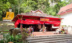
Phu Pha Man National Park
Contact Location : Phu Pha Man National Park, Na Nong Thum Sub-district, Chum Phae District, Khon Kaen Province 40290
Telephone Number : (+66) 4300 1753
Email : Phu_phaman@hotmail.com
Facebook : Phuphaman National Park
Information
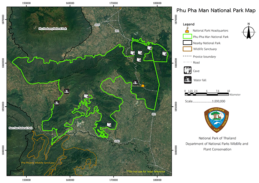
Phu Pha Man National Park is located in the forea of Dong Lan Forest located in Na Nong Thum Sub-district, Chum Phae District, Huai Muang, Wang Swap, Na Fai and Phu Pha Man Sub-district, Phu Pha Man District, Khon Kaen Province, and the area of Phu Puea Forest located in Phu Kradueng and Si Than Sub-district, Phu Kradueng District, Loei Province. The area size is approximately 350 square kilometers or approximately 218,750 rai, located between the latitude of 16? 38' 48" and 16? 50' 56" North and between the longitude 101? 42' 14" to 102? 1' 20" East,
North: Bordering Wang Kwang Sub-district, Nam Nao District, Phetchabun Province, Si Than, Pha Nok Khao and Phu Kradueng Sub-district, Kradueng District, Loei Province
South: Bordering Na Nong Thum Sub-district, Chum Phae District, Huai Muang, Na Fai and Phu Pha Man Sub-district, Phu Pha Man District, Khon Kaen Province, and Thung Phra Sub-district, Khon San District, Chaiyaphum Province.
East: Bordering Phu Han Sub-district, Si Chompoo District, and Na Nong Thum Sub-district, Chum Phae District, Khon Kaen Province.
West: Bordering the boundary line of Nam Nao District, Phetchabun Province
Phu Pha Man National Park is named after the name of a mountain range in the southern part of the National Park which houses a towering karst cliff that looks like a large curtain. It is located in the area of Chum Phae District, Khon Kaen Province and Phu Kradueng District, Loei Province, with an area of approximately 350 square kilometers or 218,750 rai.
Background
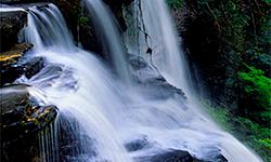
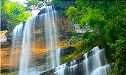
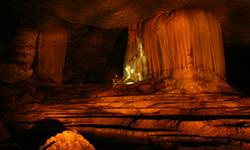
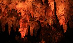
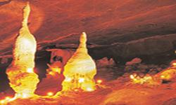
Phu Pha Man National Park used to be an area rich in various kinds of plants and wildlife. Currently, as a result of forest concessions, the forest floor and wildlife population are rapidly decreasing. The Royal Forest Department therefore issued an order No. 1473/2532 dated September 27, 1989, assigning Mr. Panom Pongsuwan, a forest officer, level 4, to explore further and establish the area of Dong Lan Forest, Chum Phae District, Khon Kaen Province, the are of Phu Puea Forest, Phu Kradueng District, Loei Province, and nearby forest areas to be a National Park. From the survey of the area, it was found that it is a watershed area and has many natural features, especially caves and waterfalls.
The government has issued a decree set to combine the area of Phu Pueai National Conserved Forest in Phu Kradueng District, Loei Province with the area of Dong Lan National Forest Chum Phae District Phu Pha Man Minor District Khon Kaen Province to establish as Phu Pha Man National Park in 1991. The royal decree specified the area of Dong Lan forest in the area of Na Nong Tum Sub-district, Chum Phae District and Huai Muang, Wang Sawap, Na Fai, Phu Pha Man and Phu Pha Man Sub-district, Phu Pha Man and Chum Phae District, Khon Kaen Province, and Phu Puea Forest in the area of Phu Kradueng and Si Than Sub-district, Phu Kradueng District, Loei Province, approximately 218,750 rai or 350 square kilometers, to be a National Park which was published in the Government Gazette, Volume 108, Part 215, dated December 8, 1991
Note : After paying the entrance fee to the National Park, please carry the receipt for inspection.
218750.00 rai (350 square kilometers)
|
|
|
||
|
|
|
||
|
|
|
||
|
|
|
||
|
|
|
||
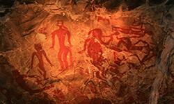
Nature trails ⇔ Visit Waterfall ⇔ Cave exploration/Geological condition ⇔ Observe flowers/plant ⇔ History and ancient-colored paintings ⇔ Bird , butterfly , wildlife watching activities ⇔ Stargazing ⇔ Take a photo/Video
Welfare shop : 08.00 - 17:00 hrs.
Mobile phone signal:
National Park Headquarters area: AIS, TRUE, DTAC
|
|
The topography of Phu Pha Man National Park is mostly a steep and complex limestone mountain range interspersed with lowland plains, located about 200-1,000 meters mean sea level. It is a mountain range that stretches from Nam Nao National Park as a natural barrier between Phu Kradueng District, Loei Province, and Pha Man and Chum Phae District, Khon Kaen Province, with "Phu Hi" being the highest peak in the area at an altitude of about 1,000 meters above mean sea level. In the north there are many important streams flowing into the Phong Stream and into Choen Stream in the south.
|
|
|
The climate of Phu Pha Man National Park is divided into 3 seasons: 1) The rainy season starts in June and lasts Until October This season is influenced by the southwest monsoon thatblows from the Indian Ocean And depression from the South China Sea bringing in the the rainfall to the area. 2) Winter starts in November and ends in February. It is influenced by the northeast monsoon blowing from China, which brings cold and dryness to the area. 3) Summer starts from March and lasts until May, influenced by the southeast monsoon, which blows the wind into the area in summer. - Average annual rainfall of 100.722 mm-Average annual temperature of 27.5°C - Average annual relative humidity is 71.8 percent- the average annual light length is 7.6 hours per day. - Average wind power per year: 4.0 knots
|
|
|
|
Plants consist of species of dry evergreen forest, mixed deciduous forest, dry dipterocarpus forest, and forest plantation. There are important plants such as Burma Padauk , Xylia xylocarpa, Bungor, Afzelia, Burma Sal, Pentacme siamensis (Miq.) Kurz, Hairy Keruing, Dipterocarpus tuberculatus Roxb., Dipterocarpus, Teak, and different types of bamboo, as well as important undergrowth plants such as Lonter Plam, Rattan, herbs, and various types of orchids. A total of about 60 species of I wildlife have been found including Chamois, Muntjac, Wild Boars, Monkeys, Burmese Hare, Pangolins, Bengal Monitors, and others. A total of about 50 kinds of birds, and more than 200 kinds of insects and butterflies have also been found.
|
How to get there by car :
From Bangkok, you can travel by car, or take a Bangkok-Loei non-air-conditioned bus or an air-conditioned bus– Travel along Highway No. 201 and turn left between the milestone No. 112-113 onto the paved road for about 5 kilometers heading to Phu Pha Man National Park.
- National Park Ranger Station Pho Mo No. 1 (Tham Pha Phuang)
- National Park Ranger Station Pho Mo No. 2 (Na Yang Tai)
- National Park Ranger Station Pho Mo No. 3 (Sam Phak Nam)
- National Park Ranger Station Pho Mo No. 4 (Khao Wong)
- National Park Ranger Station Pho Mo No. 5 (Sum Phak Thorn)
- Accommodation - Pha Man 201 (Nakharat)
- Accommodation - Pha Man 202 (Pha Phuang)
- Accommodation - Pha Man 203 (Lai Tang)
- Accommodation - Pha Man 204 (Klet Kaeo)
- Accommodation - Pha Man 205 (Thep Nimit)

