Ramkhamhaeng National Park
Contact Location : 124 Moo 2, Khiri Mat Sub-district, Khiri Mat District, Sukhothai Province 64160
Telephone Number : (+66) 9 8883 9297
Email : Ram_2523@hotmail.com
Facebook : Ramkhamhaeng National Park
Information
Mae Ping National Park is located in the Doi Tao District. Chiang Mai Province, Li District, Lamphun Province and Sam Ngao District, Tak Province. It is abundant in natural resources, forests, and wildlife, which exist on a sprawling mountain range. There are numerous waterways running through the park including Mae Hat Creek and Mae Ko Creek. The stunning natural scenery, particularly the forest area located on the western bank of the Ping River, north of the Khuean Bhumibol Reservoir. The total area is a little over 627,346 rai or approximately 1,000 square kilometers.
Background
The Tourism Promotion Board of Lamphun passed a resolution in 1978, recommending that a forest park was established to cover various tourist attractions in the Mae Hat – Mae Ko National Reserved Forest, Li District, Lamphun Province, in order to control and organize activities. ’Chiang Mai Regional Forest Office ordered Mr. chaliao nimnuan to survey the area and it turns out to be a suitable area for a Forest Park, thus a report to the Royal Forest Department was sent. Lampun Province also proposed to the Royal Forest Department to establish Mae Hat – Mae Ko Forest as a Wildlife Protection Area or a National Park, in accordance to Mr. Chiradet Barami, Forestry Officer Level 3, based in Li District.
Therefore, in December 1979, the National Park Division under the Royal Forest Department issued an order no. 2294/2522 ordering Mr. Sampan Midewan, Forestry Officer Level 3, to reinvestigate the area. It is found that mae Hat – Mae Ko Forest is a complex mountain area with pristine forest, beautiful scenery, and several unique natural environments such as ก้อหลวง Waterfall, grassland, and wildlifes. It is suitable to be established as a National Park, in accordance to the Survey Report No. Ko So 0708 (Mo Ko)/51 dated 17 June 1980.
The National Forest Division, Department of Forestry has presented the National Park Board, which had a resolution in the meeting No. 2/2523 on August 8th to designate the forest area as a National Park with a royal decree determining the areas of the Mae Hat Forest and Mae Ko Forest in the Doi Tao and Pong Thung Sub-district, Doi Tao Districe in Chiang Mai Province and Mae Lan and Ko Sub-district, Li District in Lamphun Province, and Ban Na and Yok Krabat Sub-district, Sam Ngao District in Tak Province, measuring approximately 626,875 rai or 1,003 square kilometers, was determined to be suitable to be a National Park in the year 1981, published in the Government Gazette, Volume 98, Section 115, dated July 13th, 1981, Ii became Thailand’st is the 32nd National Park in July 1981. The country.
Additionally, during the establishment of the name Mae Hat-Mae Ko National Park, the Royal Forest Department later decided to change the park’s name to Mae Ping National Park. This was because of the National Park’s westernboundary line, which followed the route of the Mae Ping River. It is a large river with stunning scenery and the most significant feature of the National Park.
Later, the park was expanded to cover Provincial Highway No. 1087 in Mae Lan and Ko Sub-district of Li District, Lamphun Province. This added another 471 rai or 0.7536 square kilometers. This was done in 1994 to help control, prevent and suppress deforestation, hunting, and to help conserve the natural resources in National Parks.Published in the Government Gazette, Volume 111, Section 59 Ko, dated December 21st, 1994.
Note : After paying the entrance fee to the National Park, please carry the receipt for inspection.
213,125 rai (341 square kilometers)
|
|
|
|
|
|
|
|
Nature trails ⇔ Trekking ⇔ Relax in a natural ⇔ Visit Waterfall ⇔ History and culture watching ⇔ Observe flowers/plant ⇔ Forest viewpoint ⇔ Admire the sunrise ⇔ Take a photo/Video
Welfare shop : 08.00 - 17:00 hrs.
Mobile phone signal:
National Park Headquarters area: AIS, DTAC
|
|
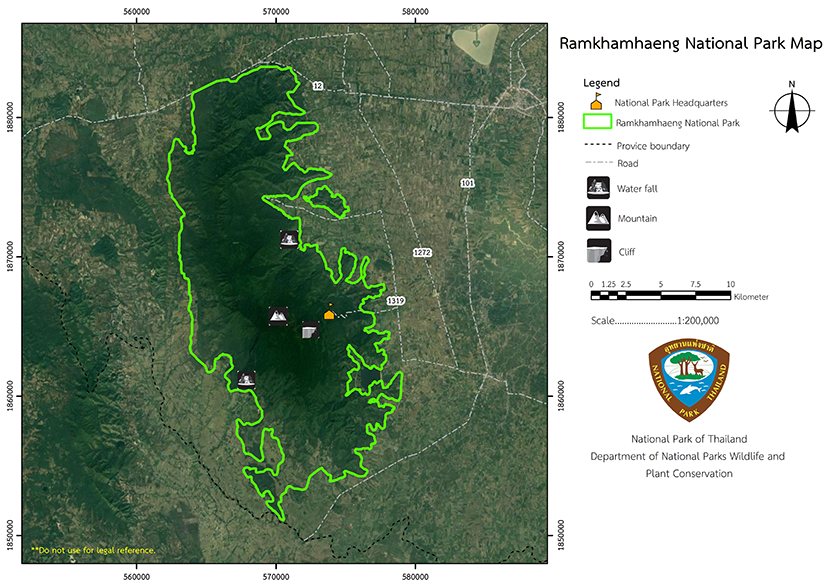
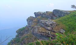
Ramkhamhaeng National Park is a high fold mountain (complex mountain landscape) which run on a north-south axis and tower above the ground like an anthill in the center of the field. It is comprised of four significant summits: Khao Phra Chedi, Khao Narai, Khao Phu Ka, and Khao Phra Mae Ya. It is a catchment area for waterways that run through the National Park and provides water for local the agricultural areas.
|
|
The weather is cold all year on the mountain’s summit, with fog frequent during the winter and rainy season. At times, it may also be breezy. On average, the temperature is between 12 and 14 degrees Celsius. Summer occurs between February and April, the rainy season occurs between August and October, and the coolest weather occurs in December and January.
|
|
|
|
Ramkhamhaeng National Park is a perfect fertile forest that is suitable for research studies and recreation. It is home to dry evergreen forest hill evergreen forest, mixed deciduous forest, deciduous dipterocarp forest and natural grassland plants. the main plant trees are Teak, Malabar Iron Wood, Black Rosewood, Sindora siamensis, and Burma Padauk. There are also many medicinal plants in the Sukhothai area growing naturally and the forest areas have foragable plants. Many wild animals live in the high mountains, including Banteng, bears, Indian Muntjac, Wild oar, monkeys, and Serows.
|
How to get there by car :
1. From Bangkok – Nakhon Sawan – Kamphaeng Phet, follow Highway No. 101 to Khiri Mart District, Sukhothai Province, then turn left into the National Park for about 16 kilometers.
2. Bangkok – Nakhon Sawan – Phitsanulok along Highway No. 117 to Sukhothai Province. Continue to Khiri Mart District along with Highway No. 101, turn right into Ramkhamhaeng National Park for about 16 kilometers.
- National Park Ranger Station Ro Kho No. 1 (Namtok Sai Rung)
- National Park Ranger Station Ro Kho No. 2 (Khlong Suan)
- National Park Ranger Station Ro Kho No. 3 (Tham Phra Mae Ya)
- National Park Ranger Station Ro Kho No. 4 (Angkepnam Khlong Khangnai)
- National Park Ranger Station Ro Kho No. 5 (Nong Thao)
- Accommodation – Ramkhamhaeng 104 (Chom Doi)
- Accommodation – Ramkhamhaeng 105 (Pa Lang)
- Accommodation – Ramkhamhaeng 106 (Pa Kham)

