Mae Ping National Park
Contact Location : Mae Ping National Park, 81 Moo 6, Mae Lan Sub-district, Li District, Lamphun Province 51110
Telephone Number : (+66) 5203 0480, (+66) 5203 0380
Email : maeping32@hotmail.com
Facebook : Mae Ping National Parkk
Information
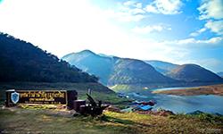
Mae Ping National Park is located in the Doi Tao District. Chiang Mai Province, Li District, Lamphun Province and Sam Ngao District, Tak Province. It is abundant in natural resources, forests, and wildlife, which exist on a sprawling mountain range. There are numerous waterways running through the park including Mae Hat Creek and Mae Ko Creek. The stunning natural scenery, particularly the forest area located on the western bank of the Ping River, north of the Khuean Bhumibol Reservoir. The total area is a little over 627,346 rai or approximately 1,000 square kilometers.
Background
The Tourism Promotion Board of Lamphun passed a resolution in 1978, recommending that a forest park was established to cover various tourist attractions in the Mae Hat – Mae Ko National Reserved Forest, Li District, Lamphun Province, in order to control and organize activities. ’Chiang Mai Regional Forest Office ordered Mr. chaliao nimnuan to survey the area and it turns out to be a suitable area for a Forest Park, thus a report to the Royal Forest Department was sent. Lampun Province also proposed to the Royal Forest Department to establish Mae Hat – Mae Ko Forest as a Wildlife Protection Area or a National Park, in accordance to Mr. Chiradet Barami, Forestry Officer Level 3, based in Li District.
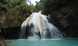
Therefore, in December 1979, the National Park Division under the Royal Forest Department issued an order no. 2294/2522 ordering Mr. Sampan Midewan, Forestry Officer Level 3, to reinvestigate the area. It is found that mae Hat – Mae Ko Forest is a complex mountain area with pristine forest, beautiful scenery, and several unique natural environments such as ก้อหลวง Waterfall, grassland, and wildlifes. It is suitable to be established as a National Park, in accordance to the Survey Report No. Ko So 0708 (Mo Ko)/51 dated 17 June 1980.
The National Forest Division, Department of Forestry has presented the National Park Board, which had a resolution in the meeting No. 2/2523 on August 8th to designate the forest area as a National Park with a royal decree determining the areas of the Mae Hat Forest and Mae Ko Forest in the Doi Tao and Pong Thung Sub-district, Doi Tao Districe in Chiang Mai Province and Mae Lan and Ko Sub-district, Li District in Lamphun Province, and Ban Na and Yok Krabat Sub-district, Sam Ngao District in Tak Province, measuring approximately 626,875 rai or 1,003 square kilometers, was determined to be suitable to be a National Park in the year 1981, published in the Government Gazette, Volume 98, Section 115, dated July 13th, 1981, Ii became Thailand’st is the 32nd National Park in July 1981. The country.
Additionally, during the establishment of the name Mae Hat-Mae Ko National Park, the Royal Forest Department later decided to change the park’s name to Mae Ping National Park. This was because of the National Park’s westernboundary line, which followed the route of the Mae Ping River. It is a large river with stunning scenery and the most significant feature of the National Park.
Later, the park was expanded to cover Provincial Highway No. 1087 in Mae Lan and Ko Sub-district of Li District, Lamphun Province. This added another 471 rai or 0.7536 square kilometers. This was done in 1994 to help control, prevent and suppress deforestation, hunting, and to help conserve the natural resources in National Parks.Published in the Government Gazette, Volume 111, Section 59 Ko, dated December 21st, 1994.
Note : After paying the entrance fee to the National Park, please carry the receipt for inspection.
627,346.00 rai (1003.7 square kilometers)
|
|
|
|
|
|
||
Nature trails ⇔ Trekking ⇔ Visit Waterfall ⇔ Cave exploration/Geological condition ⇔ History and culture watching ⇔ Forest viewpoint ⇔ Observe flowers/plant ⇔ Bird , butterfly , wildlife watching activities ⇔ Stargazing ⇔ Mountain biking ⇔ Take a boat ride or a paddle ⇔ Camping ⇔ Take a photo/Video
Welfare shop : 08.00 - 17:00 hrs.
Mobile phone signal:
National Park Headquarters area : AIS, TRUE
|
|
The topography is that of fold mountains (complex mountain landscape) which have a north-south axis, with the most northerly point at Doi Tao in Chiang Mai. The south at to the north of the Khuean Bhumibol Reservoir, in Sam Ngao District in Tak Province, and are between 400 and 800 meters above sea level. It is home to the Northeast’s highest summit, “Don Huai Lao” Which is 1,334 meters high. The mountains feed a number of waterways including the Mae Hat Creek, Mae Ko Creek, Pong Ka Creek, Muang Creek, Khun Men Creek, and Khrai Creek. . The rivers in this area are tributaries for the Ping River, which runs along the Park’s western boundary. A river flows through the valley from Doi Tao district in Chiang Mai Province to the upper part of the reservoir above Bhumibol Dam in Sam Ngao District, Tak Province. The Ping River is approximately 100 kilometers long, averages 500 meters wide, and averages 30 meters in depth. Its widest section in the National Park is approximately 6 kilometers in width, which is located in the southern area above the Bhumibol Damand is commonly referred to as “Bo Lom” or “Phra Bat Huai Hang” by locals. |
|
The Mae Ping National Park is similar to other areas in the northern provinces due to the landscape’s low elevation and extensive forest cover. However, certain areas have a climate that is distinct from the surrounding area. The average temperature in the upper portion of the National Park is around 25 degrees Celsius, while the temperature in the lower portion of the National Park, near Bhumibol Dam in Tak province, is slightly higher, at around 27 degrees Celsius. September is the wettest month, and theaverage annual rainfall is 1,060-1,184 mm.
|
|
|
|
The majority of forest areas are deciduous, forming approximately 80% of all forests, and they are scattered throughout the Park. They are especially prevalent however in the mountains, and favor sandy soil and elevations of less than 1,000 meters above sea level. The other 20%, is Evergreen Forest, which is concentrated in the narrow valleys and creeks. Mixed deciduous forests are found throughout the plains and along the mountain slopes at elevations of 450 – 800 meters. Common types of wood found are Teak, Iron Wood, Dalbergia cultrata Graham, Canarium subulatum, Millettia brandisiana, Burma Padauk, Schleichera oleosa, Dalbergia dongnaiensis, and Vitex pinnata. Lower ground plants are Bauhinia saccocalyx Pierre, Thyrsostachys siamensis Gamble, White Bamboo, Bambusa bambos, Bambusa nutans, Phoenix acaulis, Pueraria candollei, Myrica esculenta, and Colona flagrocarpa. In the deciduous forest area, animals include the Burmese Hare, Indian Muntjac, Banteng, and birds such as the Red Junglefowl, Chinese Francolin, Buttonquail, White-Bellied Woodpecker, Great Slaty Woodpecker, Common Flameback, Black-Headed Woodpecker, Red-Bellied Blue Magpie, and Rufescent Prinia. There are also reptiles such as the Ground Lizard, Clouded Monitor Lizard, Malayan Pit Viper and many others. Tropical Evergeen Forest consists of Dry Evergreen Forest and Tropical Rain Forest plants including Hopea odorata, Black Rosewood, Mangifera caloneura, Irvingia malayana, Spondias pinnata, and Beleric myrobalan. It is a habitat and hiding place for Asiatic Black Bear, Banteng, Slow Loris, Rhesus Macaque, Lar Gibbon, squirrels, and birds such as the Oriental Pied Hornbill, Puff-Throated Bulbul, and Asian Fairy Bluebird. There are grasslands such as the Thung Kik and Thung Na Ngu, which are plains located on hillsides approximately 550 meters above sea level. The soil is sandy clay or gravel, and the area is prone to frequent wildfires. There are smaller perennials scattered far and wide, including Semecarpus cochinchinensis Engl, Terminalia alata Heyne, and Terminalia chebula, while the lower ground is home to Phoenix acaulis, Imperata cylindrica, Myrica esculenta Buch, and White Angel. It is a habitat for small to medium-sized wild animals such as Indochinese Ground Squirrel, Chipmunk, Lesser Bamboo Rat, Indian Muntjac, Wild Boar, Malayan Porcupine, Civet, Common Palm Civet, Streak-Eared Bulbul, Bulbul, Grey-Headed Parakeet, Bee-Eater, Black-Headed Woodpecker, Scaly-Breasted Munia, Black-Shouldered Kite, Turnicidae, Spotted Dove, Greater Coucal. There are also many reptiles and amphibians, such as Oriental Garden Lizard, Many-Lined Sun Skink, Common Asian Toad, Rana limnocharis, and Spotted Narrow-Mouthed Frog. In the hilltop caves, cliffs and limestone cliffs are Serows, Chinese Goral, Malayan Porcupine, Indo-Malayan Bamboo Rat, Rhesus Macaque, Common Palm Civet, Squirrels, Bats, and a various types of hawks and Red-Tailed Swallow. In the area of the waterfront area or the water source are the Smooth-Coated Otter, Crab-Eating Mongoose, Fishing Cat, Common Water Monitor Lizard, and waterbirds such as the Common Moorhen, Lesser Whistling Duck, Grey Heron, Chinese Pond Heron, Little Heron, and other creatures such as the Amaurornis phoenicurus, Giant Asian Pond Turtle, Soft-Shelled Turtle, Painted Keelbacks, Rana limnocharis, Green-Backed Frog, Horseface Loach, Dwarf Snakehead, Catfish, and Eel Garden. Wild animals abound, especially along the Ping River including the Indian Muntjac, Banteng, Wild Boar, Asiatic Black Bear, Serows, Chinese Goral, Fishing Cat, Red Junglefowl, Viverricula indica, monkeys, Indo-Cchinese Lutung, gibbons, Golden Jackal, Burmese Hare, and squirrels. There are also many different species of birds, both resident and migratory, within the National Park area and it is also an important source of freshwater fish species such as theNile Tilapia, Striped Catfish, Siluridae, Cyprinidae, Goby, Giant Gouramy, Macronema Catfish, and Hampala Barb. |
How to get there by car :
From Bangkok take the Asian Highway A1 through various provinces to the north. After entering the Thoen District in Lampang Province, and turn left onto Route 106, and continue into Lamphun Province until reaching milestone No. 47. Then turn left onto Highway No. 1087 to Mae Ping National Park, whose Headquarters are between milestone No. 20 – 21. The total distance 587 kilometers.
From Chiang Mai Province take National Highway No. 106 through Sara Phi District, Chiang Mai Province. Travel to Mueang District in Lamphun Province through Pa Sang and Ban Hong District, until reaching Li District. After 3 kilometers visitors will reach the intersection with Highway No. 1087, and enter Mae Ping National Park. It is a total distance of 155 kilometers.
From Lampang Province, take National Highway A1 (Phahon yothin) to the south and turn right into Ko Kha District onHighway No. 1274. This goes through Soem Ngam and Li District. Turn left at the intersection to enter Highway No. 106 for approximately 3 kilometers to the intersection into Highway No. 1087, which is the entrance to the Mae Ping National Park. It is a total distance of 123 kilometers.
- Mae Ping National Park
- Mae Ping National Park Ranger Station Mo Po No. 1 (Namtok Ko)
- Mae Ping National Park Ranger Station Mo Po No. 2 (Kaeng Ko)
- Mae Ping National Park Ranger Station Mo Po No. 3 (Thung Kik)
- Mae Ping National Park Ranger Station Mo Po No. 4 (Mae Lan)
- Mae Ping National Park Ranger Station Mo Po No. 5 (Doi Tao)
- Mae Ping National Park Ranger Station Mo Po No. 6 (Ban Ko)
- Mae Ping National Park Ranger Station Mo Po No. 7 (Tham Mo)
- Mae Ping National Park Ranger Station Mo Po No. 8 (Huai Fa Pha)
- Mae Ping National Park Ranger Station Mo Po No. 9 (Pha Dam Pha Daeng)
- Mae Ping National Park Ranger Station Mo Po No. 10 (Um Pat)
- Mae Ping National Park Ranger Station Mo Po No. 11 (Doi Khun Men)
- Mae Ping National Park Ranger Station Mo Po No. 12 (Tham Yang Wi)
- Accommodation – Mae Ping 201 (Butsarakham)
- Accommodation – Mae Ping 401 (Ko Luang)


