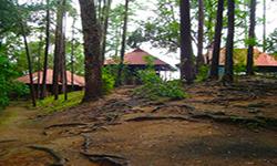
Doi Khun Tan National Park
Contact Location : Doi Khun Tan National Park, Tha Pla Duk Sub-district, Mae Tha District, Lamphun Province 51140
Telephone Number : (+66) 8 1032 6341
Email : doikhuntan@gmail.com
Facebook : Doi Khun Tan National Park
Information
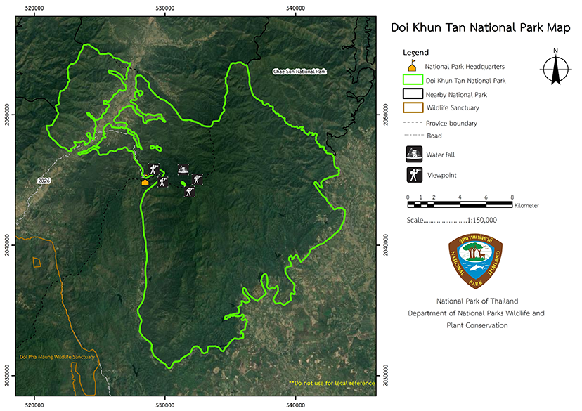
Doi Khun Tan National Park spans the districts of Mae Tha District in Lamphun Province and Hang Chat and Mueang District in Lampang Province. The area is densely forested with an abundance of plants and is also a catchment area for many waterways whichs a tranquil atmosphere. It is also home to the Khun Than Tunnel, Thailand’s longest railway tunnel, which was constructed with the help of Germany. . It covers an area of approximately 159,556 rai or 255 square kilometers.
Background
This Doi Khun Tan Forest is one of 14 forests that the Cabinet approved in the meeting on October 7th, 1959, to establish as a National Park. The Royal Forest Department has announced that the Doi Khun Tan Forest, in some areas of Tha Pladuk sub-district, Mae Tha District, Lamphun province, would become the Doi Khun Tan National Reserved Forest, according to the Ministerial Regulation No. 116 (1963), announced in the Government Gazette Volume 80, Section 82, dated 13 August 1963 covering the area of 39,206.25 rai or 62.7 square kilometers in Wiang Tan and Wo Kaeo Sub-district, Hang Chat District, Lampang Province according to Ministry Regulation, Volume 359 (1968) announced in the Government Gazzette Volumn 85, Section 109, dated 22 November 1968 covering 120,625 rai.
Maintenance Division under the Royal Forest Department issued an order no. 40/2508 dated 18 March 1965 assigning Mr. Worathep Sakemsuwan to survey the area for the establishment of the National Park. Later, the Royal Forest Department proposed to the National Park Committee at meeting 5/2517 on 10 July 1974 to establish Khun Tan Forest as a National Park. The Royal Forest Department then issued the order no. 1160/2517 dated 1 October 1974 assigning Mr. Narit Tunsuwan to survey the area refering it to the National Park borders. The survey result in accordance to the notes dated 1 December and 17 February 1974, revealed that Doi Khun Tan Forest contained many valuable natural resources such as economically valuable plants, orchids, herbs, and various wildlife species, as well as a quiet and peaceful atmosphere, and the longest tunnel in Thailand.
The Royal Forest Department withdrew Doi Khun Tan Forest from a National Reserved Forest and established it to Doi Khun Tan National Park located in Tha Pladuk Sub-district, Mae Tha District, Lamphun Province, and in Ban Ueam Sub-district, Mueang Lampang District, Wiang Tan and Wo Kaeo Sub-district, Hang Chat District, Lampang Province, covering the area of 159,556.25 rai or 255.29 square kilometers. It was announced in the Government Gazette Volume 92, Section 54 dated 5 March 1975 and became Thailand’s 10th national Park.
Note : After paying the entrance fee to the National Park, please carry the receipt for inspection.
159,556.25 rai (255.2 square kilometers)
|
|
|
|
|
|
|
|
|
|
||
Nature trails ⇔ Trekking ⇔ Visit Waterfall ⇔ Cave exploration /Geological condition ⇔ Observe flowers/plant v Bird , butterfly , wildlife watching activities ⇔ Stargazing ⇔ Mountain biking ⇔ Rafting ⇔ Take a boat ride or a paddle ⇔ Take a photo/Video
Welfare shop : 08.00 - 17:00 hrs.
Mobile phone signal :
National Park Headquarters area: AIS, TRUE, DTAC
|
|
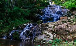
Doi Khun Tan National Park is located in the Khun Tan Mountain range, which is on the border of Chiang Mai and Lampang. Thetower karsts and complex, folded mountains are is located at 325–1,373 meters above sea level and the ridge acts as a border between the provinces. Doi Khun Tan is the highest point in the National Park, and there are small plains to the northwest, west and southeast of the park. it is headwaters and catchment area for the Ping River, which is located on the ’west of the area. The Wang River is located on the park’s eastern side and is fed by the Nam Mae Khom, Nam Mae Tam, and Nam Mae Phai rivers. The part that flows into the Mae Tha River and eventually exits the Ping River . is fed by the include Mae Pa Kha Creek, Mae Yon Wai Luang Creek, Thung Phai Creek, Song Tha Creek, and Mae Hong Hang Creek, which are useful for agriculture and animal husbandry lead the consumption of local people.
|
|
The Doi Khun Tan National Park area is located in the northern part of the country’s and and such it is influenced by the southwest and northeast monsoons. As a result, three seasons exist: the rainy season, during which the southwest monsoon winds blow through, takes place between June and October. The annual average rainfall is between 1,050 and 1,290 millimeters. Winter occurs between November and February, and March to May is summer, when the weather may become hot. Throughout the year, the average temperature is 27 degrees Celsius, with the lowestin December and the highest in April.
|
|
|
|
The Doi Khun Tan National Park ecosystem can be classified as adry evergreen forest, which covers areas with particularly high soil fertility and moisture which mainly occur in the valleys and creek such as important. Huai Mae Tan Noi Valleye, Mae Phai Creek, Mae Fueang Creek, Mae Yon Wai Creek, and Mae Khom Creek, which are at an average altitude of 500-1,000 meters above sea level. Plants found in the area are rubber, Malabar Iron Wood, Baccaurea ramiflora, Toona ciliate, Cinnamon, Artocarpus lacucha, Mangifera caloneura, Syzygium megacarpum, Sandoricum koetjape, Cleidion javanicum, Musa acuminata Colla, and Calameae. Ground plants include plants from the ginger family, Paco Fern, Lasia spinosa, and other ferns Hill evergreen forest covers an area with an altitude of 1,000 meters abovesea level. It is less dense than the tropical rain forest Because the larger trees depend on less. The wood species found are Evergreen Chinkapin, Castanopsis diversifolia, Lithocarpus sootepensis, Lithocarpus thomsonii, Lithocarpus cerifera, Schima wallichii Korth, and Orange champak. Lower ground plants include ferns, Ground Orchid, and various mosses. The deciduous dipterocarp forest is sparse and found the hills and foothills in the west and east of the National Park. The soil is made up of gravel or laterite soil conditions. The types of wood found are Burmese Sal, Burma Padauk, Phyllanthus emblica, Hairy Keruing, Chulta, and Cratoxylum formosum. Lower ground are mainly made up of grasses. The wildlifeincludes Indian Muntjac, Wild Boar, monkeys, Large Indian Civet, Lesser Bamboo Rat, Northern Treeshrew, Pallas’s Squirrel, Tamiops mcclellandii, Indochinese Ground Squirrel, Greater Short-Nosed Fruit Bat, and Oriental House Rat. Birds include the Red Junglefowl, Yellow Bittern, Barred Button Quail, Common Snipe, Wood Sandpiper, Common Sandpiper, Red Collared Dover, Plaintive Cuckoo, Green-Billed Malkoha, Greater Coucal, Collared Scops Owl, Asian Palm Swift, Common Kingfisher, Green Bee-Eater, Indochinese Roller, Coppersmith Barbet, Yellow Wagtail, Bar-Winged Flycatcher Shrike, Common Lora, Blue-Winged Leafbird, Black-Crested Bulbul, Velvet-Fronted Nuthatch, and Olive-Backed Sunbird. There are also reptiles and amphibians such as the Lat-ailed House Gecko, Orange-Winged Flying Lizard, Eutropis macularia, Clouded Monitor Lizard, Yellow-Spotted Keelback, Pope Pit Viper, Common Asian Toad, Rice Field Frog, Dark-Sided Chorus Frog, and Siamese Large-headed Terrapin. |
How to get there by car :
Doi Khun Tan National Park can be reached from 2 directions:From the intersection of National Highway No. 11 the Lampang – Chiang Mai Road, at around milestone No. 15 – 16 next to Hang Chat Police Station, you should turn right. After that it is approximately 28 kilometers to reach the National Park Headquarters.
- From Chiang Mai Province travel along National Highway No. 11 and turn right between milestone No. 46 – 47 in Mae Tha District, Lamphun Province. The road is a paved road and runs 18 kilometers to the National Park Headquarters.
How to get there by train
- The Northern Railway Line will take you to Khun Than Railway Station, which is 1.3 kilometers from the National Park Headquarters
Note
- The route from Lampang Province is paved but also it has some steep slopes and is not in perfect condition. It should only be attempted in a four-wheel drive vehicle or by those who have expertise on steep slopes.
- The route from Lamphun is paved but when entering Mu Ban Khun Than travelers should be careful as the road is narrow and on a mountainside high above a creek.
- Buses cannot travel on these routes.
- National Park Ranger Station Kho To No. 1 (Pa Tueng)
- National Park Ranger Station Kho To No. 2 (Central)
- National Park Ranger Station Kho To No. 3 (Pang Muang)
- National Park Ranger Station Kho To No. 4 (Thaku)
- National Park Ranger Station Kho To No. 5 (Mae Phrai)
- National Park Ranger Station Kho To No. 6 (Mae Fueang)
- National Park Ranger Station Kho To No. 7 (Pang Sai)
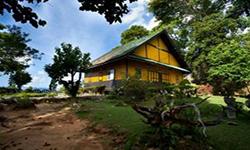
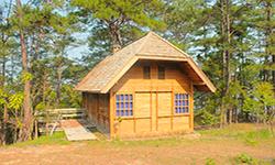
- Accommodation – Khun Tan 101 (Phuang Saet)
- Accommodation – Khun Tan 102 (Phuang Khram)
- Accommodation – Khun Tan 201 (Thong Kwao)
- Accommodation – Khun Tan 202 (Anchan)
- Accommodation – Khun Tan 203 (Chong Kho)
- Accommodation – Khun Tan 204 (Sakao Chan)
- Accommodation – Khun Tan 301 (Kasalong)
- Accommodation – Khun Tan 302 (Kradangnga)
- Accommodation – Khun Tan 303 (Kulap Pan Pi)
- Accommodation – Khun Tan 304 (Kulap Chan)
- Accommodation – Khun Tan 401 (Ueang Ngoen)
- Accommodation – Khun Tan 402 (Ueang Sam Poi Khun Tan)
- Accommodation – Khun Tan 403 (Ueang Mon Khai)
- Accommodation – Khun Tan 404 (Aiyaret)
- Accommodation – Khun Tan 405 (Fa Mui)
- Accommodation – Khun Tan 408 (Sai Nam Phueng)
- Accommodation – Khun Tan 410 (Chom Dong)
- Accommodation – Khun Tan 501 (Chom Phrai)
- Accommodation – Khun Tan 502 (Chom Doi)
- Accommodation – Khun Tan 503 (Chom Autsadong)
- Accommodation – Khun Tan 504 (Chom Dara)

