Tham Pha Thai National Park (under gazetting)
Contact Location : Tham Pha Thai National Park (under gazetting) Moo 3, Ban Huat Sub-district, Ngao District, Lampang Province 52110
Telephone Number : (+66) 8 2936 7076
Email : Phatai.office@gmail.com
Facebook : Tham Pha Thai National Park
Information
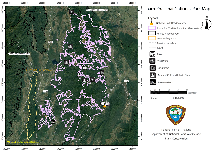
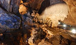
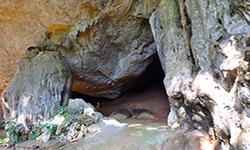
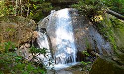
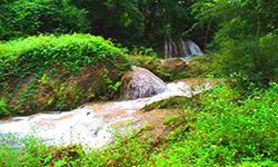
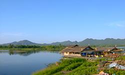
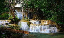
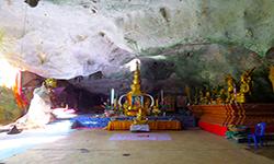
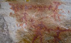
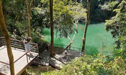
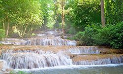
Tham Pha Thai National Park is located in ’the Ngao, Mueang, Chae Hom, Mae Mo, and Wang Nuea District in Lampang Province. The topography is generally complex mountain landscape, and there are mixed deciduous forests and The deciduous dipterocarp forest is fertile. There are teak plantations scattered around serving as habitats for animals. Most area is watershed class 160. The highlights and important places for relaxation include Pha Thai Cave, Lom Phu Khiao, Khuan Kio Lom reservoir, and Ok Ru Cave. and Mae Phlueng Creek. Additionally, there are numerous small waterfall’sand a Baby Elephant Training Center. The National Park has an approximate surface area of 768,298 rai or 1229 square kilometers.
Background
According to the Royal Forest Department 1627/2532,
Mr. Poonsathit Wongsawat,Forestry Officer Level 5 National Park Division A survey was carried out into the established forest areas Tham Pha Thai National Park – area Mae Yang National Reserved Forest – Mae Ngao Forest - Mae Ta Forest – Mae Mai Forest, Mae Ngao Fang-Khwa Forest, and Mae Pong forest in Mueang, Chae Hom and Ngao District Lampang Province to declared as a National Park. to be announced as a National Park and assigned him as a National Park Superintendent.
The survey stated that the area to be established as Tham Pha Thai National Park is covered in natural forest and was home to several well-known tourist attractions such as Kio Lom Dam and Tham Pha Thai. It was requested to use the name "Tham Pha Thai National Park" in accordance to the National Park letter no. Ko So 0713 (Pho To)/20 dated 1 February 1991. Mr. Phairoj Suwanakorn, Director-General of the Royal Forest Department, had approved it on 4 March 1991. The National Park Division is still collecting more information as part of the consideration to establish it as a National Park.
Note : After paying the entrance fee to the National Park, please carry the receipt for inspection.
768,330 rai (1229.3 square kilometers)
|
|
|
|
|
|
|
|
|
|
|
|
|
|
|
|
|
|
|
|
Nature trails ⇔ Visit Waterfall ⇔ Cave exploration/Geological condition ⇔ History and culture watching ⇔ Bird , butterfly , wildlife watching activities ⇔ Stargazing ⇔ Take a boat ride or a paddle ⇔ Camping ⇔ Take a photo/Video
Welfare shop : 08.00 - 17:00 hrs.
Mobile phone signal :
National Park Headquarters area: AIS, DTAC
|
|
The terrain is generally rugged and mountainous, and the forests are mixed deciduous forests and the area was invasion . Teak is abundant throughout the forest. The highest peak is Doi Kio Lom at 1,202 meters high, followed by Doi San Klang at 1,022 meters high, and Doi Pha Huat at 975 meters high. The majority of the area is covered in mixed deciduous forest, interspersed with deciduous dipterocarp forest. The southern section contains Doi Luang, which stands at 1,100 meters above sea level. To the east of the area is an area vital to agricultural production, but the western side is primarily covered in deciduous dipterocarp forest. Water flows westward into the Wang River or east into the Ngao River.
|
|
Summer is oppressively hot in this area, and occurs in March to May. The following rainy season is always accompanied by southwesterly winds Occasionally, powerful storms occur. from May to October, Winter, which is November to February is quite cold with fog at dawn and at night.
|
|
|
|
Due to the terrain being a high mountain and complex, the forests found are dry evergreen forests and include species such as Malabar Iron Wood, Dipterocarpaceae, Fagaceae, Toona ciliate, Cinnamon, and Cleidion javanicum. The mixed deciduous forest and deciduous dipterocarp forest include Burma Padauk, Black Rosewood, Iron Wood, Lannea coromandelica, Tamalin, different types of bamboo, Adina dissimilis Craib, Hymenodictyon orixense, Bushwillows, and Bermuda grass. Wild animals found in the park include Wild Boar, Monkeys, Malayan Porcupine, Kloss’s Mole, Common Palm Civet, Bamboo Rat, Burmese Hare, Ground Lizard, Chameleon, Eastern Bent-Toed Gecko, snakes, frogs including the Green Frog and Asiatic Burrowing Frog, toads, and various birds. There are also many different types of fish.
|
How to get there by car :
Tham Pha Thai National Park is located on Highway No. 1 which travels from Lampang Province via Phayao to Chiang Rai Province. It is 65 kilometers from Lampang Province towards Phayao Province, and located milestone No 665 – 666, is the sign for Tham Pha Thai National Park. Turn into the entrance and after about 300 meters you will reach the National Park Headquarters.
If you travelfrom Phrae Province, Ngao District, or Chiang Rai Province, before reaching Ngao District, turn left towards Lampang Province and travel for about 15 kilometers until you reach the Tham Pha Thai National Park Headquarters.
- National Park Ranger Station Phror Tho 1 (Pak Bok)
- National Park Ranger Station Phror Tho 2 (Kio Lom)
- National Park Ranger Station Phror Tho 3 (Tat Mei)
- National Park Ranger Station Phror Tho 4 (Mae Kae)
- National Park Ranger Station Phror Tho 5 (Tat Noi)
-

