Chae Son National Park
Contact Location : Chae Son National Park, Chae Son Sub-district, Mueang Pan District, Lampang Province 52240
Telephone Number : (+66) 9 3137 5533, (+66) 8 9851 3355
Email : chaeson_np13@hotmail.com
Facebook : Chae Son National Park
Information
Chae Son National Park spans the Mueang Pan, Chae Hom, Wang Nuea, and Mueang District in the northeast of Lampang Province
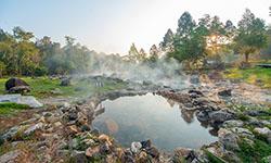
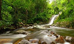
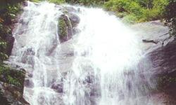
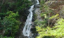
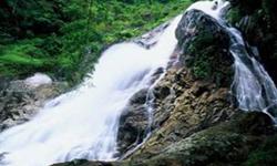
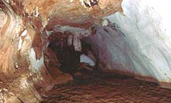
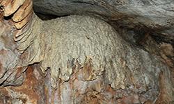
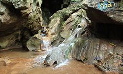
The forest is fertile and serves as the catchment area for many waterways, and it is home to numerous species of wild animals. There are also numerous beautiful natural resources, such as waterfalls, hot tub and hot springsthat demonstrate that the split in the earth's core. Chae Son National Park is one of Lampang Province's most popular tourist destinations and coversan approximate area of 480,000 rai or 768 square kilometers.
Background
Lampang Regional Forest Office issued a letter No. Ko So 0709 (Lo Po)/4181, dated 19 October 1981, requesting to mark the forest around Chae Son Waterfall to be Forest Park. The National Park Division under the Royal Forest Department then issued the order no. 1648/2524, dated 15 December 1981 assigning Mr. Narit Tunsuwan, Forestry Technical Officer Level 6, to survey the area. It turns out that the forest has many beautiful natural highlights, including waterfall and hot spring running all year round, suitable to be digsinated as in the fiscal year 1981, the Royal Forest Department established Aeg Nam Un Forest Park (Namtok Chae Son Forest Park) around Chae Son Waterfall in Chae Son Sub-district, Mueang Pan Minor District, Chae Hom District, Lampang Province, covering the area 45,000 rai or 75 square kilometers, under the supervision of Lampang Regional Forest Office.
In 1983, the Namtok Chae Son Forest Park (Aeng Nam-un Forest Park) was elevated to the level of National Park. as a destination for tourists and recreation in a province dedicated to tourism promotion.
The National Park Division additionally surveyed the area on a periodic basis. The National Park Division, Lampang Regional Forest Office, government and private sectors in Lampang Province initiated the decorations in Namtok Chae Son Forest Park to celebrate the 60th birthday of the King from May 1986 to 5 December 1987. On 13 February 1987, Prime Minister General Prem Tinsulanonda traveled to inspect Namtok Chae Son Forest Park. He was impressed with the beautiful nature, thus proposing it in the cabinet meeting to further develop it as a tourist attraction. The Cabinet approved the proposal on 17 February 1987, and sent a letter to the Royal Forest Department to work on the issue in accordance to the Secretariat of the Cabinet letter no. No Ro 0202/2889, dated 20 February 1987.
A survey was conducted in order to assemble additional informationabout the location and the upgrade of Namtok Chae Son Forest Park to National Park status. Additionally, Mr. Jirayu Isarangkun Na Ayudhya, Minister of the Prime Minister's Office, Governor of the Thailand Tourism Authority, Director General of Royal Forest Department, and Mr. Thammarong Prakopbun, and Director of the National Park Division, traveled to Namtok Chae Son Forest Park on June 6,1987, to consider the feasibility of developing it as a tourist attraction.
The National Park Division under the Royal Forest Department proposed the National Park Committee and it was approved the National Park status at the meeting no. 1/2530 on 18 June 1987, with an announcement in the Decree marking the areas in Mae Suk Forest, Mae Soi Forest, Mae Tui Fang-Sai Forest, Mae Tui Fang-Khwa Forest located in Chae Son, Mueang Pan, Ban Kho, Thung Kwao Sub-district in Chae Hom District, as well as in Ban Kha Sub-district, Mueang District, Lampang Province, covering 370,000 rai or 592 square kilometers as a National Park. It was announced in the Government Gazettee Volume 105, Section 122, dated 28 July 1988 and deemed the 58th National Park of Thailand. Later, there was an announcement to extend the area of Chae Son National Park, in accordance to the map attached to the decree B.E.2543. The additional areas include Mae Suk Forest, Mae Soi Forest, Mae Tui Fang-Sai Forest and Mae Tui Fang-Khwa Forest located in Wang Tai and Rong Kho Sub-district, Wang Nuea District, Mae Suk Sub-district, Chae Hom District and Hua Mueang and Mueang Pan Sub-district in Mueang Pan District, Lampang Province, covering 110,000 rai or 176 square kilometers, as announced in the Government Gazettee Volume 117, Section 121 Ko, dated 28 December 2000.
Note : After paying the entrance fee to the National Park, please carry the receipt for inspection.
480,000 rai (768 square kilometers)
|
|
|
|
|
|
|
|
|
|
|
|
|
|
|
|
|
|
|
|
Nature trails ⇔ Trekking ⇔ Visit Waterfall ⇔ Geological condition/Cave exploration ⇔ Observe flowers/plant ⇔ Forest Viewpoint ⇔ Bird , butterfly , wildlife watching activities ⇔ Stargazing ⇔ Mountain biking ⇔ Rafting ⇔ Take a boat ride or a paddle ⇔ hot ponds/Mineral water bathing ⇔ Camping ⇔ Take a photo/Video
Welfare shop : 08.00 - 17:00 hrs.
Mobile phone signal:
National Park Headquarters area: AIS, TRUE
|
|
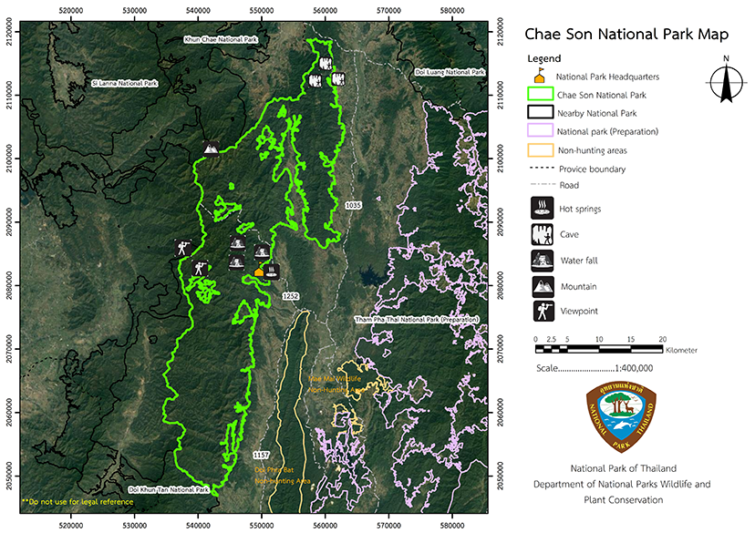
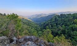
The topograp is of fold mountains (complex mountain) and it is part of the Phi Pan Nam western ridge, which runs north to southwest before continuing south to Mae Prik District, a division between Lampang ,Chiang Mai and Lamphun Provinces. Its elevation is between 300 to 2,031 meters, with Doi Lanka its highest summit. Other peaks include Doi San Phak King, Doi Chai Dan, Doi Mae Ka, Doi Takhrai, Doi Tong, Doi Wang Luang, Doi Huai Lot, Pha Lak Kai, Mon Thang Kao, Doi Mae Buek, Mon Chuang, and Doi Mae Mon and Doi Pae mueang. The majority of the area is watreshed class 1-A in Wang River basin. It is comprised of a large number of waterways of varying sizes including Nam Mae Mi, Nam Mae Tom, Nam Mae Soi, Nam Mae Mon, Nam Mae Pan, Nam Mae Ha, Nam Mae Pom, Nam Mae Bueng, Nam Mae Sui, and Nam Mae Khom, which are tributaries of the Wang River, such as Soi River, Mae Ka Creek, and Mae Pan Creek. Additionally, there is a water source that emerges from the ground as a hot spring. The geothermal area is 2,400 square meters, with nine small ponds filled with large and small rocks and sprouting hot springs. The flow emitted by the springs has a constant flow rate of approximately 15 liters per second and a temperature range of 39 to 47 degrees Celsius. |
|
Chae Son National Park's climate is classified as tropical, with a dry season in winter and a rainy season lasting from May to October, with the wettest monthl occurring in September. The average annual rainfall is 1,070 millimeters The winter months of November to February may be cool with an average temperature of 22 degrees Celsius. The summer months of March and April are quite warm with an average maximum temperature is 33 degrees Celsius. Chae Son National Park is generally accessible all year
|
|
|
|
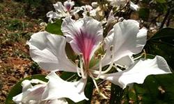
The Chae Son National Park ecosystem can be classified as mainly Deciduous dipterocarp forest is found along the foothills on the south side at 700 meters abovesea level. The predominant plant species found are Burma Sal, Burmese Sal, Hairy Keruing, Dipterocarpus tuberculatus Roxb, Spondias bipinnata Airy Shaw & Forman, Iron Wood, Burma Padauk, Lannea coromandelica, Green Pome Tree, Canarium subulatum, Tomentose wrightia, Sindora siamensis Teijsm, and the ground plants such as Arundinaria pusilia, Vietnamosasa ciliate, and Cycas siamensis. Coniferous forest (pine forests) come in patches on the mountain ridge above 900 meters elevation. The prominent plants found are Merkus Pine (Pinus merkusii Jungh & De Vriese), Khasiya Pine (Pinus kesiya Royle ex Gordon), Lithocarpus cerifer, Michelia champaca, Black Plum, Cephalotaxus griffithii, and Betula alnoides. Lower ground plants include grasses, Blumea balasamifera, Crofton Weed, and Alpinia Galangal. Tropical rain forest is found in the valleys near rivers and areas with high moisture. The predominant plant species found are Dipterocarpus, Artocarpus lacucha, Baccaurea ramiflora, Cinnamon, Syzygium aqueum, Elaeocarpus tectorius, Dimocarpus longan Lour, Xerospermum intermedium, Parkia speciosa Hassk, Ailanthus triphysa, and Dracontomelon dao. The Lower ground plants found include Cephalostachyum virgatum, ferns, Calameae, and Zingiberaceae. Due to the fertile forest conditions, ecosystems, and variable altitudes there are habitats for many wildlife species. Wild animals observed in the National Park include Indian Muntjac, Sambar Deer, Serow, Wild Boar, Leopard, Asiatic Black Bear, Lar Gibbon, Slow Loris, Porcupine, Hog-Badger, Civet, Mongoose, Sunda Pangolin, Burmese Hare, Finlayson's Squirrel, Chipmunk, Indo-Malayan Bamboo Rat, Indo-Malayan Maxomys, Lesser Flat-Headed Bat, Red Junglefowl, Green Pigeons, Green-Billed Malkoha, Himalayan Swiftlet, Common Kingfisher, Blue-Throated Barbet, Barn Swallow, Blue-winged Leafbird, Puff-Throated Bulbul, Greater Racket-Tailed Drongo, Asian Fairy-Bluebird, Striped Tit Babbler, White-Rumped Shama, Black-Naped Monarch, Scarlet-Backed Flowerpecker, Asiatic Softshell Turtle, Spotted Ground Gecko, Calotes mystaceus, Butterfly Lizards, Many-Lined Sun Skink, Banded Krait, Checkered Keelback, Pope Pit Viper, White-Eyed Litter Frog, Common Asian Toad, Puddle Frog, Rice Field Frog, Common Treefrog, and Painted Chorus Frog Each year, in April, wild cicadas gather at the hot springs to drink mineral water.
|
How to get there by car :
Chae Son National Park is approximately 75 kilometers from Lampang town. Visitors can go to the National Park as follows.
• From Lampang take Highway No. 1035 (Lampang – Wang Nuea), 58 kilometers through Chae Hom district. Turn left at the Ban Pong Khop intersection along with Highway No. 1287 (Chae Hom – Mueang Pan), and after 6 kilometers, turn right onto Highway No. 1252 (Khuang Kom – Pang Faen), for approximately 11 kilometers, and then turn left onto the Office of Accelerated Rural Development Road. After about 3 kilometers you will reach the national Park Headquarters in Chae Son National Park. The route is well-signposted.
• From Lampang town, follow National Highway No. 11 (Lampang – Hang Chat), turn right at the Ban Nam Tong intersection. Along Provincial Highway 1157 (Lampang – Huai Peng – Mueang Pan) for a distance of 55 kilometers, turn right into Provincial Highway No. 1287 (Mueang Pan – Chae Hom) for about 2 kilometers, turn left along Provincial Highway No. 1252 (Khuang Kom – Pang Faen) about 11 kilometers and turn left onto The Office of Accelerated Rural Development Road Approximately 3 kilometers more will reach the Chae Son National Park Headquarters. (There are signs along the route)
• From Chiang Rai Province along Highway No. 1 (Phahon Yothin Road) for about 25 kilometers before turning right along Highway No. 118 through Mae Saruai, Wiang Pa Pao District. The distance is about 85 kilometers to Ban Mae Khachan intersection, then turn left for 10 kilometers before turning right onto Provincial Highway No. 1035 (Lampang-Wang Nuea) for a distance of 60 kilometers to Ban Pong Khop intersection. Then turn right along Provincial Highway No. 1252 (Khuang Kom – Pang Faen) for about 11 kilometers, and then turn left into The Office of Accelerated Rural Development Road. After approximately 3 kilometers visitors will reach the Chae Son National Park Headquarters.
- Chae Son National Park
- National Park Ranger Station Cho So No. 1 (Thung Yang)
- National Park Ranger Station Cho So No. 2 (Pha Ngam)
- National Park Ranger Station Cho So No. 3 (Mae Sui)
- National Park Ranger Station Cho So No. 4 (Mae O)
- National Park Ranger Station Cho So No. 5 (Mae Cham)
- National Park Ranger Station Cho So No. 6 (Pa Miang)
- National Park Ranger Station Cho So No. 7 (Doi Lan)
- National Park Ranger Station Cho So No. 8 (Mae Ka)
- Accommodation – Chae Son 101 (Kham Chao)
- Accommodation – Chae Son 102 (Kham Foi)
- Accommodation – Chae Son 103 (Kham Yat)
- Accommodation – Chae Son 104 (Kham Doi)
- Accommodation – Chae Son 105 (Kham Khao)
- Accommodation – Chae Son 107 (Kham Saet)
- Accommodation – Chae Son 113 (Kham Mok Luang)

