Namtok Mae Surin National Park
Contact Location : Namtok Mae Surin National Park, PO Box 16, Pang Moo Sub-district, Mueang Mae Hong Son District, Mae Hong Son Province 58000
Telephone Number : (+66) 5306 1073
Email : maesurin.np@gmail.com
Facebook : Namtok Mae Surin National Park
Information
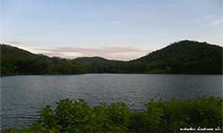
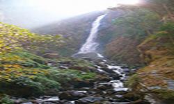
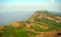
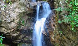
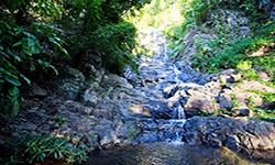
Namtok Mae Surin National Park is located in Mae Hong Son Province’s Khun Yuam and Mueang District. The area is a densely forested complex with mountains and cliffs in a variety of distinct styles. It is a fertile watershed with exceptional natural beauty, including the Mae Surin Waterfall, and Thung Bua Tong, as well as the Pai River, which features beautiful river beaches. The National Park covers an area of approximately 396.60 square kilometers or 247,875 rai.
Background
The Royal Forest Department received the Mae Hong Son letter at Mo So 09/71 on January 3rd, 1980, informing the province that it had received a letter from the Khun Yuam district at No. Mo So 0953/3338 on December 11th, In 1979 the first stages towards , requesting the establishment of the Namtok Mae Surin National Park were made to Mr. Sakul Anantakulkumnerd, Forestry Officer Level 3, proposes a project to establish the Namtok Mae Surin National Park in accordance with Dr. Theling Thamrongnawasawat in order to preserve Mae Surin Waterfall area, which is a beautiful waterfall that serves as a resting place. The Permanent Secretary of the Ministry of Agriculture and Cooperatives flew in to inspect the forest and discovered that the forest areas of Khun Yuam and Mueang District in Mae Hong Son Province are unique in their nature and home to numerous stunning waterfalls. A survey was requested to help justify the decision.
The National Park Division issued a letter no. Ko So 0708/1140, dated 15 February 1980 to the Royal Forest Department assigning officers in Mae Sariang Regional Forest Office to conduct a survey, where they issued an order no. 180/2523, dated 4 June 2980 assigning Mr. Udom Thammamala, Foresty Officer Level 4, to conduct a survey. It was found that Namtok Mae Surin Forest is a complex mountain landscape with fertile forest. It is a waterhead of many rivers, especially around Doi Pui (resemble to cone-shape bowl). The summit is a flat area, with cold weather. There are two beautiful waterfalls, Mae Surin and Pha Bong. It was suitable to be designated as a National Park in accordance to a report attached to a letter from Mae Sariang Regional Forest Office no. Ko So 0709 (Mo Ro)/2360, dated 19 August 1980.
The National Park Division, Royal Forest Department National Park Board which passed the meeting No. 3/2523 on October 21st, 1980, approved the designation of Mae Nam Pai Fang-sai Forest and Mae Surin Forest in the local of Pang Mu, Pha Bong and Huai Pong Sub-district, Mueang Mae Hong Son District and Khun Yuam and Mae Yuam Noi Sub-district, Khun Yuam District in Mae Hong Son Province, which became Thailand’s 37th National Park on October 29th 1981.
Note : After paying the entrance fee to the National Park, please carry the receipt for inspection.
247,875 rai (396.6 square kilometers)
|
|
|
|
|
|
|
|
|
|
|
|
|
|
||
Nature trails ⇔ Trekking ⇔ Visit Waterfall ⇔ Geological condition ⇔ Observe flowers/plant ⇔ Bird , butterfly , wildlife watching activities ⇔ Stargazing ⇔ Mountain biking ⇔ Take a boat ride or a paddle ⇔ Take a photo/Video
Welfare shop : 08:30 - 16:30 hrs.
Mobile phone signal :
National Park Headquarters area: AIS, TRUE, DTAC
|
|
The Namtok Mae Surin National Park topography consists of tower karst, complex, folded mountains which stretch from the north to the south. The east is more steeply sloped than the west.The elevation range is300 - 1752 meters above sea level, with Doi Pui being the highest summit, followed by Doi Ton Huai Pha Kho at 1,601 meters, Doi Huai Mee Samat at 1,465 meters high and Doi Huai Mai Khong at 1,474 meters high, Doi Ban Maikhrowep is 1,474 meters high, Doi Plai Huai Mae Cha Yam at 1,407 meters high, Doi Pha Kho at 1,352 meters high, Doi Ban Huai Ha at 1,359 meters high, and Doi Ton Huai Tong Ching at 1,310 meters above sea level. The area is a catchment area for for many different waterways, which flow mainly from east to west. The main rivers are Pai River, Mae Samat River, Pong Kun Creel, Nam Mae Sakuet, Mon Talaeng Creek, Nam Mae Hong Son, Pong Creek, Nam Mae Surin, Na On Creek, Hia Creek, U Kho Noi Creek, and U Kho Luang Creek. Most of the smaller waterways into the Pai and Yuam Rivers. |
|
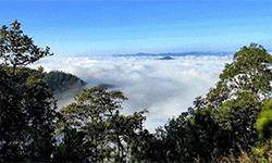
Namtok Mae Surin National Park is located in a valley that is perpetually foggy. The climate is pleasant for most of the year, with winters on the mountain cold by Thai standards. The rainy season lasts from May to October and there is annual rainfall of 1,282 mm, which makes travel difficult Summer is in the months of March and April, and April's average temperature can be hot at 38 degrees Celsius with an average temperature of 25 degrees Celsius year round.
|
|
|
|
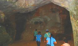
Mixed deciduous forests are found in areas with not very steep slopes in places such as river valleys, such as the valleys of Mae Sakuet Creek, Pong Kan Creek, Mai Sang Nam Creek, Mae Cha Creek, and Nam Mae Surin Creek. They prosper at an altitude of 350 to 600 meters above sea level, and are home to plants such as Thai Bungor, Beleric myrobalan, Toona ciliata, Protium serratum, Lagerstroemia duperreana Pierre, Diospyros mollis, Barringtonia acutangular, Tamalin, Croton poilanei Gagnep, Litsea glutinosa, Oroxylum indicum, White Bamboo, Bambusa tulda Roxb, Bambusa bambos, Curcuma aeruginosa, Sterculia balanghas, Shampoo Ginger, Hapaline benthamiana Schott, Harrisonia perforate, and Stemona tuberosa, Wild animals found in the park include Intermediate Leaf-Nosed Bat, which is found in large numbers in the Huai Saloi Cave, Lesser Horseshoe Bat, Sambar Deer, Common Palm Civet, Hoary Bamboo Rat, Short-Tailed Gymnure, Red Junglefowl, Mountain Bamboo Partridge, Coppersmith Barbet, Black Drongo, Black-Headed Woodpecker, Sooty-Headed Bulbul, Tokay gecko, Draco maculatus, Eutropis macularia, Cobra, Oriental Whipsnake, Smith’s Litter Frog, Rivulet Frog, Dark-Sided Frog, Siamese Raven, Lemon Emigrant, and the Club Beak. Deciduous Dipterocarp forests covered the largest area in the National Park, and they are found above 350 to 1,400 meters above sea level. species of ground plants found in the park are Dipterocarpus tuberculatus Roxb, Burma Sal, Hairy Keruing, Burmese Sal, Merkus Pine (Pinus merkusii Jungh & De Vriese), Melanorrhoea ustata, Terminalia alata Heyne, Great Elephant Apple, Diospyros ehretioides, Stereospermum neuranthum Kurz, Indigofera sootepensis Craib, Phoenix loureiroi, Heteropogon contortus, Arundinella setosa, Common Reed, and Hypoxis aurea, Wild animals that live in this type of forest include Crested Goshawk, Collared Owlet, Chestnut-Headed Bee-Eater, Greater Flameback, Olive-Backed Pipit, Racket-Tailed Treepie, Tamiops mcclellandii, Indochinese Ground Squirrel, Common Treeshrew, Greater Short-Nosed Fruit Bat, Ground Lizard, Calotes emma, Spotted Forest Skink, Common Indian Crow, and Stichophtalma louisa. Coniferous forests (Pine forests) are located on high ridges and home to the Merkus Pine (Pinus merkusii Jungh & De Vriese) and Khasiya Pine (Pinus kesiya Royle ex Gordon), in addition, many beautiful types of orchids can be found, such as Lady’s Slipper, Dendrobium scabrilingue, Vanda coerulea, Aerides multiflora, Uraria acaulis Schindl, Giant Rhynchostylis, and Eria lasiopetala. |
How to get there by car :
The National Park Headquarters is located in the Ban Pang Moo area of Mae Hong Son Province, along Provincial Highway No. 1095 Mae Hong Son - Pai District. At about 9 kilometers north of Mueang Mae Hong Son district, visitors will reach a junction where they should turn right for approximately 2 kilometers until they reach the National Park Headquarters.
- National Park Ranger Station 1 (Namtok Mae Surin)
- National Park Ranger Station 2 (Microwave)
- National Park Ranger Station 3 (Mae Sakuet)
- National Park Ranger Station 4 (Namtok Pha Bong)
- National Park Ranger Station 5 (Ban Mae Surin)
- Accommodation - Mae Surin 101 (Rim Nam Pai 1)
- Accommodation - Mae Surin 102 (Rim Nam Pai 2)
- Accommodation - Mae Surin 103 (Rim Nam Pai 3)
- Accommodation - Mae Surin 104 (Rim Nam Pai 4)


