Tham Pla - Namtok Pha Suea National Park
Contact Location : Tham Pla - Namtok Pha Suea National Park, 70 Moo 1, Huai Pha Sub-district, Mueang District, Mae Hong Son Province 58000
Telephone Number : (+66) 6 4814 0540 , (+66) 8 2191 1746
Email : npthumpla2552@gmail.com
Facebook : อุทยานแห่งชาติ ถ้ำปลา-น้ำตกผาเสื่อ
Information
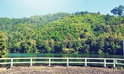
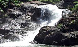
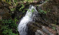
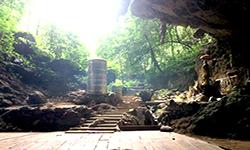
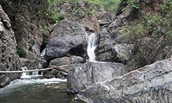
Tham Pla - Namtok Pha Suea National Park encompasses the Tham Pla - Namtok Pha Suea Forest Park in Mae Pai Fang-Khwa National Reserved Forest's east in Mueang District and Pang Mapha Minor District. The fold mountains (complex mountain) run north and south and create a catchment areas for various waterways. It is home to a one-of-a-kind natural phenomenon: Pla Cave - Pha Suea Waterfall, which is both stunning and popular. Tham Pla - Namtok Pha Suea National Park covers the area 488 square kilometers or approximately 305,000 rai (488 square kilometers).
Background
Following the resolution of the National Park Board Meeting No. 1/2540 on January 28th,In 1997, the Royal Forest Department approved a survey to establish the Tham Pla - Namtok Pha Suea National Park by proposing a draft decree defining a National Park. The Royal Forest Department has issued an order 652/2528 regarding the appointment of an area survey committee to establish a National Park dated April 10th, 1995, and the Royal Forest Department Order 240/2539 dated February 1st, 1996, for Mr. Pinit Suwannarat to proceed and explore more information in the area of Tham Pla Forest Park and Namtok Pha Suea Forest Park. To establish it as a National Park.
The survey's findings include the designation of 305,000 rai (488 square kilometers) of land as a National Park, which is a haven for wildlife. There were a small number of isolated villages that needed to be reclaimed for the creation of a National Park. It is comprised of a National Park. However, there were strong working relationships with other departments and local leaders so there was no conflict with the indigenous people. Measures were also taken to prevent and suppress the smuggling and removal of Forest Resources in Mae Hong Son Province, and in 1996, Mr. Somchate Viriyadamrung, Governor of Mae Hong Son Province, presented a resolution approving the establishment of the Tham Pla - Namtok Pha Suea National Park in Mae Hong Son Province.
Note : After paying the entrance fee to the National Park, please carry the receipt for inspection.
394,120 rai (630.5 square kilometers)
|
|
|
|
|
|
|
|
|
|
|
|
|
|
|
|
|
|
||
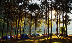
Nature trails ⇔ Visit Waterfall ⇔ Cave exploration ⇔ Relax in a natural ⇔ Geological condition ⇔ Bird , butterfly watching activities ⇔ Stargazing ⇔ Camping ⇔ Take a photo/Video
Welfare shop : 08:30 - 16:30 hrs.
Mobile phone signal :
National Park Headquarters area: AIS, TRUE, DTAC
|
|
It is a high fold mountains (complex mountain) that extends north and south. Its highest peaks are Doi Lan, Doi Tong Muak, Doi King Kom, Doi Laem, Doi Pang Hung, and Doi Na Klng Chang, with Doi Lan the highest pointat 1,918 meters above sea level. The area ranges in elevation from 300 to 1,900 meters above mean sea level with the average height of the structures at approximately 500 meters. It is a catchment area for the province's major rivers, including the Pai River, the Khong River, the Mae Sa Nga River, and the Mae Sa Ngee River. |
|
The climate in Mae Hong Son Province is tropical and has has three distinct seasons: the rainy season, which begins in mid-Mayunntil mid-October, which is influenced by the southwest monsoon. Winter begins in November and lasts until February, influenced by the northeast monsoon, when high-pressure systems in China extend into Thailand, bringing with it cold and drought. This brings fog, on about three-quarters of the month of January, the majority of which occur at dawn. Summer season begins in mid-February and ends in mid-May and is humid and hot, with April the hottest month of the year.
|
|
|
|
Forest Resources 1. Mixed Deciduous Forest or Deciduous Forest covers approximately 30% of the area and is found near the summits, on the steep slopes along the hillside at to a height of approximately 1,000 meters above mean sea level, as wel as at the water’s edge. The soil is quite substantial, often having a middle layer. Forest fires spread on the ground during the dry season so the majority of plants are resistant to fire. The forest structure is divided into three layers: the canopy, the understory, and the lower layer. Natural reproduction is relatively slow, but significant species include Lagerstroemia calyculata Kurz, Burma Padauk, Black Rosewood, Iron Wood, Golden Fig, and Bombox anceps. Additionally, a large amount of bamboo has been discovered. 2. Tropical Evergreen Forest covers around 35% of the land. The soil is quite dense and moist, and the fhe forest structure is divided into three layers: the canopy, the understory, and the lower level. Natural reproduction is relatively slow, and Rubber, Burma Padauk, and Alstonia scholaris have the highest densities. Additionally, there is Rattan, Ginger, Alpinia malaccensis, and a variety of ferns growing along the ground. 3. Deciduous Dipterocarp Forest is a deciduous forest found along the ridges and on the slopes at a height of between 300 and 900 meters above sea level. Itcovers approximately 15% of the total areaThe soil is quite thin, with outcrop areas being a mix of gravel and sand. In the dry season forest fires are common, so all the plants are stunted on a regular basis. The forest structure is composed of only two layers, and natural reproduction is limited. Important species include Burma Sal, Burmese Sal, Lagerstroemia floribunda Jack, and Sindora siamensis Teijsm. 4. Coniferous forest (Pine forests) is a type of forest that is found between 200 and 1,800 meters above sea level. It covers approximately 5% of the land withboth Merkus Pine (Pinus merkusii Jungh & De Vriese) and Khasiya Pine (Pinus kesiya Royle ex Gordon) found in Deciduous dipterocarp forest Imperata cylindrica makes up the majority of the plants on the ground. 5. Forest Plantation covers approximately 10% of the total land area, including the Mok Champae -Mae Sa Nga Forest Plantation, the Pang Tong Royal Initiative Project 1 (Huai Maukhuea Som), and the Pang Tong Royal Initiative Project 2 (Pang Ung) redevelopment projects. The Mae Pai Fang-Khwa Ton Tai National Reserved Forest (1) and (2) as Huai Pha Forest Plantation. Teak, Khasiya Pine (Pinus kesiya Royle ex Gordon), and Colocasia gigantea are among the plants in the area. 6. Disturbed forests accounts for approximately 5% of the area is covered by forest. Humans have encroached on these areas over time, clearing them for agriculture. However, the government has recently pushed out human activity to allow the forest to recover. It is expected that if no further intrusion occurs then these areas may once again become fertile. Due to the diversity of forest types in the area, there is an abundance of economically valuable wood, and without conservation, these natural resources may rapidly degrade, altering the plant and animal communities within the ecosystem.
Wildlife Resources |
How to get there by car :
How to get there by carfrom the Protected Area Regional Office No. 16 to Mae Hong Son via the Chiang Mai - Mae Hong Son route. When you arrive at Hot District, pass through Mae Sariang, Khun Yuam, and Mueang District. It is a distance of approximately 350 kilometers and 18 kilometers on Highway No. 108, which takes approximately ten hours. Alternatively, head in the opposite direction to Mae Taeng District, turning left at Ban Mae Malai, just before reaching Mae Taeng District. Highway No. 1095 goes through Pai District before reaching the Mueang District. it is located between milestone No. 192 - 193, approximately 280 kilometers from the Tham Pla Visitor Center, and takes approximately 9 hours, or less in a private car.
Update soon
- National Park Ranger Station Tho Pho No. 1 (Tham Pla)
- National Park Ranger Station Tho Pho No. 2 (Namtok Pha Suea)
- National Park Ranger Station Tho Pho No. 3 (Sop Soi)
- National Park Ranger Station Tho Pho No. 4 (Huai San)
- National Park Ranger Station Tho Pho No. 5 (Pang Tong)
-

