Mae Yom National Park
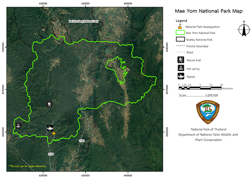
Contact Location : Mae Yom National Park, PO Box 4, Song District, Phrae Province 54120
Telephone Number : (+66) 5452 0735, (+66) 5462 6770
Email : maeyom_13@windowslive.com
Facebook : Mae Yom National Park
Information
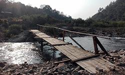
Mae Yom National Park, which is located in Lampang Province's Ngao and Song District in Phrae Province, has a fertile forest with tall natural teak that are densely packed and beautiful. It is a superb example of a northern teak forest, including a significant amount of valuable wood and stunning scenery. The area is approximately 284,218 rai or 454 square kilometers in size.
Background
Mr. Narong Wongwan, Minister of Agriculture and Cooperatives (Representative of Phrae), established the Royal Forest Department in 1982 to explore the Mae Pung-Mae Pao National Reserved Forest in Phrae Province, which is naturally endowed with a large teak and stunning scenery. The Royal Forest Department, which was established as a National Park Division, conducted a preliminary survey of Mae Pung and Nam Ngao Forests, as well as Nam Suat Forest, a dense teak forest in the north. The forest is generally in good condition, and the area is a catchment area for the Yom River. It was deemed an appropriate candidate for designation as a National Park.
The Royal Forest Department has submitted a proposal to the National Park Service. A resolution adopted at meeting No. 1/2527 on January 23rd, In 1984, determined, that a royal decree designateding that the area should become as a National Park should be issued. The given name "Later. the park was renamed Mae Pung National Park, which was later changed to the. "Mae Yom National Park " to suit the natural features of the area where the Yom River flows, and the and the Mae Yom National Park's beautiful features, which are this is caused bycreated by the Yom River. With a royal decree determining Thethe national park area of the Mae Pung Forest, Mae Pao Forest and Mae Song Forest in the area of Tao Pun and Sa-iap Sub-district, Song District in Phrae Province and Mae Ngao Fang-Sai Forest of in Mae Tip Sub-district, Ngao District in Lampang Province. It became Thailand’s 51st , is a National Park which was published in the Government Gazette, Volume 103, Chapter 34, dated March 1st,in 1986. , it is the 51st National Park in the country.
Note : After paying the entrance fee to the National Park, please carry the receipt for inspection.
284,218.75 rai (454.7 square kilometers)
|
|
|
|
|
|
||
Nature trails ⇔ Cave exploration/Geological condition ⇔ Observe flowers/plant ⇔ Bird , butterfly , wildlife watching activities ⇔ Mountain biking ⇔Take a photo/Video ⇔ Camping ⇔ Relax in a nature
Welfare shop : 08:30 - 16:30 hrs.
Mobile phone signal :
National Park Headquarters area: AIS, TRUE, DTAC
|
|
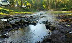
Mae Yom National Park's topography is dominated by high mountains to the east and west which slope down towards the Mae Yom River, which runs through the heart of the park. Mountains include Doi Luang, Doi Yao, Doi Khun Huai Pae, and Doi Ton. These high mountains form the upper reaches of the catchment area, and feed numerous rivers and creeks including Nam Mae Pung, Nam Mae Lam, Nam Mae Ten, Nam Mae Sa Kuen, Nam Mae Pao Rivers, Pha Lat Creek, Mae Pong Creek, Mae Phung Creek, Mae Paeng Creek, Khet Creek, Pui Creek, Loem Creek, Mae Phung Creek. The plain area slopes north to south from 180 meters above sea level in song district to 157 meters, with the east and west lines sloping to the Yom River on both sides. The majority of the soil is laterite and sandy loam. Sedimentary and shell stones are two types of stones. The area can be classified as a class 1 watershed, a class 2 watershed, a class 3 watershed, and a class 4 watershed. |
|
Mae Yom National Park has a tropical monsoon climate, with the temperature and distribution of rainfall is influenced by the southwest monsoon and the northeast monsoon. Between May and October, the southwest monsoonbrings heavy rains, and between November and April, the northeast monsoon takes over creating drier conditions. The cold and dry weather from China brings dry season, which due to the mountainous terrain, the region experiences cold weather from November to February. In March and April it is quite hot and dry weather with an average maximum temperature of 33 degrees Celsius compared with a minimum temperature of 14 degrees Celsius in January. The average year-round temperature is 26 degrees Celsius, and the average annual rainfall is 1,095 millimeters.
|
|
|
|
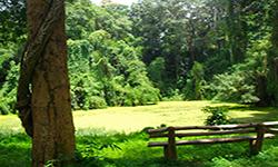
The majority of the forest is relatively undisturbed and composed of a variety of forest types, including mixed deciduous forest, which is prevalent in the National Park. The area immediately above the dam and to the west of the Yom River is full of Teak, Black Rosewood, Iron Wood, Burma Padauk, and Lagerstroemia calyculata Kurz. Deciduous Dipterocarp forests are more common in the north and in the drought-stricken areas. These contain Burma Sal, Burmese Sal, Dipterocarpus tuberculatus Roxb, Melanorrhoea glabr, Canarium subulatum, and Tamalin. Dry evergreen forest's important plants inlcude Hopea odorata, Anisoptera costata, Artocarpus lacucha, Dipterocarpus, Toona ciliata, and Lithocarpus cerifer. Coniferous forest (pine forests) are located on the eastern summit of the National Park, about 1,200 meters above sea level. Plants include Khasiya Pine (Pinus kesiya Royle ex Gordon), Evergreen Chinkapin, Quercus helferiana, and more. The wildlife survey found 39 species of mammals, 135 birds, 28 reptiles, and 14 amphibians, among which four were of near extinction. There is one endangered wildlife species, which is theFishing Cat and the IUCN Red Book includes the Serow. Other wildlife species that are commonly seen include the Indian Muntjac, Asiatic Black Bear, wild boar, Burmese Hare, Slow Lorises, Asiatic Brush–Tailed Porcupine, Asian Small-Clawed Otter, Lesser Bamboo Rat, Tamiops mcclellandii, Greater Short-Nosed Fruit Bat, Malayan Horseshoe Bat, Oriental House Rat, and Red Junglefowl, Birds found in the park include the Thick-Billed Green Pigeon, Vernal Hanging Parrot, Greater Coucal, Asian Barred Owlet, Large-Tailed Nightjar, Indian Roller, Great Barbet, Blue-Throated Barbet, Grey-Capped Woodpecker, Pacific Swift, Velvet-Fronted Nuthatch, Striped Tit Babbler, Black-Browed Reed Warbler, Grey Wagtail, Puff-Throated Bulbul, Grey-Headed Canary Flycatcher, Olive-Backed Sunbird, as well as amphibians and reptiles such as the Elongated Tortoise, Soft-Shelled Turtle, Calotes mystaceus, butterflies and lizards. They includes, Bowring’s Supple Skink, Spiny-Tailed House Gecko, Burmese Python, Banded Krait, Painted Chorus Frog, Rice Field Frog, Green-Backed Frog, and Common Asian Toad. |
How to get there by car :
To reach Mae Yom National Park, drive along National Highway No. 101, the Phrae-Nan Line, to the Rong Kwang District intersection from Phrae Province. Turn left onto Highway No. 103, the Rong Kwang-Ngao route, and travel approximately 26 kilometers to Song District. From Song District, continue on Provincial Highway No. 1154, the Song-Ngao route, for approximately 20 kilometers to the Mae Yom National Park Headquarters. Phrae Province and Mae Yom National Park are approximately 70 kilometers apart.
- National Park Ranger Station Mo Yo No. 1 (Pong Nam Ron)
- National Park Ranger Station Mo Yo No. 2 (Pha Ing)
- National Park Ranger Station Mo Yo No. 3 (Pu Sum)
- National Park Ranger Station Mo Yo No. 4 (Bo Ton Sak)
- National Park Ranger Station Mo Yo No. 5 (Pha Lat)
- National Park Ranger Station Mo Yo No. 6 (Na Fai)
- National Park Ranger Station Mo Yo No. 7 (Pak Ngao)
- National Park Ranger Station Mo Yo No. 8 (Mae Phrao)
- Accommodation - Mae Yom 101 (Kaeng Suea 1)
- Accommodation - Mae Yom 102 (Kaeng Sua 2)


