Namtok Chat Trakan National Park
Contact Location : Namtok Chat Trakan National Park, Moo 3, Ban Pak Rong, Chat Trakan Sub-district, Chat Trakan District, Phitsanulok Province 65170
Telephone Number : (+66) 5590 6522
Email : namtokchattrakan@hotmail.com
Facebook : Chattrakan Waterfall National Park
Information
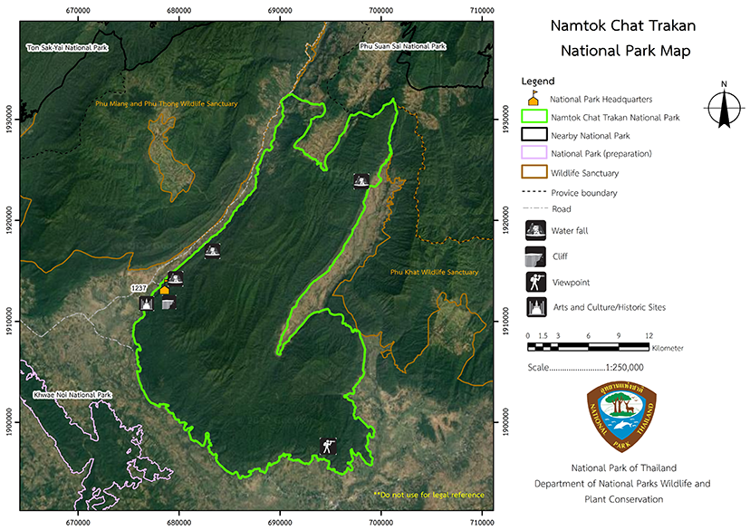
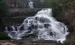
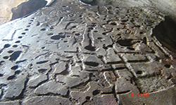
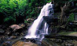
Namtok Chat Trakan National Park is located in Phitsanulok Province's Chat Trakan and Nakhon Thai District. The general condition is one of fertile forest and stunning natural beauty, with features such as Chat Trakan Waterfall, which locals refer to as "Pak Rong Waterfall" due to its location in Mu Ban Pak Rong. There is also a colored tower kasrt that shows early human art, which is carved into the rock atop a mountain ridge. The area is roughly 339,375 rai or 543 square kilometers.
Background
The sub-district headman, village headman, and villager of Nakhon Thai, Nam Kum Sub-distrcts, Chat Trakan, and Nakhon Thai District in Phitsanulok Province proposed to the Department of Forestry, through Mr. Prathuang Vijarnprecha, Member of the House of Representatives of Phitsanulok Province, to manage the area of Khao Ya Puk Forest, which features a beautiful waterfall, as a forest park in order to preserve the forest. The National Forest Headquarters surveyed the area and established a forest park called "Khao Ya Puk Forest Park," which was renamed "Namtok Chat Trakan Forest Park" in March 1982.
Later that year, on June 11th, 1982, the Department of Forestry issued a letter No. 0706/10459 appointing a working group comprised of rangers from the Phitsanulok Regional Forest Office. The National Park Headquarters and the Forest Management Department conducted surveys to determine whether the area should be designated as a National Park. The results of the working group's survey The Phitsanulok Regional Forest Office and Forest Management Department division should designate Chat Trakan Waterfall and the surrounding forest area at Khao Ya Puk as a National Park. The area is approximately 253 square kilometers or 146,875 rai. Mr. Phum Somwatthanasak, Civil Technology 3 of the Namtok Chat Trakan Forest Park, agreed that all areas surveyed should be determined. A National Park covers an area of approximately 1,274 square kilometers or 764,250 rai. When the working group conducts the survey, the area considers the survey's scope to be appropriate. Approximately half of the surveyed areas should be designated as National Parks, based on the management of National Parks and the conservation of forests and watersheds. Additional surveys have been conducted by the National Park Headquarters of the Royal Forest Department.
On 2 April 1985, National Park Committee issued a resolution of the meeting 1/2528 approving in principle to set up a National Park in that area, with consideration of the possibility to manage the National Park and forest conservation. The National Park Division then designated the area of high complex mountain landscape, locating waterhead forest for small and big rivers, as the area for toursim, education, and research, covering 339,375 rai to be a national Park in accordance to the decree marking the area in Nam Phak Forest, Lam Nam Khwae Noi Fang-Sai Forest on the west of Daeng Forest, and Chat Trakan Forest in Chat Trakan, Nam Kum, and Nakhonchum Sub-district. It was announced in the Government Gazette, Volume 104, Section 220, dated 2 November 1987. It is the 55th National Park in Thailand.
Note : After paying the entrance fee to the National Park, please carry the receipt for inspection.
339,375 rai (543 square kilometers)
|
|
|
|
|
|
|
|
|
|
|
|
Nature trails ⇔ Observe flowers/plant ⇔ Bird watching activities ⇔ Visit Waterfall ⇔ Swimming ⇔ Geological condition ⇔ History and culture watching ⇔ Camping ⇔ Relax in a nature
Welfare shop : 08:30 - 16:30 hrs.
Mobile phone signal:
National Park Headquarters area: AIS, TRUE, DTAC
|
|
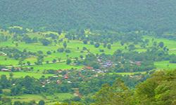
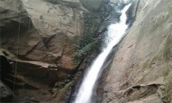
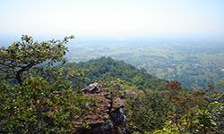
The topology is predominantly mountainous with high fold mountains (complex mountain). It is a catchment area for numerous rivers including the Phak River and Khwae Noi River (Little River Khwae). The sandstone mountains, particularly the cliffs surrounding this waterfall, are the result of long-deposited sandstone rock formations, and the soil is sandy as it benefits from the erosion of the area's sandstone.
|
|
The weather is generally pleasant. Between March and May, the temperature ranges between 25 - 29 degrees Celsius, while the rainy season lasts from June to October, and the winter season lasts from November to February, when the temperature can drop into single figures at night.
|
|
|
|
State of the forest consists of a deciduous dipterocarp forest on laterite soil with a relatively low-quality ofsoil condition. Prominent trees include Burma Sal, Burmese Sal, Hairy Keruing, Iron Wood, Burma Padauk, Shorea roxburghii, and others which are found along waterways and in areas with high moisture. The evergreen forest also grows along riverbanks and in areas with high moisture but it prefers more fertile soil. Trees in the evergreen forest include Dipterocarpus, Anisoptera costata, Lithocarpus cerifera, Mangifera caloneura, Black Rosewood, and Lagerstroemia calyculata Kurz, as well as ground plants such as Palm, Rattan, and various bamboos.
|
How to get there by car :
- From Phitsanulok Province, take one of two routes: First, you can follow the Phitsanulok-Lom Sak Highway to Nakhon Thai District, then turn left into Nakhon Thai District; or from Nakhon Thai District to Chat Trakan District, travel 1 kilometer before reaching Chat Trakan District, where there is an intersection. Turn right and travel for approximately 9 kilometers, then turn right into the National Park route, traveling for another 1 kilometer to reach the Headquarters.
- From Wat Bot district, take the Wat Bot - Khan Sonk - Pong Kae route, then bear right into Chat Trakan district and then left to the National Park. The total distance covered is roughly 120 kilometers.
- National Park Ranger Station Cho Ko No. 1 (Na Fong Daeng)
- National Park Ranger Station Cho Ko No. 2 (Khao Chang Luang)
- National Park Ranger Station Cho Ko No. 3 (Bung Phum)
- National Park Ranger Station Cho Ko No. 4 (Nam Kum)
Accommodation - Chat Trakan 102 (Phueng Luang)

