Mae Puem National Park
Contact Location : Mae Puem National Park, Moo 8, Ban Pa Tung, Mae Chai Sub-district, Mae Chai District, Phayao Province 56130
Telephone Number : (+66) 9 3265 3035, (+66) 8 8290 9433
Email : maepuem.np@hotmail.co.th
Facebook : Mae Puem National Park
Information
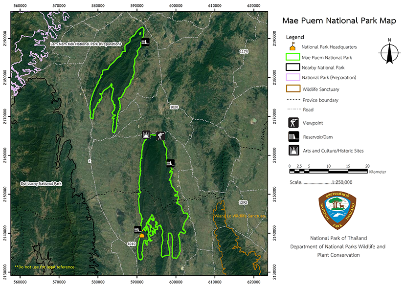
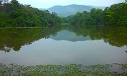
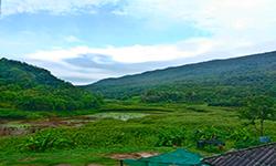
The Mae Puem National Park is a small park that is covered by mixed deciduous forest and deciduous dipterocarp forests. These provide stunning colors during the dry season when the forests leaves change color and drop. The National Park is divided into two sections: Doi Pui Forest and Mae Puem Forest. Doi Pui Forest is located in the Phan and Mueang districts of Chiang Rai province, while Mae Puem Forest is located in the Phan and Pa Daet districts in Chiang Rai province, as well as Mae Chai District in Phayao Province. These cover approximately 137,431 rai or 220 square kilometers in Chiang Rai Province and about 85,069 rai or 136 square kilometers in Phayao Province.
Background
Due to widespread destruction of the forestthe government introduced a policy is to conserve forest resources in already-abundant forests, including National Parks. Chiang Rai Province received a letter Cho Ro No. 0009/17043 dated June 20th, 1994, requesting a preliminary survey report and permission from Royal Forest Department to establish a National Reserved Forest in Mae Puem Forest, Mae Phung Forest, Huai Ton Yang Forest, and Huai Mae Kaeo Forest in the Phan and Pa Daet districts of Chiang Rai Province, and Mae Chai District in Phayao Province, covering the area of 219,087 rai. The Sub-Committee on the Prevention and Suppression of Forest Resource Smuggling in Chiang Rai Province adopted Resolution No. 1/1994 on March 8, 1994, and Resolution No. 2/2537 on April 7, 1994, establishing the a National Park.
The Protected Area Regional OfficeBureau has reviewed the Forest Preservation Ranger's initial survey report for the area. Already, the Chiang Rai Provincial Forest Department viewed it is deemed appropriate to establish a National Park, as proposed by Chiang Rai Province, in collaboration with Mr. Chavalit Lohkhunasopbut, Forest Officer Level 5, Khuean Sinakarin National Park, Kanchanaburi Province, to conduct additional surveys and establish the area as a National Park, with Mr. Chavalit serving as the park's superintendent.
Since 1994, Mae Puem National Park has been surveyed and established, encompassing areas in the provinces of Chiang Rai and Phayao. With a total area of approximately 356 square kilometers or 222,500 rai, the area is divided into two sections:
Section 1 is located in Doi Pui National Reserved Forest in Chiang Rai Province's Mueang District. Huai Ton Yang National Reserved Forest and Huai Mae Kaeo Forest are located in Chiang Rai Province's Phan District. They cover an area of 108 square kilometers or 67,500 rai.
Section 2 is located in the Mae Puem and Mae Phung National Reserved Forests, in Phan and Pa Daet District, Chiang Rai Province, and in Mae Chai District, Mueang District, Phayao Province, as well as Mae Puem and Dong Pradu National Reserved Forest, Mae Chai, Mueang District, Phayao Province, and Mae Hong Po National Reserved Forest, Huai Kaeo Forest, and Mae Ing Fang-Sai Forest, Phu Kam Yao Minor District, Phayao Province. The total land area is 248 square kilometers or 155,000 rai.
According to the minutes of the National Park Board's meeting No. 2/2538 on May 18, 1995, establishing Mae Puem National Park. Mae Puem National Park was established within the surveyed area. It is part of the Mae Puem and Mae Phung National Reserved Forests in Pa Ngoe, Rong Chang and Si Pho Ngoen Sub-district, Pa Daet District, Chiang Rai Province, San Ma Ket, Doi Ngam, Wiang Hao, and Than Tawan Sub-district, Phan District, Chiang Rai Province; Pa Phaek and Ban Lao Sub-district, Mae Chai District, Phayao Province, Doi Pui National Reserved Forest is located in San Sai, Pa O Doi Chai, Mok kaeo and Dong Mada Sub-district, Mueang Chiang Rai District, Chiang Rai Province, and Ton Yang National Reserved Forest and Huai Mae Kaeo Forest are located in Charoen Mueang and Mae O Sub-district, Phan District, Chiang Rai province, 227,312 rai (363.70 square kilometers) in size. It is a rainforest and headwater of Nam Mae Puem and Nam Mae Kaeo. It is blessed with fertile forest conditions. It is a haven for a variety of wildlife and is endowed with numerous stunning natural features along with breathtaking natural scenery that deserves to be declared a National Park.
On July 25, 1994, the Royal Forest Department issued Order No. 1231/2537 appointing Mr. Choavalit Lohkhunasopbut, Forestry Officer Level 5, National Park Division, to conduct additional research in order to announce the area's designation as a National Park. During this additional survey, portions of Mae Puem National Forest Reserve and Mae Pung Forest were removed from the Park’s total size but several additional areas were added within the Doi Pui National Reserved Forest.
On 18th May 1995, the National Park Board meeting No. 2/2538 approved the establishment of a survey, and the Forest Service despatched rangers. A survey was conducted, and it was decided that theMae Puem National Park would border Chiang Rai and Phayao, covering an area of 350.8252 square kilometers (219,266 rai) and a distance of 220 kilometers around the border.
The location of National Park would include Doi Pui Forest, Huai Ton Yang Forest and Huai Mae Kaeo Forest , Mae Puem Forest ,and Mae Phung Forest, Nam Mae Puem Forest, Dong Pradu Forest, Huai Bong Forest, Huai Khian Forest, and Mae Hong Po Forest, Huai Kaeo Forest, and Mae Ing Fang-Sai Forest. the areas of Tha Sai, Huai Sak and Pa O Don Chai Sub-district, Mueang Chiang Rai District, Than Thong, Mae O, Sai Khao, Charoen Mueang, San Ma Ket , Wiang Hao and Than Tawan Sub-district, Phan District, Pa Ngoe, Rong Chang and Si Pho Ngoen Sub-district, Pa Daet District, Chiang Rai Province, Ban Lao and Mae Chai Sub-district, Mae Chai District, Dong Chen, Huai Kaeo, Phu Kam Yao District, Mae Puem Sub-district, Mueang Phayao District, Phayao Province and together they fomed Thailand’s 120th National Park, which was established in 2009.published in the Government Gazette, Volume 126, Part 97 Ko, on December 25th, 2009.
Note : After paying the entrance fee to the National Park, please carry the receipt for inspection.
219,226 rai (350.8 square kilometers)
|
|
|
|
|
|
|
|
|
|
||
Nature trails ⇔ Trekking ⇔ Observe flowers/plant ⇔ Bird watching activities ⇔ Stargazing ⇔ Camping ⇔ Relax in a nature
Welfare shop : 08:30 - 16:30 hrs.
Mobile phone signal:
National Park Headquarters area: AIS, TRUE, DTAC
|
|
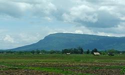
Part 1: The topography is mostly high mountains, with very few plains in the Park, which runs approximately 27 kilometers on a north-south axis. It is also the source of the Mae Kaeo Stream, which features beautiful rocks and has year-round water flow. The east and west sides are sloped, and in the with elevations of 403 to 936 meters above sea level. Part 2: The topography is tower karst mountains that extend from the North to the south for about 32 kilometers. Slopes face east and west, with the only flat land on the ridge which is about 4 kilometers wide and the origin of Mae Puem River. Water flows in the river all year round. The highest point is in the North, with elevations of 403 to 978 meters above sea level. |
|
Mae Puem National Park's climate is classified as tropical monsoon due to the influence of the southwest monsoon during the rainy season and the northeast monsoon during the winter. The average temperature is around 25 degrees Celsius, with the lowest temperature being 9-12 degrees Celsius in December. The months of May to October typically see heavy rain with an average annual rainfall is approximately 1,550 millimeters.
|
|
|
|
Mae Puem National Park contains four distinct forest types: dry evergreen forest, mixed deciduous forest, deciduous dipterocarp forest and coniferous forest (Pine Forest). Teak, Ironwood, Burma Padauk, Black Rosewood, Tamarind, Burma Sal, Burmese Sal, Hairy Keruing, Dipterocarpus tuberculatus Roxb, and Merkus Pine (Pinus merkusii Jungh & De Vriese) and Fagaceae More than 40 species of bird species were found, such as Grey-Capped Emerald Dove, Orange-Bellied Leafbird, Thick-Billed Green Pigeon, Great Slaty Woodpecker, Black-Crested Bulbul, and Hawk-Eagle. Other wildlife found include the Indian Muntjac, Wild Boar, Fishing Cat, Mouse Deer, Tamiops Mcclellandii, and Squirrels.
|
How to get there by car :
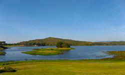
Mae Puem National Park Headquarters is located on the edge of Mae Puem Reservoir. From Phayao town, take Highway No. 1 (Phayao - Chiang Rai) for 17 kilometers to the milestone No. 754 Take a right at the intersection and continue for another 6 kilometers to the Mae Puem National Park Headquarters. The total distance covered is roughly 23 kilometers.
- National Park Ranger Station Mo Po No. 1 (Pa Daeng Ngam)
- National Park Ranger Station Mo Po No. 2 (Huai Phaya Kao)
- National Park Ranger Station Mo Po No. 3 (Huai Luang)
- Non Reserve

