Nanthaburi National Park (under gazetting)
Contact Location : Nanthaburi National Park, P.O. Box 3, Tha Wang Pha District, Nan Province 55140
Telephone Number : (+66) 6 5416 8853
Email : nanthaburi_np13@hotmail.com
Facebook : Nanthaburi National park
Information
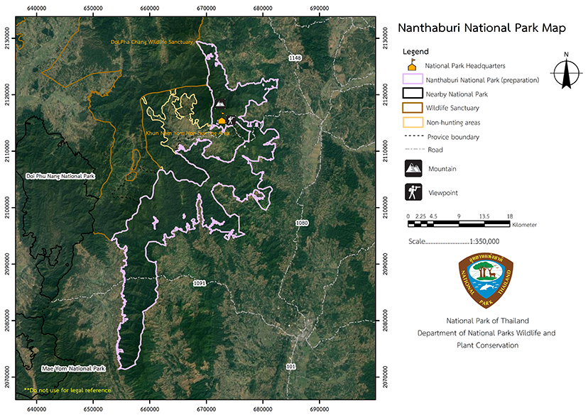
The Nanthaburi National Park is a natural resource-filled forest that spans the districts of Tha Wang Pha, Mueang, and Ban Luang District in Nan Province. The area is is biodiverse and home to many natural wonders that serve as tourist attractions. It covers an area of approximately 283,319 rai or 453 square kilometers. This area was historically a critical strategic point that fell under the influence of the Communist Party of Thailandresulting in violent conflict between government officials and communist terrorists (PPK), and enormous loss of life and property. It was previously known on the battlefield as "The Battle of Doi Pha Chi."
Background
In 1994, the Nan Provincial Forestry Department submitted a letter to the Royal Forest Department recognizing the value of the forest's resources and the abundance of wildlife and proposed to explore it in order to establish a national park that would protect the forest.Mr. Chakkrit Serinonchai, Forestry Officer Level 5 from the National Park Sub-Division, was issued an order 1657/2539 dated September 5th, 1996, by Royal Forest Department. To conduct a comprehensive survey of the Nam Yao-Nam Suat National Reserved Forest, the Tham Pha Tup National Reserved Forest, and adjacent forest areas in order to determine the suitability of establishing a National Park.
The survey results indicated that the area of the Nam Yao-Nam Suat National Reserved Forest in the Tan Chum, Si Phum, Saen Thong, Pha Thong and Pa Kha Sub-district, Tha Wang Pha District, Bo, Rueng, Sanian, Sauk, Thuem Tong, Chai Sathan and Pha Singh Sub-district, Mueang District and Ban Phi, Pa Kha Luang, Ban Fa and Suat Sub-district, Ban Luang District, Nan Province would create a good National Park The area is roughly 453 square kilometers in size and rich in natural resources and biodiversity. It also serves as a catchment area for a number of waterways.
Note : After paying the entrance fee to the National Park, please carry the receipt for inspection.
296,464.71 rai (474.3 square kilometers)
|
|
|
|
Nature trails ⇔ Visit Waterfall ⇔ Observe flowers/plant ⇔ Bird , butterfly ⇔ Stargazing ⇔ Camping
Welfare shop : -Non
Mobile phone signal:
National Park Headquarters area: AIS, TRUE, DTAC
|
|
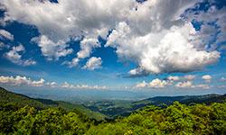
The topographical features are of a high fold mpuntains (complex mountain) range running north to south. It is located in the west of Nan province until the border with Laos, and has an altitude range between 300 and 1,710 meters above sea level. The mountains have a gradient that averages 50%, and the highest summit is "Doi Wao." The majority of rock formations are sedimentary rocks which were formed during the Mesozoic, Paleozoic, and Neozoic eras. In addition there are igneous rocks scattered throughout the area. It is a catchment area for a number of creeks that the Nan and Yom Streams, including the Samun Stream, Samian Stream, Wow Stream, Yao Streamr, Phi Stream, Tuum Stream, Si Phan Stream, Salai Stream, Raphi Stream, and Khang Stream. |
|
The climate is that of a tropical monsoon, which is influenced by the southwest monsoon during the rainy season and the monsoon northeast in winter. It is divided into 3 seasons:
|
|
|
|
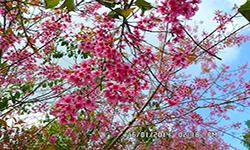
The area is covered by mixed deciduous forest in the west and dry evergreen forests in the west and north. There are some hill evergreen forests along the mountain summit at heights of 900 meters above sea level. In addition, there are deciduous dipterocarp forests, karst topography forests, and grasslands, with differing trees and ground plants in each type of forest. In the mixed deciduous forests there is Teak, Black Rosewood, Gamari, Beleric myrobalan, Anogeissus acuminata, Dendrocalamus strictus, Bambusa nutans, Gigantochloa albociliata Munro, and Tinwa Bamboo. The Dry Evergreen Forest is home to Dipterocarpus turbinatus, Hopea ferrea Laness, Hopea odorata, Xerospermum intermedium, Mangifera caloneura, Dalbergia assamica, Miliusa velutin, Mucuna pruiens, Calamus siamensis, and Shower Orchid. The hill evergreen forest include trees such as Schima wallichii, Podocarpus neriifolius, Betula alnoides, Quercus kingiana Craib, Eagle Wood, White Rose, Gordonia axillaris, Clidemia hirta, Frangula crenata, and Fingerroot. The deciduous dipterocarp forests are a source of Burma Sal, Burmese Sal, Hairy Keruing, Dipterocarpus tuberculatus, Vietnamosasa pusilla, Phoenix acaulis, Kaempferia marginata Carey, and Ampelocissus martini, Burma Padauk, Acacia catechu, Feroniella lucida, Imperata cylindrica, and Dactyloctenium aegyptium. These are found near water sources, as are Sunrise Willow, Hydrilla verticillate, Cyperus rotundus, Salvinia cucullate, and Wolffia globosa. The species of wild animals found in Nanthaburi National Park are the Indian Muntjac, Yellow-Throated Marten, Pig-Tailed Macaque, Rhesus Macaque, Common Palm Civet, Lesser Bamboo Rat, Sunda Pangolin, Sunda Flying Lemur, Burmese Hare, Callosciurus caniceps, Chinese Pipistrelle, and the Southeast Asian Shrew. There are also many birds, including the Crested Goshawk, Pompadour Green Pigeon, Black-Naped Oriole, Blue-Winged Leafbird, Black-Crested Bulbul, Spangled Drongo, Myna, as well as the Elongated Tortoise, Siamese Big-headed Terrapin, Clouded Monitor Lizard, Ground Lizard, Burmese Python, Chinese Rat Snake, Long-Tailed Skink, Blanford's Flying Lizard, Slender-Legged Bush Frog, Truncated-Snout Burrowing Frog, Malayan Giant Frog, Common Puddle Frog, and Flat-Headed Toad. Common Bluebottle, Common Birdwing and Common Rose In the rivers there are fish such as the Flying Barb, Barbodes gonionotus, Asian Swamp Eel, Clarias macrocephalus, Kissing Gourami, Bivalves, Pond Snail, Apple Snail , and Lanchester’s Freshwater Prawn. |
How to get there by car :
Take the provincial Highway No. 1080, the Nan-Thung Chang line, from Nan town and proceed to Tha Wang Pha District, where you should take Provincial Highway No. 1148, Tha Wang Pha-Song Khwae line, for approximately 1.5 kilometers. which is separated by Provincial Highway No. 1082, Na Nun-Sop Khun line. AscendTravelTravel to milestone No 27th and bear right for 500 meters to reach the National Park Headquarters.
- Non Agency
- Non Reserve


