Lan Sang National Park
Contact Location : Lan Sang National Park, Mae Tho Sub-district, Mueang Tak District, Tak Province 63000
Telephone Number : (+66) 5589 4640, (+66) 8 2890 1778, (+66) 6 2461 5120
Email : lansangtak14@gmail.com
Facebook : Lan Sang National Park
Information
According to legend, around 200 years ago, when the Lan Sang Forest was still fully fertile, King of Thonburi’s Army fought against an army from Chiang Mai for the second time. They were successful, and came to a halt at Ban Rahaeng, Mueang Tak district, where the Mon and Burmese either fled or surrendered. King of Thonburi had organized hisarmy to drive the Mon to Burma. One night, he became disoriented and despite ordering his soldiers to follow him, it was so dark that they blended into the dense forest . As it was pitch black, and the soldiers were exhausted it was difficult for them to keep up. However, a miracle occurred while those Thai soldiers rested, as to the sound of horses, a light flashed into the sky. The resting soldiers rushed to locate the lighted spot, and when they did, they discovered King Taksin the Great seated on a throne in the courtyard's center with his body emitting light. The Thai soldiers were stunned by this miracleand by 50 Burmese soldiers kneeling in worship and surrendering in front of him. As this event coincided with dawn, the area later became known as "Lan Sang."
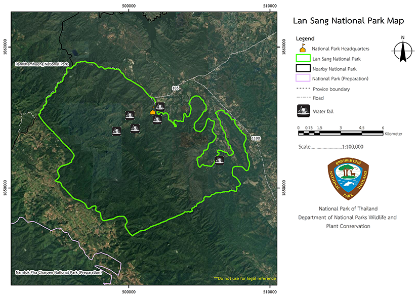
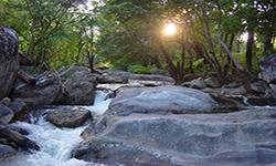
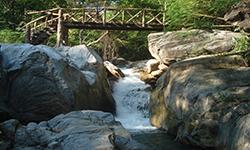
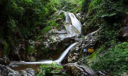
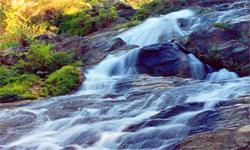
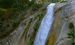
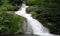
Lan Sang National Park is located in Tak Province's Mueang District. It comprises of a river areaand is densely forested, teeming with wildlife, and truly unique in nature. There is beautiful scenery, including numerous waterfalls and the famous"Lan Sang Waterfall", which is an ideal location for relaxation. Lan Sang National Park is approximately 65,000 rai or 104 square kilometers.
Background
Mr. Pradit Wanapitak, Director of Tak Regional Forest Office the governor of Tak ProvinceInitiated the process of establishing the Lan Sang Waterfall area as a forest park to serve as a recreation area for the public. Later that year, on October 7th, 1959, a Cabinet resolution designated 14 forests and Lan Sang, Tak Province, as potential National Parks. The Royal Forest Department began a preliminary survey of Lan Sang Forest in 1961and Lan Sang Forest was initially designated a national reserved forest by the Royal Forest Department.
Ministerial Regulation No. 342 (1968), dated October 25th, 1968, established this National Reserved Forest as a National Park under the National Reserved Forest Acts 1964. Mr. Surin Aramkul of the Lan Sang National Park reported the survey findings in the Lan Sang National Park letter No. Ko So 0708 (Lo So)/Special dated May 16th, 1974, and by Mr. Somyot Sukapiboon, a forestry Technical Officer Level 4 in the Lan Sang National Park letter No. Ko So 0808 (Lo Wo)/115 dated November 5th, 1976. This appears to be the natural state of the forest. Beautiful, with numerous waterfalls and an abundance of wildlife, it was suitable to be established as a National Park.
The National Park Division established Lan Sang Forest in Mae Tho Sub-district , Mueang District in Tak Province, as the 15th national park in 1979 under a decree announced in the Government Gazette, Volume 96, Part 80, dated May 14, 1979.
Note : After paying the entrance fee to the National Park, please carry the receipt for inspection.
65,000 rai (1040 square kilometers)
|
|
|
|
|
|
|
|
|
|
|
|
|
|
||
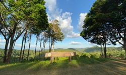
Nature trails ⇔ Mountain biking ⇔ Forest Viewpoint ⇔ Observe flowers/plant ⇔ Bird/Butterfly ⇔ Visit Waterfall ⇔ Stargazing⇔ Camping
How to get there by car :
From Bangkok, travel along Asian Highway No.1 (Asian Highway) until Tak Province, where you should turn left onto National Highway No.105 (Asian Route 2 Tak-Mae Sot). After milestone No. 12 bear left at the sign for Lan Sang National Park and continue on the road for approximately 1 kilometer to reach the headquarters Approximately 430 kilometers from Bangkok.
How to get there by bus
Take a bus from Bangkok Northern Bus Terminal on the Bangkok-Tak Line and alight at Tak Transport Station Then continue on the Tak-Mae Sot route by van or bus, informing the bus driver that visitors wish to visit Lan Sang National Park at milestone No. 12 to the left-hand side. From there walk to the National Park Headquarters, which is 1 kilometer, or 2 kilometers to the visitor center, lodging, camping, and restaurants. The paved road into the National Park is pleasant and not too steep, and there is waterfall you can wade in.
Welfare shop : 08.30 - 16:30 hrs.
Mobile phone signal:
National Park Headquarters area: AIS, DTAC, TRUE
|
|
The topographical features are of fold mountains (complex mountain) with Thanon Thongchai Mountain range located in the National Park's center. The mountains run north to southeast and Um Yom, at approximately 1,065 meters above sea level, is the highest summit. Almost all of the National Park ismountainous with sparsely forested areas. Slopes are higher on the southwestward side rather than northeastward, with the lowest point in the southwest is 910 meters above sea level, while the lowest point in the northeast is only 210 meters. This geomorphology, which is wider than the low slopes in the southwest, creates a rain-shadow zone along the National Park's northeast boundary. The Lan Sang National Park area has experienced geological changes over three discernible phases. The first is the period of sediment deposition, which occurred when the area was on a continent's edge, for approximately a thousand years or more during the second Precambrian Era. After that, two significant changes in topographic morphology occurred. The first was the deflection or curvature of the Earth's crust, which probably occurred during the Carboniferous period (approximately 350 million years ago). This resulted in stratification which widened the continent's edge into the sea. The third epoch is marked by significant change when pressure changed the rock by folding and twisting, resulting in the formation of high mountains and ravines. This geological change resulted in the formation of distinct rock types within the National Park. These wonderful rocks arere spread out over a large area with metamorphic rocks such as marble and limestone incorporated into the rock formations. Sedimentary rocks of the shale type are located in some regions near the surface, especially near the Lan Sang waterfall. Each rock contains material that is at least 350 million years old. |
|
Lan Sang National Park’s climate is divided into three seasons: the rainy season, which runs from May to October, the winter season, which runs from November to January, and the summer season, which runs from February to April. The temperature can get very high in the park, and has reached a maximum of 43 degrees Celsius, with a minimum temperature of 7 degrees Celsius also noted.
|
|
|
|
Lan Sang National Park is home to a variety of forests, including a dry evergreen forest in the valleys and along creek areas with Tetrameles nudiflora, Irvingia malayana, Hopea ferrea and hill evergreen forest, which is found in patches in the high mountains near the watershed. Lithocarpus cerifer and Schima wallichii are the two most common plants in the coniferous forest (pine forest), which is located approximately 700 meters above sea level. Merkus Pine (Pinus merkusii Jungh & De Vriese) was discovered mixed in with Burma Sal, Burmese Sal, Hairy Keruing, and Dipterocarpus tuberculatus, all of which were populated with a variety of species. The mixed deciduous forest is not that densely forested but includes with Xylia xylocarpa, Burma Padauk, Black Rosewood, Teak, Orchid Tree, Croton oblongifolius, Dalbergia dongnaiensis, Schleichera oleosa, Chebulic myrobalans, and numerous bamboo species. The are small patches of deciduous dipterocarp forest found on hilltops and outcrops, and that is dominated by Burma Sal, Burmese Sal, and Phyllanthus emblica. |
How to get there by car :
From Bangkok, travel along Asian Highway No.1 (Asian Highway) until Tak Province, where you should turn left onto National Highway No.105 (Asian Route 2 Tak-Mae Sot). After milestone No. 12 bear left at the sign for Lan Sang National Park and continue on the road for approximately 1 kilometer to reach the headquarters Approximately 430 kilometers from Bangkok.
How to get there by bus
Take a bus from Bangkok Northern Bus Terminal on the Bangkok-Tak Line and alight at Tak Transport Station Then continue on the Tak-Mae Sot route by van or bus, informing the bus driver that visitors wish to visit Lan Sang National Park at milestone No. 12 to the left-hand side. From there walk to the National Park Headquarters, which is 1 kilometer, or 2 kilometers to the visitor center, lodging, camping, and restaurants. The paved road into the National Park is pleasant and not too steep, and there is waterfall you can wade in.
- National Park Ranger Station Lo So No. 1 (Um-Yom)
- National Park Ranger Station Lo So No. 2 (Tha Le)
- National Park Ranger Station Lo So No. 3 (Doi Pha Daeng)
- Accommodation - Lan Sang 101 (Phrai Phana)
- Accommodation - Lan Sang 104 (Wanakorn)
- Accommodation - Lan Sang 204/2 (Ing Doi)
- Accommodation - Lan Sang 204/3 (Ing Doi)
- Accommodation - Lan Sang 204/1 (Ing Doi)
- Accommodation - Lan Sang 205 (Khun Dong)
- Accommodation - Lan Sang 206 (Kiat Lan Sang)

