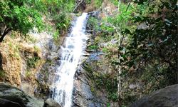
Mae Moei National Park
Contact Location : Mae Moei National Park, Mae Song Sub-district, Tha Song Yang District, Tak Province 63150
Telephone Number : (+66) 6 1352 3703
Email : maemoei@hotmail.com
Facebook : Mae Moei National Park
Information
Mae Moei National Park was established in 1989 under the National Park Division, Royal Forest Department, Ministry of Agriculture and Cooperatives. It is called Mae Moei National Park due to the presence of the Moei River, which separates Thailand and Burma. It spans nearly 50 kilometers from west to south, and is peculiar as it flows from the south to the north. The area surveyed was designated as a National Park and includes Tham Mae U Su Forest Park and portions of the Tha Song Yang National Reserved Forest. There is a forest on a mountain range called Thanon Thongchai that stretches from Mae Tan sub-district through Mae Song sub-district to Tha Song Yang District in Tak Province and it covers an area of approximately 713,750 rai or 1,142 square kilometers.
Background
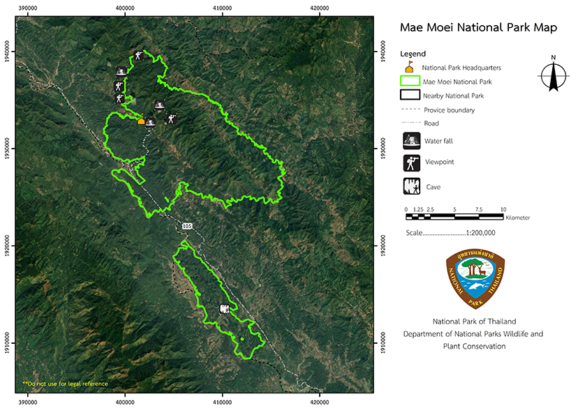
Mae Moei National Park was established as a National Park defining the area of the Tha Song Yang National Reserved Forest in Mae Song and Mae U Su Sub-district, Tha Song Yang District, Tak Province, published in the Government Gazette, Volume 116, Section 40 Ko, dated May 20, 1999, with a total area of approximately 115,800 rai or 185 square kilometers. There was originally a Tham Mae U Su Forest Park in the Mae U Su Sub-district area, which is north of the Moei River toward Pong Creek and Mueang Creek. The east borders Phu Sa Creek and Pho Noko Creek along the Mae Sot-Mae Sariang Highway, while the west borders the Moei River in the Mae Song Sub-district area. The Tha Song Yang National Reserved Forest extends north to the Mae Salit-Omkoi Highway, south to the Mae Song Stream and the Mae Sot-Mae Sariang Highway, and east to Mae Lui Creek and the Mae Song Stream.
Note : After paying the entrance fee to the National Park, please carry the receipt for inspection.
115,800 rai (185.2 square kilometers)
|
|
|
|
|
|
|
|
|
|
|
|
|
|
|
|
Nature trails ⇔ Visit Waterfall ⇔ Cave exploration/Geological condition ⇔ Observe flowers/plant ⇔ Bird , Butterfly , Stargazing ⇔ Camping
Welfare shop : 08.00 - 16:30 hrs.
Mobile phone signal:
National Park Headquarters area: AIS
|
|
The majority of complex mountain landscape in nature, with very few plains. The average elevation is 680 meters above sea level, while the highest point is 1,250 meters and totally encircled by forest However, there are few large trees. It serves as catchment areafor the Mae Song Stream, Mae U Su Stream, Mae Salit Luang Stream, and Moei river. |
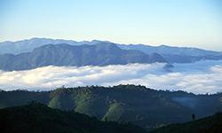
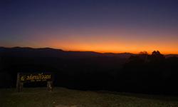
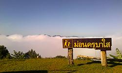
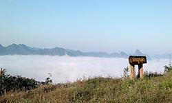
During the rainy season, which lasts from May to October, there may be heavy rain, which makes it unsuitable for tourists. Summer weather is quite pleasant and it becomes bitterly cold in the winter, which is the optimal time to see the mists. The southwest monsoon blows in from the Andaman Sea and has an effect on the Mae Moei National Park area, which is enhanced as the location is in front of a mountain, resulting in stronger monsoon winds than in other areas. The rainy season, which lasts from May to October, is unsuitable for tourism. Summer weather is quite pleasant but it can be quite cold in the winter by Thai standards, though that is the best time to watch the sea of mist.
|
|
|
|
The Mae Moei National Park areas have a variety of ecosystems because they are located in a dry evergreen forest and broad valleys at an elevation of approximately 300 - 700 meters above sea level. Common trees include Hopea ferrea Laness, Lagerstroemia calyculata Kurz, Tetrameles, Syzygium aqueum, Anisoptera costata, Dipterocarpus, Terminalia alata Heyne, and Beleric myrobalan, with ground plants including bamboos, rattan, and ferns. There is a tropical rain forest at an elevation of 400 - 1,200 meters above sea level, particularly in the valley and along the stream. This is a dense forest composed of Dipterocarpus, Hopea ferrea Laness, Cinnamon, Baccaurea ramiflora Lour, Queen's Flower, Livistona speciosa Kurz, Mitragyna diversifolia, Duabanga grandiflora Walp. Calameae, Caryota uens, Spiny Bamboo, Dendrocalamus hamiltonii, Bambusa bambos, ferns, cycads, and ginger, galangal, and other ginger family plants comprise the lower ground vegetation. Mixed deciduous forests are primarily found 300-600 meters above sea level along streams and valleys. They include trees such as Teak, Xylia xylocarpa, Burma Padauk, Black Rosewood, Sindora siamensis Teijsm, Tamalin, Yellow Millettia, Thai Bungor, Vitex pinnata, and Tomentose wrightia. Deciduous dipterocarp forest is frequently found on hills, ridges, and foothills, particularly in areas with outcrops. They are home to Burma Sal, Burmese Sal, Hairy Keruing, Dipterocarpus tuberculatus, Dillenia scabrella, Phyllanthus emblica, Morinda coreia Buch.-Ham, Morinda coreia Ham, Morinda angustifolia Roxb, and Cratoxylum formosum (Jacq.). Mae Moei National Park has a sparse wildlife population as habitat has been destroyed and human activity such as hunting has led to reduced numbers, As a result, the animals that have survived are small in size and visitors rarely encounter large animals. However, some that might be observed include bears, wild boars, monkeys, gibbons, Indian Muntjac, Mouse Deer, bears, wild boars, monkeys, Gibbons, Langur, Slow Lorises, Common Palm Civet, Civet Porcupine, Burmese Hare, Squirrels, and birds such as the Red Junglefowl, Hornbills, Myna, Indian Roller, White-Crested Laughing Thrush, Grey-Capped Emerald Dove. There are also large snakes including the Cobra, King Cobra, Reticulated Python, Rat Snake, and reptiles such as the Clouded Monitor Lizard, Ground Lizard, Chameleon, Soft-Shelled Turtle, and numerous frogs. |
How to get there by car :
• From Tak, travel approximately 164 kilometers to Mae Sot and Tha Song Yang District. Take Highway No. 105 (Mae Sot-Mae Sariang) for approximately 33 kilometers from Tha Song Yang District before turning right at the Mae Salid Luang intersection. Proceed approximately 11 kilometers along Provincial Highway No. 1267 (Mae Salid - Omkoi) noting that the route is quite steep and ends at the Mae Moei National Park Headquarters.
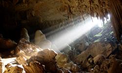
• Mae U Su Cave is located along National Highway No. 105 approximately 13 kilometers from Tha Song Yang District (Mae Sot-Mae Sariang). Take the left onto The Office of Accelerated Rural Development Road, passing BanTenoko. This road will take you 2 kilometers to Mae U Su Cave.
- National Park Ranger Station Mo Mo No. 1 (Mae Song)
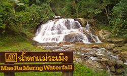
- National Park Ranger Station Mo Mo No. 2 (Mae Ramoeng)
- Accommodation - Mae Moei 103 (Khu Phrueksa)
- Accommodation - Mae Moei 101 (Phrai Phiman)

