Namtok Pha Charoen National Park (under gazetting)
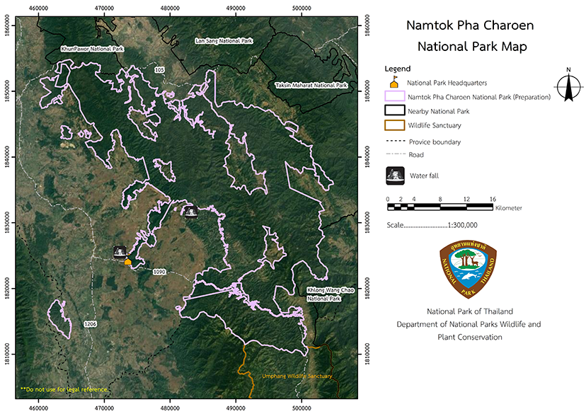
Contact Location : Namtok Pha Charoen National Park (under gazetting), Moo 6, Mae Sot-Umphang Road, milestone No. 40, Chong Khaep Sub-district, Phop Phra District, Tak Province 63160
Telephone Number : (+66) 5503 0178
Email : pacharoen-37@hotmail.com
Facebook : Namtok Phacharoen National Park
Information
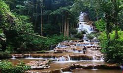
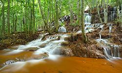
Pha Charoen Waterfall is a magnificent limestone waterfall with numerous smallercascades. It is located near the town of Mae Sotnear the highway so it is a popular spot for relaxation. It is managed by the Namtok Pha Charoen National Park and encompasses the fertile forests of Mae Sot and Phop Phra District in Tak Province. The area is characterized by a complex mountain landscape, which acts as Mae Lamao Creek watershed, and it occupies an area of approximately 534,375 rai or 855 square kilometers.
Background
The Namtok Pha Charoen Forest Park was established by the National Forest Division of the Royal Forest Department after consideration from February 1992 onwards. The forested areas in the Mae Sot National Reserved Forest area, Phop Phra District in Tak in order to stop them being destroyed and to manage the sizable collection of natural gifts. Mr. Tarakorn Udomtham, Forestry Officer Lavel5 National Park Division, by the Royal Forest Department’s order number 937/2536, was assigned to be the superintendent of Namtok Pha Charoen Forest Park and conducted additional surveys and established forest areas surrounding Namtok Pha Charoen Forest Park. Tak Province and nearby forest areas were deemed suitable for a National Park that would include the areas of Mae Lamao National Reserved Forest, Mae Sot National Reserved Forest, Chong Khaep National Reserved Forest, and Mae Kon Ken Forest.
From the minutes of the National Park Board meeting on November 8, 1994, it was decided to establish the Namtok Pha Charoen Forest Park in Tak Province as Namtok Pha Charoen National Park which would include the areas of Dan Mae Lamao, Phawo, That Pha Daeng, Mae Ku, Mae Tao and Maha Wan Sub-district, Mae Sot District, Chong Khaep, Phop Phra and Khiri Rat Sub-district, Phop Phra District, Tak Province. There is a complete forest and natural beauty features that make this area an excellent candidate for establishment as a National Park.
Later on, the Royal Forest Department directed that additional areas to be explored to establish a national park by allocating all forest areas within the Mae Sot theonal Reserved Forest to the park. Namtok Pha Charoen National Park was established and has a total area of 534,375 rai or 855 square kilometers and is spread across the Dan Mae Lamao, Phawo, Phra That Pha Daeng, Mae Ku, Mae Tao and Maha Wan Sub-district, Mae Sot District, Chong Khaep, Phop Phra and Khiri Rat Sub-district, Prop Phra District, Tak Province. The National Park Board Meeting No. 4/2537 on November 8, 199” approved the establishment of a "National Park" in principle.
Note : After paying the entrance fee to the National Park, please carry the receipt for inspection.
481,550.07 rai
|
|
|
|
|
|
||
Nature trails ⇔ Visit Waterfall ⇔ Stargazing ⇔ Mineral water bathing ⇔ Camping
Welfare shop : 08.00 - 16:30 hrs.
Mobile phone signal:
National Park Headquarters area: AIS, DTAC,TRUE
|
|
The complex mountain landscape that form the park run north-south. There is a river, and also a small plain. Doi Pa Tan, Doi Den Krathing, Doi Luang, and Doi Mak Muen, Khao Lom Pak Yen are prominent summits in the area, and they are all part of Thanon Thongchai Mountain range. The peak is in the south, rising to 1,765 meters above mean sea level. The region is characterized by southwest monsoons which cause rain throughout the year. As such, it is a catchment area of the Mae Lamao Creek, and Um Pium Creek, which both flow in a south-to-north direction. Numerous tributaries originate in this region and flow into the agricultural areas of Mae Sot and Phop Phra District, including Mae Sot Creek, Mae Dao Creek, and Phak Kut Creek. |
|
As a result of its location it is subject to the southwest monsoon but because of its altitude it is mostly cool. It has three distinct seasons: summer, which runs from March to May, rainy season, which runs from June to October, and winter, which runs from November to February. During the summer, the weather is more pleasant tha’ other areas of Thailand, owing to the location's elevation and the prevailing wind. Winter is quite cold, with minimums of 6 degrees Celsius. The rainy season is characterized by frequent and persistent rain throughout the season with annual rainfall between 1,500 and 2,000 millimeters.
|
|
|
|
Natural forest conditionthee still intact in the National Park, with the majority of the area being covered with are mixed deciduous forest, but some are coniferous forest (pine forest) too. The most common trees are Teak, Dipterocarpus, Burma Padauk, Pinus kesiya Royle ex Gordon, Mangifera caloneura, Burma Sal, Burmese Sal, Hairy Keruing, Anogeissus acuminata, Hopea odorata, Black Rosewood, Sindora siamensis Teijsm, Xylia xylocarpa, and Toona ciliata. Common ground plants include ferns, Elephant Ear, and Curcuma sessilis Gage.
|
How to get there by car :
From downtown Tak, take Highway No. 12 Mae Sot intersection to the Mae Sot District for 80 kilometers until visitors reach the Mae Sot Circle intersection. From there, proceed approximately 40 kilometers on National Highway No. 1090 (Mae Sot-Um Phang route) (the entrance is at milestone No. 40). After approximately 700 meters, bear left to reach the Namtok Pha Charoen National Park Headquarters.
How to get there by bus :
Traveling by bus from Bangkok-Mae Sot via Highway No. 105 north of Highway No. 1090, to thewest and south there are various tourist attractions in the Namtok Pha Charoen National Park.
- National Park Ranger Station No Pho No. 1 (Pa Wai)
- National Park Ranger Station No Pho No. 2 (Bo Nam Ron)
- National Park Ranger Station No Pho No. 3 (Huai Ya U)
- Non Reserve


