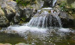
Si Lanna National Park
Contact Location : Si Lanna National Park, Ban Pao Sub-district, Mae Taeng District, Chiang Mai Province 50150
Telephone Number : (+66) 5347 9079, (+66) 5347 9090
Email : npsilanna@hotmail.com, venuscat@windowslive.com
Facebook : Si Lanna National Park
Information
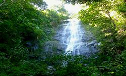
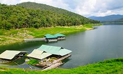
Si Lanna National Park is divided into three administrative districts: Mae Taeng, Chiang Dao, and Phrao District, all of which are in Chiang Mai Province. It s characterized by fertile forest conditions and it is a significant catchment area for the upper Ping River, as well as diverse wildlife and stunning natural features such as the Mon Hin Lai Waterfall and Khuean Mae Ngat Sombun Chon Reservoir. It is one of five National Parks being established as part of the National Park Establishment Project on the auspicious occasion of the 5th cycle on December 5th, 1987, in honor of His Majesty the King, with an area of approximately 878,750 rai or 1,406 square kilometers.
Background
Initially, according to the Cabinet Resolution dated January 14th, 1975, Chiang Dao Forest, Mae Ngat Forest, and Mae Taeng Forest were classified as Watershed class 1, and closed forest according to the Cabinet Resolution dated January 9th, 1979. Mr. Santi SiKularb, Forestry Officer Level 4, was directed by the National Park Division’s order No. 280/2524, dated March 6th, 1981, to explore and collect information about the forest area in Doi Wiang Pha, Chiang Mai Provincein accordance to Mr. Arun Sumruatkit‘s letter to the Director-General of the Royal Forest Department dated January 14th, 1981.
Later that year, in January, 1983, the National Park Division issued order No. 1/2526, dated January 3rd, 1983, to Mr. Maitree Anukulruangkit, Forestry Officer Level 3, for the purpose of exploring the Doi Wiang Pha area and around Mon Hin Lai Waterfall in Chiang Mai Province, to gather additional information in establishing a National Park. On February 20, 1985, the Royal Forest Department issued a letter No. 293/2528 ordering Mr. Arun Liaowanawat, Forestry Officer Level 4, to investigate for establishing the Mae Kong Forest, Mae Ngat Forest, Chiang Dao Forest, and Fang Forest in Chiang Mai Province as a National Park. According to a report attached to a letter No. Ko So 0713 (Do Ko)/1, dated December 9th, 1985, the survey area was in Mae Taeng Forest (some parts), Mae Ngat Forest (some parts), and Chiang Dao Forest (some parts). The forests are in natural state and suitable for the establishment as a National Park.
The National Park Division Royal Forest Department Board Meeting No. 2/2529 approved the establishment of a forest area above the Khuean Mae Ngat Sombun Chon Reservoir in Chiang Mai Province as a National Park on March 18th,1986 to honor of His Majesty on the occasion of the 5th cycle celebration. On November 9th, 1986, His Excellency General Prem Tinsulanonda, the Prime Minister, visited Si Lanna National Park in Chiang Mai Province and agreed to establish “ National Park. " Please take good care of the forest and do not allow it to be invaded so that the beautiful natural forest conditions and environment are lost,” he ordered and warned.
which the Cabinet has already recognized for the purpose of glorifying the National Park establishment project. According to the Ministerial Secretariat letter No. 0202/21487 dated November 25th, 1987 ordering the National Park Division, under the Royal Forest Department to issue a royal decree declaring the area of Chiang Dao Forest, Mae Ngat Forest, and Mae Taeng Forest in the Ping Khong, Chiang Dao and Mae Na Sub-district, Chiang Dao District, San Sai, Pa Nai, Ban Pong, Nam Phrae, Pa Tum, Mae Waen, Mae Pang and Long Khot Sub-district, Phrao District, Ban Pao, Cho Lae and Mae Ho Phra Sub-district, Mae Taeng District in Chiang Mai Province to be a National Park according to the National Park Act 1961, which was announced in the Government Gazette, Volume 106, Section 120, dated August 1st, 1989, becoming the 60th National Park with the second-largest area in the North or the 8th largest in the country.
Note : After paying the entrance fee to the National Park, please carry the receipt for inspection.
878,557.90 rai (1405.6 square kilometers)
|
|
|
|
|
|
Nature trails ⇔ Trekking ⇔ Visit Waterfall ⇔ Geological condition ⇔ Bird , butterfly , wildlife watching activities ⇔ Stargazing ⇔ Mountain biking ⇔ Take a boat ride or a paddle
Welfare shop : 08.30 - 17:30 hrs.
Mobile phone signal:
1. National Park Headquarters area: AIS, TRUE, DTAC
2. Mae Ngat Sombun Chon Dam area: AIS, TRUE, DTAC
3. The area in Mae Ngat Sombun Chon Dam: AIS
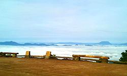
4. Doi Mon Lan Summit: AIS, TRUE, DTAC
5. Doi Mon Lan service center area: AIS, TRUE, DTAC
6. Area of the National Park Ranger Station No. So Lo 8, Doi Mon Lan: AIS
|
|
The topography is dominated by Khao Phi Pan Nam, which includes Doi Wiang Pha, Doi Luang, Doi Pui, Doi Panwa, Doi Pha Kiang, Doi Khun Kon, Doi Mae Ra Ngong, Doi Mae Ngae, and Doi Ton. The elevation is between 400 and1,718 meters above sea level, with Doi Chom Hot being’the park's highest summit. It is acatchment area for the upper Ping River, and includes streams from numerous creeks that flow into the Mae Ngat Sombun Chon Reservoir. The upper Ping River is comprised of the Nom Mae Ngat, Nam Mae Kon, Nam Mae Wan, Nam Mae Sa Ruam, Nam Mae That, and Nam Mae Khot.
|
|
The climate in the Si Lanna National Park area is similar to that of the tropics, with three distinct seasons; the rainy season runs from June to October, and annually there is an average rainfall of 1,156 mm. The winter season runs from November to February and is characterized by northeast monsoons and the hot Summer season begins in March and lasts until May. Throughout the year, the average temperature is 26 degrees Celsius.
|
|
|
|
The plant community in Si Lanna National Park is comprised of a Deciduous dipterocarp forest is an ecosystem that encompasses the majority of the National Park. Merkus Pine (Pinus merkusii Jungh & De Vriese), and Khasiya Pine (Pinus kesiya Royle ex Gordon) are found in deciduous deciduous forests at an elevation of 200 to1200 meters above sea level. Burma Sal, Burmese Sal, Hairy Keruing, Dipterocarpus tuberculatus, Melanorrhoea ustata, Schleichera oleosa, Quercus kerrii Craib, and Symplocos cochinchinensis are among the plants discovered, with lower-ground plants including Curcuma sessilis Gage, Selaginella argentea Spring, Big Lygodium, Maidenhair Fern, Dendrolobium triangulare, Leea indica Merr, Smilax lanceifolia, Dendrobium aphyllum, Dendrobium albosanguineum, and Doritis pulcherrima others. Mixed deciduous forests can be found in the valley and along the creek, and they include Teak, Protium serratum, Terminalia alata Heyne, Schleichera oleosa, Strychnos nux-vomica, Paraderris elliptica, Croton poilanei Gagnep, White Myrtle, Colona flagrocarpa, Dendrocalamus strictus, Tinwa Bamboo, Bambusa nutans, Gigantochloa albociliat Turmeric, ferns, Molineria latifolia, Indian Head Ginger, Amorphophallus paeoniifolius, and other lower ground plants Throughout the year, dry evergreen forests can be found in moist trenches and valleys, and they include Dipterocarpus turbinatus, Antidesma sootepense Craib, Lagerstroemia duperreana Pierre, Dillenia indica, Diospyros montana, Knema furfuracea, Bambusa polymorpha Munro, Dendrocalamus hamiltonii, and Sugar Palm. The lower ground is dominated by plants such as Paraderris elliptica, Millettia extensa Benth, Hultholia mimosoides, Spatholobus parviflorus, Uvaria dulcis Dunal, Amalocalyx microlobus Pierre, Calameae, and Alpinia malaccensis. Coniferous forests (Pine Forest) are found along the ridges at an altitude over 800 meters above sea level, and they include Merkus Pine (Pinus merkusii Jungh & De Vriese), Khasiya Pine (Pinus kesiya Royle ex Gordon), Craibiodendron stellatum, Indo-Chinese Tanoak, Buchanania latifolia, Vaccinium sprengelii, and Wendlandia tinctoria are just a few of the plants discovered. Lower ground vegetation includes Melastoma malabathricum, Inula cappa, Big Lygodium, and Maidenhair Fern. Hill evergreen forest covers a moist and cool area at a height of about 1,000 meters above sea level and include Schima wallichii, Siam Benzoin, Beilschmiedia gammieana, Syzygium albiflorum, Melanorrhoea pilosa, Glochidion sphaerogynum, Lithocarpus fenestratus, Lithocarpus thomsonii, Archidendron clypearia, as were lower ground plants such as Curcuma sessilis Gage, Dunbaria longiracemosa, The wild animals in the park include the Indian Muntjac, Hoary Bamboo Rat, Asiatic Brush–Tailed Porcupine, Dhole, Viverricula indica, Masked Palm Civet, Jungle Cats, Burmese ’ares, Finlayson's Squirrel, Oriental House Rat, Greater Short-Nosed Fruit Bat, Greater Long-Tongued Fruit Bat, Rufous Treepie, Racket-Tailed Treepie, Jungle Crow, Black-Naped monarch, Common Lora, Vivid Niltava, The White- Rumped Shama, Common Stonechat, Common Tailorbird, Two-Barred Leaf Warbler, Buff-Breasted Babbler, Elaphe radiata, Indo-Chinese Rat Snake, Spotted Ground Gecko, Tokay Gecko, Draco fimbriatus, Red-Eared Frog, Common Puddle Frog, Asiatic Burrowin’ Frog, Berdmore' s Chorus Frog, Common Asian Toad, and Dwarf Bush Frog, In the watershed area there is the Mae Ngat Sombun Chon Reservoir which is a habitat for a variety of aquatic and wildlife species, such as the Common Kingfisher, Lesser Whistling Duck, Rugosed Frog, Indian Rice Frog, Inornate Froglet, Goldfin Tinfoil Barb, Siames River Abramine, Flying Barb, Greater Brook Carp, Wrestling Halfbeak, Goby, Jullien’s Mud Carp, an’ many more. |
How to get there by car :
Si Lanna National Park can be reached via four routes.
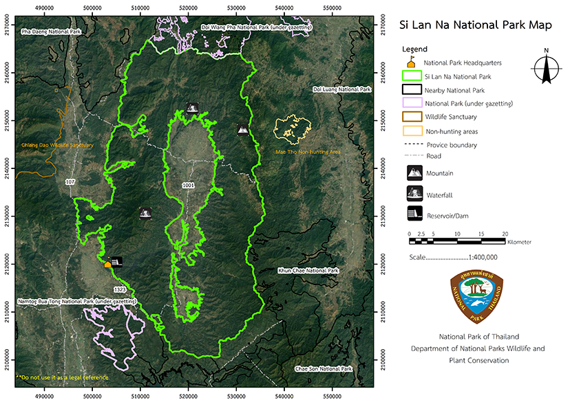
• Highway No.107 Chiang Mai-Fang Line follows the Ping River, passing through Chiang Dao Forest on the left. It is a well-maintained asphalt road.
• Highway No. 1001, which connects Chiang Mai and Phrao via Mae Taeng and Mae Ngat forests, is a well-maintained asphalt road. milestone No. 79th, Ban Pradu is located in Mae Pang Sub-district, Phrao District in Chiang Mai Province. The area surrounding the National Park Headquarters and the Mon Hin Lai Waterfall is open to visitors.• Highway No. 1150 The Ping Khong, Chiang Dao-Phrao Highway is a detour from Highway No. 107 that passes through the upper Chiang Dao and upper Mae Ngat forests. The gravel road is well-maintained.
• Highway No. 1150, the Chiang Rai route, passes through Doi Saket in Chiang Mai Province and on to Wiang Pa Pao District in Chiang Rai Province. The asphalt roads are in excellent condition.
- National Park Ranger Station So Lo No. 1 (Mae Phaeng - Mon Hin Lai)
- National Park Ranger Station So Lo No. 2 (Pang Mayao)
- National Park Ranger Station So Lo No. 3 (Ban On)
- National Park Ranger Station So Lo No. 4 (Huai San)
- National Park Ranger Station So Lo No. 5 (Mae Ra Ngong)
- National Park Ranger Station So Lo No. 6 (Huai Kum)
- National Park Ranger Station So Lo No. 7 (Huai Pui)
-

