Khun Khan National Park
Contact Location : Khun Khan National Park, Moo 1, Mae Sap Sub-district, Samoeng District, Chiang Mai Province 50250
Telephone Number : (+66) 5200 0410
Email : Khunkhan_np@hotmail.com
Facebook : -
Information
Khun Khan National Park is located within the Samoeng National Reserved Forest, while Mae Chaem Forest is located within the Mae Sap, Bo Kaeo, Samoeng Nuea and Samoeng Tai Sub-district, Samoeng District in Chiang Mai Province.
Background
A survey was conducted by the Chiang Mai Regional Forest Office todetermine that the Samoeng National Reserved Forest Area at Samoeng District in Chiang Mai Province has fertile forest conditions. There are numerous natural features, including waterfalls, cliffs, and caves, that the Royal Forest Department should be aware of and consider. As a result, the Royal Forest Department issued order 934/2536and on June 7th 1993, Mr. Surasak Wuttin was appointed as Forestry Officer Level 5 National Park Division to conduct a survey. preparing for the establishment of a National Park. "Khun Khan National Park"
The survey established that the Khun Khan National Park covers approximately 708 square kilometers, which is approximately the size of the Samoeng National Reserved Forest and Mae Cheam Forest Mae Sap and Bo Kaeo, Samoeng Nuea and Samoeng Tai Sub-district, Samoeng District and Ban Chan, Mae Na Chan Sub-district, and Mae Chaem District in Chiang Mai Province. On May 18th, 1995, Chiang Mai Province was reported to the National Park Division and considered by the National Park Board. The meeting concluded that the survey area was expanded to include the site in response to complaints about the northern National Park's 13 locations. As a result of the meeting's conclusion, "Allow the Khun Khan National Park's Superintendent to take corrective action. The public complained about 13 National Parks that initially encroached on people's arable land."
Khun Khan National Park's Superintendent joined the consideration process to resolve the people's problems, and on April 29th, 1997, the Cabinet approved the outcome of negotiations on the forest and land issues. In the case of conservation forests in the north (Area of the National Park, wildlife sanctuary, and Watershed class 1 area) they wer enot included in the Khun Khan National Park. A clarification meeting with the Sub-district Council to resolve issues in the National Park area with the the National Park's residential areas and people's farming areas chief among discussions The chief village managers and members of the Sub-district administrative Organization jointly defined the National Park's boundary in order to condense the area to approximately 150,000 rai (240 square kilometers.)
Note : After paying the entrance fee to the National Park, please carry the receipt for inspection.
129,959.00 rai (207.9 square kilometers)
|
|
|
|
|
|
Nature trails ⇔ Trekking ⇔ visit Waterfall ⇔ geological condition ⇔ Observe flowers/plant ⇔ Bird , butterfly , wildlife watching activities ⇔ stargazing ⇔ Mountain biking ⇔ Rafting ⇔ Take a boat ride or a paddle
Welfare shop : Non
National Park Headquarters : AIS
|
|
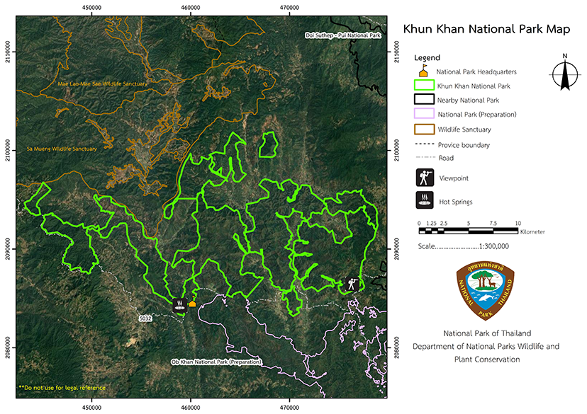
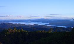
Khun Khan National Park is located between latitude of 18 degrees 46 minutes to 19 degrees 02 minutes north and longitude of 98 degrees 23 minutes to 98 degrees 49 minutes is bordered to the north by the Samoeng Wildlife Sanctuary, Yang Moen Sub-district Samoeng District, Chiang Mai Province, in thesouth is the preparing area for the announcement of Op Khan National Park, Bo Kaeo and Mae Sap Sub-distrcits, Samoeng District, Chiang Mai Province, and the Mae Chaem National Reserved Forest, Mae Na Chon Sub-district, Mae Chaem District, Chiang Mai Province. The East is adjacent to the Mae Rim District, Pong Yaeng and Mae Ram Sub-district, Mae Rim District in Chiang Mai Province and the west is adjacent to Mae Chaem National Reserved Forest, Mae Daet and Mae Na Chon Sub-district, Mae Chaem District, Chiang Mai Province. The majority of area is a fold mountain (complex mountain) structure with elevations ranging between 500 - 1,708 meters above sea level. The highest summit is Doi Pung Kia at 1,708 meters which is the headwater for both the Mae Khan and Mae Chaem rivers, both of which are triburaries of the Ping River. |
|
There is a cool climate all year round with an average high of 28 degrees Celsius. The average low temperature is 18 degrees Celsius, with an overall average of 23 degrees Celsius. The average annual rainfall is 1,380 millimeters.
|
|
|
|
The National Park's forests are made up of five distinct forest types: Coniferous Forest (Pine Forest) is generally found at the mountain summit, between 700 - 1,300 meters, which consists of the Merkus Pine (Pinus merkusii Jungh & De Vriese), Khasiya Pine (Pinus kesiya Royle ex Gordon), Quercus semiserrata, Burmese Sal, and Hairy Keruing, among others. Deciduous dipterocarp forests are found primarily in lower reachesand include plants such as Burma Sal, Burmese Sal, Hairy Keruing, Dipterocarpus tuberculatus, Merkus Pine (Pinus merkusii Jungh & De Vriese), Spondias pinnata, Lagerstroemia venusta, and Orchid Tree. Numerous wild animals inhabit the area, including Barking Deer, Wild Boar, Red Junglefowl, Porcupine, Dhole, Golden Jackal, Sunda Pangolin, Kloss's Mole, Squirrels, Burmese Hare, Sunda Flying Lemurs, Bats, Common Palm Civet, Mongoose, Monkeys, Gibbons, Tigers, Serows, and Great Hornbills among others. |
How to get there by car :
Khun Khan National Park is accessible from Chiang Mai City with 2 possible routes.
• Travel 16 kilometers along National Highway No. 107, the Chiang Mai - Fang route, to Mae Rim District where you turn left onto the provincial highway no. 1096, for a 35-kilometer journey to the Samoeng District Office. Proceed 18 kilometers along the Office of Accelerated Rural Development's Samoeng-Ban Wat Chan Road to the Khun Khan National Park Headquarters.
• On Highway No. 108 between Chiang Mai - Mae Sariang route, approximately 10 kilometers before reaching Hang Dong District you will reach the Samoeng District Office, and bear right onto Provincial Highway No. 1296 for 48 kilometers. Proceed 18 kilometers along the Office of Accelerated Rural Development's Samoeng-Ban Wat Chan Road to the Khun Khan National Park Headquarters.
- National Park Ranger Station Kho Kho No. 1 (Tham Luang Mae Sap)
- Forest Protection and Preservation Cho Mo No. 14 (Mae Khan)
- Samoeng Forest Fire Control Station
- Tham Luang Mae Sap National Park Ranger Station Temporary, , Khun Khan No. 1
Non Reserve


