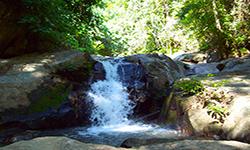
Lam Nam Kok National Park (under gazetting)
Contact Location : Lam Nam Kok National Park (under gazetting), Doi Hang Sub-district, Mueang Chiang Rai District, Chiang Rai Province 57000
Telephone Number : (+66) 8 3764 6475
Email : Lamnamkok.np@gmail.com
Facebook : Lam nam kok National Park
Information
Lam Nam Kok National Park is located in the districts of Mae Chan, Mueang, Mae Suai and Mae Lao District in Chiang Rai Province. It is made up of three Forest Parks: Namtok Khun Kon Forest Parks, Namtok Huai Kaeo - Bo Nam Ron Huai Mak Liam Forest Park, and Namtok Pong Phrabat Forest Park.
Background
Namtok Khun Kon Forest Park Area is located in Chiang Rai Province Namtok Huai Kaeo - Bo Nam Ron Huai Mak Liam Forest Park, and Namtok Pong Phrabat Forest Park. It is located within a National Reserved Forest that covers a similar area and is relatively prosperous. Nonetheless, such management is not mandated by law so it is unable to develop sites and major tourist attractions with sufficient potential to support the community’s growth. Visitors normally travel from the Chiang Rai Province area.
The Royal Forest Department surveyed the forest, including the National Reserved Forest and neighboring regions in January 2001. The Royal Forest Department directed officials to take control of the area in July 2001, when Lam Nam Kok National Park was declared. The Royal Forest Department developed a plan in fiscal year 2002 and the budget for the Lam Nam Kok National Park included approval for the construction of an office building on the Huai Mak Liam Watershed Management site in Doi Hang Sub-district, Mueang District, Chiang Rai Province. On May 10th, 2002, they reached an agreement with the Royal Forest Department to use the area.
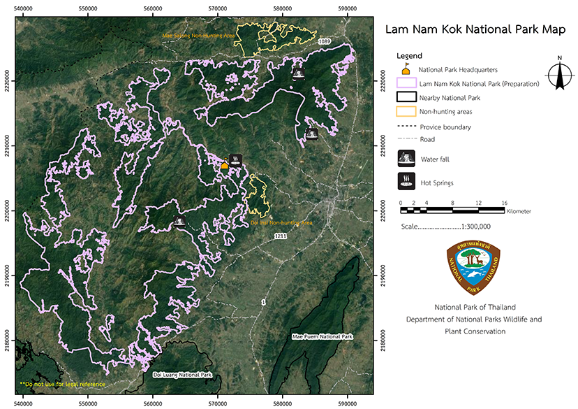
The Lam Nam Kok National Park area is approximately 396,794 rai or 635 square kilometers. It covers several districts of Chiang Rai Province, namely Pa Tueng and Mae Chan Sub-district, Mae Chan District, Tha Sut, Nang Lae, Mae Yao, Huai Chomphu, Doi Hang, Ban Du and Mae Kon Sub-district, Mueang District, Wawi and Mae Suai Sub-district, Mae Suai District, and Pong Phrae, Dong Ma Da and Chom Mok Kaeo Sub-district, and Mae Lao District.
It encompasses the area
North of the Mae Chan - Mae Ai National Highway in Pa Tueng Sub-district, Mae Chan District, Chiang Rai Province.
South of Chiang Rai, adjacent to the Chiang Rai - Mae Suai National Highway, and Ban Pong Fu Fueang, Mae Suai Sub-district, Mae Suai District, Chiang Rai Province.
East of Mae Chan Sub-district, Mae Chan District, Tha Sut, Nang Lae, Doi Hang and Mae Kon Sub-district, Mueang District, Pong Phrae Sub-district, Mae Lao District, Chiang Rai Province.
West is bordered by Mae Yao and Huai Chomphu Sub-district, Mueang District, Mae Suai and Wawi Sub-district, and Mae Suai District in Chiang Rai Province. It is currently gathering additional information in order to make a recommendation to the National Park Board for consideration and approval of the establishment of a National Park.
Note : After paying the entrance fee to the National Park, please carry the receipt for inspection.
368,339.88 rai (589.3 square kilometers)
|
|
|
|
|
|
Nature trails ⇔ Forest Viewpoint ⇔ Observe flowers/plant ⇔ Visit Waterfall ⇔ Take a boat ride or a paddle ⇔ Mineral water bathing
Welfare shop : Open daily from 8.00 – 17.00 hrs.
National Park Headquarters : TRUE
|
|
Lam Nam Kok National Park's topography is defined by tower karst mountains interspersed with narrow plains. The valley is in the north, while the area's south side is a low slope with a river basin in the center interspersed with channels. The mountain ranges in elevation from 500 to 1,720 meters above sea level with Doi Chang's summit being the highest , rising approximately 1,720 meters above sea level. Doi Yao, Doi Bo, Doi Chang, and Doi Pha Mup are the area's most significant summits. The Kok River is a significant river in the upper North that flows through the area's central lowlands. The river originates in Burma and flows through Thailand to Tha Ton Sub-district in Chiang Rai Province's Mae Ai District. The total distance between Tha Ton Sub-district and the National Park is approximately 85 kilometers from west to east, and numerous tributaries run through the area, including Mae Kon Creek, Mae Mon Creek, Ya Di Creek, Chom Phu Creek, San Creek, Mae Sai Creek, and Lao Ai Creek. All of these creeks eventually join to form a large river, and they flow in conjunction with the Lao and Mae Kok Rivers, which are the province's primary waterways. The Northern border: Private land of Ban Wang Duan and the Border Patrol Police Camp 14 |
|
Chiang Rai Province is affected by monsoon climates, with the rainy season caused by the southwest monsoon and winter by the northeast monsoon. They can be classified into three distinct seasons:
|
|
|
|
There are four types of ecosystem in the Lam Nam Kok National Park area: The dry evergreen forest is at an altitude of 300 - 600 meters above sea level. In the area of valleys and along the river, ground plants include Dipterocarpus urbinatus, Anisoptera costata, Hopea ferrea Laness, Shorea siamensis, Xerospermum intermedium, Hydnocarpus ilicifolius, Microcos paniculata, Streblus ilicifolius, Diospyros undulata Wall, Rose Apple, Calamus samensis, Toddalia asiatica, Ferns, Lobelia angulata, Setaria Palmifolia, Bridal Creeper, and Smilax lanceifolia. Deciduous dipterocarp forests are found scattered throughout the area at altitudes of 400 - 600 meters upwards. The plants and plants of the ground are Burma Sal, Burmese Sal, Dipterocarpus tuberculatus, Hairy Keruing, Dipterocarpus intricatus Dyer, Strychnos nux-vomica, Phyllanthus emblica, Vietnamosasa pusilla, and Vietnamosasa ciliata. |
How to get there by car :
Travel there by reaching the Ban Den Ha Intersection in Chiang Rai, which passes in front of Meng Rai Maharat Camp and continues into Doi Hang Sub-district until it reaches Ban Pha Seot. The distance between the two points is approximately 19 kilometers. Then travel to the Huai Mak Liam, National Park Headquarters for another 1.5 kilometers, or ride a long-tailed boat along the Kok Stream or a raft from the Kok Stream Bridge in Chiang Rai town to the Mak Liam Creek area for about 20 kilometers.
- Lam Nam Kok National Park Ranger Station No. 1 (Namtok Khun Kon)
- Lam Nam Kok National Park Ranger Station No. 2 (Namtok Pong Phra Bat)
- Lam Nam Kok National Park Ranger Station No. 3 (Yapha)
- Mae Chan Watershed Conservation and Management Station
- Huai Mak Liam Watershed Management Station
- Mae Suai Watershed Management Station
-

